Block
From the record
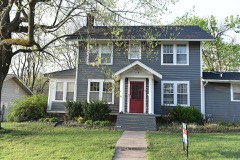
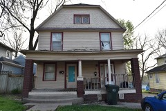
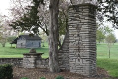
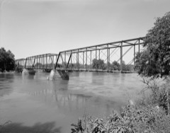
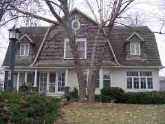
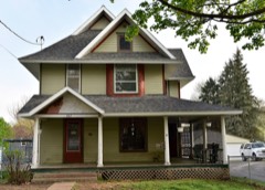
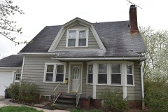
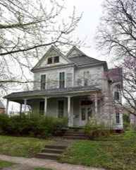
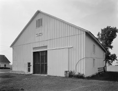
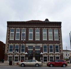
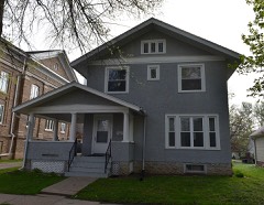
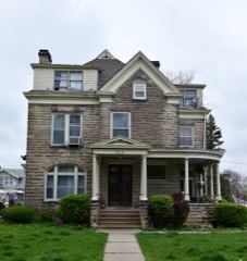
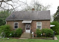
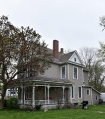
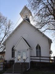
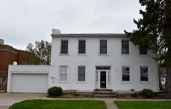
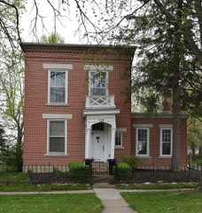
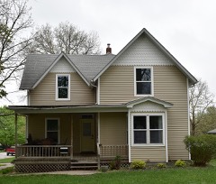
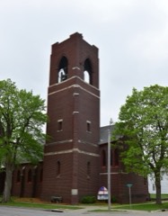
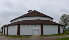
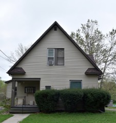
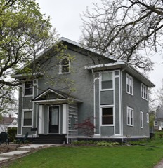
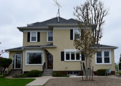
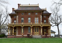
49 National Register listings published here.
Sources: the National Register database, National Park Service
30 topographic sheets cover 31 settlements here, and 49 properties are on the National Register of Historic Places.
49 National Register listings published here.
Sources: the National Register database, National Park Service
Every property in this county listed on the National Register of Historic Places, with the year it was listed and the federal nomination document.
Every wildfire the federal occurrence database records inside this county: 55 of them, burning about 1,982 acres. None started naturally and 1 was recorded as arson. Each settlement page carries the fires within five miles of it.
| Reported cause | Fires |
|---|---|
| Debris and open burning | 44 |
| Missing data/not specified/undetermined | 9 |
| Arson/incendiarism | 1 |
| Smoking | 1 |
The five largest, by the area the report gives. None of them was recorded as arson.
| Date | Cause | Size | Reported by | Name on the report |
|---|---|---|---|---|
| 30 March 2014 | Debris and open burning | 1,000 acres | Iowa Department of Natural Resources | not named |
| 11 March 2015 | Missing data/not specified/undetermined | 200 acres | Iowa Department of Natural Resources | not named |
| 16 March 2015 | Missing data/not specified/undetermined | 140 acres | Iowa Department of Natural Resources | not named |
| 8 April 2014 | Debris and open burning | 100 acres | Iowa Department of Natural Resources | not named |
| 29 March 2014 | Debris and open burning | 80 acres | Iowa Department of Natural Resources | not named |
| 15 March 2009 | Missing data/not specified/undetermined | 65 acres | Iowa Department of Natural Resources | not named |
| 18 March 2015 | Debris and open burning | 40 acres | Iowa Department of Natural Resources | not named |
| 9 April 2014 | Debris and open burning | 40 acres | Iowa Department of Natural Resources | not named |
Every settlement page carries the fires within five miles of it - see the settlement index below.
The NOAA Storm Events Database holds 428 reports for this county, causing 1 death, 37 injuries and about $39,480,000 in recorded property damage. Each settlement page carries the reports that name it.
| Kind of event | Reports |
|---|---|
| Thunderstorm Wind | 151 |
| Hail | 91 |
| Flood | 78 |
| Heavy Rain | 39 |
| Flash Flood | 29 |
| Tornado | 27 |
| Lightning | 8 |
| Funnel Cloud | 5 |
The most serious of them, by death, then injury, then recorded damage. The accounts are quoted exactly as the forecast office filed them.
| When | Event | Place named | Harm | What the report says |
|---|---|---|---|---|
| June 1984 | Tornado (F4) | not stated | 1 killed, 30 hurt, $25,000,000 | no account filed |
| May 1985 | Tornado (F1) | not stated | 4 hurt, $25,000 | no account filed |
| September 1978 | Tornado | not stated | 1 hurt, $250,000 | no account filed |
| June 1953 | Tornado (F2) | not stated | 1 hurt, $2,500 | no account filed |
| August 1996 | Lightning | Oskaloosa | 1 hurt | no account filed |
| August 2010 | Flood | Cedar | $1,000,000 | no account filed |
| May 1996 | Hail | Oskaloosa | $530,000 | no account filed |
| August 2010 | Flash Flood | Oskaloosa Roth Arpt | $500,000 | Water receding but still flooding in Oskaloosa. Numerous houses inundated in town with 18 people rescued. |
| September 2007 | Tornado (EF2) | Peoria | $500,000 | Tornado moved into Mahaska County from Marion County, then continued northeast into Jasper County.| |
| June 2008 | Flood | Peoria | $500,000 | no account filed |
| June 2000 | Flash Flood | Countywide | $500,000 | no account filed |
| May 1996 | Flash Flood | Oskaloosa | $500,000 | no account filed |
| June 2000 | Flash Flood | Oskaloosa | $350,000 | no account filed |
| June 1997 | Thunderstorm Wind | Oskaloosa | $300,000 | no account filed |
| May 2019 | Flood | Beacon | $250,000 | The Muchakinock Creek gauge went into flood during the evening hours on the 28th and continued into the early afternoon hours of the 29th. Water goes over the road on Highway 92 west of Oskaloosa when it is flooding. |
| July 2015 | Flood | Cedar | $250,000 | The Des Moines River at Eddyville crested a second time in as many days at 62.00 feet at 8:00 AM CDT on 29 July. |
| July 2015 | Flood | Cedar | $250,000 | The Des Moines River at Eddyville crested at 62.40 feet at 1:45 AM CDT on 28 July. |
| June 2011 | Flood | Evans | $250,000 | Highway 92 was closed due to high water between County Highway T25 and Highway 163. |
| August 2010 | Flash Flood | Cedar | $250,000 | Several homes in Wright were flooded. |
| August 2007 | Flash Flood | New Sharon Arpt | $250,000 | Numerous reports of flooding were received from throughout the county with stalled cars. No travel advised. Highway 63 construction area was muddy and flooded. |
| July 2010 | Flood | Cedar | $250,000 | no account filed |
| April 2007 | Flood | Taintor | $250,000 | no account filed |
| May 1988 | Tornado (F1) | not stated | $250,000 | no account filed |
| September 1978 | Tornado | not stated | $250,000 | no account filed |
| May 1971 | Tornado (F0) | not stated | $250,000 | no account filed |
| April 2012 | Thunderstorm Wind | Oskaloosa Muni Arpt | $200,000 | RFD winds measured by AWOS site at the airport. Hangar doors and buildings damaged. |
| August 2010 | Flash Flood | Oskaloosa | $200,000 | Iowa DOT and local media report Highway 92 closed east of Oskaloosa due to the flooding from Spring Creek. |
| August 2010 | Flood | Peoria | $200,000 | no account filed |
| August 1998 | Lightning | Oskaloosa | $200,000 | no account filed |
| May 2013 | Flood | New Sharon | $150,000 | Highway 146 is closed from Highway 63 at New Sharon north to the Poweshiek County line due to flooding on the North Skunk River. |
| June 2011 | Tornado (EF1) | New Sharon | $150,000 | Winds estimated at 110 MPH. Numerous trees downed with some trees on top of houses. Power lines down and storage shed shifted from its foundation and cars pushed into a ditch. |
| May 2019 | Flood | Cedar | $100,000 | The Des Moines River at Eddyville crested at 63.12 feet on 27 May 2019 at 22:45 UTC. |
| September 2018 | Flood | Peoria | $100,000 | Emergency management reported widespread road closures due to flooding or being washed out across much of the county. |
| June 2015 | Flood | Runnells | $100,000 | The Des Moines River at Eddyville crested at 65.64 feet at 10:15 AM CST on 26 June. |
| July 2015 | Flash Flood | Olivet | $100,000 | Law Enforcement reported some roads flooded with water over them in the southwest portion of the county. |
| July 2015 | Thunderstorm Wind | Beacon | $100,000 | Five to 6 large trees were blown down and power lines were blown down as well. |
| July 2015 | Thunderstorm Wind | Oskaloosa | $100,000 | A large tree fell on an apartment building. Four of the apartments had to be evacuated. |
| May 2013 | Flood | New Sharon | $100,000 | Highway 63 east of town and highway 146 north of town flooded by the North Skunk River. |
| June 2011 | Thunderstorm Wind | New Sharon | $100,000 | Damage to power lines, trees and houses. |
| June 2010 | Flash Flood | Oskaloosa | $100,000 | Estimated 4-5 inches of rainfall. |
| April 2008 | Tornado (EF1) | Truax | $100,000 | Shingles were removed from the roof of a house. An outbuilding was damaged and the top of an outbuilding was crushed. Damage was done to structures on the west side of Oskaloosa from the storm after the tornado had lifted. Intermittent track with rain wrapped tornado and considerable RFD wind damage. |
| June 2011 | Flood | Oskaloosa Muni Arpt | $100,000 | no account filed |
| June 2010 | Flood | Peoria | $100,000 | no account filed |
| April 2007 | Flood | Oskaloosa | $100,000 | no account filed |
| May 2002 | Flash Flood | Countywide | $100,000 | no account filed |
| May 1996 | Thunderstorm Wind | Fremont | $100,000 | no account filed |
| June 1998 | Thunderstorm Wind | New Sharon | $90,000 | no account filed |
| July 2018 | Tornado (EF2) | Peoria | $80,000 | This tornado continued into Mahaska county from Marion county. The tornado path was initially east in Mahaska county but a satellite tornado moved south on the backside of the parent rotation and the interaction turned the main circulation back to the southeast remaining in that heading for the remainder of the path. The tornado did encounter one farmstead producing EF2 damage to the structures onsite before remaining in agricultural fields for the rest of its path. |
| November 2015 | Tornado (EF2) | Indianapolis | $75,000 | Tornado started in rural Mahaska county south of Barnes City. Tornado damaged or destroyed several structures along its path. Also damaged several trees with branches and trunks snapped. In Barnes City, multiple outbuildings were slid off their foundation. The back end of one car was shifted by 2 ft. Tornado then moved into Poweshiek county before dissipating. |
| April 2014 | Thunderstorm Wind | Oskaloosa | $75,000 | Roof taken off of the Oskaloosa Family Medical Center. |
| April 2012 | Tornado (EF1) | Wright | $75,000 | The tornado was determined to be an EF1 with a broad and intense rear flank downdraft south of the track. Peak wind was around 100 MPH. |
| May 2008 | Tornado (EF1) | Olivet | $75,000 | Several homes were damaged or destroyed, two mobile homes were destroyed. Considerable tree damage was reported. The EF2 damage occurred in the Attica area, along with 10 injuries. The tornado weakened as it moved into Mahaska County out of Marion County. |
| June 2007 | Thunderstorm Wind | Lacey | $75,000 | no account filed |
| May 2004 | Thunderstorm Wind | Cedar | $75,000 | no account filed |
| June 1996 | Lightning | Oskaloosa | $75,000 | no account filed |
| May 2019 | Flood | Cedar | $50,000 | The Des Moines River at Eddyville crested twice, with the first crest at 65.61 feet on 29 May 2019 at 15:00 UTC and the second crest at 65.53 feet on 20 May 2019 at 07:30 UTC. |
| October 2018 | Flood | Olivet | $50,000 | Iowa DOT reported water covering Highway 92 between Highway T17 in Marion County and Highway 163 in near Oskaloosa. |
| June 2015 | Flood | Runnells | $50,000 | The Des Moines River at Eddyville had a second crest at 61.97 feet at 5:15 AM CST on 29 June. |
| July 2015 | Flash Flood | Evans | $50,000 | Department of Ttransportation reported water over the road on Iowa Highway 92 at approximately mile marker 178. Initial report of 5 to 6 inches of water on the road. Delayed report. |
| July 2015 | Flood | Cedar | $50,000 | The Des Moines River at EddyVille crested at 62.66 feet at 4:30 PM CDT on 16 July. |
The Survey's mineral resources record lists 37 workings inside this county. 3 still produce and 34 are closed or unrecorded. Each settlement page carries the workings within five miles of it.
| Commodity | Workings |
|---|---|
| Stone, Crushed/Broken | 15 |
| Sand and Gravel, Construction | 12 |
| Zinc | 7 |
| Clay | 2 |
| Clay, Bituminous | 1 |
The least common of them first, because a county's hundredth gravel pit says nothing its first ten did not.
| Where | Site | Commodity | Status | Recorded |
|---|---|---|---|---|
| Oskaloosa Paving Brick Co. | Clay, Bituminous | Past Producer | ||
| Oskaloosa Clay Products Co. Pit | Clay | Past Producer | ||
| Unknown | Clay | Past Producer | ||
| Drill Hole | Zinc | Past Producer | Sphalerite | |
| Drill Hole | Zinc | Past Producer | Sphalerite | |
| Drill Hole | Zinc | Past Producer | Sphalerite | |
| Occurrence | Zinc | Past Producer | Sphalerite | |
| Occurrence | Zinc | Past Producer | Sphalerite | |
| Occurrence | Zinc | Past Producer | Sphalerite | |
| Occurrence | Zinc | Past Producer | Sphalerite | |
| Bellefountain Pit | Sand and Gravel, Construction | Past Producer | ||
| Eddyville Sand Plant | Sand and Gravel, Construction | Past Producer | ||
| Llyed Barnes Pit | Sand and Gravel, Construction | Past Producer | ||
| Miller Sand Pit | Sand and Gravel, Construction | Past Producer | ||
| Unknown | Sand and Gravel, Construction | Past Producer | ||
| Unknown | Sand and Gravel, Construction | Past Producer | ||
| Unknown | Sand and Gravel, Construction | Past Producer | ||
| Unknown | Sand and Gravel, Construction | Past Producer | ||
| Unknown | Sand and Gravel, Construction | Past Producer | ||
| Unknown | Sand and Gravel, Construction | Past Producer | ||
| Unknown | Sand and Gravel, Construction | Past Producer | ||
| Unknown | Sand and Gravel, Construction | Past Producer | ||
| Archie Harding Quarry | Stone, Crushed/Broken | Past Producer | ||
| Givin Quarry | Stone, Crushed/Broken | Past Producer | ||
| Groenendyk Mcconville Rock Quarry | Stone, Crushed/Broken | Producer | ||
| Langstraat Quarry | Stone, Crushed/Broken | Past Producer | ||
| Oskaloosa Mine & Mill | Stone, Crushed/Broken | Producer | ||
| Peoria Quarry No. 1 | Stone, Crushed/Broken | Past Producer | ||
| Reese Quarry | Stone, Crushed/Broken | Past Producer | ||
| South River Limestone Quarry | Stone, Crushed/Broken | Producer | ||
| Tunis Goemaat Quarry | Stone, Crushed/Broken | Past Producer | ||
| Unknown | Stone, Crushed/Broken | Past Producer | ||
| Unknown | Stone, Crushed/Broken | Past Producer | ||
| Unknown | Stone, Crushed/Broken | Past Producer | ||
| Unknown | Stone, Crushed/Broken | Past Producer | ||
| Unknown | Stone, Crushed/Broken | Past Producer | ||
| Upton Quarry | Stone, Crushed/Broken | Past Producer |
Named settlements recorded in the Geographic Names Information System, each with the topographic sheets covering it. Villages, hamlets and abandoned places alike. Each is shown with the nearest named watercourse or landform and the survey quadrangle it falls on.
Pleasant Grove township · 50027 · Gibson quadrangle
7 sheets, 1954 to 1982
No longer a settlement
Garfield township · 52534 · On Little Muchakinock Creek · Oskaloosa quadrangle
7 sheets, 1954 to 1982
Richland township · 50207 · On Ballinger Creek · Peoria quadrangle
11 sheets, 1910 to 1982
No longer a settlement
Garfield township · 52577 · On Saint Joseph Creek · Oskaloosa quadrangle
7 sheets, 1954 to 1982
No longer a settlement
White Oak township · 52577 · University Park quadrangle
7 sheets, 1954 to 1982
No longer a settlement
Richland township · 50153 · Peoria quadrangle
11 sheets, 1910 to 1982
No longer a settlement
West Des Moines township · 52553 · On Little Bluff Creek · Eddyville quadrangle
7 sheets, 1954 to 1982
Monroe township · 50207 · On Pleasant Creek · Gibson quadrangle
7 sheets, 1954 to 1982
The vanished settlements of Mahaska County: the places named above that are no longer on the map.