 Block
From the record
13 National Register listings published here.
Sources: the National Register database, National Park Service
21 topographic sheets cover 20 settlements here, and 13 properties are on the National Register of Historic Places.
13 National Register listings published here.
Sources: the National Register database, National Park Service
Every property in this county listed on the National Register of Historic Places, with the year it was listed and the federal nomination document.
| Photograph | Property | Type | Listed | Reference |
|---|---|---|---|---|
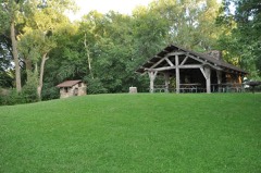 | Blackhawk State Park, Black Hawk Preserve (Area B) | district | 1990 | 90001679 |
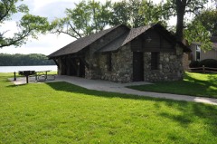 | Blackhawk State Park, Denison Beach Area (Area C) | building | 1990 | 90001680 |
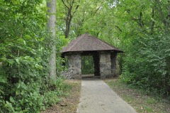 | Blackhawk State Park, Wildlife Preserve Area (Area A) | district | 1990 | 90001678 |
| Chautauqua Park Historic District | district | 2014 | 13001138 | |
| Chicago and North Western Passenger Depot | building | 2003 | 03000358 | |
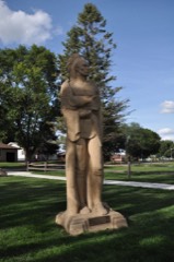 | Chief Black Hawk Statue | object | 2000 | 00000532 |
 | Lakeside Park Historic District | district | 1991 | 91001841 |
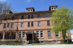 | Park Hotel | building | 2017 | 100000491 |
 | George and Lola Perkins House | building | 2016 | 15000997 |
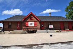 | Sac City Chicago and North Western Depot | building | 2016 | 15000998 |
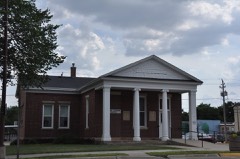 | Sac City Monument Square Historic District | district | 2015 | 15000193 |
 | Sac County Courthouse | building | 1981 | 81000268 |
 | Seven Oaks | building | 1996 | 96000236 |
Every wildfire the federal occurrence database records inside this county: 9 of them, burning about 32 acres. None started naturally and none was recorded as arson. Each settlement page carries the fires within five miles of it.
| Reported cause | Fires |
|---|---|
| Missing data/not specified/undetermined | 7 |
| Debris and open burning | 2 |
The five largest, by the area the report gives. None of them was recorded as arson.
| Date | Cause | Size | Reported by | Name on the report |
|---|---|---|---|---|
| 19 March 2006 | Missing data/not specified/undetermined | 20 acres | Iowa Department of Natural Resources | not named |
| 7 October 2011 | Missing data/not specified/undetermined | 5.0 acres | Iowa Department of Natural Resources | JANA REC. AREA WMA (0.2 AC), MARK HOSTENG FARMS (5 |
| 14 April 2006 | Missing data/not specified/undetermined | 2.0 acres | Iowa Department of Natural Resources | not named |
| 23 April 2018 | Debris and open burning | 2.0 acres | Iowa Department of Natural Resources | not named |
| 27 July 2011 | Missing data/not specified/undetermined | 1.0 acres | Iowa Department of Natural Resources | 1555 HIGHWAY 20, IA |
| 7 April 2018 | Debris and open burning | 1.0 acres | Iowa Department of Natural Resources | not named |
| 25 June 2006 | Missing data/not specified/undetermined | under an acre | Iowa Department of Natural Resources | not named |
| 27 October 2009 | Missing data/not specified/undetermined | under an acre | Iowa Department of Natural Resources | not named |
Every settlement page carries the fires within five miles of it - see the settlement index below.
The NOAA Storm Events Database holds 292 reports for this county, causing no deaths, 1 injury and about $15,325,450 in recorded property damage. Each settlement page carries the reports that name it.
| Kind of event | Reports |
|---|---|
| Hail | 110 |
| Thunderstorm Wind | 99 |
| Tornado | 25 |
| Flash Flood | 19 |
| Heavy Rain | 14 |
| Funnel Cloud | 13 |
| Flood | 11 |
| Lightning | 1 |
The most serious of them, by death, then injury, then recorded damage. The accounts are quoted exactly as the forecast office filed them.
| When | Event | Place named | Harm | What the report says |
|---|---|---|---|---|
| May 2004 | Thunderstorm Wind | Early | 1 hurt, $80,000 | no account filed |
| April 1991 | Tornado (F3) | not stated | $2,500,000 | no account filed |
| April 1984 | Tornado (F2) | not stated | $2,500,000 | no account filed |
| April 2011 | Tornado (EF3) | Odebolt | $2,000,000 | Tornado moved northeast for nearly 4 miles before abruptly turning north northwest for the remainder of the path. Lots of debris and power outages. Numerous homes damaged or destroyed. |
| April 2011 | Tornado (EF2) | Nemaha | $2,000,000 | This long track tornado touched down in Sac County and crossed the border into Buena Vista County. This large tornado occurred in conjunction with many satellite tornadoes producing a large and varying debris field. |
| April 2011 | Tornado (EF2) | Odebolt | $1,000,000 | Multiple homes damaged along the track of the storm. Storm passed through the town of Early before quickly dissipating. |
| April 2011 | Tornado (EF2) | Nemaha | $500,000 | This was the first satellite tornado that developed in far northern Sac County producing a narrow but strong swath of damage as it crossed into Buena Vista County. |
| August 2010 | Thunderstorm Wind | Schaller | $300,000 | Trees down and uprooted. Power lines down with some trees snapped. |
| May 2012 | Thunderstorm Wind | Odebolt | $250,000 | Damage swath observed from east of Odebolt through the Early area, to the east side of Lake View. Numerous power poles down, roof blown off outbuildings, turkey, and hog confinements buildings, and boats were thrown at a dealership. |
| July 2010 | Flash Flood | Sac City Muni Arpt | $250,000 | Sierra road was closed from Shasta Ave to 270th St due to flooding. Other road closures are on 170th St north of Sac City and 350th St near Grant City. |
| April 2007 | Flood | Lake View | $250,000 | no account filed |
| June 2003 | Thunderstorm Wind | Auburn | $250,000 | no account filed |
| March 2019 | Flood | Schaller | $200,000 | Numerous secondary roads closed throughout Sac County due to flooding. |
| May 2012 | Thunderstorm Wind | Lake View | $200,000 | Thirteen large power poles were snapped along a mile long stretch of Perkins Ave. One third of the roof of a hog confinement building was ripped off one half mile up the road. Another half mile up the road, one third of a machine shed was destroyed. Little damage was noted east or west of this area. Wind speeds were estimated around 90 MPH. |
| May 2001 | Flash Flood | Countywide | $200,000 | no account filed |
| June 1996 | Flash Flood | Lytton | $200,000 | no account filed |
| December 2021 | Tornado (EF2) | Carnarvon | $150,000 | This tornado move into Sac county from Carroll county. This tornado passed just on the southeast side of the hamlet of Carnarvon with EF1 damage from a destroyed outbuilding. The tornado continued northeast through rural south and east Sac county producing EF0 to EF1 damage to outbuildings and trees. EF2 damage was observed when power poles were snapped along 310th street east of Union Avenue. The tornado eventually lifted to the southwest of Lytton. |
| June 2003 | Thunderstorm Wind | Auburn | $150,000 | no account filed |
| July 2010 | Flash Flood | Schaller | $100,000 | Numerous roads were closed, including Hope Ave between 190th and 200th St, 170th between Ira and Jackson, Lee Ave was down to one lane between 390th and 400th. |
| March 2006 | Thunderstorm Wind | Odebolt | $100,000 | no account filed |
| April 1998 | Thunderstorm Wind | Odebolt | $100,000 | no account filed |
| June 1998 | Flash Flood | Lytton | $100,000 | no account filed |
| August 2014 | Tornado (EF0) | Odebolt | $90,000 | This tornado moved northward before encountering a farmstead west of Odebolt. The tornado destroyed 4 grain bins at this site and damage a few augers before taking a 90 degree turn to the east for the remainder of its path. Tornado was found and rated using high resolution satellite imagery. |
| August 1996 | Flood | Sac City | $75,000 | no account filed |
| July 1997 | Thunderstorm Wind | Wall Lake | $70,000 | no account filed |
| August 2023 | Tornado (EF0) | Auburn | $50,000 | Report of damage from emergency manager later identified as a tornado path using high resolution satellite imagery. The tornado impacted a outbuilding and tossed debris northward into an agricultural field with EF0 damage. |
| December 2015 | Flood | Odebolt | $50,000 | Flooding was reported along the North Raccoon River from near Sac City to northwest of Lanesboro. |
| May 2007 | Flash Flood | Sac City | $50,000 | no account filed |
| June 2004 | Flash Flood | Countywide | $50,000 | no account filed |
| August 2004 | Hail | Odebolt | $50,000 | no account filed |
| June 2001 | Thunderstorm Wind | Sac City | $50,000 | no account filed |
| July 1998 | Flood | Sac City | $50,000 | no account filed |
| July 1997 | Thunderstorm Wind | Lake View | $50,000 | no account filed |
| June 1996 | Flash Flood | Sac City | $50,000 | no account filed |
| June 1994 | Thunderstorm Wind | Lake View | $50,000 | no account filed |
| May 1998 | Thunderstorm Wind | Wall Lake | $40,000 | no account filed |
| August 1996 | Thunderstorm Wind | Wall Lake | $35,000 | no account filed |
| August 2016 | Thunderstorm Wind | Lake View | $30,000 | Public reported numerous trees with diameter upwards of one foot down around Lake view. Tree reported downed onto truck. Time and location estimated from radar. |
| June 1998 | Thunderstorm Wind | Schaller | $30,000 | no account filed |
| June 1996 | Flood | Sac City | $30,000 | no account filed |
| June 1996 | Flood | Sac City | $30,000 | no account filed |
| July 2016 | Thunderstorm Wind | Lake View | $25,000 | Public reported trees down all around town. Estimated 60-70 mph winds in the storm. Report came via social media and time radar estimated. |
| August 2010 | Flash Flood | Lytton | $25,000 | Sac County law enforcement reports flooding over Highway 20 near Lytton. |
| May 2009 | Hail | Odebolt | $25,000 | Quarter to golf ball size hail covered the ground to a depth of 2 to 3 inches. |
| May 2009 | Hail | Odebolt | $25,000 | Quarter to golf ball size hail covered the ground to a depth of 2 to 3 inches. |
| August 2009 | Hail | Wall Lake Muni Arpt | $25,000 | Wind driven hail with crops completly destroyed. |
| May 2008 | Flash Flood | Ulmer | $25,000 | Water was reported over the road at 175th and Voss Ave. |
| August 2009 | Hail | Wall Lake | $25,000 | no account filed |
| April 2002 | Thunderstorm Wind | Schaller | $25,000 | no account filed |
| June 2001 | Thunderstorm Wind | Sac City | $25,000 | no account filed |
| August 2001 | Flash Flood | Southeast Portion | $25,000 | no account filed |
| May 1998 | Hail | Auburn | $25,000 | no account filed |
| August 1998 | Flood | Odebolt | $25,000 | no account filed |
| June 1998 | Thunderstorm Wind | Lake View | $25,000 | no account filed |
| July 1978 | Tornado | not stated | $25,000 | no account filed |
| September 2018 | Thunderstorm Wind | Schaller | $20,000 | Law enforcement reported trees down on power lines along Dean Ave. Time estimated from radar. |
| June 2015 | Thunderstorm Wind | Wall Lake | $20,000 | Wind damage including numerous branches down and a few trees down across southern and southwestern Sac County. |
| May 2012 | Thunderstorm Wind | Odebolt | $20,000 | Several large trees were blown down in a cemetery by estimated winds of 60 MPH. |
| June 2008 | Flash Flood | Lake View | $20,000 | Street flooding at Second and High Streets in Lake View. |
| March 2006 | Thunderstorm Wind | Lake View | $20,000 | no account filed |
The Survey's mineral resources record lists 43 workings inside this county. 5 still produce and 38 are closed or unrecorded. Each settlement page carries the workings within five miles of it.
| Commodity | Workings |
|---|---|
| Sand and Gravel, Construction | 43 |
The least common of them first, because a county's hundredth gravel pit says nothing its first ten did not.
| Where | Site | Commodity | Status | Recorded |
|---|---|---|---|---|
| Black Hawk Lake State Area Pits | Sand and Gravel, Construction | Past Producer | ||
| Blaus Pit | Sand and Gravel, Construction | Past Producer | ||
| Buckley Pit | Sand and Gravel, Construction | Past Producer | ||
| Engle Pit | Sand and Gravel, Construction | Past Producer | ||
| George Kaser Pit | Sand and Gravel, Construction | Past Producer | ||
| Hosteng Pit | Sand and Gravel, Construction | Producer | ||
| Hosteng Pit and Plant | Sand and Gravel, Construction | Producer | ||
| Lake View Pit and Plant | Sand and Gravel, Construction | Producer | ||
| Meister Pit | Sand and Gravel, Construction | Producer | ||
| Myer Pit | Sand and Gravel, Construction | Past Producer | ||
| Old State Pit | Sand and Gravel, Construction | Past Producer | ||
| Peters Pit | Sand and Gravel, Construction | Past Producer | ||
| Sac County Pits | Sand and Gravel, Construction | Producer | ||
| Unknown | Sand and Gravel, Construction | Past Producer | ||
| Unknown | Sand and Gravel, Construction | Unknown | ||
| Unknown | Sand and Gravel, Construction | Unknown | ||
| Unknown | Sand and Gravel, Construction | Past Producer | ||
| Unknown | Sand and Gravel, Construction | Past Producer | ||
| Unknown | Sand and Gravel, Construction | Past Producer | ||
| Unknown | Sand and Gravel, Construction | Past Producer | ||
| Unknown | Sand and Gravel, Construction | Past Producer | ||
| Unknown | Sand and Gravel, Construction | Past Producer | ||
| Unknown | Sand and Gravel, Construction | Past Producer | ||
| Unknown | Sand and Gravel, Construction | Past Producer | ||
| Unknown | Sand and Gravel, Construction | Past Producer | ||
| Unknown | Sand and Gravel, Construction | Past Producer | ||
| Unknown | Sand and Gravel, Construction | Past Producer | ||
| Unknown | Sand and Gravel, Construction | Past Producer | ||
| Unknown | Sand and Gravel, Construction | Past Producer | ||
| Uren Pit | Sand and Gravel, Construction | Past Producer | ||
| Wall Lake Pit | Sand and Gravel, Construction | Past Producer | ||
| Waters Pit | Sand and Gravel, Construction | Past Producer | ||
| Wpa Pit | Sand and Gravel, Construction | Past Producer |
Named settlements recorded in the Geographic Names Information System, each with the topographic sheets covering it. Villages, hamlets and abandoned places alike. Each is shown with the nearest named watercourse or landform and the survey quadrangle it falls on.
Wall Lake township · 51450 · Near Gun Shot Hill · Lake View quadrangle
8 sheets, 1954 to 1985
Wall Lake township · 51450 · Near Gun Shot Hill · Lake View quadrangle
8 sheets, 1954 to 1985
Jackson township · 50583 · On Cedar Creek · Sac City East quadrangle
8 sheets, 1954 to 1993
Viola township · 51466 · Lake View quadrangle
8 sheets, 1954 to 1985
No longer a settlement
The vanished settlements of Sac County: the places named above that are no longer on the map.