 Block
From the record
13 National Register listings published here.
Sources: the National Register database, National Park Service
20 topographic sheets cover 19 settlements here, and 13 properties are on the National Register of Historic Places.
13 National Register listings published here.
Sources: the National Register database, National Park Service
Every property in this county listed on the National Register of Historic Places, with the year it was listed and the federal nomination document.
| Photograph | Property | Type | Listed | Reference |
|---|---|---|---|---|
 | Chicago, Rock Island and Pacific Railroad Stone Arch Viaduct | structure | 1998 | 98000870 |
| Jens Otto Christiansen House | building | 1997 | 96001584 | |
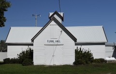 | Floral Hall | building | 1985 | 85000765 |
 | Harlan Courthouse Square Commercial District | district | 1994 | 94001099 |
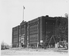 | Irwin Consolidated School | building | 2002 | 02001246 |
| Chris Larsen House | building | 1991 | 91001456 | |
| Pleasant View Stock Farm Historic District | district | 2019 | 100004112 | |
| Chris Poldberg Farmstead | building | 1991 | 91001459 | |
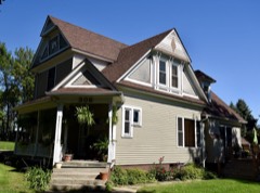 | George Rewerts House | building | 1991 | 91001450 |
 | Saint Boniface Catholic Church District | district | 1991 | 91001449 |
| Shelby Consolidated School | building | 2014 | 13001139 | |
 | Shelby County Courthouse | building | 1978 | 78001258 |
 | St. Paul's Episcopal Church | building | 1978 | 78001259 |
Every wildfire the federal occurrence database records inside this county: 36 of them, burning about 878 acres. None started naturally and 1 was recorded as arson. Each settlement page carries the fires within five miles of it.
| Reported cause | Fires |
|---|---|
| Debris and open burning | 20 |
| Missing data/not specified/undetermined | 11 |
| Equipment and vehicle use | 4 |
| Arson/incendiarism | 1 |
The five largest, by the area the report gives. None of them was recorded as arson.
| Date | Cause | Size | Reported by | Name on the report |
|---|---|---|---|---|
| 26 March 2014 | Debris and open burning | 340 acres | Iowa Department of Natural Resources | not named |
| 26 March 2014 | Equipment and vehicle use | 130 acres | Iowa Department of Natural Resources | not named |
| 19 October 2015 | Equipment and vehicle use | 120 acres | Iowa Department of Natural Resources | not named |
| 12 May 2013 | Debris and open burning | 120 acres | Iowa Department of Natural Resources | not named |
| 30 March 2014 | Debris and open burning | 50 acres | Iowa Department of Natural Resources | not named |
| 22 March 2017 | Debris and open burning | 20 acres | Iowa Department of Natural Resources | not named |
| 22 March 2015 | Debris and open burning | 15 acres | Iowa Department of Natural Resources | not named |
| 15 March 2015 | Debris and open burning | 15 acres | Iowa Department of Natural Resources | not named |
Every settlement page carries the fires within five miles of it - see the settlement index below.
The NOAA Storm Events Database holds 303 reports for this county, causing no deaths, no injuries and about $8,103,500 in recorded property damage. Each settlement page carries the reports that name it.
| Kind of event | Reports |
|---|---|
| Hail | 133 |
| Thunderstorm Wind | 130 |
| Tornado | 30 |
| Funnel Cloud | 5 |
| Flash Flood | 4 |
| Heavy Rain | 1 |
The most serious of them, by death, then injury, then recorded damage. The accounts are quoted exactly as the forecast office filed them.
| When | Event | Place named | Harm | What the report says |
|---|---|---|---|---|
| September 1989 | Tornado (F1) | not stated | $2,500,000 | no account filed |
| May 1987 | Tornado (F1) | not stated | $2,500,000 | no account filed |
| November 2015 | Tornado (EF1) | Shelby | $1,200,000 | This tornado entered Shelby County from Pottawattamie County from the southwest. The tornado impacted a total of 6 farmsteads in the county as it tracked to the north northeast. Damage at these farmsteads was confined to mainly outbuilding being damaged or destroyed, trees uprooted, and electrical power poles downed. The tornado tracked across the western side of the Harlan Airport without doing damage to the airport, but a wind gust associated with the rear-flank downdraft of the storm was measured at 76 mph at the automatic observing equipment on the east side of the airport. The tornado finally ended just to the southeast of the city of Harlan. |
| June 1999 | Thunderstorm Wind | Elk Horn | $400,000 | Thunderstorm winds blew the roofs off of 5 downtown buildings and felled several large trees. Power lines were also downed and substantial damage to the town's grain elevator was sustained. |
| September 1989 | Tornado (F0) | not stated | $250,000 | no account filed |
| May 1962 | Tornado (F1) | not stated | $250,000 | no account filed |
| May 1998 | Thunderstorm Wind | Portsmouth | $120,000 | Two sheds destroyed. |
| May 1998 | Thunderstorm Wind | Elk Horn | $100,000 | Cement shed, barn, and machine shed destroyed. Another machine shed was also damaged. |
| May 1998 | Thunderstorm Wind | Portsmouth | $100,000 | Large confinement building destroyed. |
| May 1998 | Thunderstorm Wind | Portsmouth | $80,000 | Two grain bins destroyed. |
| November 1994 | Thunderstorm Wind | Earling | $75,000 | no account filed |
| May 1998 | Thunderstorm Wind | Harlan | $70,000 | Two walls at the landfill destroyed. |
| May 1998 | Thunderstorm Wind | Harlan | $60,000 | Storage building destroyed. |
| June 2014 | Flash Flood | Harlan | $50,000 | Local law enforcement reported that many county roads had water flowing across them in low spots. There was also street flooding reported in the city of Harlan. |
| May 1998 | Thunderstorm Wind | Defiance | $45,000 | Shed and hog house destroyed. |
| May 1998 | Thunderstorm Wind | Earling | $25,000 | Machine shed destroyed. |
| June 1992 | Tornado (F0) | not stated | $25,000 | no account filed |
| May 1975 | Tornado (F2) | not stated | $25,000 | no account filed |
| September 1973 | Tornado (F2) | not stated | $25,000 | no account filed |
| September 1972 | Tornado (F1) | not stated | $25,000 | no account filed |
| May 1955 | Tornado (F2) | not stated | $25,000 | no account filed |
| July 2010 | Thunderstorm Wind | Harlan | $20,000 | Thunderstorm winds estimated at 55 to 60 mph downed a large tree which crushed the roof of a house in the Harlan area. Time was estimated by radar. |
| May 1998 | Thunderstorm Wind | Jacksonville | $20,000 | Machine shed destroyed. |
| May 1998 | Thunderstorm Wind | Kirkman | $20,000 | Shed destroyed. |
| May 1998 | Thunderstorm Wind | Elk Horn | $20,000 | Machine shed destroyed. |
| May 1998 | Thunderstorm Wind | Kirkman | $20,000 | Chicken house roof and two shop doors destroyed. |
| October 1994 | Hail | Portsmouth | $15,000 | no account filed |
| June 2000 | Hail | Panama | $10,000 | Hail near baseball size did significant car and crop damage near Panama. |
| October 1994 | Hail | Earling | $10,000 | no account filed |
| April 2001 | Tornado (F0) | Tennant | $5,000 | This tornado briefly touched down knocking down power lines which ignited a few trees. From the same mini-supercell that produced the 2 tornadoes that touched down near Emerson and Carson, Iowa. |
| July 1994 | Hail | not stated | $5,000 | no account filed |
| July 1994 | Thunderstorm Wind | Shelby | $5,000 | no account filed |
| April 1991 | Tornado (F1) | not stated | $2,500 | no account filed |
| October 1994 | Tornado (F1) | Manilla to | $500 | no account filed |
| April 1989 | Tornado (F0) | not stated | $250 | no account filed |
| April 1989 | Tornado (F0) | not stated | $250 | no account filed |
| April 2026 | Hail | Westphalia | - | Delayed public report via social media of mail measured up to quarter sized with picture and coin for reference via social media. Time estimated via radar. |
| August 2025 | Thunderstorm Wind | Defiance | - | Law enforcement report of a barn blown down and damage to trees. Winds gusted to an estimated 90-100 mph. |
| July 2025 | Thunderstorm Wind | Westphalia | - | Trained spotter measured wind gust using a handheld anemometer. Had consistent 45-55 mph gusts and one gust of 70 mph. |
| July 2025 | Thunderstorm Wind | Corley | - | KHNR AWOS measured thunderstorm wind gust of 68 mph. |
| May 2024 | Thunderstorm Wind | Shelby | - | A 67 miles per hour wind gust was measured by a personal weather station. |
| May 2024 | Funnel Cloud | Harlan | - | The office received a public report of a funnel clouds 3 miles southwest of Harlan, near 900th Street and Juniper Road. |
| May 2024 | Thunderstorm Wind | Harlan | - | A photo was relayed to the office of a tree that was blown ontop of a house. At the same time, a personal weather station in town recorded a gust of 60 miles per hour. It was likely that the wind gust the blew the tree down on the house was stronger than this. |
| May 2024 | Thunderstorm Wind | Kirkman | - | A 65 miles per hour wind gust was measured one a personal weather station. |
| May 2024 | Thunderstorm Wind | Harlan | - | A 64 miles per hour wind gust was measured on a personal weather station. |
| May 2024 | Tornado (EF1) | Shelby | - | This is a continuation of the EF-1 tornado that started in Pottawattamie County. This tornado crosses into far southwest Shelby County just east of the intersection of Elmwood Road and 100th Street. Several tree trunks were snapped along Elmwood Road as the tornado continued to the northeast. This tornado dissipated about a quarter of a mile into Shelby County. Peak wind speeds for this final segment of the tornado track were estimated at 88 mph. Peak tornado width was measured at 100 yards, with an average width in this segment of the track estimated at 50 yards. |
| May 2024 | Tornado (EF0) | Westphalia | - | This brief spin-up tornado damaged roofs off an outbuilding and downed several trees. The peak winds in this tornado were estimated to be at 80 miles per hour. The maximum path width and estimated average path width were both 40 yards. |
| May 2024 | Thunderstorm Wind | Harlan | - | A 65 miles per hour wind gust was measured by a personal weather station. |
| May 2024 | Hail | Harlan | - | The office received a report from the public of quarter sized hail on the northeast side of Harlan, Iowa. |
| May 2024 | Hail | Harlan | - | The office received a report from the 911 Call Center of 2 inch hail that had fallen 3 miles north of Harlan, Iowa. |
| May 2024 | Tornado (EFU) | Tennant | - | At 818 PM CDT, a landspout developed half a mile north of 500th Street in southwestern Shelby County. This landspout tracked north-northeast for approximately two minutes over open farmland. The tornado dissipated just under half a mile northeast of the end of 550th Street. No damage indicators were hit, and there was no discernable damage after the fact, hence this was assigned an EF-U rating. |
| April 2024 | Tornado (EF1) | Irwin | - | This tornado touched down in the V and W Petersen Wildlife Management Area, less than half a mile south of the Shelby-Crawford County border between Road M36 and Quince Road. This tornado quickly moved into Crawford County, but not before snapping several tree trunks on 2500th Street. Here, EF-1 damage was noted, with peak winds estimated at 107 miles per hour. The tornado continued into Crawford County where it completely destroyed a barn 1 mile northwest of Manilla, Iowa, resulting in a final EF-2 rating for the tornado. In Shelby County, the tornado reached a peak width of 100 yards, with an average width estimated at 50 yards. |
| April 2024 | Tornado (EF3) | Shelby | - | This is a continuation of the Minden, Iowa EF-3 tornado. Prior to this segment, the tornado had tracked through Pottawattamie County and a small portion of extreme southeast Harrison County. After crossing into Shelby County between York Road and 335th Street, tree and powerline damage continued to the northeast, with a home having its roof blown off near County Road M16 and 450th Street. Trees in the area were uprooted or snapped at the base of the trunk. A home was badly damaged, and a barn was destroyed less than one mile southeast of Tennant. The tornado appears to have been widest near 750th Street and Hackberry Road, at approximately 1900 yards in width based on tree and powerline damage. At Highway 44, a home was destroyed along with substantial tree damage. Most walls of the home were standing, but a large automobile was thrown or rolled nearly a quarter mile. The tree and vehicle damage suggested that this location was a stronger section of the tornado, and was subsequently rated EF-3. The tornado tracked approximately 1.5 miles northwest of Harlan and began to turn more towards the north, significantly damaging at least 3 homes near Highway 59 as it crossed. It turned almost due north and traveled several miles along Linden Road, and missed the town of Defiance, Iowa by less than half a mile to the east. A second tornado developed just to the east of this one at this time, tracking along Oak Road and causing separate damage. Near Defiance the tornado also became rain-wrapped according to chaser video, and appears likely to have ended just south of the Crawford-Shelby county line. There is some potential based on radar data that this tornado tracked farther north into Crawford County, but damage surveys did not identify a track continuation. The peak estimated winds in this segment of the tornado track were 140 miles per hour. The maximum width of the tornado was measured at 1900 yards with an average width estimated at 1300 yards. |
| April 2024 | Tornado (EF1) | Defiance | - | This tornado touched down less than a mile southeast of Defiance, Iowa just north of the Linden Road and Knotty Pine Road Intersection. Here, a roof was blown off a barn and several tree trunks in the area were snapped. The tornado moved to the northeast, skirting the town of Defiance by less than a mile to the east. A home at the intersection of Linden Road and 2300th Street received minor roof damage and had its car garage completely destroyed. This was the worst damage from this tornado in Shelby County, warranting an EF-1 rating with max wind speeds estimated at 105 miles per hour. Another large barn at the intersection of Street F16 and Mulberry Road had large sections of its roof damaged. At 1753 CST, the tornado crossed into Crawford County half a mile west of 300th Street. At this point in time, EF-1 damage was still being done with several tree trunks being snapped with the passage of the tornado. The peak width achieved by this tornado in Shelby County was 300 yards, with an average width of 200 yards. This tornado continued into Crawford County and produced additional EF-0 and EF-1 damage until it dissipated 6 miles north-northeast of Manilla, Iowa. |
| July 2024 | Funnel Cloud | Shelby | - | Emergency management reported a funnel cloud. |
| June 2024 | Thunderstorm Wind | Harlan | - | A 72 miles per hour wind gust was measured on a personal weather station 2 miles east of Harlan. |
| June 2024 | Hail | Shelby | - | The office received a report of quarter sized hail from a CO-OP observer. |
| June 2024 | Hail | Harlan | - | The office received a report of quarter to golf ball sized hail from the public. |
| June 2024 | Thunderstorm Wind | Harlan | - | The office received a public report of a 62 miles per hour wind gust. This wind gust was accompanied by quarter to golf ball sized hail (this has been put as a separate event given the different event type). |
| July 2023 | Thunderstorm Wind | Harlan | - | Public reported a semi blown over and part of roof blown off a building. |
The Survey's mineral resources record lists 2 workings inside this county. 1 still produces and 1 is closed or unrecorded. Each settlement page carries the workings within five miles of it.
| Commodity | Workings |
|---|---|
| Sand and Gravel, Construction | 2 |
The least common of them first, because a county's hundredth gravel pit says nothing its first ten did not.
| Where | Site | Commodity | Status | Recorded |
|---|---|---|---|---|
| Corley Pit and Plant | Sand and Gravel, Construction | Past Producer | ||
| Harlan Pit & Plant | Sand and Gravel, Construction | Producer |
Named settlements recorded in the Geographic Names Information System, each with the topographic sheets covering it. Villages, hamlets and abandoned places alike. Each is shown with the nearest named watercourse or landform and the survey quadrangle it falls on.
Harlan city · 51537 · On West Fork West Nishnabotna River · Harlan quadrangle
8 sheets, 1954 to 1980
Jackson township · 51537 · On Bonnie Creek · Jacksonville quadrangle
8 sheets, 1954 to 1980
Clay township · 51531 · On Prairie Rose Creek · Prairie Rose Lake quadrangle
8 sheets, 1954 to 1980