 Block
From the record
6 National Register listings published here.
Sources: the National Register database, National Park Service
26 topographic sheets cover 14 settlements here, and 6 properties are on the National Register of Historic Places.
6 National Register listings published here.
Sources: the National Register database, National Park Service
Every property in this county listed on the National Register of Historic Places, with the year it was listed and the federal nomination document.
| Photograph | Property | Type | Listed | Reference |
|---|---|---|---|---|
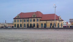 | Chicago, Burlington and Quincy Railroad-Creston Station | building | 1973 | 73000739 |
| Grand River Bridge | structure | 1998 | 98000479 | |
 | Iowana Hotel | building | 2009 | 09000298 |
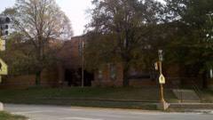 | Jefferson Elementary School | building | 2002 | 02001223 |
| Odd Fellows Block | building | 2014 | 13001079 | |
 | U. S. Post Office | building | 1978 | 78001264 |
Every wildfire the federal occurrence database records inside this county: 125 of them, burning about 1,592 acres. 1 started naturally and 1 was recorded as arson. Each settlement page carries the fires within five miles of it.
| Reported cause | Fires |
|---|---|
| Debris and open burning | 63 |
| Missing data/not specified/undetermined | 46 |
| Smoking | 5 |
| Equipment and vehicle use | 4 |
| Railroad operations and maintenance | 3 |
| Recreation and ceremony | 2 |
| Arson/incendiarism | 1 |
| Natural | 1 |
The five largest, by the area the report gives. None of them was recorded as arson.
| Date | Cause | Size | Reported by | Name on the report |
|---|---|---|---|---|
| 15 March 2012 | Debris and open burning | 120 acres | Iowa Department of Natural Resources | not named |
| 1 April 2015 | Debris and open burning | 100 acres | Iowa Department of Natural Resources | not named |
| 23 March 2010 | Missing data/not specified/undetermined | 80 acres | Iowa Department of Natural Resources | 5154 COUNTY RD. X-64, IOWA |
| 22 March 2015 | Debris and open burning | 80 acres | Iowa Department of Natural Resources | not named |
| 6 March 2020 | Debris and open burning | 80 acres | Iowa Department of Natural Resources | not named |
| 7 April 2013 | Debris and open burning | 80 acres | Iowa Department of Natural Resources | not named |
| 5 April 2013 | Debris and open burning | 75 acres | Iowa Department of Natural Resources | not named |
| 7 March 2020 | Debris and open burning | 60 acres | Iowa Department of Natural Resources | not named |
Every settlement page carries the fires within five miles of it - see the settlement index below.
The NOAA Storm Events Database holds 406 reports for this county, causing no deaths, 9 injuries and about $44,774,280 in recorded property damage. Each settlement page carries the reports that name it.
| Kind of event | Reports |
|---|---|
| Thunderstorm Wind | 138 |
| Hail | 120 |
| Heavy Rain | 59 |
| Tornado | 42 |
| Flash Flood | 26 |
| Funnel Cloud | 13 |
| Flood | 5 |
| Lightning | 3 |
The most serious of them, by death, then injury, then recorded damage. The accounts are quoted exactly as the forecast office filed them.
| When | Event | Place named | Harm | What the report says |
|---|---|---|---|---|
| April 2012 | Tornado (EF2) | Cromwell | 2 hurt, $5,000,000 | This tornado continued in from Adams county. NWS storm survey confirmed a strong EF2 tornado. It entered Union county just southwest of Cromwell and tracked east-northeast through the far northwest portion of Creston. The Greater Regional Medical Center and Southwest Community College sustained EF2 damage with the worst occurring to the Green Hills Education Center. The tornado continued tracking northeast and damaged a few farmsteads northeast of Creston. |
| May 1995 | Tornado (F4) | Creston to | 2 hurt, $3,000,000 | Twin vortex tornado. |
| March 1979 | Tornado (F3) | not stated | 2 hurt, $2,500,000 | no account filed |
| April 1999 | Tornado (F4) | Creston | 1 hurt, $2,000,000 | no account filed |
| May 1998 | Thunderstorm Wind | Creston | 1 hurt, $10,000 | no account filed |
| June 2004 | Thunderstorm Wind | Afton | 1 hurt, $2,000 | A tree was blown over and injured one person. He received a punctured lung and head injuries. |
| May 1989 | Tornado (F4) | not stated | $25,000,000 | no account filed |
| May 2007 | Hail | Afton | $750,000 | no account filed |
| April 2024 | Tornado (EF2) | Afton | $500,000 | This tornado formed between the BNSF railroad and Highway 34 west of Afton and took a track very similar to a tornado which occurred earlier in the hour. It produced EF2 damage to several house on either side of Highway 34 as it travelled to the northeast. The tornado crossed Three Mile Lake just upstream of the dam and impacted a structure in the Wildlife Management Building area just a few hundred yards from the one impacted in the earlier tornado. This tornado then moved northeast through rural Union County impacting another farmstead producing EF2 damage. The tornado dissipated in the north central portion of Union County near the intersection of Pheasant Avenue and 130th Street. |
| August 2009 | Thunderstorm Wind | Afton | $500,000 | A two-story brick building with wooden roof and shingles was damaged. Roof and shingles were blown off. A 4 foot diameter tree was uprooted in the city park and 3 air handling units were blown off of the East Union High School in Afton. Tin was blown off the feed mill. |
| April 2024 | Tornado (EF2) | Cromwell | $300,000 | This tornado entered Union County from Adams County south of Cromwell. The tornado moved northeast through western Union county remaining in mostly rural locations. It did impact a few farmsteads along the way with mostly tree and outbuilding damage. The tornado moved into the far northwest portions of Creston producing EF2 damage to a multiple story townhouse along with taking down several trees. The tornado weakened quickly after this point with some minor damage observed at the atletic fields of the high school. The tornado then moved into open farmland north of Creston before dissipating. |
| April 2012 | Thunderstorm Wind | Creston | $250,000 | Twenty inch tree down with other large trees uprooted. |
| May 2011 | Flash Flood | Creston Arpt | $250,000 | Four inches of rain with flash flooding in low lying areas. |
| September 2010 | Flash Flood | Cromwell | $250,000 | Numerous roads flooded from Creston west to the county line. Rainfall reported of 4 to 6 inches. |
| September 2003 | Tornado (F0) | Creston | $250,000 | Tornado cut a continous path from south of Creston through the town of Creston. |
| April 1964 | Tornado (F2) | not stated | $250,000 | no account filed |
| September 2014 | Flash Flood | Kent | $200,000 | Water over many secondary roads in southern Union County. Water in areas that rarely see flooding. |
| September 2014 | Flood | Spaulding | $200,000 | Numerous rural roads had water over them with some damage to bridge approaches from the water. |
| April 2001 | Tornado (F2) | Afton | $150,000 | Tornado moved from Ringgold County, across Union County, into Clarke County. |
| November 2015 | Tornado (EF1) | Kent | $125,000 | This tornado crossed three counties in southern Iowa. This is segment three in Union county. This long track tornado damaged a number of farmsteads along its 22 mile long path. The tornado was at its strongest in NW Ringgold County where EF-1 damage was found. The beginning and end sections of the track were narrow and intermittent. The narrow tornado also clipped the town of Clearfield to the NW early in its life. |
| April 2024 | Tornado (EF2) | Afton | $100,000 | This tornado developed west of Afton and quickly moved northeast. It crossed the BNSF railroad and Highway 34 before passing near the Three Mile Lake Dam. This tornado produced EF2 at one of the Wildlife Management Center's buildings before proceeding into rural areas of northern Union county. There was limited damage in this rolling terrain area with mostly tree damage although a few farmsteads were impacted with EF0 or EF1 damage. The tornado then crossed into Madison County northwest of Lorimor. |
| July 2015 | Flood | Afton | $100,000 | Flooding continued on over a dozen roads in the southeastern quarter of the county due to the 3 to 5 inches of rain that had fallen. Numerous roads near the Thayer area had been impacted. |
| June 2010 | Flash Flood | Creston | $100,000 | Manhole cover was lifted due to rushing water at the intersection of Highway 34 and Elm St. Some underpasses submerged on Osage St. |
| June 2008 | Flash Flood | Creston | $100,000 | Cherry Street north of Creston was closed due to high water. |
| August 2007 | Flash Flood | Spaulding | $100,000 | Water was reported over several county roads. The water had receded but most creeks remain out of their banks. |
| June 2010 | Flood | Creston | $100,000 | no account filed |
| May 2007 | Hail | Arispe | $100,000 | no account filed |
| May 2007 | Hail | Afton | $100,000 | no account filed |
| May 2004 | Flash Flood | Creston | $100,000 | no account filed |
| May 1995 | Thunderstorm Wind | Cromwell | $100,000 | no account filed |
| August 2007 | Flash Flood | Lorimor | $75,000 | Flash flooding was reported throughout the east and southeast portions of Union County. The flooding was along the Thompson River and tributaries were well out of their banks. Several gravel roads were under water with trees on the roads, carried by flood waters. |
| May 2007 | Tornado (EF0) | Thayer | $75,000 | Tornado formed on the back side of a bow echo. Damage was limited to EF0, but evidence suggested weak circulation. |
| June 1997 | Thunderstorm Wind | Creston | $75,000 | no account filed |
| April 2024 | Tornado (EF1) | Creston | $50,000 | Emergency management found damage along this path in north central Union County. The tornado formed about 5 miles northeast of Creston and remained in rural areas of the county. It impacted 3 different farmsteads producing up to EF1 damage to outbuildings at one of the sites. The tornado dissipated a few miles northwest of the northern end of Three Mile Lake. |
| December 2021 | Thunderstorm Wind | Creston | $50,000 | Emergency manager reported a tree down on a powerline and house. Time estimated from radar. |
| July 2015 | Flash Flood | Lorimor | $50,000 | Emergency Manager reported road closures across the eastern portions of the county. |
| August 2011 | Thunderstorm Wind | Creston | $50,000 | Trained spotter reports a measured wind gust of 71 MPH. Trees were uprooted on the west side of Creston with some roof damage. |
| June 2008 | Flash Flood | Lorimor | $50,000 | County roads were washed out due to heavy rains. |
| June 2008 | Tornado (EF1) | Creston Arpt | $50,000 | Damage to power poles. A farm was hit with damage to out buildings. |
| July 2008 | Flash Flood | Creston Arpt | $50,000 | Pole and Cherry Streets were closed due to high water over the road from the south end of Creston south to 270th Street. |
| August 2007 | Flash Flood | Talmage | $50,000 | Highway P64 was completely covered in water south of Thayer. |
| May 2001 | Lightning | Creston | $50,000 | no account filed |
| July 2000 | Flash Flood | West Portion | $50,000 | no account filed |
| May 1996 | Flood | Creston | $50,000 | no account filed |
| April 1994 | Thunderstorm Wind | Shannon City | $50,000 | no account filed |
| April 2025 | Tornado (EF1) | Kent | $46,000 | The tornado developed in southwest Union county and tracked through rural portions of the county. Four properties reported damage, ranging from damage to outbuildings to shingle damage to a home. |
| October 2018 | Tornado (EF1) | Cromwell | $40,000 | This tornado developed between Creston and Cromwell in western Union county and traveled on a somewhat unusual northwest path. Tornado was mostly in open rural cropland for nearly two miles producing only crop damage. However, the tornado encountered farmsteads along Clover Avenue about one half mile south of 170th Street. A garage was destroyed on the west side of the road and was rated EF1 damage given generally poor construction. Additional EF1 damage was observed with the nearby house with a portion of the roof and truss structure removed. Tree damage was observed across the road at an adjacent house. Additional minor damage was found about one quarter mile farther up the road with the last damage noted north of 170th Street on the west side of the road where a few roof panels were blown off an old metal shed. |
| March 2006 | Tornado (F0) | Creston | $40,000 | Tornado touched down briefly west of Creston. Damage was done to an attached two-car breezeway and tore it away from the house. There was little apparent damage to the car inside. |
| May 2011 | Lightning | Creston | $40,000 | no account filed |
| September 2001 | Thunderstorm Wind | Creston | $40,000 | no account filed |
| May 2018 | Thunderstorm Wind | Creston Arpt | $30,000 | Emergency manager reported two barns damaged west of Creston. |
| June 2018 | Thunderstorm Wind | Creston | $30,000 | Amateur radio operator reported power lines down along Highway 34 in Creston. |
| April 2024 | Tornado (EF1) | Creston Arpt | $25,000 | This tornado began a few miles south of the Creston airport and moved northeast in rural portions of central Union County. This tornado damaged trees and grain bins shortly after forming with only tree damage observed for most of its path. The tornado crossed Highway 34 between Creston and Afton and passed along the Twelve Mile Lake Dam before dissipating. |
| May 2013 | Hail | Creston | $25,000 | Golf ball size hail was reported on the northeast side of Creston. |
| May 2013 | Hail | Creston | $25,000 | Golf ball size hail covering the ground. Lasted 12 minutes. |
| June 2011 | Flash Flood | Creston | $25,000 | Several road intersections impassable within the Creston city limits due to fast moving water. |
| June 2008 | Tornado (EF1) | Creston | $25,000 | The roof was taken off of an outbuilding and power lines were blown down north of Creston. |
| August 2007 | Flash Flood | Spaulding | $25,000 | South Cherry Street was closed due to flash flooding. |
| August 2009 | Thunderstorm Wind | Afton | $25,000 | no account filed |
| July 2006 | Thunderstorm Wind | Creston | $25,000 | no account filed |
The Survey's mineral resources record lists 10 workings inside this county. 2 still produce and 8 are closed or unrecorded. Each settlement page carries the workings within five miles of it.
| Commodity | Workings |
|---|---|
| Sand and Gravel, Construction | 6 |
| Stone, Crushed/Broken | 4 |
The least common of them first, because a county's hundredth gravel pit says nothing its first ten did not.
| Where | Site | Commodity | Status | Recorded |
|---|---|---|---|---|
| Bullock Quarry | Stone, Crushed/Broken | Past Producer | ||
| Thayer Quarry | Stone, Crushed/Broken | Producer | ||
| Unknown | Stone, Crushed/Broken | Past Producer | ||
| Unknown | Stone, Crushed/Broken | Past Producer | ||
| Afton Pit | Sand and Gravel, Construction | Past Producer | ||
| Afton-Lacena Pit | Sand and Gravel, Construction | Past Producer | ||
| Spring Valley Lake | Sand and Gravel, Construction | Past Producer | ||
| Thayer Pit | Sand and Gravel, Construction | Producer | ||
| Unknown | Sand and Gravel, Construction | Past Producer | ||
| Unknown | Sand and Gravel, Construction | Past Producer |
Named settlements recorded in the Geographic Names Information System, each with the topographic sheets covering it. Villages, hamlets and abandoned places alike. Each is shown with the nearest named watercourse or landform and the survey quadrangle it falls on.
Jones township · 50254 · On Star Branch · Lorimor South quadrangle
11 sheets, 1951 to 1993
No longer a settlement
Union township · 50830 · On Indian Creek · Arispe quadrangle
8 sheets, 1955 to 1985
No longer a settlement
Jones township · 50254 · On Threemile Creek · Lorimor South quadrangle
11 sheets, 1951 to 1993
The vanished settlements of Union County: the places named above that are no longer on the map.