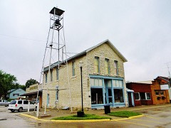
Block
From the record
23 National Register listings published here.
Sources: the National Register database, National Park Service
31 topographic sheets cover 26 settlements here, and 23 properties are on the National Register of Historic Places.
23 National Register listings published here.
Sources: the National Register database, National Park Service
Every property in this county listed on the National Register of Historic Places, with the year it was listed and the federal nomination document.
Every wildfire the federal occurrence database records inside this county: 15 of them, burning about 529 acres. None started naturally and none was recorded as arson. Each settlement page carries the fires within five miles of it.
| Reported cause | Fires |
|---|---|
| Missing data/not specified/undetermined | 11 |
| Debris and open burning | 3 |
| Smoking | 1 |
The five largest, by the area the report gives. None of them was recorded as arson.
| Date | Cause | Size | Reported by | Name on the report |
|---|---|---|---|---|
| 30 March 2014 | Debris and open burning | 200 acres | Iowa Department of Natural Resources | not named |
| 17 February 2017 | Smoking | 150 acres | Iowa Department of Natural Resources | not named |
| 30 March 2014 | Debris and open burning | 75 acres | Iowa Department of Natural Resources | not named |
| 25 March 2008 | Missing data/not specified/undetermined | 60 acres | Iowa Department of Natural Resources | not named |
| 5 October 2011 | Missing data/not specified/undetermined | 20 acres | Iowa Department of Natural Resources | 31827 HWY 2 FARMINGTON, IA |
| 11 March 2008 | Missing data/not specified/undetermined | 10 acres | Iowa Department of Natural Resources | not named |
| 28 February 2006 | Missing data/not specified/undetermined | 5.0 acres | Iowa Department of Natural Resources | not named |
| 17 April 2008 | Missing data/not specified/undetermined | 3.0 acres | Iowa Department of Natural Resources | not named |
Every settlement page carries the fires within five miles of it - see the settlement index below.
The NOAA Storm Events Database holds 327 reports for this county, causing 3 deaths, 20 injuries and about $17,552,950 in recorded property damage. Each settlement page carries the reports that name it.
| Kind of event | Reports |
|---|---|
| Hail | 126 |
| Thunderstorm Wind | 126 |
| Tornado | 27 |
| Flash Flood | 23 |
| Flood | 13 |
| Heavy Rain | 6 |
| Lightning | 5 |
| Funnel Cloud | 1 |
The most serious of them, by death, then injury, then recorded damage. The accounts are quoted exactly as the forecast office filed them.
| When | Event | Place named | Harm | What the report says |
|---|---|---|---|---|
| April 1967 | Tornado (F3) | not stated | 2 killed, 16 hurt, $2,500,000 | no account filed |
| April 2003 | Lightning | Keosauqua | 1 killed, 1 hurt | no account filed |
| May 1959 | Tornado (F3) | not stated | 1 hurt, $250,000 | no account filed |
| June 2012 | Thunderstorm Wind | Stockport | 1 hurt, $25,000 | Wind gusts estimated to be 70 mph blew a tree into a house in Stockport, IA around 510 pm CDT June 16. A four inch limb went through a window of the house injuring a teenage girl. |
| May 2002 | Lightning | Douds | 1 hurt | A man was left with a headache after being struck by lightning. |
| October 2024 | Lightning | Utica | $10,000,000 | Broadcast media reported that a historic church north of Keosauqua Iowa was struck by lightning that resulted in a fire and the total loss of the building. The time of the event was estimated using radar. |
| June 2008 | Flood | Selma | $540,000 | no account filed |
| August 2010 | Flood | Selma | $500,000 | no account filed |
| April 2013 | Flash Flood | Selma | $250,000 | Several rounds of heavy rains resulted in flash flooding across much of Van Buren County during the afternoon of April 17. |
| July 2010 | Flash Flood | Mt Sterling | $250,000 | Heavy rains resulted in flash flooding of Farmington, IA and much of southeast Van Buren County during the late evening of July 19 and morning of July 20. The Burg building in Farmington was inundated with flood waters. Some rural roads were covered by flood waters that flowed out of farm fields. The flooding had receded by 830 am CDT July 20. |
| July 2010 | Flood | Selma | $250,000 | no account filed |
| July 2010 | Flood | Selma | $250,000 | no account filed |
| April 1989 | Tornado (F2) | not stated | $250,000 | no account filed |
| November 1975 | Tornado (F2) | not stated | $250,000 | no account filed |
| April 1967 | Tornado (F2) | not stated | $250,000 | no account filed |
| January 1967 | Tornado (F3) | not stated | $250,000 | no account filed |
| August 1964 | Tornado (F2) | not stated | $250,000 | no account filed |
| April 2008 | Tornado (EF2) | Lebanon | $150,000 | An EF2 tornado moved northeast from just southeast of Lebanon to just northeast of Lebanon during the early evening of April 10th. A wine shed and mobile home were destroyed. The top was ripped off of a silo and the second story of a winery was damaged. A house sustained minor structural damage and several large trees were topped off. |
| July 2003 | Flash Flood | Farmington | $100,000 | On Hwy 81 at the Iowa/Missouri state line |
| May 2003 | Tornado (F0) | Birmingham | $100,000 | no account filed |
| June 2010 | Lightning | Keosauqua | $86,000 | Lightning struck the county 911 tower, damaging a console. |
| July 2003 | Thunderstorm Wind | Farmington | $80,000 | Old porch roof off & trailer overturned |
| June 2011 | Thunderstorm Wind | Cantril | $50,000 | Wind gusts estimated to be 70 mph blew a tree down onto a house in Cantril, IA at 800 pm CDT June 26. |
| June 2011 | Flash Flood | Lake Sugema Camp Gd | $50,000 | Heavy rains caused some flash flooding in southeastern Van Buren County during the morning of June 20. The Fox River flooded out of its banks and encroached onto Jersey Ave about 4 miles east of Cantril, IA. Some gravel roads about 3 miles west southwest of Bonaparte, IA washed out. In Farmington, water was across some roads and ditches and creeks were running high. |
| June 2009 | Thunderstorm Wind | Douds | $50,000 | Winds estimated to be 70 mph blew a tree down onto a house along Highway 98 south of the Pedrick Funeral Home on the north side of Douds, IA around 11 pm June 7. |
| September 2008 | Flash Flood | Stockport | $50,000 | Heavy rains caused flash flooding of Stockport, IA and areas east of Cantril, IA during the morning of September 13.||Near Stockport, a driver of an SUV had to be rescued from the flood waters after driving into a flooded rural road. The flood waters were over the hood of the vehicle.||About 5 miles east of Cantril, the approaches to the Fox River bridge were flooded and some basements were flooded. |
| July 2008 | Thunderstorm Wind | Farmington | $50,000 | Wind gusts estimated to be 65 mph blew down several trees and power lines in Farmington, IA around 700 pm July 27. One tree fell on a house at 519 N. 2nd Street. Another tree fell on a car on Washington Street. Additional tree damage was reported near Pearl Street and 4th Street. |
| August 2004 | Flash Flood | South Portion | $50,000 | Thunderstorms trained across southern Van Buren County producing rainfall rates of up to 1.5 inches per hour. Ground truth reports indicated anywhere from 3.5 to 6 inches of rain. A house between Cantril and Mt Sterling had its basement flooded. The 290th Street Bridge located between Underwood and Timber Avenues southwest of Farmington collapsed after the embankments were washed away due to the flood waters. |
| May 2003 | Thunderstorm Wind | Farmington | $50,000 | no account filed |
| April 1994 | Thunderstorm Wind | Milton | $50,000 | no account filed |
| July 2003 | Thunderstorm Wind | Milton | $40,000 | no account filed |
| April 2008 | Tornado (EF1) | Utica | $30,000 | An EF1 tornado moved northeast from about 2 miles west of Utica to 2 miles north of Stockport. The roof of a barn was ripped off and a shed was blown off its foundation. Some trees were also damaged and a utility pole was blown over onto a car. Time estimated. |
| March 2006 | Hail | Keosauqua | $30,000 | Emergency manager's truck damaged. There is probable unknown damage to residences and cars in town as well. |
| April 2006 | Tornado (F2) | Pittsburg | $30,000 | Rated F2. |
| July 2003 | Hail | Bonaparte | $30,000 | Jct J40 & W40 |
| June 2011 | Thunderstorm Wind | Farmington | $25,000 | Wind gusts estimated to be 70 mph blew a tree down onto a mobile home in Farmington, IA at 825 pm CDT June 26. |
| June 1990 | Tornado (F0) | not stated | $25,000 | no account filed |
| June 1980 | Tornado (F1) | not stated | $25,000 | no account filed |
| April 1964 | Tornado (F2) | not stated | $25,000 | no account filed |
| April 1960 | Tornado (F1) | not stated | $25,000 | no account filed |
| July 2008 | Thunderstorm Wind | Bonaparte | $20,000 | Wind gusts estimated to be 65 mph blew down numerous trees and power lines near Bonaparte, IA around 655 pm July 27. A power outage was observed for most of the eastern half of Van Buren County. |
| April 2006 | Hail | Keosauqua | $20,000 | Hail ranged from 1 to 1.75 inches. Several reports were received from the general public and fire department. |
| August 2004 | Lightning | Farmington | $20,000 | Lightning strike destroyed the entire electrical system of a house and all electric appliances that were plugged into it. |
| June 1997 | Thunderstorm Wind | Keosauqua | $20,000 | Numerous trees downed. One homeowner reported her windows and window fan were blown out of her bedroom. Still another damage report was that of a top torn off a grain bin. |
| July 2003 | Hail | Bonaparte | $20,000 | no account filed |
| March 2006 | Hail | Countywide | $15,000 | Hail ranging from 1.00 inch (quarter) to 1.75 inch (golfball) fell from Keosauqua northeast to the Van Buren/Henry county line from a supercell. Trained spotters, the emergency manager, and the Keosauqua co-operative observer reported 1.00-1.75 inch hail covering the ground in Keosauqua around 1745 CST. One inch hail occurred in Utica during the 1750-1754 CST time period along with heavy rain. |
| April 2006 | Tornado (F1) | Mt Zion | $15,000 | Rated F1 |
| June 1998 | Thunderstorm Wind | Countywide | $15,000 | Thunderstorms roared through Van Buren County leaving a trail of destruction. Numerous trees were downed across the county including 20 trees, valued at $4000, at Harmony Middle School in Farmington. Also in Farmington, the roof at Harmony High School was damaged, a light fixture at the front of the building was broken, and high winds blew down the outfield fence of the baseball field. A large maple tree, uprooted by the winds, fell against the corner of a home in Farmington causing major damage to the roof and eaves. A bar and an adjacent building were closed due to possible structural damage after windows were blown out of the buildings At least 14 power lines were downed across the Farmington area, and a large machine shed was destroyed by the thunderstorms. In Mt. Sterling an aluminum building blown onto a road knocked down a power line. A funnel cloud was reported near Douds along with damages reports of downed trees or power lines in Douds, Bonaparte, Cantril, Milton, Stockport and Mt Sterling. |
| June 2010 | Flash Flood | Farmington | $10,000 | Heavy rains resulted in flash flooding of several streets in Farmington, IA as well as Highway 2 just east of Farmington during the morning of June 21. According to the local paper, more than 20 property owners reported damage from the storm. In particular, a two block stretch of Highway 2 or North 4th Street in Farmington was flooded from runoff from Shimek Forest with debris washed across the road near Pearl Street. A section of State Street between 3rd and 4th streets was eroded. Several buildings were flooded, including the historic old buggy factory located at Second and State Streets, an accounting business, and an auto body repair shop. Rapid runoff scraped the surface of many city streets and numerous basements were flooded. The local newspaper also reported that the mayor of Farmington measured about 4.5 inches of rain between 3 am and 430 am CDT (90 minutes). |
| June 2010 | Thunderstorm Wind | Bonaparte | $10,000 | Wind gusts estimated to be 70 mph blew a tree down onto a garage in Bonaparte, IA around 530 pm June 23. |
| April 2006 | Tornado (F1) | Stockport | $10,000 | Rated F1 |
| June 2005 | Hail | Keosauqua | $10,000 | Small branches down with estimated 43 knot (50 mph) winds. |
| March 2006 | Hail | Douds | $6,000 | hail damage to a car |
| June 2011 | Thunderstorm Wind | Pittsburg | $5,000 | Wind gusts estimated to be 70 mph blew a billboard over about 1 mile north of Keosauqua, IA at 815 pm CDT June 26. |
| July 2010 | Flash Flood | Lake Sugema Camp Gd | $5,000 | Heavy rains resulted in flash flooding about 5 miles east of Cantril, IA during the late afternoon of July 19. The basement of a trained spotter was flooded. |
| July 2008 | Thunderstorm Wind | Farmington | $5,000 | Wind gusts estimated to be 65 mph blew down numerous trees and power lines in Farmington, IA at 655 pm July 27. A power outage was also observed. |
| July 2008 | Thunderstorm Wind | Birmingham | $5,000 | Wind gusts estimated to be 65 mph blew down numerous trees and power lines in Birmingham, IA at 637 pm July 27. A power outage was also observed. |
| July 2008 | Thunderstorm Wind | Keosauqua | $5,000 | Wind gusts estimated to be 65 mph blew down numerous trees and power lines in Keosauqua, IA at 645 pm July 27. A power outage was also observed. |
| July 2008 | Thunderstorm Wind | Bonaparte | $5,000 | Wind gusts estimated to be 65 mph blew down numerous trees and power lines in Bonaparte, IA at 650 pm July 27. A power outage was also observed. |
| June 2006 | Thunderstorm Wind | Bonaparte | $5,000 | numerous tree limbs down; roof blown off a feed shed. |
The Survey's mineral resources record lists 17 workings inside this county. 5 still produce and 12 are closed or unrecorded. Each settlement page carries the workings within five miles of it.
| Commodity | Workings |
|---|---|
| Stone, Crushed/Broken | 16 |
| Sand and Gravel, Construction | 1 |
The least common of them first, because a county's hundredth gravel pit says nothing its first ten did not.
| Where | Site | Commodity | Status | Recorded |
|---|---|---|---|---|
| Farmington Pit | Sand and Gravel, Construction | Producer | ||
| Anderson Quarry | Stone, Crushed/Broken | Past Producer | ||
| Camanche Quarry | Stone, Crushed/Broken | Producer | ||
| Dawson Quarry | Stone, Crushed/Broken | Producer | ||
| Douds Underground Mine | Stone, Crushed/Broken | Producer | ||
| Downing Quarry | Stone, Crushed/Broken | Past Producer | ||
| Gardner Quarry | Stone, Crushed/Broken | Past Producer | ||
| Miller Quarry | Stone, Crushed/Broken | Past Producer | ||
| Old County Quarry | Stone, Crushed/Broken | Past Producer | ||
| Sargent Quarry | Stone, Crushed/Broken | Past Producer | ||
| Selma-Nedrow Quarry | Stone, Crushed/Broken | Past Producer | ||
| Unknown | Stone, Crushed/Broken | Past Producer | ||
| Unknown | Stone, Crushed/Broken | Past Producer | ||
| Unknown | Stone, Crushed/Broken | Past Producer | ||
| Unknown | Stone, Crushed/Broken | Past Producer | ||
| Van Buren County Quarry | Stone, Crushed/Broken | Producer | ||
| Winsell-Clayton Quarry | Stone, Crushed/Broken | Past Producer |
Named settlements recorded in the Geographic Names Information System, each with the topographic sheets covering it. Villages, hamlets and abandoned places alike. Each is shown with the nearest named watercourse or landform and the survey quadrangle it falls on.
Washington township · 52565 · On Bear Creek · Bonaparte quadrangle
12 sheets, 1958 to 1990
Bonaparte township · 52620 · On Honey Creek · Bonaparte quadrangle
12 sheets, 1958 to 1990
Farmington township · 52626 · On Big Indian Creek · Farmington quadrangle
12 sheets, 1958 to 1990
Lick Creek township · 52535 · On Lick Creek · Mount Zion quadrangle
11 sheets, 1958 to 1990
Bonaparte township · 52620 · On Mud Creek · Bonaparte quadrangle
12 sheets, 1958 to 1990
No longer a settlement
Vernon township · 52573 · On Fox River · Mount Sterling quadrangle
13 sheets, 1958 to 1990
Van Buren township · 52565 · On Lick Creek · Mount Zion quadrangle
11 sheets, 1958 to 1990
Bonaparte township · 52620 · On Christie Creek · Bonaparte quadrangle
12 sheets, 1958 to 1990
No longer a settlement
Union township · 52535 · Mount Zion quadrangle
11 sheets, 1958 to 1990
No longer a settlement
Van Buren township · 52565 · On Chequest Creek · Keosauqua quadrangle
11 sheets, 1958 to 1990
Van Buren township · 52565 · Keosauqua quadrangle
11 sheets, 1958 to 1990
No longer a settlement
Farmington township · 52626 · On Big Indian Creek · Farmington quadrangle
12 sheets, 1958 to 1990
The vanished settlements of Van Buren County: the places named above that are no longer on the map.