 Block
From the record
13 National Register listings published here.
Sources: the National Register database, National Park Service
49 topographic sheets cover 35 settlements here, and 13 properties are on the National Register of Historic Places.
13 National Register listings published here.
Sources: the National Register database, National Park Service
Every property in this county listed on the National Register of Historic Places, with the year it was listed and the federal nomination document.
| Photograph | Property | Type | Listed | Reference |
|---|---|---|---|---|
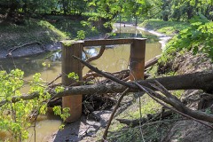 | Coal Creek Bridge | structure | 1998 | 98000473 |
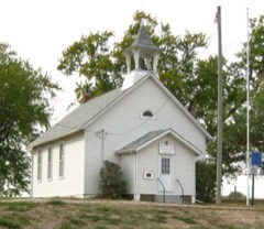 | Hoosier Row School | building | 2011 | 11000393 |
 | Indianola Carnegie Library | building | 2017 | 100001568 |
 | Indianola High School | building | 2002 | 02001247 |
| Lake Ahquabi State Park, Bathhouse Area (Area B) | district | 1990 | 90001664 | |
| Lake Ahquabi State Park, Picnic Area (Area A) | district | 1990 | 90001663 | |
| Lake Ahquabi State Park, Refectory Area (Area C) | building | 1990 | 90001665 | |
 | Octagon Barn, Otter Township | building | 1986 | 86001448 |
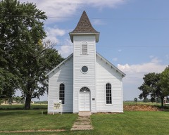 | Palmyra Methodist Episcopal Church | building | 1979 | 79000945 |
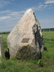 | Polled Hereford Breed Origin Site | site | 1983 | 83000408 |
 | Science Hall | building | 1991 | 91000535 |
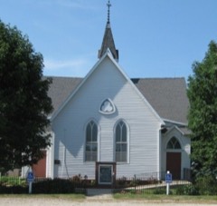 | United Presbyterian Church, Summerset | building | 1976 | 76000811 |
 | Warren County Court House | building | 2003 | 03000818 |
Every wildfire the federal occurrence database records inside this county: 57 of them, burning about 1,190 acres. None started naturally and none was recorded as arson. Each settlement page carries the fires within five miles of it.
| Reported cause | Fires |
|---|---|
| Debris and open burning | 30 |
| Missing data/not specified/undetermined | 22 |
| Equipment and vehicle use | 4 |
| Misuse of fire by a minor | 1 |
The five largest, by the area the report gives. None of them was recorded as arson.
| Date | Cause | Size | Reported by | Name on the report |
|---|---|---|---|---|
| 13 February 2006 | Missing data/not specified/undetermined | 346 acres | Iowa Department of Natural Resources | not named |
| 26 March 2014 | Missing data/not specified/undetermined | 320 acres | Iowa Department of Natural Resources | DONAR |
| 18 April 2007 | Missing data/not specified/undetermined | 150 acres | Iowa Department of Natural Resources | not named |
| 22 February 2006 | Missing data/not specified/undetermined | 40 acres | Iowa Department of Natural Resources | not named |
| 20 March 2007 | Missing data/not specified/undetermined | 35 acres | Iowa Department of Natural Resources | not named |
| 7 October 2011 | Missing data/not specified/undetermined | 35 acres | Iowa Department of Natural Resources | 240TH AND MCKINNELY, IA |
| 22 March 2015 | Missing data/not specified/undetermined | 30 acres | Iowa Department of Natural Resources | not named |
| 28 March 2015 | Debris and open burning | 25 acres | Iowa Department of Natural Resources | not named |
Every settlement page carries the fires within five miles of it - see the settlement index below.
The NOAA Storm Events Database holds 884 reports for this county, causing 1 death, 10 injuries and about $37,515,030 in recorded property damage. Each settlement page carries the reports that name it.
| Kind of event | Reports |
|---|---|
| Hail | 338 |
| Thunderstorm Wind | 233 |
| Heavy Rain | 123 |
| Flood | 79 |
| Tornado | 48 |
| Flash Flood | 38 |
| Funnel Cloud | 19 |
| Lightning | 6 |
The most serious of them, by death, then injury, then recorded damage. The accounts are quoted exactly as the forecast office filed them.
| When | Event | Place named | Harm | What the report says |
|---|---|---|---|---|
| August 2000 | Lightning | Milo | 1 killed, $65,000 | no account filed |
| April 2001 | Thunderstorm Wind | Carlisle | 5 hurt, $20,000 | School bus overturned by wind gust. |
| June 1953 | Tornado (F1) | not stated | 2 hurt, $25,000 | no account filed |
| March 2002 | Thunderstorm Wind | Indianola | 1 hurt, $100,000 | Two semi-tractortrailer rigs blown of U.S. Highway 65. One driver received minor injuries. |
| June 1999 | Lightning | Indianola | 1 hurt, $10,000 | no account filed |
| March 1979 | Tornado (F3) | not stated | 1 hurt | no account filed |
| March 2022 | Tornado (EF2) | Churchville | $20,000,000 | This is a continuation of the tornado which started in Madison county and passed into Warren county. The tornado remained very broad with a maximum width of up to 500 yards at times. Video evidence supports a multi-vortex circulation with the tornado across much of Warren county. The tornado cross Interstate 35 shortly after entering the county but fortunately, no vehicles were impacted. The tornado remained in rural areas to the west southwest of Norwalk producing mostly tree and outbuilding damage. The tornado passed along the southeast edge of Norwalk producing EF0 to EF1 damage along Coolidge Street and along Highway G14 near Warrior Run Golf Course. The tornado crossed Highway 5 just west of the intersections of Highway 5 and Highway 69 approaching the southeast side of Des Moines. The tornado entered into Polk county shortly after crossing Highway 69 near the intersection of Highway 69 and Indianola Avenue. |
| June 2015 | Flood | Cumming | $1,000,000 | Emergency Manager reported Highway 92 closed between S23 and S31. Three bridges were destroyed across the county and numerous culverts washed out. Numerous farm to market roads sustained damage including bridge approaches and also several structures damaged. |
| July 2010 | Tornado (EF1) | Spring Hill | $750,000 | Tornado west to west northwest of Indianola. Multiple reports with barns and houses damaged. |
| June 2007 | Tornado (EF2) | Cumming | $700,000 | Tornado spotted by amateur radio, law enforcement, Warren County Emergency Manager, and trained spotters. Touched down near Cumming and lifted south of the Norwalk area. Damage was done to several buildings. One house had the roof taken off. Numerous trees and power lines were downed. The tornado track was generally east-southeast, however the track was not straight. |
| July 2015 | Flash Flood | Cumming | $500,000 | The Emergency Manager sent a list of all the roads impacted by water. They included the following: Hwy 5 at the Hartford railroad underpass, Hwy 92 at the South River, 20th Ave from Hwy 92 to Jersey St., Kennedy St. just east of 150th Ave with signs of it being washed out and 4 feet of water over the road, 180th and Hwy 92, Hwy S23 and Grimes had 3 feet of water over the road, Interstate 35 between mile marker 57 and 59, Hwy 92 and the railroad overpass by Beech and S31, 165th Ave and Clarke St. had 2 feet over the road, Hwy 92 west of S23, Fulton both at 115th and around S23, G24 from west of R57 to 73rd and from 115th to Hwy 65/69, Idaho St. east of Hwy 28. Hwy 28 on the north edge of Martensdale, S23 north of Hwy 92, and at 165th and Buchanan. |
| June 2011 | Flood | Hartford | $500,000 | Water over Highway 5 between County Roads S31 and S23 reported by the IDOT. |
| August 2019 | Tornado (EF3) | Indianola Arpt | $350,000 | The second of three tornadoes associated with a fast moving QLCS. The particularly strong tornado moved across rural Warren county producing mainly crop and tree damage. However, the tornado encountered the several large steel buildings with I-beam construction. Significant damage occurred to these buildings with some being totally destroyed producing the EF3 damage. The tornado continued to the southeast beyond this area remaining in rural crop and woodland areas. |
| June 1998 | Flash Flood | Indianola | $350,000 | no account filed |
| July 2014 | Flash Flood | Milo | $300,000 | Ditches are completely full and flowing through the town of Millo. Roughtly 80 percent of the town still had standing water in the yards up to 3 feet deep. |
| June 2007 | Tornado (EF1) | Norwalk | $300,000 | Tornado spotted by the Norwalk Fire Department, law enforcement, Warren County Emergency Manager, and trained spotters. Touched down near Norwalk, then tracked southeast into northeast Norwalk, then east-southeast of Norwalk. Damage was done to several buildings. One house had the roof taken off. Numerous trees and power lines were downed. |
| June 2011 | Flood | Churchville | $300,000 | no account filed |
| June 2015 | Flood | Sandyville | $250,000 | The South River at Ackworth crested at 31.95 feet at 11:00 AM CST on 25 June. |
| July 2015 | Flood | Churchville | $250,000 | The Middle River at Indianola crested at 24.90 feet at 2:15 PM CDT on 29 July. |
| June 2015 | Flood | Churchville | $250,000 | The Middle River at Indianola crested at 23.85 feet at 11:15 AM CST on 25 June. |
| July 2015 | Flash Flood | Scotch Ridge | $250,000 | Emergency Manager reported US 65/69 south of Indianola closed due to water flowing over the road. Additional sections of US 65/69 closed elsewhere in the county also due to water flowing over the road. Delayed report and time estimated via radar. |
| July 2010 | Tornado (EF1) | Beech | $250,000 | Several houses damaged. |
| May 1988 | Tornado (F1) | not stated | $250,000 | no account filed |
| June 1980 | Tornado (F1) | not stated | $250,000 | no account filed |
| June 1980 | Tornado (F1) | not stated | $250,000 | no account filed |
| March 1979 | Tornado (F2) | not stated | $250,000 | no account filed |
| April 2012 | Tornado (EF1) | Medora | $200,000 | Brief EF1 tornado confirmed by NWS damage survey. The tornado touched down three miles east of New Virginia and tracked about a mile to the east-northeast before dissipating. The tornado severely damaged several farm outbuildings and flipped several camper trailers. Wind speeds were estimated around 100 MPH. |
| June 2011 | Flood | Hartford | $200,000 | no account filed |
| May 1998 | Hail | Indianola | $200,000 | no account filed |
| June 2023 | Lightning | Norwalk | $150,000 | House fire started by lightning strike. The home experienced significant damage to the roof and upper floor. Time matched to CG lightning data. |
| June 2018 | Thunderstorm Wind | Summerset | $150,000 | Public reported grain bins knocked over and widespread tree damage, including trees snapped at the trunk. |
| June 2014 | Thunderstorm Wind | Wick | $150,000 | Swath of winds downstream of a dissipating tornado. Worst damage was at the beginning, where an outbuilding was very heavily damaged and debris thrown east across a road. The damage intensity lessened and the path broadened within a few miles SE of the start point. |
| June 2008 | Tornado (EF1) | Liberty Center | $150,000 | Tornado touched down in the central part of the county and tracked to the northeast corner. For the most part, the track was across open country with damage to outbuildings and one house. Tornado crossed from Warren County in Marion County. |
| June 2008 | Flood | Churchville | $150,000 | no account filed |
| June 2014 | Thunderstorm Wind | Martensdale | $125,000 | Building and house partially destroyed on 50th Ave and Highway 92. |
| June 2014 | Thunderstorm Wind | Wick | $125,000 | Large grain bin destroyed along with two hoop buildings. |
| August 2019 | Thunderstorm Wind | Lacona | $100,000 | Emergency manager reported several structures damaged, including machine sheds, grain elevators, and power lines down. Time estimated from radar. |
| May 2019 | Flood | Churchville | $100,000 | The North River at Norwalk crested at 23.26 feet on 26 May 2019 at 03:45 UTC. |
| June 2018 | Thunderstorm Wind | Indianola | $100,000 | Public reported large trees down, damage to vehicles, and power lines down near Boston Ave in Indianola. |
| May 2016 | Lightning | Spring Hill | $100,000 | WHO Des Moines reported a fire at a Warren County pet cemetery and funeral home in the early morning hours. Given the building was under construction with no current electrical, it was suspected that an overnight/early morning storm sparked the blaze with lightning. The call for the fire came in around 5 am and it is estimated that the lightning strike was around 4:30 am based on radar data. ||The building fire drew crews from North Warren, Carlisle, and Norwalk. |
| June 2015 | Flood | Churchville | $100,000 | The North River at Norwalk crested at 23.59 feet at 4:00 PM CST on 26 June. |
| December 2015 | Flood | Cumming | $100,000 | Many county roads were closed across portions of the county from flooding with rises on local streams and creeks. |
| September 2014 | Flash Flood | Norwalk | $100,000 | Water 3 to 5 feet deep reported on Cherry Street. |
| September 2014 | Flash Flood | Cumming | $100,000 | Numerous roads underwater across the county. |
| September 2014 | Flood | Cumming | $100,000 | Numerous roads remain underwater across the county. |
| June 2011 | Flash Flood | Norwalk | $100,000 | Eight to 10 inches of water flowing rapidly across lawns. |
| May 2004 | Tornado (F1) | Bevington | $100,000 | Tornado spun up in a well organized bow echo and tracked across northern Warren County. |
| June 2014 | Hail | Sandyville | $100,000 | no account filed |
| June 2014 | Hail | Sandyville | $100,000 | no account filed |
| September 2014 | Flood | Churchville | $100,000 | no account filed |
| September 2014 | Flood | Churchville | $100,000 | no account filed |
| May 2011 | Flood | Hartford | $100,000 | no account filed |
| June 2010 | Flood | Churchville | $100,000 | no account filed |
| June 2008 | Flood | Hartford | $100,000 | no account filed |
| May 2001 | Flash Flood | Countywide | $100,000 | no account filed |
| June 1998 | Thunderstorm Wind | Carlisle | $100,000 | no account filed |
| May 1996 | Flood | Indianola | $100,000 | no account filed |
| March 2017 | Tornado (EF1) | Liberty Center | $80,000 | Tornado developed southwest of Milo and moved quickly northeast. It destroyed a small outbuilding shortly after developing. It then destroyed another garage tossing it several hundred yards before settling on the other side of the road in a neighbors yard. Additional tree damage occurred before encountering another residence where significant roof and window damage occurred. The tornado then continued in mainly rural areas southeast of Milo with only tree damage prior to lifting. |
| June 1997 | Thunderstorm Wind | Hartford | $80,000 | no account filed |
| May 2024 | Thunderstorm Wind | Clarkson | $75,000 | Emergency manager reported a tree on a house. |
The Survey's mineral resources record lists 5 workings inside this county. None of them still produces: all are closed or unrecorded. Each settlement page carries the workings within five miles of it.
| Commodity | Workings |
|---|---|
| Sand and Gravel, Construction | 2 |
| Flagstone | 2 |
| Clay | 1 |
The least common of them first, because a county's hundredth gravel pit says nothing its first ten did not.
| Where | Site | Commodity | Status | Recorded |
|---|---|---|---|---|
| Carlisle Brick and Tile Co. Pit | Clay | Past Producer | ||
| Carlisle Sand and Gravel Pit | Sand and Gravel, Construction | Past Producer | ||
| Kibbey Pit | Sand and Gravel, Construction | Past Producer | ||
| Lockridge Sandstone Quarry | Flagstone | Past Producer | ||
| Unknown | Flagstone | Past Producer |
Named settlements recorded in the Geographic Names Information System, each with the topographic sheets covering it. Villages, hamlets and abandoned places alike. Each is shown with the nearest named watercourse or landform and the survey quadrangle it falls on.
Jefferson township · 50240 · On Clanton Creek · Saint Charles quadrangle
9 sheets, 1951 to 1984
Richland township · 50118 · On Middle River · Hartford quadrangle
9 sheets, 1910 to 1984
No longer a settlement
Palmyra township · 50047 · On Skinaway Creek · Hartford quadrangle
9 sheets, 1910 to 1984
No longer a settlement
Otter township · 50001 · Milo quadrangle
9 sheets, 1910 to 1984
No longer a settlement
Jefferson township · 50160 · On Clanton Creek · Martensdale quadrangle
11 sheets, 1931 to 1984
Virginia township · 50210 · New Virginia quadrangle
10 sheets, 1950 to 1984
No longer a settlement
Greenfield township · 50125 · On Felters Branch · Norwalk quadrangle
11 sheets, 1931 to 1984
East Lincoln township · 50125 · On Plug Run · Scotch Ridge quadrangle
11 sheets, 1931 to 1984
East Lincoln township · 50125 · On Plug Run · Scotch Ridge quadrangle
11 sheets, 1931 to 1984
No longer a settlement
The vanished settlements of Warren County: the places named above that are no longer on the map.