 Block
Folsom, Iowa
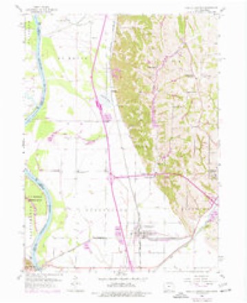
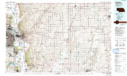
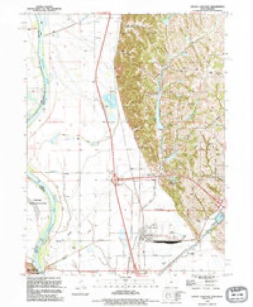
13 topographic sheets cover this place, the earliest surveyed in 1954 and the latest in 1993. It stands in Oak Township. It lies in ZIP code area 51561. It lies near Indian Hollow. The Survey maps it on the Pacific Junction quadrangle.
Topographic sheets covering this place
6 surveys from 13 printed sheetsMatched by testing this settlement's coordinate against the published boundary of every sheet in the United States Geological Survey's historical collection. Each opens the scanned sheet at the Survey.
- 1954 USGS Omaha quadrangle1:250000, 3 printings
- 1956 USGS Pacific Junction quadrangle1:24000, 4 printings
- 1957 USGS Omaha quadrangle1:250000
- 1958 USGS Omaha quadrangle1:250000, 2 printings
- 1985 USGS Omaha quadrangle1:100000, 2 printings
- 1993 USGS Pacific Junction quadrangle1:24000
Fires near this place
43 since 2009Regional context, not property-specific evidence. The federal wildfire occurrence database lists 43 fires within 5 miles of Folsom between 2009 and 2020, burning about 704 acres in total. None started naturally. 1 was recorded as arson. Distance is straight-line from the map coordinates, so a fire counted here may appear on a neighbouring settlement's page as well.
| Reported cause | Fires |
|---|---|
| Missing data/not specified/undetermined | 20 |
| Debris and open burning | 14 |
| Smoking | 4 |
| Equipment and vehicle use | 2 |
| Recreation and ceremony | 1 |
| Fireworks | 1 |
| Arson/incendiarism | 1 |
The most recent of them, most recent first, with the day each was reported and the service that recorded it.
| Date | Cause | Size | Reported by | Name on the report |
|---|---|---|---|---|
| 22 August 2012 | Smoking | 1.0 acres | Iowa Department of Natural Resources | not named |
| 5 July 2020 | Missing data/not specified/undetermined | under an acre | Nebraska Forest Service | not named |
| 3 July 2012 | Fireworks | under an acre | Nebraska Forest Service | not named |
| 18 July 2012 | Missing data/not specified/undetermined | under an acre | Nebraska Forest Service | not named |
| 9 April 2014 | Missing data/not specified/undetermined | under an acre | Nebraska Forest Service | not named |
| 9 April 2014 | Missing data/not specified/undetermined | 1.0 acres | Nebraska Forest Service | not named |
| 29 April 2018 | Missing data/not specified/undetermined | under an acre | Nebraska Forest Service | not named |
| 28 April 2018 | Recreation and ceremony | 12 acres | Nebraska Forest Service | not named |
Settlements close enough to share some of these fires:
Mines and quarries near this place
2 within 5 milesRegional context, not property-specific evidence. The federal mineral resources record lists 2 workings within 5 miles of Folsom: 2 producers. All of them still produce. What was taken out: Sand and Gravel, Construction, Stone, Crushed/Broken. Distance is straight-line from the map coordinates, so a quarry counted here may appear on a neighbouring settlement's page as well.
| Where | Site | Commodity | Status | Recorded |
|---|---|---|---|---|
| Amick Pit | Sand and Gravel, Construction | Producer | ||
| Glenwood Quarry | Stone, Crushed/Broken | Producer |
Storms near this place
12 since 2008Regional context, not property-specific evidence. The National Weather Service names Folsom in 12 storm reports between 2008 and 2025: 9 flood, 1 hail, 1 tornado, 1 thunderstorm wind. No death or injury is recorded in these reports. Each account below is quoted exactly as the forecast office filed it, from the NOAA Storm Events Database, and each date opens the federal record of that event.
| When | Event | Place named | Harm | What the report says |
|---|---|---|---|---|
| June 2010 | Flood | Folsom | $50,000 | Heavy rain over much of eastern Nebraska and western Iowa during most of June caused a prolonged period of flooding along the Missouri River, especially downstream of Omaha through Rulo. The flood damage was increased near the confluence of the Platte River where flood waters from the Platte added to the flow. In Plattsmouth the Missouri River crested a little over 33 feet in the late afternoon of June 22nd, flood stage is 26 feet. The river climbed above flood stage in the afternoon of June 11 and remained above flood stage into July. Several mobile home and camping communities along the river were flooded, including some trailers and mobile homes. Roads and farmland along the river were also flooded. |
| July 2011 | Flood | Folsom | $25,000 | Flooding along the Missouri River gradually worsened over the area during June into July as record releases from Gavins Point Dam brought widespread flooding along the River. At Plattsmouth the river started June around 30 feet, flood stage is 26 feet, and eventually reached a little over 36 feet by the end of the month before falling a little in July. However, at least moderate flooding persisted well into August. The flooding affected farmland along the river along with roads and recreational areas. The water treatment plant and wellheads near Glenwood were sandbagged to prevent flood waters from reaching it. By the middle of June about 125 of the 500 residences along the river had left their dwellings, some due to mandatory evacuations west of I-29 since rising ground water caused impassable county roads blocking possible evacuation routes. |
| June 2011 | Flood | Folsom | $10,000 | Flooding along the Missouri River gradually worsened over the area during June as record releases from Gavins Point Dam brought widespread flooding along the River. At Plattsmouth the river started June around 30 feet, flood stage is 26 feet, and eventually reached a little over 36 feet by the end of the month. The flooding affected marshes and farmland along the river and a few roads and recreational areas were also flooded. The water treatment plant and wellheads near Glenwood were sandbagged to prevent flood waters from reaching them. By the middle of June about 125 of the 500 residences along the river had left their dwellings. The flooding persisted into July. |
| July 2010 | Flood | Folsom | $10,000 | This flooding carried over from June when heavy rain over much of eastern Nebraska and western Iowa during most of the month caused a prolonged period of flooding along the Missouri River downstream of Omaha through Rulo. The flood damage was increased near the confluence of the Platte River where flood waters from the Platte added to the flow. In Plattsmouth the Missouri River crested a little over 33 feet in the late afternoon of June 22nd, flood stage is 26 feet. During July the river crested close to 29.5 feet in the afternoon of July 1. The river climbed above flood stage in the afternoon of June 11 and remained close to or above flood stage most of July into August. Several mobile home and camping communities along the river were flooded, including some trailers and mobile homes. Roads near the river were also flooded. |
| May 2011 | Flood | Folsom | $5,000 | This flooding carried over from April when several episodes of heavy rain combined with snow melt and heavy rain upstream caused a prolonged period of high flows along the Missouri River. At Plattsmouth the river fluctuated a little above and below its 26 foot flood stage until around May 21st then started steadily rising ending the month a little over 30 feet. Although the flooding mainly affected marshes and farmland along the river, a few roads and recreational areas were also flooded. |
| September 2011 | Flood | Folsom | $5,000 | Flooding along the Missouri River, which had gradually worsened over Mills county during June and July began improving during August into September as record releases from Gavins Point Dam were reduced during August. At Plattsmouth the river reached a crest of a little over 36 feet by the end of June, flood stage is 26 feet. The river level near Plattsmouth fell a little in July and a bit more in early to mid August and by the first of September the river had fallen to around 30 feet. The river near Plattsmouth finally fell below flood stage on Sept. 27th. The flooding affected farmland along the river along with roads and recreational areas. |
| August 2010 | Flood | Folsom | $3,000 | This flooding carried over from June and July when heavy rain over much of eastern Nebraska and western Iowa during those months caused a prolonged period of flooding along the Missouri River downstream of Omaha through Rulo. In Plattsmouth the Missouri River crested a little over 33 feet in the late afternoon of June 22nd, flood stage is 26 feet. During July the river crested close to 29.5 feet in the afternoon of July 1 and a crest of around 29 feet was observed during the first week of August. The river climbed above flood stage in the afternoon of June 11 and remained close to or above flood stage most of July into August. Several mobile home and camping communities along the river were flooded, including some trailers and mobile homes. Roads near the river were also flooded, although the more significant flooding was seen in June and July. |
| April 2025 | Thunderstorm Wind | Folsom | - | Personal weather station measured gust of 65 mph, likely due to the evaporating of anvil precipitation helping to mix down a strong low-level jet. |
| July 2024 | Flood | Folsom | - | This is a continuation of river flooding from the end of June. River levels crested along this stretch of the Missouri at the end of June, hence flood waters were receding by this time. As such, the greatest impacts were felt in June (and discussed in the June entry for StormData). For the first part of July while flood waters continued to recede, continued impacts were felt in the form of residual flooding in low-lying areas of roads, trails, and riverfront properties. Damage amounts can be found in June StormData. |
| June 2024 | Flood | Folsom | - | Excessive rainfall across much of eastern South Dakota resulted in river flooding along the Missouri River at the end of June. Moderate flood stage was observed along the Missouri, with the river gauge in Bellevue cresting at 33.84 feet on 6/29. Flood stage at this river gauge is at 30.0 feet. The crest further south across the river from Plattsmouth was the same day but at 31.75 feet. Flood stage at this gauge is 26.0 feet. The county did not report any damages to the State of Iowa from this flooding event, so have left as zero. |
| June 2017 | Tornado (EF1) | Folsom | - | This is a continuation of the tornado that struck Offutt Air Force Base in Sarpy County, Nebraska. The tornado crossed the Missouri River just east of a water treatment plant in Bellevue, Nebraska. The tornado continued moving southeast into rural, river bottom land in Iowa and then struck a farmstead on Gaston Avenue in Mills County. Several outbuildings and barns were damaged or destroyed. The farm home suffered roof damage. The tornado continued southeast and then tipped over a center pivot irrigation system before dissipating. |
| April 2008 | Hail | Folsom | - | A significant amount of pea to dime size hail fell for about 10 minutes. |
Nearest settlements
The eight closest, with where each one stands in the county. Distances are straight-line, computed from the Geographic Names Information System coordinates.
| Map | Place | Distance | Sheets |
|---|---|---|---|
| Hentons (historical) | 0.8 miles | 13 | |
| Pacific City | 3.1 miles | 13 | |
| Glenwood | 5.0 miles | 12 | |
| Pacific Junction | 5.0 miles | 13 | |
| Mills | 5.6 miles | 13 | |
| Mineola | 7.4 miles | 11 | |
| Balfour | 8.4 miles | 12 | |
| Hillsdale | 9.6 miles | 12 |
Provenance
This settlement is recorded in the Geographic Names Information System as feature 464547. The sheet list is computed by point-in-boundary test against the United States Geological Survey's historical topographic inventory. Both are works of the United States government and carry no copyright under 17 U.S.C. 105.
Wildfire. Short, Karen C. 2022. Spatial wildfire occurrence data for the United States, 1992-2020 [FPA_FOD_20221014]. 6th Edition. Fort Collins, CO: Forest Service Research Data Archive. https://doi.org/10.2737/RDS-2013-0009.6 Collected with United States Government funding and usable without additional permissions or fees.
Mines and quarries. USGS Mineral Resources Data System (MRDS) https://mrdata.usgs.gov/mrds/ A work of the United States government, no copyright under 17 U.S.C. 105.
Storms. NOAA National Centers for Environmental Information, Storm Events Database https://www.ncei.noaa.gov/stormevents/ A work of the United States government, no copyright under 17 U.S.C. 105. Narratives are quoted verbatim from the National Weather Service report and are not edited or summarised.