 Block
River Sioux, Iowa
8 topographic sheets cover this place, the earliest surveyed in 1955 and the latest in 1986. It stands in Little Sioux Township. It lies in ZIP code area 51545. It stands on Little Sioux River. The Survey maps it on the Little Sioux quadrangle.
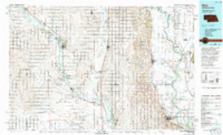
Topographic sheets covering this place
5 surveys from 8 printed sheetsMatched by testing this settlement's coordinate against the published boundary of every sheet in the United States Geological Survey's historical collection. Each opens the scanned sheet at the Survey.
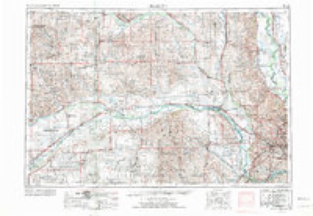
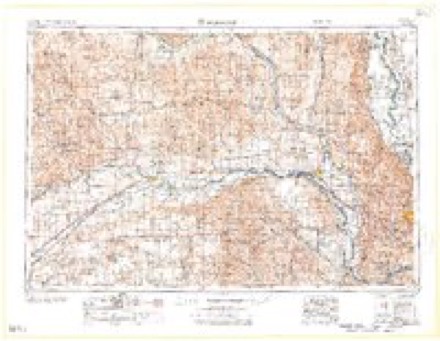
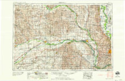
- 1955 USGS Fremont quadrangle1:250000, 3 printings
- 1957 USGS Fremont quadrangle1:250000
- 1958 USGS Fremont quadrangle1:250000
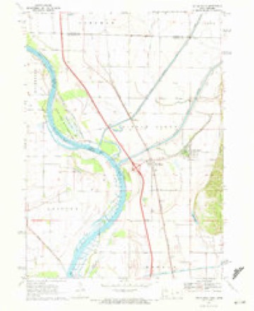
- 1970 USGS Little Sioux quadrangle1:24000
- 1986 USGS Blair quadrangle1:100000, 2 printings
Fires near this place
10 since 2006Regional context, not property-specific evidence. The federal wildfire occurrence database lists 10 fires within 5 miles of River Sioux between 2006 and 2017, burning about 290 acres in total. None started naturally. None was recorded as arson. Distance is straight-line from the map coordinates, so a fire counted here may appear on a neighbouring settlement's page as well.
| Reported cause | Fires |
|---|---|
| Missing data/not specified/undetermined | 10 |
The most recent of them, most recent first, with the day each was reported and the service that recorded it.
| Date | Cause | Size | Reported by | Name on the report |
|---|---|---|---|---|
| 4 August 2006 | Missing data/not specified/undetermined | 1.0 acres | Iowa Department of Natural Resources | not named |
| 9 April 2014 | Missing data/not specified/undetermined | under an acre | Iowa Department of Natural Resources | not named |
| 22 April 2017 | Missing data/not specified/undetermined | 47 acres | Iowa Department of Natural Resources | not named |
| 22 April 2014 | Missing data/not specified/undetermined | 32 acres | Iowa Department of Natural Resources | not named |
| 25 March 2008 | Missing data/not specified/undetermined | 2.0 acres | Iowa Department of Natural Resources | not named |
| 18 March 2011 | Missing data/not specified/undetermined | 202 acres | Iowa Department of Natural Resources | 1801 124TH TRAIL, PISGAH, IA |
| 24 February 2006 | Missing data/not specified/undetermined | under an acre | Iowa Department of Natural Resources | not named |
| 4 December 2006 | Missing data/not specified/undetermined | 4.0 acres | Iowa Department of Natural Resources | not named |
Settlements close enough to share some of these fires:
Mines and quarries near this place
2 within 5 milesRegional context, not property-specific evidence. The federal mineral resources record lists 2 workings within 5 miles of River Sioux: 2 past producers. None of them still produces. What was taken out: Sand and Gravel, Construction. Distance is straight-line from the map coordinates, so a quarry counted here may appear on a neighbouring settlement's page as well.
| Where | Site | Commodity | Status | Recorded |
|---|---|---|---|---|
| Little Sioux Pit | Sand and Gravel, Construction | Past Producer | ||
| Wallace Pit | Sand and Gravel, Construction | Past Producer |
Storms near this place
35 since 2007Regional context, not property-specific evidence. The National Weather Service names River Sioux in 35 storm reports between 2007 and 2023: 24 thunderstorm wind, 5 flood, 4 hail, 1 tornado. No death or injury is recorded in these reports. Each account below is quoted exactly as the forecast office filed it, from the NOAA Storm Events Database, and each date opens the federal record of that event.
| When | Event | Place named | Harm | What the report says |
|---|---|---|---|---|
| August 2011 | Flood | River Sioux | $7,000,000 | Flooding along the Missouri River gradually worsened over the area during June and July and continued into August as record releases from Gavins Point Dam brought widespread flooding along the River. The river near Blair climbed to a little under 33 feet by the end of June, flood stage is 26.5 feet, before falling slightly during July and a little more in early to mid August. However, by late August decreased releases from Gavins Point Dam had allowed the river near Blair to fall to around 28 feet. County roads and highways, some homes and farmland and parts of Interstate 29 were flooded along with several parks and recreation areas near the river. Sand bag operations were used near Missouri Valley, Modale and Mondamin where at least 100 to 200 voluntary evacuations of residences occurred. The flooding forced the post office in Modale to move operations to a nearby town. Large TrapBags placed along Highway 30 west of Missouri Valley to stop flood waters from backing up from a downstream levee breach would trap water from any heavy rain event causing flooding and its temporary closure, including a severe storm/heavy rain event on Aug. 18th. Although river levels started dropping by the end of August, minor flooding persisted into September. The Iowa Farm Bureau Federation estimated that the flood event caused total crop and economic losses of $36.7 million in Harrison county. |
| June 2011 | Flood | River Sioux | $150,000 | Flooding along the Missouri River gradually worsened over the area during June as record releases from Gavins Point Dam brought widespread flooding along the River. The river near Blair started June around 28 feet, flood stage is 26.5 feet, and gradually climbed to a little under 33 feet by the end of the month. County roads and at least one highway and parts of Interstate 29 were flooded as were several parks and recreation areas near the river. Sand bag operations were used near Missouri Valley, Modale and Mondamin where at least 100 to 200 voluntary evacuations of residences were noted. The flooding forced the post office in Modale to move operations to a nearby town. Highway 30 west of Missouri Valley had to have a temporary barrier of large sandbags installed on both sides to keep flood waters at bay that reached the area from a downstream breach. However, anytime heavy rain would fall in that area water would pond on the highway causing a temporary closure. Flooding along the Missouri continued through July and into August. |
| July 2011 | Flood | River Sioux | $10,000 | Flooding along the Missouri River gradually worsened over the area during June and continued into July as record releases from Gavins Point Dam brought widespread flooding along the River. The river near Blair climbed to a little under 33 feet by the end of June before falling slightly during July. However, moderate flooding persisted through July and into late August before river levels began to fall. County roads and at least one highway and parts of Interstate 29 were flooded as were several parks and recreation areas near the river. Sand bag operations were used near Missouri Valley, Modale and Mondamin where at least 100 to 200 voluntary evacuations of residences occurred. The flooding forced the post office in Modale to move operations to a nearby town. Highway 30 west of Missouri Valley had to have a temporary barrier of large sandbags installed on both sides to keep flood waters at bay that reached the area from a downstream breach. However, anytime heavy rain would fall in that area water would pond on the highway causing a temporary closure. |
| September 2011 | Flood | River Sioux | $5,000 | Flooding along the Missouri River gradually improved and then basically ended over Harrison county during September as decreased releases from Gavins Point Dam allowed the river near Blair to fall below its 26.5 foot flood stage by the 18th. However, county roads, highways and parts of Interstate 29 sustained damage from flood waters as did some homes and several parks and recreation areas near the river. Parts of Interstate 29 remained closed during the month. |
| August 2023 | Heavy Rain | River Sioux | - | COOP Observer reported 4.25-inches of rainfall. |
| May 2022 | Thunderstorm Wind | River Sioux | - | Coop Observer estimated wind gusts at 70 mph and visibility down to 2 miles due to dust. Also reported dime sized hail. |
| April 2022 | Thunderstorm Wind | River Sioux | - | IADOT sensor measured a peak wind gust of 76 mph. |
| July 2022 | Thunderstorm Wind | River Sioux | - | COOP Observer estimated wind gusts at 65 to 70 mph with tree damage in the area. |
| July 2021 | Thunderstorm Wind | River Sioux | - | COOP observer reported an estimated wind gust of 60 mph and nickel size hail. |
| June 2021 | Thunderstorm Wind | River Sioux | - | COOP Observer estimated wind gusts at 60 mph. |
| August 2020 | Thunderstorm Wind | River Sioux | - | Coop Observer estimated winds of 70 mph. Noted that several trees were down in his area. |
| July 2020 | Thunderstorm Wind | River Sioux | - | CO-OP observer reported estimated winds near 60 mph. |
| March 2019 | Flood | River Sioux | - | This is for flooding along the Missouri River. The river gage at Blair, operated by the Army Corps of Engineers, peaked at 31.12 feet at 5 pm on March 18th. Moderate flood stage is 28.2 feet. Gage data is preliminary. Many roads along the river were impacted and damaged due to the flowing water over these roads. County flood damage flood totals are inthe entry above regard the Boyer River Flood. |
| September 2019 | Thunderstorm Wind | River Sioux | - | A Coop observer estimated winds from 55 to 65 mph, which broke some limbs on trees. |
| June 2018 | Thunderstorm Wind | River Sioux | - | A cooperative observer near Little Sioux estimated 60 mph winds. |
| May 2018 | Thunderstorm Wind | River Sioux | - | The NWS Cooperative Observer near Little Sioux estimated a 60 mph wind gust. |
| June 2017 | Hail | River Sioux | - | Cooperative observer near Little Sioux reported 2 inch hail and wind gusts between 55 to 60 mph. |
| August 2016 | Thunderstorm Wind | River Sioux | - | The observer indicated the gusty winds lasted for nearly 15 minutes. |
| July 2016 | Thunderstorm Wind | River Sioux | - | The COOP observer estimated wind gusts up to 60 mph. |
| June 2015 | Thunderstorm Wind | River Sioux | - | The COOP observer reported winds to near 60 mph. No damage was reported. |
| June 2014 | Thunderstorm Wind | River Sioux | - | The observer estimated 60 mph winds and pea size hail. |
| June 2014 | Thunderstorm Wind | River Sioux | - | Trees up to 12 inches in diameter were downed and power was knocked out. The observer estimated the winds to be near 85 mph. |
| June 2013 | Thunderstorm Wind | River Sioux | - | The cooperative observer near Little Sioux estimated thunderstorm wind gusts were around 60 mph in the area. |
| June 2011 | Thunderstorm Wind | River Sioux | - | A thunderstorm wind gust estimated at around 70 mph downed at least 1 large tree northwest of Little Sioux. |
| August 2010 | Thunderstorm Wind | River Sioux | - | The coop observed near Little Sioux estimated thunderstorm wind gusts of between 60 and 65 mph. |
| June 2010 | Thunderstorm Wind | River Sioux | - | Thunderstorm wind gusts estimated at over 60 mph downed trees and caused outbuilding damage near Little Sioux and a Scout ranch in the area. |
| May 2008 | Thunderstorm Wind | River Sioux | - | Thunderstorm wind gusts estimated at 60 mph downed large tree branches and caused shed damage 4 miles north northwest of Little Sioux. |
| May 2008 | Thunderstorm Wind | River Sioux | - | A Cooperative Observer estimated thunderstorm wind gusts of 65 mph with this storm. This was the second severe thunderstorm to hit the area in a several hour period. |
| May 2008 | Thunderstorm Wind | River Sioux | - | A Coop Observer estimated thunderstorm wind gusts of 60 to 65 mph downed 4 to 6 inch in diameter tree limbs. |
| June 2008 | Thunderstorm Wind | River Sioux | - | Thunderstorm wind gusts estimated at over 60 mph knocked down large tree limbs and toppled a dead tree knocking power out to the area. |
| June 2008 | Thunderstorm Wind | River Sioux | - | A Cooperative Observer estimated thunderstorm winds gusted to 60 mph. |
| June 2008 | Tornado (EF2) | River Sioux | - | This is a continuation of the tornado that initially touched down in Burt county Nebraska, about 4.5 miles west of Little Sioux Iowa. The tornado eventually reached EF3 strength in Monona county when it hit a boyscout camp where 4 fatalities and 48 injuries occurred. The tornado crossed into Harrison county near mile marker 97 on Interstate 29 where a semi-truck was flipped. The tornado snapped power poles northeast of there with an estimated strength of EF2 in Harrison county. The tornado then crossed into Monona county Iowa about 4 miles north of Little Sioux. |
| September 2019 | Hail | River Sioux | - | no account filed |
| July 2014 | Hail | River Sioux | - | no account filed |
| May 2007 | Hail | River Sioux | - | no account filed |
Nearest settlements
The eight closest, with where each one stands in the county. Distances are straight-line, computed from the Geographic Names Information System coordinates.
| Map | Place | Distance | Sheets |
|---|---|---|---|
| Little Sioux | 1.4 miles | 8 | |
| Orson | 3.8 miles | 8 | |
| Pisgah | 6.6 miles | 8 | |
| Mondamin | 6.7 miles | 8 | |
| Echo | 7.1 miles | 8 | |
| Magnolia | 11.8 miles | 8 | |
| Allen (historical) | 12.1 miles | 8 | |
| Modale | 13.0 miles | 9 |
Provenance
This settlement is recorded in the Geographic Names Information System as feature 460651. The sheet list is computed by point-in-boundary test against the United States Geological Survey's historical topographic inventory. Both are works of the United States government and carry no copyright under 17 U.S.C. 105.
Wildfire. Short, Karen C. 2022. Spatial wildfire occurrence data for the United States, 1992-2020 [FPA_FOD_20221014]. 6th Edition. Fort Collins, CO: Forest Service Research Data Archive. https://doi.org/10.2737/RDS-2013-0009.6 Collected with United States Government funding and usable without additional permissions or fees.
Mines and quarries. USGS Mineral Resources Data System (MRDS) https://mrdata.usgs.gov/mrds/ A work of the United States government, no copyright under 17 U.S.C. 105.
Storms. NOAA National Centers for Environmental Information, Storm Events Database https://www.ncei.noaa.gov/stormevents/ A work of the United States government, no copyright under 17 U.S.C. 105. Narratives are quoted verbatim from the National Weather Service report and are not edited or summarised.