 Block
Tipton, Iowa
12 topographic sheets cover this place, the earliest surveyed in 1889 and the latest in 1984. It stands in Center Township. It lies in ZIP code area 52772. The Survey maps it on the Tipton West quadrangle. 3,149 people lived here at the 2020 count. It stands 823 feet above sea level.
On record in Tipton
Buildings and businesses the archive holds for this place. Each opens its own page, with the source record it came from.
On the National Register 7 records
 Cedar County Sheriff's House and Jaillisted 2003
 Floral Halllisted 1976
 Hardacre Theaterlisted 2016
 Hotel Tiptonlisted 1998
 Red Oak Grove Presbyterian Church and Cemeterylisted 2010
 John Christian and Bertha Landrock Reichert Houselisted 1991
 Tipton State Banklisted 2000
Population over time
2 figuresTipton fell from 3,221 to 3,149 between 2010 and 2020. These are the recorded population figures Wikidata holds for this place, reached through the Geographic Names Information System number this page is keyed on rather than by name, so they belong to this place and not to another of the same name. Most are census counts, but not all are: an early figure may be a founding or settlement estimate, and an estimate published within five years of a census is left out. The change column is computed, and is left blank where more than 20 years separate a figure from the one before it, because a gap that long is not a change between two counts.
| Year | People | Change |
|---|---|---|
| 2010 | 3,221 | |
| 2020 | 3,149 | -72 (-2%) |
Topographic sheets covering this place
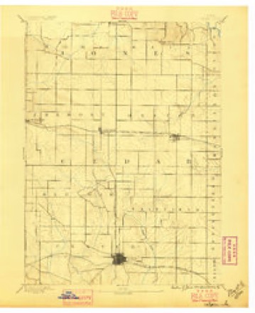
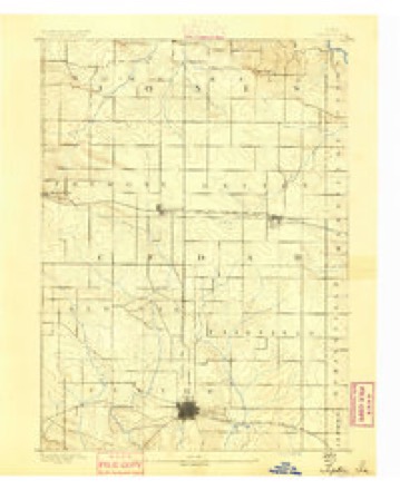
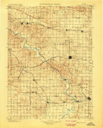
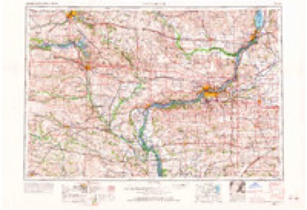
8 surveys from 12 printed sheetsMatched by testing this settlement's coordinate against the published boundary of every sheet in the United States Geological Survey's historical collection. Each opens the scanned sheet at the Survey.
- 1889 USGS Tipton quadrangle1:62500
- 1890 USGS Tipton quadrangle1:62500, 2 printings
- 1901 USGS Stanwood quadrangle1:125000, 2 printings
- 1958 USGS Davenport quadrangle1:250000, 2 printings
- 1961 USGS Davenport quadrangle1:250000
- 1962 USGS Davenport quadrangle1:250000
- 1965 USGS Tipton West quadrangle1:24000
- 1984 USGS Iowa City quadrangle1:100000, 2 printings
Fires near this place
4 since 2009Regional context, not property-specific evidence. The federal wildfire occurrence database lists 4 fires within 5 miles of Tipton between 2009 and 2011, burning about 20 acres in total. None started naturally. None was recorded as arson. Distance is straight-line from the map coordinates, so a fire counted here may appear on a neighbouring settlement's page as well.
| Reported cause | Fires |
|---|---|
| Missing data/not specified/undetermined | 4 |
The most recent of them, most recent first, with the day each was reported and the service that recorded it.
| Date | Cause | Size | Reported by | Name on the report |
|---|---|---|---|---|
| 3 April 2011 | Missing data/not specified/undetermined | 3.0 acres | Iowa Department of Natural Resources | 946 MONROE AVE., TIPTON, IA |
| 2 April 2011 | Missing data/not specified/undetermined | 5.0 acres | Iowa Department of Natural Resources | 1050 210TH ST., TIPTON, IA |
| 21 March 2009 | Missing data/not specified/undetermined | 7.0 acres | Iowa Department of Natural Resources | not named |
| 15 March 2011 | Missing data/not specified/undetermined | 5.0 acres | Iowa Department of Natural Resources | 1110 CEDAR VALLEY RD, TIPTON, IA |
Settlements close enough to share some of these fires:
Mines and quarries near this place
2 within 5 milesRegional context, not property-specific evidence. The federal mineral resources record lists 2 workings within 5 miles of Tipton: 2 past producers. None of them still produces. What was taken out: Stone, Crushed/Broken. Distance is straight-line from the map coordinates, so a quarry counted here may appear on a neighbouring settlement's page as well.
| Where | Site | Commodity | Status | Recorded |
|---|---|---|---|---|
| Hodgden Quarry | Stone, Crushed/Broken | Past Producer | ||
| Mc Guire Quarry | Stone, Crushed/Broken | Past Producer |
Storms near this place
60 of 65 shownRegional context, not property-specific evidence. The National Weather Service names Tipton in 65 storm reports between 1993 and 2026: 45 thunderstorm wind, 17 hail, 1 funnel cloud, 1 flash flood. No death or injury is recorded in these reports. Each account below is quoted exactly as the forecast office filed it, from the NOAA Storm Events Database, and each date opens the federal record of that event.
| When | Event | Place named | Harm | What the report says |
|---|---|---|---|---|
| April 2006 | Thunderstorm Wind | Tipton | $200,000 | A series of downbursts in a 3 mile wide path occurred from 4 miles west of Tipton to 4 miles northeast of Tipton. Winds were estimated at 70-78 knots (80-90 mph). Time is estimated based on radar. Newspapers reported trees down and a roof off of a barn 3 miles west of Tipton, and trees down 1.6 miles south southwest of Wald.At the Marge Schott farm on Jackson Avenue, a 70 foot silo was destroyed along with 3 sheds and several trees. A house was damaged and a livestock trailer was flipped over. A the Jeff Meier home on 220th Street, the end of an equipment building was blown out. At the Tom and Lori Schott farm just down the road on 220th Street, a livestock building had the roof peeled off. At the co-operative observer 4 miles northeast of Tipton, a barn door was blown off with 8-10 inch diameter limbs down in the yard. |
| April 1995 | Thunderstorm Wind | Tipton | $100,000 | no account filed |
| July 1995 | Thunderstorm Wind | Tipton | $75,000 | no account filed |
| March 2002 | Thunderstorm Wind | Tipton | $50,000 | The Tipton Country Club suffered heavy damage. A large cart shed was destroyed and blown into a parking area south of the clubhouse. Damage to the carts in the shed was minor. Several large trees were blown down. A roof was peeled back on another shed, holes were punched in a third shed, the roof was blown off a small structure next to the pool, and approximately 9 trees were damaged or destroyed. At Country Estates, the skirting was blown off several homes, and a roof was blown off a barn. |
| June 1994 | Thunderstorm Wind | Tipton | $50,000 | no account filed |
| June 1994 | Thunderstorm Wind | Tipton | $50,000 | no account filed |
| August 1993 | Thunderstorm Wind | Tipton | $50,000 | no account filed |
| June 1995 | Thunderstorm Wind | Tipton | $15,000 | A thunderstorm developed over Cedar County. Winds from the storm caused some minor damage and downed several trees in Tipton. Lightning struck a house there as well. Damage was minor and restricted to electrical appliance damage. |
| April 1995 | Thunderstorm Wind | Tipton | $15,000 | no account filed |
| September 2013 | Thunderstorm Wind | Tipton | $10,000 | A trained spotter reported that several large trees were down on the west side of town. A cattle shed at the fairgrounds was also blown down. Time of the event was estimated from radar. |
| July 1995 | Thunderstorm Wind | Tipton | $10,000 | Warm, moist, and unstable air streamed into Iowa ahead of an advancing cold front. In fact, the warm front passed north of the state during the morning, placing Iowa near the passage of the triple point in the system. Thunderstorms erupted well ahead of the cold front, in the warm sector, during the afternoon. A few of the storms became strong. Severe weather occurred in Tama County. Sixty mph winds swept through an area south of Lincoln. Golf ball-size hail pelted Tama County about six miles south of Guthrie Center causing considerable crop damage. Hail three-quarters of an inch in diameter damaged crops in the Traer area. Further east a few storms became severe over Benton and Cedar Counties. Trees were downed in several locations. Damage was done by high winds to a barn on one farmstead new West Branch. A shed roof was also damaged. High winds destroyed two hog sheds on a farmstead northwest of Tipton as well. |
| June 2005 | Thunderstorm Wind | Tipton | $7,000 | Trees down in Tipton and north on highway 38 |
| September 2010 | Thunderstorm Wind | Tipton | $5,000 | Wind gusts estimated to be 65 mph split a tree in half in Tipton, IA around 250 pm CDT September 21. A large branch from the tree fell onto some power lines. |
| May 2004 | Hail | Tipton | $5,000 | Also reported by a storm chaser |
| July 1999 | Thunderstorm Wind | Tipton | $5,000 | Thunderstorm winds downed large tree limbs and power lines in Tipton, which resulted in a power outage in the community. |
| July 1995 | Thunderstorm Wind | Tipton | $5,000 | Warm, moist, and unstable air streamed into Iowa ahead of an advancing cold front. In fact, the warm front passed north of the state during the morning, placing Iowa near the passage of the triple point in the system. Thunderstorms erupted well ahead of the cold front, in the warm sector, during the afternoon. A few of the storms became strong. Severe weather occurred in Tama County. Sixty mph winds swept through an area south of Lincoln. Golf ball-size hail pelted Tama County about six miles south of Guthrie Center causing considerable crop damage. Hail three-quarters of an inch in diameter damaged crops in the Traer area. Further east a few storms became severe over Benton and Cedar Counties. Trees were downed in several locations. Damage was done by high winds to a barn on one farmstead new West Branch. A shed roof was also damaged. High winds destroyed two hog sheds on a farmstead northwest of Tipton as well. |
| March 2005 | Hail | Tipton | $5,000 | no account filed |
| June 1994 | Thunderstorm Wind | Tipton | $5,000 | no account filed |
| August 2005 | Thunderstorm Wind | Tipton | $3,000 | 10 inch diameter limbs and 2 foot diameter trees were downed on the south side of the city. |
| June 1999 | Thunderstorm Wind | Tipton | $2,000 | Wind-driven pea-sized hail damaged some fields of corn and soybeans. The hail covered the ground making itlook as if it had snowed. A machine shed was also destroyed by straight line winds estimated around 70 mph. The south side of a barn suffered damage while hail sheared the brome waterways so closely they appeared mown. |
| October 2004 | Thunderstorm Wind | Tipton | $1,000 | Tree down blocking traffic. |
| April 2026 | Hail | Tipton | - | Emergency management reported damaging golf ball size hail. |
| April 2026 | Thunderstorm Wind | Tipton | - | The time was estimated using radar data. |
| May 2024 | Thunderstorm Wind | Tipton | - | Six to 10 inch diameter tree limbs blown down in Tipton, Iowa. |
| July 2023 | Thunderstorm Wind | Tipton | - | Large tree branches were blown down by thunderstorm winds. |
| July 2023 | Thunderstorm Wind | Tipton | - | Numerous trees downed throughout town. |
| May 2023 | Thunderstorm Wind | Tipton | - | Large tree fell on a shed. Time was estimated by radar. |
| July 2022 | Thunderstorm Wind | Tipton | - | The Emergency Manager reported power lines down south of Tipton. The time of the event was estimated using radar. |
| June 2022 | Thunderstorm Wind | Tipton | - | Emergency management reported a tree down on private property. |
| July 2020 | Thunderstorm Wind | Tipton | - | Several trees were blown down in Tipton. |
| June 2020 | Thunderstorm Wind | Tipton | - | A few trees blown down. |
| June 2019 | Thunderstorm Wind | Tipton | - | Numerous trees damaged in town. |
| August 2019 | Thunderstorm Wind | Tipton | - | Several small trees were blown down. |
| September 2019 | Thunderstorm Wind | Tipton | - | A large tree was blown down. |
| June 2017 | Thunderstorm Wind | Tipton | - | Trees and power lines down across Highway 38. The public report time is estimated from radar data. |
| July 2016 | Thunderstorm Wind | Tipton | - | A tree a foot and a half in diameter was down. |
| August 2016 | Thunderstorm Wind | Tipton | - | Law Enforcement has received several reports of limbs and trees down in Tipton. One of these limbs fell on powerlines and brought them down. |
| November 2015 | Thunderstorm Wind | Tipton | - | A coop observer reported a building was destroyed with debris scattered to the other side of the road and wrapped around trees. The time was estimated from radar. |
| June 2014 | Thunderstorm Wind | Tipton | - | Measured 65 mph winds. |
| September 2013 | Thunderstorm Wind | Tipton | - | A trained spotter reported that 8 to 12 inch diameter tree limbs were down. |
| August 2012 | Thunderstorm Wind | Tipton | - | A public report received via ESPOTTER estimated thunderstorm wind gusts near 60 mph. |
| August 2011 | Heavy Rain | Tipton | - | Minor street flooding is occurring. |
| August 2011 | Thunderstorm Wind | Tipton | - | A utility pole was broken in town. |
| July 2009 | Flash Flood | Tipton | - | Heavy rains resulted in some flash flooding just south of Tipton, IA during the afternoon of July 10. Flood waters covered about half of Highway 38 just south of town. |
| October 2009 | Hail | Tipton | - | The fire department reported nickel size hail at Tipton. |
| October 2009 | Hail | Tipton | - | A trained spotter reported penny size hail at Tipton. |
| June 2008 | Hail | Tipton | - | A trained spotter estimated hail the size of nickels at Tipton. |
| August 2008 | Hail | Tipton | - | Nickel-sized hail fell in Tipton, IA at 608 pm August 9. This report was relayed by a trained spotter. |
| August 2008 | Hail | Tipton | - | Nickel to quarter-sized hail fell in Tipton, IA around 611 pm August 9. |
| July 2002 | Thunderstorm Wind | Tipton | - | A large tree was blown down on a home on West 7th Street. |
| July 2002 | Thunderstorm Wind | Tipton | - | Numerous trees blown down. |
| July 2002 | Thunderstorm Wind | Tipton | - | According to some, many areas in Tipton resembled a war zone. Damaging winds of 70 mph knocked down or severely damaged more than 50 trees causing thousands of dollars in damage. Some city blocks lost 2 or 3 large trees, and there was damage to several homes. Also, trees fell on at least 4 vehicles and power was knocked out in some areas. Several streets including Highway 38 were blocked by downed trees. While damage was widespread, areas along 4th and 5th Streets were hit hardest. Some nuisance flooding was also reported around 5th and Plum Streets and Cedar and 10th Streets. |
| July 2001 | Thunderstorm Wind | Tipton | - | Large tree limbs downed. Reported by law enforcement. |
| May 2024 | Hail | Tipton | - | no account filed |
| July 2020 | Hail | Tipton | - | no account filed |
| April 2020 | Hail | Tipton | - | no account filed |
| April 2020 | Hail | Tipton | - | no account filed |
| April 2020 | Hail | Tipton | - | no account filed |
| July 2020 | Hail | Tipton | - | no account filed |
| May 2012 | Hail | Tipton | - | no account filed |
Nearest settlements
The eight closest, with where each one stands in the county. Distances are straight-line, computed from the Geographic Names Information System coordinates.
| Map | Place | Distance | Sheets |
|---|---|---|---|
| Wald | 4.7 miles | 12 | |
| Buchanan | 6.3 miles | 12 | |
| Rochester | 6.8 miles | 12 | |
| Cedar Valley | 7.0 miles | 12 | |
| Ayresville | 8.4 miles | 14 | |
| Bennett | 8.4 miles | 15 | |
| Stanwood | 8.6 miles | 12 | |
| Lime City | 8.8 miles | 14 |
Elsewhere
Matched on this settlement's Geographic Names Information System number rather than its name, so it cannot be a different place of the same name in another state.
| Wikipedia article on Tipton | An encyclopaedic summary. Its text is share-alike, so it is linked here rather than copied. |
| Wikidata item Q1925245 | The structured record the population and elevation above come from. Public domain (CC0). |
Provenance
This settlement is recorded in the Geographic Names Information System as feature 462257. The sheet list is computed by point-in-boundary test against the United States Geological Survey's historical topographic inventory. Both are works of the United States government and carry no copyright under 17 U.S.C. 105.
Wildfire. Short, Karen C. 2022. Spatial wildfire occurrence data for the United States, 1992-2020 [FPA_FOD_20221014]. 6th Edition. Fort Collins, CO: Forest Service Research Data Archive. https://doi.org/10.2737/RDS-2013-0009.6 Collected with United States Government funding and usable without additional permissions or fees.
Mines and quarries. USGS Mineral Resources Data System (MRDS) https://mrdata.usgs.gov/mrds/ A work of the United States government, no copyright under 17 U.S.C. 105.
Storms. NOAA National Centers for Environmental Information, Storm Events Database https://www.ncei.noaa.gov/stormevents/ A work of the United States government, no copyright under 17 U.S.C. 105. Narratives are quoted verbatim from the National Weather Service report and are not edited or summarised.