BlockBefore

Fish Creek Bridge

Listed on the National Register of Historic Places in 1998.

From the record

“The Fish Creek Bridge is a historic structure that was originally located east of Salem, Iowa, United States. The span carried Hickory Road over Fish Creek for 50 feet (15 m).”

Wikipedia article Fish Creek Bridge (Salem, Iowa), CC BY-SA 4.0.

One of 54 National Register listings published here for Henry County · listed in 1998 · category: Structure.

Sources: the Wikipedia article · the case file at the National Archives · the National Register database, National Park Service · the Wikipedia article
The listing

  • What is counted as historic. The nomination lists 1 structure as contributing to the listing.
  • Address. Hickory Rd. over Fish Cr., Salem, 52649
  • When was it listed? May 1998
  • Category. structure
  • Also known as. Highway Bridges of Iowa MPS
  • Township. Jackson township
  • Architect. King Bridge Company
  • National Register reference number. 98000524 - the number the National Park Service assigned this property when it was listed, and the key its nomination file is catalogued under at the National Archives.

Mines and quarries near this property

1 within 5 miles

Regional context, not property-specific evidence. The federal mineral resources record lists 1 working within 5 miles of Fish Creek Bridge: 1 past producer. None of them still produces. What was taken out: Stone, Crushed/Broken. Distance is straight-line from the map coordinates, so a quarry counted here may appear on a neighbouring settlement's page as well.

Where SiteCommodity StatusRecorded
Beattie QuarryStone, Crushed/BrokenPast Producer

Every working recorded in Henry County

Storms near this property

19 since 2000

Regional context, not property-specific evidence. The National Weather Service names Salem, the town this property stands in, in 19 storm reports between 2000 and 2025: 10 thunderstorm wind, 7 hail, 1 flood, 1 tornado. The reports record 1 death. Each account below is quoted exactly as the forecast office filed it, from the NOAA Storm Events Database, and each date opens the federal record of that event.

WhenEvent Place namedHarm What the report says
June 2000FloodSalem1 killedno account filed
July 2003Thunderstorm WindSalem$30,000Corn bent and broken off stalks
June 2009Thunderstorm WindSalem$25,000Wind gusts estimated to be 70 mph overturned a semi truck on Highway 27/218 about 3.5 miles east southeast of Salem, IA around 448 pm June 19.
July 2003Thunderstorm WindSalem$5,000Lawn furniture thrown across yard
March 2025Thunderstorm WindSalem-Shingles reported blown off roof, and outdoor furniture blown over. The time was estimated from radar information.
April 2024Tornado (EF2)Salem-An NWS survey team confirmed a long-track EF2 tornado Tuesday afternoon in southeast Iowa. The tornado developed just southwest of Houghton, Iowa in Lee County. Significant damage to homes, trees, and outbuildings was observed. The worst damage occurred at a farmstead north of New London in Henry County, where the roof was removed from a brick house, one of the exterior walls collapsed, and the garage was destroyed. Numerous out buildings were also destroyed at nearby farmsteads. Maximum winds were estimated around 130 mph. The tornado continued into northwest Des Moines County and caused additional damage at several farmsteads southeast of Yarmouth. Public video confirmed that the tornado continued northeast into Louisa County, where a vehicle was blown off the road just east of Morning Sun. The tornado then damaged trees near the Port Louisa National Wildlife refuge, and finally lifted near the confluence of the Iowa and Mississippi Rivers. The tornado had a maximum path width around 600 yards. The tornado path length was around 42 miles. There were no injuries. Numerous emergency managers provided valuable assistance to NWS Quad Cities during the survey.
April 2024HailSalem-Public report of nickel size hail occurring at this time.
May 2023Thunderstorm WindSalem-Trees blown down and shingles blown off of the roof.
July 2022Thunderstorm WindSalem-A COOP Observer reported several tree branches down on their property. The time of the event was estimated using radar.
July 2022Thunderstorm WindSalem-The COOP Observer 1 mile south of Salem reported several tree branches down on their property. The time of the event was estimated using radar.
June 2010HailSalem-Quarter sized hail fell about 1 mile north of Salem, IA at 1037 pm June 1.
October 2005HailSalem-From co-op observer.
March 2002Thunderstorm WindSalem-Several large tree limbs down.
March 2002Thunderstorm WindSalem-Barn destroyed.
July 2001Thunderstorm WindSalem-Large trees down. Reported by trained storm spotter.
April 2020HailSalem-no account filed
March 2006HailSalem-no account filed

Every storm recorded in Henry County

Map coverage status

No historic map-sheet match is published for this property yet. That does not mean no map exists. This record needs a coordinate-quality review before it can be joined to a sheet boundary. Browse the county's mapped places while that work is pending.

Listed places nearby

6 within 8 miles

Other National Register properties close enough to walk or drive between, ordered by distance from this one. Both positions come from the same geocoding pass that matched these properties to their map sheets.

Photograph PropertyDistance Listed
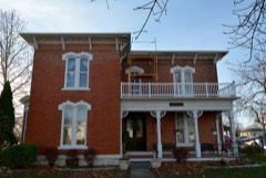
Joseph A. and Lydia A. Edwards House0.5 miles2015
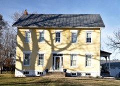
Collins-Bond House2.1 miles2010
Reeves, Isaac and Agnes (Bells), House2.1 miles2010
Farmers Savings Bank2.1 miles2010
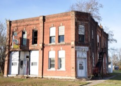
Bicksler Block2.1 miles2010
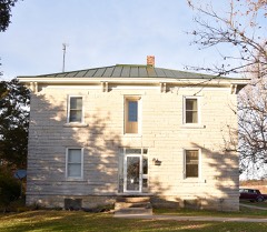
Cook-Johnson House2.2 miles2010

Sources for this property

National Archives recordThe nomination case file for reference 98000524 in Record Group 79.
Wikipedia articleCommunity-written account of this property, licensed CC BY-SA.
Henry CountyAll 54 listed properties in this county.

Provenance

  • Listing record. National Park Service National Register of Historic Places, listed-properties dataset, current to 2026-05-22.
  • Map join. Address geocoded through the United States Census geocoder, then tested against the published boundary of every sheet in the USGS Historical Topographic Map Collection.
  • How this page is made. Listing fields come from federal records; map-sheet coverage is a labelled coordinate-to-boundary calculation, not a source-field claim.
  • Mines and quarries. USGS Mineral Resources Data System (MRDS) https://mrdata.usgs.gov/mrds/ A work of the United States government, no copyright under 17 U.S.C. 105.
  • Storms. NOAA National Centers for Environmental Information, Storm Events Database https://www.ncei.noaa.gov/stormevents/ A work of the United States government, no copyright under 17 U.S.C. 105. Narratives are quoted verbatim from the National Weather Service report and are not edited or summarised.