 Block
From the record
18 National Register listings published here.
Sources: the National Register database, National Park Service
109 topographic sheets cover 61 settlements here, and 18 properties are on the National Register of Historic Places.
18 National Register listings published here.
Sources: the National Register database, National Park Service
Every property in this county listed on the National Register of Historic Places, with the year it was listed and the federal nomination document.
| Photograph | Property | Type | Listed | Reference |
|---|---|---|---|---|
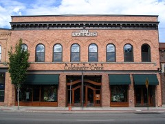 | W. A. Bernd Building | building | 1983 | 83000282 |
| Co-op Gas & Supply Company | building | 2020 | 100004821 | |
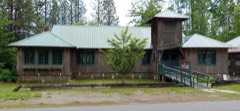 | Dover Church | building | 1989 | 86002153 |
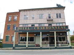 | Hotel Charbonneau | building | 1991 | 91001718 |
| Lake Pend Oreille Lime and Cement Industry Historic District | district | 1997 | 94001450 | |
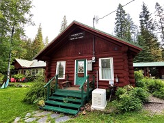 | Lamb Creek School | building | 1999 | 99001418 |
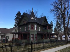 | Amanda Nesbitt House | building | 1982 | 82002508 |
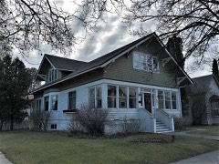 | Charles A. and Mary Olson House | building | 2001 | 01000566 |
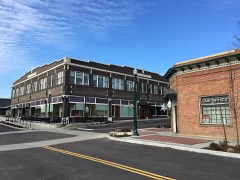 | Priest River Commercial Core Historic District | district | 1995 | 95001057 |
| Priest River Experimental Forest | district | 1994 | 94000661 | |
| Priest River High School | building | 1995 | 95001402 | |
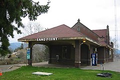 | Sandpoint Burlington Northern Railway Station | building | 1973 | 73000682 |
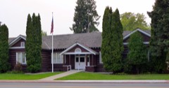 | Sandpoint Community Hall | building | 1986 | 86002148 |
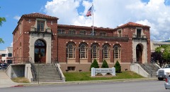 | Sandpoint Federal Building | building | 2001 | 01000836 |
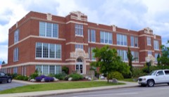 | Sandpoint High School | building | 1999 | 99001277 |
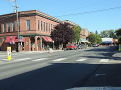 | Sandpoint Historic District | district | 2018 | 84001100 |
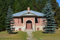 | Settlement School | building | 1999 | 99000418 |
| Vinther and Nelson Cabin | building | 1982 | 82002507 |
Every wildfire the federal occurrence database records inside this county: 2,004 of them, burning about 22,195 acres. 992 started naturally and 36 were recorded as arson. Each settlement page carries the fires within five miles of it.
| Reported cause | Fires |
|---|---|
| Natural | 992 |
| Missing data/not specified/undetermined | 309 |
| Debris and open burning | 295 |
| Recreation and ceremony | 170 |
| Equipment and vehicle use | 72 |
| Smoking | 49 |
| Arson/incendiarism | 36 |
| Fireworks | 28 |
| Railroad operations and maintenance | 23 |
| Power generation/transmission/distribution | 17 |
| Misuse of fire by a minor | 10 |
| Other causes | 3 |
The five largest, by the area the report gives. None of them was recorded as arson.
| Date | Cause | Size | Reported by | Name on the report |
|---|---|---|---|---|
| 28 July 2018 | Natural | 7,871 acres | Idaho Panhandle National Forest | COUGAR |
| 13 August 2015 | Natural | 2,057 acres | Idaho Panhandle National Forest | SCOTCHMAN PEAK |
| 15 August 1994 | Natural | 1,522 acres | Kootenai National Forest | SMITH PEAK |
| 5 July 2015 | Missing data/not specified/undetermined | 1,326 acres | Idaho Panhandle National Forest | CAPE HORN |
| 8 September 2020 | Missing data/not specified/undetermined | 1,276 acres | Kootenai National Forest | CALLAHAN |
| 19 August 2006 | Natural | 1,234 acres | Idaho Panhandle National Forest | PLOWBOY |
| 15 August 1994 | Natural | 1,000 acres | Kootenai National Forest | ROBERTS |
| 7 September 2020 | Missing data/not specified/undetermined | 684 acres | Pend Oreille Area Office | HUNTER 2 |
Every settlement page carries the fires within five miles of it - see the settlement index below.
The NOAA Storm Events Database holds 125 reports for this county, causing 2 deaths, 12 injuries and about $12,115,100 in recorded property damage. Each settlement page carries the reports that name it.
| Kind of event | Reports |
|---|---|
| Thunderstorm Wind | 57 |
| Hail | 29 |
| Flood | 22 |
| Tornado | 4 |
| Heavy Rain | 4 |
| Debris Flow | 4 |
| Lightning | 2 |
| Flash Flood | 1 |
| Wildfire | 1 |
| Funnel Cloud | 1 |
The most serious of them, by death, then injury, then recorded damage. The accounts are quoted exactly as the forecast office filed them.
| When | Event | Place named | Harm | What the report says |
|---|---|---|---|---|
| September 2024 | Thunderstorm Wind | Sandpoint | 1 killed, $10,000 | Tree fell on 17 year old male in backyard of home. Several reports of trees downed and tops snapped in the Sandpoint, Dover areas. There was a report of shingles being blown off roof. The BMX track was damaged by downed trees. Wind gusts estimated to be around 65 MPH. |
| June 2020 | Thunderstorm Wind | Hope | 1 killed | The broadcast media reported that a 21 foot boat with 10 people capsized on Lake Pend Oreille with 1 fatality. There were high waves due to a passing thunderstorm with an estimated 30 mph wind gusts. |
| August 1989 | Thunderstorm Wind | not stated | 4 hurt | no account filed |
| July 2014 | Thunderstorm Wind | Lakeview | 2 hurt, $2,000,000 | Damaging winds led to widespread tree damage across central Bonner County. A navy bouy located on the south end of Lake Pend Oreille clocked a wind gust of 75 mph. Multiple trees were knocked down across the city of Sandpoint and smaller communities surrounding Lake Pend Oreille. Many roads were closed until trees and power lines were removed including Highway 95 near the intersection of McArthur Street. Power was out for the entire city of Sandpoint and majority of Bonner County directly following the storm. Several trees fell on houses. Southern exposed bays on Lake Pend Oreille experienced the worst damage. Over thirty trees were knocked down between Gamlin Lake and Garfield Bay. Two people were injured by a falling tree at Green Bay. Further north on the lake, roughly twenty trees were downed in Shaw Bay. On a ridge, known as Hawkins Point, over fifty trees were snapped four feet from the ground. The winds created three to six foot waves in sections of the lake resulting in dock and boat damage. Broadcast media also reported numerous trees downed at the Western Pleasure Guest Ranch located eleven miles northeast of Ponderay. |
| June 2013 | Lightning | Sagle | 2 hurt | The exact time of the lightning strike was estimated. |
| August 2002 | Lightning | Oldtown | 2 hurt | Two workers were installing siding on a garden shed when lightning struck a nearby tree, arcing from the tree to the shed and the workers. Both men were briefly hospitalized. |
| June 2007 | Thunderstorm Wind | Sandpoint | 1 hurt, $220,000 | no account filed |
| August 1978 | Tornado (F1) | not stated | 1 hurt, $25,000 | no account filed |
| March 2017 | Flood | Nordman | $2,000,000 | Periodic heavy rain and spring time snow melt created saturated soil conditions which promoted numerous debris flows and widespread areal flooding through out Bonner County from the middle to the end of March. A train carrying 50 to 60 empty coal cars derailed near Kootenai after flooding undermined the tracks. A landslide knocked a home off it's foundation and carried it down a hillside near Sagle, with six more homes threatened. Numerous roads were closed due to flooding or cut by debris flows. Bonner County was included in a Presidential Disaster Declaration issued as a result of the damage caused by this episode. |
| August 2014 | Thunderstorm Wind | Outlet Bay | $2,000,000 | Widespread wind damage was observed across the cities of Priest Lake, Sandpoint, Ponderay, Kootenai, Oden, and Lake Pend Oreille. Hundreds of trees ranging from eight to twenty two inches in diameter were snapped or downed. Some trees landed on homes, others took out miles of power lines and poles. At one point after the storm, all of Sandpoint, Idaho was without power. A spotter in Clark Fork stated fifteen foot trees were almost touching the ground while sixty foot trees were bending at 45 degree angles. The most widespread damage was along the Highway 200 corridor between Hope and Sandpoint. The Elk Golf Course in this corridor lost thirteen trees. The Sandpoint AWOS, also in this area, measured sustained winds of 40 mph with gusts to 56 mph before the power outage. A roof of a storage shed was blown off in downtown Sandpoint. Numerous boats and docks on Lake Pend Oreille were damaged from waves that ranged between three to six feet. Significant tree damage was observed on the south side of the lake in Bottle Bay between the 3800th and 5016th blocks. All trees were leaning to the east southeast. Residents interviewed during a storm survey mentioned the winds lasted roughly 40 minutes. |
| November 2006 | Flood | Clark Fork | $2,000,000 | Spring Creek Road leading into Clark Fork washed out near the confluence of Lightning and Spring Creeks. 100 to 150 homes and residents near Clark Fork, Idaho were stranded after two roads were washed out. In the Lightning Creek drainage, washouts were up to 700 feet long and 15 feet deep. A debris jam was also observed just west of Lightning Creek. The creek carried large cedars and cottonwoods that fell from mountainsides upstream. |
| March 2011 | Flood | Elmira | $1,790,000 | The emergency manager of Bonner County relayed numerous road damage reports from across the county due to flooding from March 31st. The roads included in this report were Fish Creek, Sandborn Creek, West Shingle Mill, Bottle Bay, Dufort, Peninsula, Eastriver, Blacktail, Beare, Eureka, Helen Thompson, Moore Loop, South First Street, Spring Haven Drive, Wells, North Riley Creek, Mountain Creek, Snow Valley, Forest Siding, Comeback Lane, Cocolalla Loop, and LeClerc Road. Several other private roads were also damaged from flooding. |
| March 2012 | Flood | Westmond | $550,000 | High runoff and saturated grounds from a month of record rainfall combined with excessive snow melt resulted in a major road washout under a section of Cocolalla Loop Road. It was estimated that 25 feet of earth below the road, roughly 100 feet in length, was washed down the hillside as the underground culverts became overwhelmed or clogged. The road washed out on March 31st. Additional flooding was observed along the northeastern shores of Lake Cocolalla, specifically Melody Lane, where several secondary, recreational houses were inundated with water from the swollen lake. Minor damage was also observed at a small wooden bridge where Cocolalla Creek crosses under Cocolalla Creek. |
| April 1991 | Tornado (F2) | not stated | $250,000 | no account filed |
| June 2007 | Thunderstorm Wind | Coolin | $200,000 | no account filed |
| May 1997 | Thunderstorm Wind | Priest River | $125,000 | numerous reports of wind damage |
| June 2004 | Tornado (F0) | Coolin | $100,000 | A severe thunderstorm over Bonner County during the evening of June 25th produced a tornado. The tornado formed over Priest Lake about two miles north of Coolin. The tornado moved onshore and passed through the town of Coolin before dissipating south of the town. Eight homes and businesses in the town of Coolin were damaged and the roof of a fire station was peeled off as the tornado passed through the town. |
| May 1998 | Flash Flood | Sandpoint | $100,000 | significant street flooding |
| May 1997 | Thunderstorm Wind | Sandpoint | $90,000 | numerous reports of damage from high winds |
| May 1997 | Thunderstorm Wind | Sagle | $85,000 | numerous reports of wind damage |
| March 2012 | Flood | Priest River | $72,000 | Several roads were washed out, flooded, or experienced some damage across Bonner County due to high spring runoff caused by record March rainfall and excess snow melt. These roads including Gold Creek (8 NE Sandpoint), Talache, East Shores Drive (4 NE Coolin), Geenan, Schneiders, Rapid Lightning Creek, Bowen Arrow (4 NE Colburn), and Merril Martin. Six homes and some businesses were isolated due to road closures. Five homes and some businesses had limited one lane access. |
| March 2012 | Flood | Forest Siding | $70,000 | Fourteen cars of an Union Pacific Train derailed when 350 feet of track was washed out near the intersection of Colburn and Selkirk Roads. Six of the rail cars were carrying soybeans with the other eight cars empty. |
| June 2007 | Thunderstorm Wind | Blanchard | $54,000 | no account filed |
| April 2017 | Debris Flow | Priest River | $50,000 | The Bonner County Sheriff reported a debris flow across East River Road, temporarily cutting travel along the eastern shore of Priest River. |
| June 1994 | Thunderstorm Wind | not stated | $50,000 | Strong thunderstorm winds toppled several trees and destroyed a large workshop near Sagle, 37 miles north of Coeur d'Alene. Downed power lines in the area resulted in local power outages. |
| July 2012 | Thunderstorm Wind | Nordman | $40,000 | Priest Lake State Park reported numerous trees down. RV and Cabins throughout the park received extensive damage. A few cars were totaled by falling trees. |
| March 2014 | Flood | Ponderay | $25,000 | Standing water reported across the area. A mobile home park in Ponderay was hardest hit with one trailer inundated with two feet of water inside the home. Damage costs were estimated. |
| June 2004 | Thunderstorm Wind | Sandpoint | $25,000 | no account filed |
| December 2025 | Flood | Clark Fork | $20,000 | East Spring Creek Road washed out along Spring Creek. Road washed out on Lightning Creek Road. Between 300 to 400 residents sheltering in place above Clark Fork as they are trapped due to the road closure. Damage cost is estimated. |
| July 2011 | Flood | Factory | $20,000 | Minor spring flooding occurred along the Pend Oreille River, Clark Fork River, and Lake Pend Oreille. Johnson Creek Road on the south side of the Clark Fork River had some sloughing. In central and western areas of the county, Priest River inundated portions of LeClerc Road just east of Oldtown as well as Dufort Road, just east of Priest Lake. Numerous docks and lakeside yards were flooded by high water levels along the shores of Lake Pend Oreille. In Sandpoint, ID the basement of the Old Power House was flooded. |
| June 2011 | Flood | Factory | $20,000 | Minor spring flooding occurred along the Pend Oreille River, Clark Fork River, and Lake Pend Oreille. Johnson Creek Road on the south side of the Clark Fork River had some sloughing. In central and western areas of the county, Priest River inundated portions of LeClerc Road just east of Oldtown as well as Dufort Road, just east of Priest Lake. Numerous docks and lakeside yards were flooded by high water levels along the shores of Lake Pend Oreille. In Sandpoint, ID the basement of the Old Power House was flooded. |
| May 2006 | Thunderstorm Wind | Sandpoint | $18,000 | no account filed |
| June 2020 | Thunderstorm Wind | Elmira | $15,000 | A member of the public reported downed trees on power lines across Elmira Road due to thunderstorm winds. Time of report was estimated based on radar. |
| June 2012 | Flood | Clark Fork | $15,000 | Denton Road was partially washed out by Riser Creek. The cost to repair the washout was estimated at $15,000. Other minor flooding was reported along Riser Creek, Strong Creek, and Lightning Creek in the area. Portions of East Spring Creek Road were underwater due to flooding from Lightning Creek. |
| May 2020 | Flood | Elmira | $10,000 | U.S. Forest Service reported a partial road closure on Forest Service Road 280 near Grouse Creek. This was due to Grouse Creek flooding and flood damage caused by spring snow melt and heavy rain. There were no known injuries or damage to buildings. |
| July 2019 | Thunderstorm Wind | Nordman Priest Lk Us | $10,000 | A member of the public reported a tree down on a garage and apartment near Coolin due to thunderstorm wind gusts. Time estimated from radar data. |
| May 1997 | Thunderstorm Wind | Oldtown | $10,000 | numerous reports of wind damage |
| July 2012 | Thunderstorm Wind | Nordman | $6,000 | A tree fell on a moving vehicle killing the driver. |
| July 2019 | Thunderstorm Wind | Sandpoint | $5,000 | The Sandpoint Police Department reported 9 roads blocked by downed trees in and around Sandpoint from thunderstorm wind gusts. Time estimated from radar data. |
| May 2018 | Flood | Factory | $5,000 | The USGS River Flow Gage at Abeni Falls Dam which controls the flow of the Pend Oreille River below the dam surpassed the Flood Flow of 95,000 Cubic Feet per Second (CFS) at 2:30 PM PST on May 11th. The flow increased and passed through the Moderate Flood Flow of 115,000 CFS at 12:15 PM on May 18th. The flow continued to increase and peaked at the Moderate Flood reading of 121,000 CFS at at 5:00 AM on May 27th. The flow continued to fluctuate between 118,000 CFS and 121,000 CFS through the end of May. The flow receded to below the Flood Flow on June 6th.||Above Albeni Falls Dam the river is a slow moving extension of Lake Pend Oreille. The USGS Lake Level Gage on Lake Pend Oreille near Hope recorded a rise above the Flood Stage of 2063.5 feet on May 18th. The lake level crested at 2063.8 on May 23rd. The lake level remained at or slightly above Flood Stage through the remainder of the month. |
| August 1998 | Wildfire | Hope | $5,000 | Lighting sparked three fires in the vicnity of Hope, each about an acre in size. Two small fires also started in the Priest Lake area. |
| July 2023 | Hail | Blanchard | $4,000 | One inch hail reported in Blanchard. The thunderstorm wind also knocked down trees and powerlines near Kelso Lake Road near Spirit Lake and Barrett Road near Priest River. |
| July 2019 | Thunderstorm Wind | Priest River | $4,000 | Multiple reports of tree damage were received from the town of Priest River including a 100 foot tall pine tree uprooted during thunderstorm winds. Some homes suffered damage to shingles and fences. Time estimated from radar data. |
| June 2023 | Thunderstorm Wind | Nordman | $3,000 | Kalispell Boat Launch and boat at Priest Lake damaged and dislodged from strong wind gusts. |
| May 2018 | Flood | Sandpoint Arpt | $2,500 | The USGS Lake Level Gage on Lake Pend Oreille near Hope recorded a rise above the Flood Stage of 2063.5 feet on May 18th. The lake level crested at 2063.8 on May 23rd. The lake level remained at or slightly above Flood Stage through the remainder of the month. |
| August 2022 | Thunderstorm Wind | Dover | $2,000 | A band of weak thunderstorms pushed through the area. Spotter estimated wind gusts from a thunderstorm in the area near Sandpoint. Downed tree and wires north of Priest River, with over 1000 customers without power. |
| August 2007 | Thunderstorm Wind | Kootenai | $2,000 | no account filed |
| August 2007 | Thunderstorm Wind | Sandpoint | $2,000 | no account filed |
| December 2023 | Flood | East Hope | $1,000 | Lightning Creek flooding led to washout of Forest Service Road 419 North of Clark Fork, Idaho. |
| June 2020 | Hail | Elmira | $1,000 | A trained spotter reported hail with a diameter of 1 inch and heavy hain with a passing thunderstorm near Elmira. |
| December 2019 | Debris Flow | Trestle Creek | $1,000 | Idaho Department of Transportation reported a rock slide across Highway 200 near Trestle Creek. |
| September 2024 | Hail | Dover | $500 | Spotter recorded one inch hail and estimated 65 MPH wind gust. Spotter also out of power. |
| September 2024 | Thunderstorm Wind | Factory | $500 | Observer reported tree down in Oldtown. A max wind gusts 41 MPH was reported in Oldtown. |
| January 2023 | Debris Flow | Coolin | $500 | Rock slide along East Sore Road blocking one lane of traffic. |
| August 2014 | Thunderstorm Wind | Careywood | $500 | A tree was blown down on a power line in Sandpoint, ID. |
| August 2013 | Thunderstorm Wind | Oldtown | $500 | A large tree was knocked onto power lines resulting in 41 power outages in Oldtown, ID. The storm also downed numerous trees across the Priest Lake Ranger District of western Bonner County. An incident management team was put together to quickly assess and manage hazards discovered in developed campgrounds and recreation sites throughout the national forest given the approaching Labor Day holiday. Based on the incident map, Navigation, Trapper, Geisinger, Plowboy, and Beaver Creek were among the sites that required hazardous tree removal. |
| May 2023 | Thunderstorm Wind | Hope | $100 | Emergency management office reported a tree down in Hope Idaho. |
| August 2025 | Hail | Midas | - | Three reports of one inch hail were recorded for a strong thunderstorm for Dover and Sagle Idaho near Sandpoint. The reports came from a trained spotter and two from the public including a mPing. |
| June 2022 | Hail | Coolin | - | Observer reported 1.25 hail. |
| June 2022 | Heavy Rain | Harlem | - | Observer reported an inch of rain since midnight. |
The Survey's mineral resources record lists 461 workings inside this county. 18 still produce and 443 are closed or unrecorded. Each settlement page carries the workings within five miles of it.
| Commodity | Workings |
|---|---|
| Sand and Gravel, Construction | 113 |
| Silver | 63 |
| Gold | 38 |
| Lead | 30 |
| Copper | 29 |
| Uranium | 17 |
| Lead, Silver | 14 |
| Silver, Lead | 11 |
| Tungsten | 9 |
| Zinc, Silver, Lead | 9 |
| Beryllium | 8 |
| Zinc, Lead | 7 |
| Silver, Copper | 7 |
| Iron | 7 |
The least common of them first, because a county's hundredth gravel pit says nothing its first ten did not.
| Where | Site | Commodity | Status | Recorded |
|---|---|---|---|---|
| Alamo Mine | Lead, Iron, Gold, Copper, Zinc | Prospect | ||
| Alamo Prospect | Gold, Silver, Copper, Lead, Zinc | Occurrence | Chalcocite, Chalcopyrite, Covellite, Galena, Malachite | |
| Auxer Property Mine | Gold, Copper, Silver, Zinc, Lead | Producer | 1956 | |
| Big Hill Mine | Gold, Silver, Copper, Bismuth | Past Producer | Surface/Underground | |
| Big Step Prospect | Gold, Zinc, Lead, Silver, Copper, Molybdenum | Occurrence | 1950 | |
| Big Step Prospect | Gold, Zinc, Silver, Molybdenum | Prospect | ||
| Binarch Cr. Mining Co. Prospect | Gold, Silver, Zinc, Copper | Occurrence | Vein | |
| Blair and Collins Lease | Silver, Manganese, Lead, Iron | Prospect | ||
| Blue Flame | Gold, Zinc, Silver, Lead, Copper | Prospect | ||
| Bluebird Mine | Silver, Gold, Copper, Antimony, Lead, Zinc | Producer | Vein | |
| Bodie Canyon Mine | Silver, Zinc, Molybdenum, Copper | Prospect | ||
| Bodie Canyon Prospect | Silver, Molybdenum, Copper | Occurrence | Vein | |
| Bonner Vein | Gold, Lead, Zinc | Occurrence | Chalcopyrite, Galena, Gold, Sphalerite | |
| Boulder Mountain | Sodium | Occurrence | ||
| Boyer Mines | Zinc, Silver, Lead, Copper, Gold | Prospect | ||
| Brown Bear | Silver, Zinc, Copper, Gold, Lead | Past Producer | ||
| Campbell Mine | Silver, Zinc, Lead, Gold, Copper | Prospect | ||
| Cape Horn Prospect | Copper, Gold, Silver | Occurrence | Vein | |
| Clagst One Pit | Stone | Past Producer | ||
| Clark Fork District | Silver, Gold, Lead, Copper | Producer | VEIN/FAULT ZONE, REPLACEMENT | |
| Clark Fork District | Silver, Copper, Lead, Zinc, Gold | Past Producer | 1903 | |
| Conjecture Mine | Silver, Gold, Antimony, Lead, Zinc, Copper, Tungsten | Past Producer | 1894 | |
| Conjecture Mine | Silver, Gold, Lead, Zinc, Copper | Past Producer | 1875, 1888 | |
| Cuban ? Prospect | Sulfides | Occurrence | Vein | |
| Davis Property Prospect | Copper, Lead, Gold, Silver | Occurrence | Vein | |
| Dougherty Prospect | Lead, Copper, Silver | Prospect | ||
| Eagen | Zinc, Silver, Lead, Gold | Past Producer | ||
| Eberly Prospect | Lead, Zinc, Antimony | Occurrence | Galena, Sphalerite | |
| Glowing Rock Prospect | Copper, Tungsten | Occurrence | Chalcopyrite | |
| Green Monarch | Gold, Copper, Silver | Past Producer | ||
| Halliwill Prospect | Uranium, Copper | Occurrence | Torbernite | |
| Hayes Prospect | Lead, Silver, Copper | Occurrence | Vein | |
| Hope Mine | Silver, Zinc, Lead, Copper, Antimony, Gold, Arsenic | Past Producer | 1923, 1927 | |
| Hotchkiss Claim Prospect | Molybdenum, Gold, Tungsten | Occurrence | Gold, Molybdenite, Powellite, Scheelite | |
| Idaho Copper Prospect | Copper, Zinc | Occurrence | Chalcopyrite, Sphalerite | |
| Iron Deposit Prospect | Iron, Copper, Gold | Occurrence | ||
| Keep Cool Mine | Gold, Copper, Antimony, Zinc, Silver, Lead | Past Producer | ||
| Kootenai No. 2 Prospect | Gold, Silver, Copper, Lead | Occurrence | Galena | |
| Lakeview District | Silver, Copper, Lead, Zinc | Occurrence | SHEAR ZONE, VEIN | |
| Lakeview Prospect | Mica, Beryllium | Occurrence | Beryl | |
| Lawrence Mine | Silver, Lead, Copper, Antimony, Gold, Zinc | Past Producer | 1903 | |
| Lightning Peak | Silver, Zinc, Lead, Gold | Occurrence | ||
| Lightning Peak Prospect | Gold, Silver, Zinc, Lead | Occurrence | Vein | |
| Lost Tin Mine | Tin | Occurrence | ||
| Lucky Lead Mine | Tin, Silver, Manganese, Lead | Prospect | ||
| Lucky Lead Prospect | Tin, Silver, Lead | Occurrence | Galena | |
| Lucky Strike | Copper, Zinc, Silver, Lead | Prospect | ||
| Marguerite Prospect | Lead, Silver, Gold | Occurrence | Vein | |
| Miller Mine | Silver, Lead, Antimony, Zinc | Past Producer | 1927 | |
| Milwaukee Mine | Beryllium, Lead, Silver | Prospect | ||
| Milwaukee Mines | Gold, Silver, Zinc | Unknown | ||
| Minerva and Whalen | Gold, Copper, Lead, Silver, Zinc | Past Producer | ||
| Mountain Chief | Zinc, Silver, Copper, Lead | Prospect | ||
| Nevada Mines Prospect | Gold, Lead, Silver, Zinc | Occurrence | Vein | |
| Nevada Mines Prospect | Lead, Zinc, Silver, Gold | Occurrence | ||
| New Rainbow Mine | Silver, Zinc, Lead, Gold, Copper | Prospect | ||
| Nickelplate | Silver, Copper, Gold, Lead, Nickel | Prospect | ||
| Packsaddle Prospect | Lead, Silver, Gold, Copper | Occurrence | Vein | |
| Patten Prospect | Lead, Cobalt | Occurrence | Vein | |
| Pebco Silver | Silver, Gold, Tungsten | Past Producer | ||
| Pend Oreille District | Lead, Zinc, Silver, Gold | Producer | FISSURE VEINS, SHEAR ZONE | |
| Plowboy - Bluebell Prospect | Silver, Zinc, Copper, Lead | Occurrence | Chalcopyrite, Tetrahedrite | |
| Plume Creek | Lead, Zinc, Silver, Gold, Copper | Past Producer | ||
| Ponderosa | Silver, Lead, Iron, Copper | Prospect | ||
| Poorboy-Slowpoke | Molybdenum, Tungsten, Gold | Prospect | ||
| Regal Group | Silver, Zinc, Gold, Copper, Lead | Occurrence | Chalcopyrite, Galena, Sphalerite | |
| Silver Butte Mine | Silver, Gold, Lead, Zinc, Copper, Antimony | Producer | 1906 | |
| Silver Fox Group | Lead, Zinc, Silver | Past Producer | ||
| Silver Leaf Group Prospect | Lead, Gold, Silver, Zinc | Occurrence | Gold, Lead, Silver | |
| Silver Prospect | Silver, Sulfides | Occurrence | Vein | |
| Soldier Creek Prospects | Beryllium, Mica | Occurrence | 1941 | |
| Sullivan Mine | Gold, Molybdenum, Graphite | Past Producer | Underground | |
| Talache District | Silver, Tungsten | Occurrence | SILVER VEINS | |
| Talache Mine | Gold, Silver, Copper, Lead, Zinc, Antimony | Producer | 1895, 1906 | |
| Tungsten Occ. #2 Bonner County | Gold, Lead, Silver, Tungsten | Unknown | ||
| Vulcan Mine | Silver, Lead, Tungsten, Zinc, Molybdenum | Past Producer | 1890 | |
| Vulcan Mine | Zinc, Tungsten, Silver, Copper, Lead | Past Producer | ||
| Weber Mine | Copper, Gold, Silver, Zinc, Lead | Past Producer | 1888, 1890 | |
| Whitedelf Mine | Lead, Silver, Copper, Gold, Zinc, Antimony, Cadmium | Past Producer | 1926 | |
| Woodrat Mine | Silver, Lead, Zinc, Copper, Gold | Past Producer | 1905 | |
| American Eagle Prospect | Silver, Lead, Gold, Copper, Zinc | Occurrence | Vein | |
| Anderson Prospect | Copper, Lead, Gold, Silver, Zinc | Occurrence | Vein | |
| B.F. and H. Mine | Silver, Lead, Gold, Copper, Zinc | Past Producer | 1917 | |
| Better Times Prospect | Copper, Zinc, Lead, Gold, Silver | Occurrence | Vein | |
| Bumble Bee Prospect | Copper, Silver, Lead, Gold | Occurrence | Vein | |
| Cabinet | Clay | Prospect | ||
| Clarinda Copper Mining Co. | Copper, Silver, Lead | Prospect | ||
| Complex | Lead, Silver, Copper, Gold | Prospect | ||
| Cuban | Sulfur | Occurrence | ||
| Davis Property | Silver, Lead, Gold, Copper | Occurrence | ||
| Davis Prospect | Copper, Gold, Lead, Silver | Occurrence | Chalcopyrite, Galena | |
| Falls Creek Mine | Copper, Silver, Lead, Gold | Past Producer | ||
| Falls Creek Prospect | Copper, Silver, Lead | Occurrence | Vein | |
| Farmer Jones | Lead, Gold, Silver | Past Producer | ||
| Gem Copper Min. Co. Prospect | Silver, Copper, Gold | Occurrence | Underground | |
| Goat Mountain | Silver, Zinc, Lead | Past Producer | ||
| Hidden Treasure | Silver, Lead, Antimony | Past Producer | ||
| Hidden Treasure Mine | Silver, Lead, Antimony | Past Producer | Galena, Tetrahedrite | |
| Hines Clay Deposit | Clay | Occurrence | Sedimentary | |
| Hope Mine | Zinc, Silver, Gold, Lead, Copper | Past Producer | ||
| Howard Davis Prospect | Silver, Lead, Gold | Prospect | ||
| Iron Mask | Silver, Lead, Gold, Copper | Past Producer | ||
| M B Prospect | Copper, Zinc, Lead, Gold, Silver | Occurrence | Vein | |
| Minerva Mine | Gold, Silver, Copper, Lead, Zinc | Past Producer | Chalcopyrite, Galena, Sphalerite, Tetrahedrite | |
| Nickel Plate Prospect | Silver, Lead, Gold | Occurrence | Vein | |
| Packsaddle Mine | Copper, Gold, Lead, Silver | Prospect | ||
| Pier & Cady Mine | Silver, Lead, Zinc, Antimony, Copper | Past Producer | 1926 | |
| Priest River Mining Co. Prospect | Lead, Gold, Silver | Occurrence | Unknown | |
| Red Cliff Prospect | Silver, Zinc, Lead | Occurrence | Galena, Sphalerite | |
| Silver Prospect | Silver, Sulfur | Occurrence | ||
| Snowbird Mine | Silver, Gold, Copper, Lead, Zinc | Past Producer | Vein | |
| Stemwinder Prospect | Copper, Lead, Gold, Silver, Zinc | Occurrence | Vein | |
| Sweeney - Walker Group | Gold, Lead, Silver | Occurrence | Vein | |
| Sweeney-Walker Group | Gold, Lead, Silver | Occurrence | ||
| Weber Mine | Gold, Silver, Lead, Antimony | Past Producer | 1890 | |
| Weisenberger Prospect | Gold, Silver, Lead | Occurrence | ||
| Whitedelph Mine | Zinc, Copper, Gold, Silver, Lead | Past Producer | 1924, 1926 | |
| Wisconsin Prospect | Zinc, Copper, Gold, Silver, Lead | Occurrence | Vein | |
| Woodrat Mine | Zinc, Silver, Gold, Lead, Copper | Past Producer | ||
| Berry Creek | Mica | Occurrence | ||
| Berry Creek Mica Prospect | Mica | Occurrence | ||
| Black Bear | Silver, Lead, Gold, Copper | Prospect | ||
| Black Jack Mine | Silver, Gold, Copper, Zinc, Lead | Producer | Vein | |
| Camp Bird Mine | Silver, Lead, Copper | Prospect | ||
| Cape Horn | Silver, Gold, Copper | Prospect | ||
| Dougherty Prospect | Copper, Lead | Occurrence | 1890 | |
| Flower | Gold, Copper, Lead | Occurrence | ||
| Fullgarth | Lead, Zinc, Silver | Occurrence | ||
| Gem Copper | Copper, Gold, Silver | Prospect | ||
| Homestake | Silver, Lead, Gold, Copper | Past Producer | ||
| Idaho Lakeview Mine | Silver, Lead, Zinc, Copper | Producer | 1888 | |
| Iron Mask Prospect Mine | Silver, Gold, Copper, Zinc, Lead | Producer | Vein | |
| King Solomon Property | Gold, Copper | Occurrence | Chalcopyrite | |
| Lakeview Limestone | Limestone, General | Past Producer | ||
| Lone Butte Prospect | Silver, Lead, Zinc | Occurrence | Vein | |
| Silver Star Prospect | Lead, Zinc, Silver | Occurrence | Vein | |
| Squaw Bay Limestone | Limestone, General | Past Producer | 1904 | |
| Squaw Bay Limestone | Limestone, General | Unknown | ||
| Sundance Mountain | Beryllium, Mica | Occurrence | ||
| Surprise Mine | Silver, Gold, Copper, Zinc, Lead | Past Producer | Vein | |
| Valid Mine | Zinc, Silver, Lead, Copper | Unknown | ||
| Venzuela Mine | Silver, Lead, Gold, Copper | Past Producer | 1926 | |
| Walter Prospect | Lead, Zinc, Silver | Occurrence | ||
| Weir Prospect | Silver, Lead, Copper | Prospect | ||
| Wisenberger | Silver, Gold, Copper | Occurrence | ||
| Auxer Gold Property | Gold, Silver, Lead, Copper | Occurrence | ||
| B R 132 Pit | Stone, Crushed/Broken | Producer | ||
| Blacktail | Copper, Gold, Lead, Silver, Zinc | Past Producer | ||
| Brand S Laclede Pit | Stone, Crushed/Broken | Past Producer | ||
| Cabinet Range | Copper, Silver, Gold | Occurrence | ||
| Camp Bird Prospect | Copper, Lead, Silver | Occurrence | Vein | |
| Campbell Prospect | Zinc, Lead, Copper | Occurrence | Chalcopyrite, Galena, Sphalerite | |
| Clarinda Group Prospect | Copper, Lead, Silver | Occurrence | Bornite, Chalcopyrite, Cuprite, Freibergite, Galena, Tetrahedrite | |
| Conjecture Mine | Copper, Gold, Lead, Silver, Zinc | Past Producer | 1894 | |
| Goat Mountain Property | Lead, Zinc | Occurrence | Galena, Sphalerite | |
| Gold Coin | Silver, Lead, Copper, Zinc | Past Producer | ||
| Gold Coin Mine | Copper, Lead, Silver | Past Producer | Underground | |
| Homestake Prospect | Lead, Zinc | Occurrence | ||
| Idaho | Copper, Silver, Gold | Occurrence | ||
| Lawrence Mine | Copper, Gold, Lead, Silver, Zinc | Past Producer | 1912 | |
| Lucky Strike Group | Zinc, Lead, Copper | Occurrence | Chalcopyrite, Galena, Sphalerite | |
| Minerva Mine | Copper, Gold, Lead, Silver, Zinc | Past Producer | ||
| Morning Star Prospect | Lead, Copper | Occurrence | Vein | |
| Moss Prospect | Zinc, Lead, Copper | Occurrence | 1927 | |
| Moss Prospect | Silver, Lead, Copper, Zinc | Prospect | ||
| Mountain Chief Prospect | Copper, Lead, Silver | Occurrence | Chalcopyrite, Galena | |
| North Idaho Mining and Development Co. Prospect | Lead, Zinc | Occurrence | Vein | |
| O'Shaughnessy Prospect | Copper, Silver, Gold | Occurrence | ||
| Plowboy Mine | Silver, Lead, Copper, Zinc | Past Producer | ||
| Ponderosa Group | Lead, Copper | Occurrence | Galena | |
| Quarry | Stone, Crushed/Broken | Past Producer | ||
| Quarry | Stone, Crushed/Broken | Past Producer | ||
| Rat Group | Silver, Lead, Zinc | Prospect | ||
| Regal Mine | Silver, Lead, Copper, Zinc | Prospect | ||
| Silver Butte Mine | Silver, Lead, Copper | Past Producer | ||
| Sulphide Mine | Zinc, Lead, Copper | Occurrence | Vein | |
| Freeman Lake | Silica | Prospect | ||
| Freeman Lake Silica Mine | Silica | Past Producer | Vein | |
| Gold Creek Quartzite | Silica | Occurrence | ||
| Little Grass Mt. Quartz Deposit | Silica | Occurrence | ||
| Patchen Group | Lead, Zinc | Prospect | ||
| Pend Oreille | Zinc, Lead, Silver, Copper | Past Producer | ||
| Unnamed Location | Silica | Occurrence | ||
| Anderson Prospect | Silver, Lead, Gold, Copper, Zinc | Occurrence | ||
| Better Times Prospect | Silver, Lead, Gold, Copper, Zinc | Occurrence | ||
| Kootenai No. 2 | Lead, Gold, Copper, Zinc | Prospect | ||
| Snowbird Mine | Silver, Lead, Gold, Copper, Zinc | Unknown | ||
| Stemwinder Prospect | Silver, Lead, Gold, Copper, Zinc | Occurrence | ||
| Surprise Mine | Silver, Lead, Gold, Copper, Zinc | Unknown | ||
| Ankle Prospect | Silver, Copper, Lead | Occurrence | Vein | |
| Antelope Prospect | Zinc, Lead | Occurrence | Surface/Underground | |
| Bellville Mine | Zinc, Lead | Prospect | ||
| Big Creek Mining Group | Molybdenum, Tungsten | Unknown | ||
| Binarch Cr. Group | Iron | Prospect | ||
| Carpie Prospect | Silver, Copper | Occurrence | Vein | |
| Copper Giant | Gold, Silver, Copper | Past Producer | ||
| Fullgarth Prospect | Zinc, Lead | Occurrence | Vein | |
| Gold Creek Iron Deposit | Iron | Occurrence | ||
| Gold Creek Iron Deposit | Iron | Unknown | ||
| Golden Eagle Claims | Molybdenum | Occurrence | ||
| Granite Creek Prospect | Copper, Molybdenum | Prospect | ||
| Hammond Property | Zinc, Lead | Occurrence | Galena, Sphalerite | |
| Hanna | Iron, Silver | Occurrence | ||
| Hines Nordman | Molybdenum | Occurrence | Molybdenite, Powellite, Scheelite | |
| Hummer | Gold, Silver, Copper | Occurrence | ||
| Iron Occurrence | Iron, Tungsten | Occurrence | ||
| Iron Occurrence | Iron, Silver | Occurrence | ||
| Iron Occurrence | Iron, Gold | Occurrence | ||
| Mariposa | Gold, Silver, Copper | Past Producer | ||
| North Light | Gold, Silver, Copper | Prospect | ||
| Ralph Property | Zinc, Lead | Occurrence | Galena, Sphalerite | |
| Sullivan | Gold, Molybdenum | Past Producer | ||
| Vat Group | Molybdenum | Prospect | ||
| Walter Prospect | Zinc, Lead | Occurrence | Galena, Sphalerite | |
| L & M | Beryllium | Occurrence | ||
| L. and M. Prospect | Beryllium | Occurrence | Beryl | |
| Lakeview Claim No 1 | Beryllium | Prospect | ||
| New Discovery | Beryllium | Occurrence | ||
| State Line Occurrence | Beryllium | Occurrence | Beryl | |
| State Line Occurrence | Beryllium | Prospect | ||
| Unnamed Location | Beryllium | Occurrence | ||
| Carywood Tungsten Prospect | Tungsten | Occurrence | Vein | |
| Fire Chief Mine | Tungsten, Copper | Occurrence | Chalcopyrite, Scheelite | |
| Fire Chief Mine | Tungsten | Occurrence | ||
| Glowing Rock | Tungsten | Unknown | ||
| Hammond Mine | Zinc, Silver, Lead | Prospect | ||
| Hotchkiss | Tungsten | Unknown | ||
| Keep Cool Mine | Zinc, Silver, Lead, Copper | Producer | Boulangerite, Chalcopyrite, Galena, Sphalerite, Tetrahedrite | |
| Kootenai Prospect | Zinc, Silver, Lead | Occurrence | 1928 | |
| Little Senator | Zinc, Silver, Lead | Past Producer | ||
| Red Cliff | Zinc, Silver, Lead | Past Producer | ||
| Silver Leaf Mine | Zinc, Silver, Lead | Past Producer | ||
| Silver Star | Zinc, Silver, Lead | Prospect | ||
| Snow Slide | Zinc, Silver, Lead | Occurrence | ||
| Tungsten Occ. #1 Bonner County | Tungsten | Unknown | ||
| Unnamed Location | Tungsten | Occurrence | ||
| Whitedelf Extension Prospect | Zinc, Silver, Lead | Occurrence | Vein | |
| Belleville Prospect | Silver, Lead | Occurrence | Vein | |
| Delorah Prospect | Silver, Lead | Occurrence | Vein | |
| Eberly Prospect | Silver, Lead | Prospect | ||
| Hayes Mine | Silver, Lead | Occurrence | ||
| Miller Prospect | Silver, Lead | Prospect | ||
| Naomi | Silver, Lead | Prospect | ||
| Reynolds Mine | Silver, Lead | Occurrence | ||
| Silver Mountain | Silver, Lead | Prospect | ||
| American Eagle | Lead, Silver | Prospect | ||
| Bay City | Lead, Silver | Occurrence | ||
| Blue Bird | Lead, Silver | Prospect | ||
| Delorah | Lead, Silver | Occurrence | ||
| Gene Lee | Lead, Silver | Prospect | ||
| Kootenai | Lead, Silver | Occurrence | ||
| Little Senator Prospect | Lead, Silver | Occurrence | Anglesite, Galena | |
| Milwaukee Mines Prospect | Lead, Silver | Occurrence | Vein | |
| Opportunity | Lead, Silver | Past Producer | ||
| Pier and Cady | Lead, Silver | Prospect | ||
| Ralph Prospect | Lead, Silver | Prospect | ||
| Rose of Killarney | Lead, Silver | Prospect | ||
| Silver Mountain Prospect | Lead, Silver | Occurrence | Vein | |
| Halliwill | Uranium, Copper | Occurrence | ||
| Halliwill Prospect | Uranium | Occurrence | ||
| Hottentot Claims | Uranium | Occurrence | ||
| Hottentot Claims | Uranium | Occurrence | ||
| Macburney | Uranium | Occurrence | ||
| Macburney Prospect | Uranium | Occurrence | ||
| Mosquito Bay Mine | Uranium | Prospect | ||
| Mosquito Bay Prospect | Uranium | Occurrence | ||
| Unnamed Location | Uranium | Occurrence | ||
| Unnamed Location | Uranium | Occurrence | ||
| Unnamed Location | Uranium | Occurrence | ||
| Unnamed Location | Uranium | Occurrence | ||
| Unnamed Location | Uranium | Occurrence | ||
| Unnamed Location | Uranium | Occurrence | ||
| Unnamed Location | Uranium | Occurrence | ||
| Uranium Deposit | Uranium | Occurrence | Vein | |
| Uranium Deposit | Uranium | Unknown | ||
| Bumble Bee | Copper | Occurrence | ||
| Carpie Mine | Copper, Silver | Prospect | ||
| Copper Giant Prospect | Copper | Occurrence | Bornite, Chalcocite, Chalcopyrite, Malachite | |
| Dixie Queen Prospect | Copper | Occurrence | Chalcopyrite | |
| Green Monarch Prospect | Copper | Occurrence | Chalcopyrite, Copper | |
| Idaho Copper | Copper | Prospect | ||
| Idaho Panhandle | Copper, Gold | Occurrence | ||
| Iron Deposit Prospect | Gold, Copper | Occurrence | ||
| June Bug | Copper | Occurrence | ||
| June Bug Prospect | Copper | Occurrence | Bornite, Chalcopyrite | |
| Maurice J. Avery Property | Copper | Prospect | ||
| R. J. Price Mining Co. | Copper | Prospect | ||
| Sonny Boy | Copper | Prospect | ||
| Sulphide Mine | Copper | Prospect | ||
| Swanson-Dechamps | Copper, Lead | Prospect | ||
| Unnamed Location | Copper | Occurrence | ||
| Unnamed Location | Copper | Occurrence | ||
| Unnamed Location | Copper | Occurrence | ||
| Welch-Shipley | Copper | Occurrence | ||
| Antelope | Lead, Silver | Past Producer | ||
| Appolo Group | Silver, Lead | Occurrence | ||
| Big Casino | Silver, Lead | Occurrence | ||
| Blair and Collins Lease | Lead | Occurrence | 1927 | |
| Eagan Prospect | Lead | Occurrence | Galena | |
| Gabriel | Silver, Lead | Prospect | ||
| Geneva Claims | Lead | Unknown | ||
| Grey Goose | Lead, Silver | Prospect | ||
| Little Casino | Silver, Lead | Occurrence | ||
| Lucky Abe | Lead, Silver | Unknown | ||
| Morning Star | Lead | Prospect | ||
| North Idaho Mining and Dev. Co. | Lead | Prospect | ||
| Plume Creek Prospect | Lead | Occurrence | Vein | |
| Thomason Group | Lead, Silver | Prospect | ||
| Tiger | Silver, Lead | Occurrence | ||
| Unnamed Location | Lead, Silver | Occurrence | ||
| Unnamed Location | Lead, Silver | Occurrence | ||
| Unnamed Location | Lead, Silver | Occurrence | ||
| Unnamed Location | Lead | Occurrence | ||
| Whitcomb Lease | Silver, Lead | Past Producer | ||
| Wiberg | Silver, Lead | Occurrence | ||
| Apex | Gold | Unknown | ||
| Big Hill | Gold, Silver | Past Producer | ||
| Bonner Mine | Gold | Past Producer | ||
| Brittania Mining Co. | Gold | Occurrence | ||
| Hope and Faith Shaft | Gold, Silver | Past Producer | ||
| Hunt | Gold | Occurrence | ||
| King Solomon | Gold | Occurrence | ||
| Lost Cave Mine | Gold, Silver | Occurrence | ||
| Lost Cave Prospect | Gold | Occurrence | Vein | |
| Lost Penny | Gold | Occurrence | ||
| Lost Penny Prospect | Gold | Occurrence | Vein | |
| Marguerite | Gold | Occurrence | ||
| Mcwilliams | Gold | Occurrence | ||
| Pend Oreille Silver Lease | Silver, Gold | Past Producer | ||
| Pine Creek Prospects | Gold | Occurrence | ||
| Rebecca Mine & Mill | Gold | Past Producer | ||
| Unnamed Location | Gold | Occurrence | ||
| Baldwin Group | Silver | Prospect | ||
| Brown Bear Mine | Silver | Past Producer | ||
| Hanna Prospect | Silver | Occurrence | ||
| M.B. | Silver | Occurrence | ||
| Max Dunn | Silver | Occurrence | ||
| Max Dunn Prospect | Silver | Occurrence | Vein | |
| Nancy K | Silver | Prospect | ||
| Nancy K Prospect | Silver | Occurrence | Vein | |
| Pay Rock Sunrise Mine | Silver | Past Producer | ||
| Perry Mine | Silver | Occurrence | Vein | |
| Rennie Prospect | Silver | Occurrence | Vein | |
| Robert Rennie | Silver | Occurrence | ||
| Santiago - Evans Mine | Silver | Past Producer | Vein | |
| Santiago-Evans | Silver | Prospect | ||
| Shannon Group | Silver | Prospect | ||
| Unnamed Location | Silver | Occurrence | ||
| Borrow Pit | Sand and Gravel, Construction | Past Producer | ||
| Borrow Pit | Sand and Gravel, Construction | Past Producer | ||
| Borrow Pit | Sand and Gravel, Construction | Past Producer | ||
| Borrow Pit | Sand and Gravel, Construction | Past Producer | ||
| Borrow Pit | Sand and Gravel, Construction | Past Producer | ||
| Borrow Pit | Sand and Gravel, Construction | Past Producer | ||
| Borrow Pit | Sand and Gravel, Construction | Past Producer | ||
| Borrow Pit | Sand and Gravel, Construction | Past Producer | ||
| Borrow Pit | Sand and Gravel, Construction | Past Producer | ||
| Borrow Pit | Sand and Gravel, Construction | Past Producer | ||
| Borrow Pit | Sand and Gravel, Construction | Past Producer | ||
| Dover Pit | Sand and Gravel, Construction | Past Producer | ||
| Frank Linscott Pit No. 1 | Sand and Gravel, Construction | Producer | ||
| Gravel Pit | Sand and Gravel, Construction | Past Producer | ||
| Gravel Pit | Sand and Gravel, Construction | Past Producer | ||
| Gravel Pit | Sand and Gravel, Construction | Past Producer | ||
| Gravel Pit | Sand and Gravel, Construction | Past Producer | ||
| Gravel Pit | Sand and Gravel, Construction | Past Producer | ||
| Gravel Pit | Sand and Gravel, Construction | Past Producer | ||
| Gravel Pit | Sand and Gravel, Construction | Past Producer | ||
| Gravel Pit | Sand and Gravel, Construction | Past Producer | ||
| Gravel Pit | Sand and Gravel, Construction | Past Producer | ||
| Gravel Pit | Sand and Gravel, Construction | Past Producer | ||
| Gravel Pit | Sand and Gravel, Construction | Past Producer | ||
| Gravel Pit | Sand and Gravel, Construction | Past Producer | ||
| Gravel Pit | Sand and Gravel, Construction | Past Producer | ||
| Gravel Pit | Sand and Gravel, Construction | Past Producer | ||
| Gravel Pit | Sand and Gravel, Construction | Past Producer | ||
| Gravel Pit | Sand and Gravel, Construction | Past Producer | ||
| Gravel Pit | Sand and Gravel, Construction | Past Producer | ||
| Gravel Pit | Sand and Gravel, Construction | Past Producer | ||
| Gravel Pit | Sand and Gravel, Construction | Past Producer | ||
| Gravel Pit | Sand and Gravel, Construction | Past Producer | ||
| Gravel Pit | Sand and Gravel, Construction | Past Producer | ||
| Gravel Pit | Sand and Gravel, Construction | Past Producer | ||
| Gravel Pit | Sand and Gravel, Construction | Past Producer | ||
| Gravel Pit | Sand and Gravel, Construction | Past Producer | ||
| Gravel Pit | Sand and Gravel, Construction | Past Producer | ||
| Gravel Pit | Sand and Gravel, Construction | Past Producer | ||
| Gravel Pit | Sand and Gravel, Construction | Past Producer | ||
| Gravel Pit | Sand and Gravel, Construction | Past Producer | ||
| Gravel Pit | Sand and Gravel, Construction | Past Producer | ||
| Gravel Pit | Sand and Gravel, Construction | Past Producer | ||
| Gravel Pit | Sand and Gravel, Construction | Past Producer | ||
| Gravel Pit | Sand and Gravel, Construction | Past Producer | ||
| Gravel Pit | Sand and Gravel, Construction | Past Producer | ||
| Gravel Pit | Sand and Gravel, Construction | Past Producer | ||
| Gravel Pit | Sand and Gravel, Construction | Past Producer | ||
| Gravel Pit | Sand and Gravel, Construction | Past Producer | ||
| Gravel Pit | Sand and Gravel, Construction | Past Producer | ||
| Gravel Pit | Sand and Gravel, Construction | Past Producer | ||
| Gravel Pit | Sand and Gravel, Construction | Past Producer | ||
| Gravel Pit | Sand and Gravel, Construction | Past Producer | ||
| Gravel Pit | Sand and Gravel, Construction | Past Producer | ||
| Gravel Pit | Sand and Gravel, Construction | Past Producer | ||
| Gravel Pit | Sand and Gravel, Construction | Past Producer | ||
| Gravel Pit | Sand and Gravel, Construction | Past Producer | ||
| Gravel Pit | Sand and Gravel, Construction | Past Producer | ||
| Gravel Pit | Sand and Gravel, Construction | Past Producer | ||
| Gravel Pit | Sand and Gravel, Construction | Past Producer | ||
| Gravel Pit | Sand and Gravel, Construction | Past Producer | ||
| Gravel Pit | Sand and Gravel, Construction | Past Producer | ||
| Gravel Pit | Sand and Gravel, Construction | Past Producer | ||
| Gravel Pit | Sand and Gravel, Construction | Past Producer | ||
| Gravel Pit | Sand and Gravel, Construction | Past Producer | ||
| Gravel Pit | Sand and Gravel, Construction | Past Producer | ||
| Gravel Pit | Sand and Gravel, Construction | Past Producer | ||
| Gravel Pit | Sand and Gravel, Construction | Past Producer | ||
| Gravel Pit | Sand and Gravel, Construction | Past Producer | ||
| Gravel Pit | Sand and Gravel, Construction | Past Producer | ||
| Gravel Pit | Sand and Gravel, Construction | Past Producer | ||
| Gravel Pit | Sand and Gravel, Construction | Past Producer | ||
| Gravel Pit | Sand and Gravel, Construction | Past Producer | ||
| Gravel Pit | Sand and Gravel, Construction | Past Producer | ||
| Gravel Pit | Sand and Gravel, Construction | Past Producer | ||
| Gravel Pit | Sand and Gravel, Construction | Past Producer | ||
| Gravel Pit | Sand and Gravel, Construction | Past Producer | ||
| Gravel Pit | Sand and Gravel, Construction | Past Producer | ||
| Gravel Pit | Sand and Gravel, Construction | Past Producer | ||
| Gravel Pit | Sand and Gravel, Construction | Past Producer | ||
| Gravel Pit | Sand and Gravel, Construction | Past Producer | ||
| Gravel Pit | Sand and Gravel, Construction | Past Producer | ||
| Gravel Pit | Sand and Gravel, Construction | Past Producer | ||
| Gravel Pit | Sand and Gravel, Construction | Past Producer | ||
| Gravel Pit | Sand and Gravel, Construction | Past Producer | ||
| Gravel Pit | Sand and Gravel, Construction | Past Producer | ||
| Gravel Pit 087 | Sand and Gravel, Construction | Past Producer | ||
| Gravel Pit 125 | Sand and Gravel, Construction | Past Producer | ||
| Grouse Creek Pit | Sand and Gravel, Construction | Prospect | ||
| Lake Pre-Mix Pit | Sand and Gravel, Construction | Producer | ||
| Linscott Pit No.1 | Sand and Gravel, Construction | Producer | ||
| Merritt Pit | Sand and Gravel, Construction | Producer | ||
| Newport Pit and Plant | Sand and Gravel, Construction | Past Producer | ||
| Paisley Pit | Sand and Gravel, Construction | Past Producer | ||
| Peak Paving | Sand and Gravel, Construction | Producer | ||
| Sandpit | Sand and Gravel, Construction | Past Producer | ||
| Sandpit | Sand and Gravel, Construction | Past Producer | ||
| Sandpit | Sand and Gravel, Construction | Past Producer | ||
| Sandpit | Sand and Gravel, Construction | Past Producer | ||
| Sandpit | Sand and Gravel, Construction | Past Producer | ||
| Sandpit | Sand and Gravel, Construction | Past Producer | ||
| Sandpit | Sand and Gravel, Construction | Past Producer | ||
| Sandpit | Sand and Gravel, Construction | Past Producer | ||
| Schell Pit & Plant | Sand and Gravel, Construction | Producer | ||
| Schell Pit and Plant | Sand and Gravel, Construction | Producer | ||
| State Pit 509-097 | Sand and Gravel, Construction | Unknown | ||
| Stewart Pit | Sand and Gravel, Construction | Past Producer | ||
| Stewart Pit and Plant | Sand and Gravel, Construction | Past Producer | ||
| Trestle Creek Br-70 | Sand and Gravel, Construction | Unknown | ||
| Unnamed Location | Sand and Gravel, Construction | Past Producer | ||
| Unnamed Location | Sand and Gravel, Construction | Past Producer | ||
| Unnamed Location | Sand and Gravel, Construction | Past Producer | ||
| Unnamed Location | Sand and Gravel, Construction | Past Producer |
Named settlements recorded in the Geographic Names Information System, each with the topographic sheets covering it. Villages, hamlets and abandoned places alike. Each is shown with the nearest named watercourse or landform and the survey quadrangle it falls on.
Blanchard-Glengary census division · 83860 · On Pearl Creek · Minerva Peak quadrangle
16 sheets, 1911 to 1996
Blanchard-Glengary census division · 83804 · On Poirier Creek · Blanchard quadrangle
17 sheets, 1901 to 1996
Sandpoint census division · 83864 · On Schweitzer Creek · Sandpoint quadrangle
17 sheets, 1901 to 1996
Clark Fork census division · 83811 · In Cabinet Gorge · Cabinet quadrangle
14 sheets, 1911 to 1989
Blanchard-Glengary census division · 83809 · On Careywood Creek · Careywood quadrangle
17 sheets, 1901 to 1996
Clark Fork census division · 83803 · On Cedar Creek · Minerva Peak quadrangle
16 sheets, 1911 to 1996
Clark Fork census division · 83811 · On Mosquito Creek · Clark Fork quadrangle
15 sheets, 1911 to 1996
Blanchard-Glengary census division · 83813 · On Fish Creek · Cocolalla quadrangle
16 sheets, 1901 to 1996
Sandpoint census division · 83864 · On Jack Creek · Colburn quadrangle
16 sheets, 1901 to 1996
Blanchard-Glengary census division · 83804 · Near Pitz Mountain · Blanchard quadrangle
17 sheets, 1901 to 1996
Priest River census division · 83821 · On Chase Creek · Coolin quadrangle
16 sheets, 1901 to 1996
Clark Fork census division · 83836 · On Cougar Creek · Clark Fork quadrangle
15 sheets, 1911 to 1996
Priest River census division · 83856 · On Binarch Creek · Outlet Bay quadrangle
18 sheets, 1901 to 1996
Sandpoint census division · 83864 · Near Tank Hill · Sandpoint quadrangle
17 sheets, 1901 to 1996
Blanchard-Glengary census division · 83860 · On Bridgeview Creek · Sagle quadrangle
18 sheets, 1901 to 1996
Clark Fork census division · 83836 · On Strong Creek · Hope quadrangle
16 sheets, 1911 to 1996
Sandpoint census division · 83864 · On White Creek · Elmira quadrangle
14 sheets, 1911 to 1996
Blanchard-Glengary census division · 83801 · Cocolalla quadrangle
16 sheets, 1901 to 1996
Priest River census division · 83856 · Near Snow Valley · Quartz Mountain quadrangle
17 sheets, 1901 to 1996
Blanchard-Glengary census division · 83860 · On Garfield Creek · Talache quadrangle
16 sheets, 1911 to 1996
Clark Fork census division · 83803 · On Granite Creek · Minerva Peak quadrangle
16 sheets, 1911 to 1996
Clark Fork census division · 83803 · On Granite Creek · Minerva Peak quadrangle
16 sheets, 1911 to 1996
Sandpoint census division · 83840 · On Boyer Slough · Sandpoint quadrangle
17 sheets, 1901 to 1996
Sandpoint census division · 83841 · On Manley Creek · Laclede quadrangle
16 sheets, 1901 to 1996
Clark Fork census division · 83803 · On North Gold Creek · Lakeview quadrangle
14 sheets, 1909 to 1996
Blanchard-Glengary census division · 83860 · On Sagle Slough · Sagle quadrangle
18 sheets, 1901 to 1996
Blanchard-Glengary census division · 83860 · On Morton Slough · Morton quadrangle
17 sheets, 1901 to 1996
Blanchard-Glengary census division · 83860 · On Garfield Creek · Talache quadrangle
16 sheets, 1911 to 1996
Priest River census division · 83848 · Near Bismark Meadows · Priest Lake NW quadrangle
12 sheets, 1911 to 1996
Sandpoint census division · 83864 · On Trout Creek · Oden Bay quadrangle
14 sheets, 1911 to 1996
Blanchard-Glengary census division · 83822 · Near Kelly Island · Newport quadrangle
13 sheets, 1936 to 1996
Priest River census division · 83856 · On Lamb Creek · Outlet Bay quadrangle
18 sheets, 1901 to 1996
Sandpoint census division · 83852 · On Little Sand Creek · Sandpoint quadrangle
17 sheets, 1901 to 1996
Priest River census division · 83856 · On Priest River · Priest River quadrangle
16 sheets, 1901 to 1996
Priest River census division · 83841 · On Manley Creek · Laclede quadrangle
16 sheets, 1901 to 1996
No longer a settlement
Blanchard-Glengary census division · 83860 · On Fry Creek · Sagle quadrangle
18 sheets, 1901 to 1996
Sandpoint census division · 83864 · On Sand Creek · Elmira quadrangle
14 sheets, 1911 to 1996
Sandpoint census division · 83864 · On Sand Creek · Sandpoint quadrangle
17 sheets, 1901 to 1996
Blanchard-Glengary census division · 83860 · Near Hoodoo Valley · Laclede quadrangle
16 sheets, 1901 to 1996
Blanchard-Glengary census division · 83860 · Near Hoodoo Valley · Laclede quadrangle
16 sheets, 1901 to 1996
Priest River census division · 83821 · On Soldier Creek · Coolin quadrangle
16 sheets, 1901 to 1996
Sandpoint census division · 83864 · On Sunnyside Mountain · Oden Bay quadrangle
14 sheets, 1911 to 1996
Blanchard-Glengary census division · 83860 · On Talache Creek · Talache quadrangle
16 sheets, 1911 to 1996
Blanchard-Glengary census division · 83860 · On Pearl Creek · Talache quadrangle
16 sheets, 1911 to 1996
Priest River census division · 83856 · Near The Settlement · Laclede quadrangle
16 sheets, 1901 to 1996
Sandpoint census division · 83836 · On Trestle Creek · Trout Peak quadrangle
14 sheets, 1911 to 1996
Priest River census division · 83856 · Priest Lake SW quadrangle
12 sheets, 1911 to 1996
Blanchard-Glengary census division · 83813 · On Westmond Creek · Sagle quadrangle
18 sheets, 1901 to 1996
Sandpoint census division · 83864 · On Trickle Creek · Morton quadrangle
17 sheets, 1901 to 1996
The vanished settlements of Bonner County: the places named above that are no longer on the map.