 Block
From the record
14 National Register listings published here.
Sources: the National Register database, National Park Service
66 topographic sheets cover 25 settlements here, and 14 properties are on the National Register of Historic Places.
14 National Register listings published here.
Sources: the National Register database, National Park Service
Every property in this county listed on the National Register of Historic Places, with the year it was listed and the federal nomination document.
| Photograph | Property | Type | Listed | Reference |
|---|---|---|---|---|
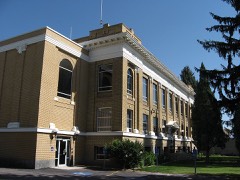 | Caribou County Courthouse | building | 1987 | 87001582 |
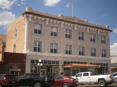 | Enders Hotel | building | 1993 | 93000384 |
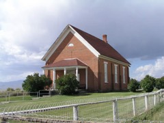 | Fanny Call House | building | 1980 | 80001297 |
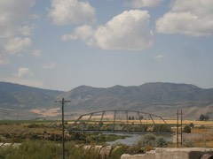 | Grace Pegram Truss Railroad Bridge | structure | 1997 | 97000758 |
| Hatch House | building | 1980 | 80001297 |
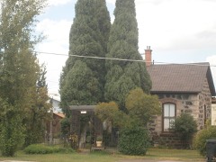 | William Hopkins House | building | 1979 | 79000787 |
| Lander Road | structure | 1975 | 75000627 | |
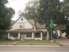 | Edgar Walter Largilliere Sr. House | building | 1991 | 91001870 |
| Livery Barn | building | 1980 | 80001297 |
| McClellan Cabin | building | 1980 | 80001297 |
| Meetinghouse | building | 1980 | 80001297 |
| Muir House | building | 1980 | 80001297 |
| Muir Store | building | 1980 | 80001297 |
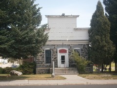 | Soda Springs City Hall | building | 1993 | 93000385 |
Every wildfire the federal occurrence database records inside this county: 258 of them, burning about 26,379 acres. 145 started naturally and 4 were recorded as arson. Each settlement page carries the fires within five miles of it.
| Reported cause | Fires |
|---|---|
| Natural | 145 |
| Missing data/not specified/undetermined | 35 |
| Recreation and ceremony | 31 |
| Equipment and vehicle use | 22 |
| Debris and open burning | 10 |
| Power generation/transmission/distribution | 5 |
| Arson/incendiarism | 4 |
| Railroad operations and maintenance | 4 |
| Misuse of fire by a minor | 1 |
| Other causes | 1 |
The five largest, by the area the report gives. None of them was recorded as arson.
| Date | Cause | Size | Reported by | Name on the report |
|---|---|---|---|---|
| 27 August 1996 | Natural | 3,124 acres | Idaho Falls District | MABEY |
| 13 August 2018 | Natural | 2,380 acres | Fort Hall Agency | CHESTERFIELD |
| 15 August 1994 | Natural | 2,000 acres | Caribou-Targhee National Forest | BROWN CANYON |
| 29 June 2012 | Equipment and vehicle use | 1,736 acres | Idaho Falls District | TEN MILE PASS |
| 18 October 1995 | Missing data/not specified/undetermined | 1,420 acres | Idaho Falls District | CHESTERFLD |
| 26 July 2000 | Natural | 1,248 acres | Idaho Falls District | GENTILE VALLEY |
| 5 August 2013 | Natural | 1,142 acres | Idaho Falls District | MABEY |
| 8 October 2012 | Missing data/not specified/undetermined | 881 acres | Idaho Falls District | ROCKY CANYON |
Every settlement page carries the fires within five miles of it - see the settlement index below.
The NOAA Storm Events Database holds 105 reports for this county, causing no deaths, no injuries and about $2,223,250 in recorded property damage. Each settlement page carries the reports that name it.
| Kind of event | Reports |
|---|---|
| Hail | 44 |
| Thunderstorm Wind | 35 |
| Flood | 8 |
| Funnel Cloud | 5 |
| Tornado | 4 |
| Heavy Rain | 3 |
| Flash Flood | 3 |
| Lightning | 1 |
| Wildfire | 1 |
| Dust Devil | 1 |
The most serious of them, by death, then injury, then recorded damage. The accounts are quoted exactly as the forecast office filed them.
| When | Event | Place named | Harm | What the report says |
|---|---|---|---|---|
| June 2023 | Flood | Chesterfield | $1,500,000 | Extreme snowmelt from heavy snowfall and extreme flows on the Portneuf River caused damage to the Chesterfield Reservoir spillway. The old structure started to deconstruct and makeshift repairs were made to alleviate any significant flooding. Cost to repair the damaged structure were estimated at around 1.5 million dollars. |
| February 2017 | Flood | Chesterfield | $427,000 | A warmup in early February caused extensive sheet flooding throughout Caribou County. The main issues were extensive flooded back roads, extensive field flooding. Lots of agricultural land was affected with extensive property and road damage. Many of the road closures occurred in the Grace area with the worst flooding from the 8th through the 14th. Several houses to the south of Grace flooded and more road flooding occurred after the 19th. Caribou County did declare a county disaster. |
| September 2000 | Lightning | Chesterfield | $150,000 | A lightning ignited fire destroyed a school at the Chesterfield historic town site. The 81 year old school , constructed of hand made brick and mortar, housed the historical records of the Chesterfield foundation. Fortunately, most of the hundreds of historical books, ledgers and museum displays were saved prior to the school becoming totally engulfed in flames. The school had educated children until 1941 and had remained a focal point for visitors interested in Chesterfield's LDS (Mormon) heritage. |
| March 2018 | Flood | Bancroft | $65,000 | Heavy rain added to snow melt to cause extensive sheet flooding in the Bancroft and Chesterfield areas with extensive damage to back roads which became unpassable. Damage estimates in the county rose above 60 thousand dollars. |
| March 2017 | Flood | Chesterfield | $42,000 | Sheet flooding from snow melt continued in March in Caribou County. Some homes reported basement flooding near King Creek. On the 15th and 16th multiple side roads off of Highway 34 were under water and got close to Highway 34 as well. |
| February 2000 | Thunderstorm Wind | Bancroft | $10,000 | One wheel line irrigation system damaged. |
| September 2021 | Hail | Conda | $6,000 | Multiple reports of ping pong ball and half dollar sized hail with many vehicles dented by the hail. |
| September 2025 | Hail | Soda Spgs | $5,000 | Severe crop damage, vehicle damage and damage to home was reported west of Soda Springs. |
| July 2017 | Dust Devil | Soda Spgs | $5,000 | Strong winds from what appeared to be a dust devil, seen by eyewitnesses including a television reporter on vacation who recorded the damage, damaged a store in Soda Springs on July 17th at around 4 pm. The winds blew parts of the concrete roof onto the street damaging a car with pieces of the roof blown into the street. It occurred on Highway 30 right in Soda Springs. | |Neighbors and emergency crews quickly cleaned up the mess of concrete, bricks from the buildings facade and tree limbs. The car sustained minor damage and was driven away. |
| August 2004 | Flash Flood | Grace | $5,000 | no account filed |
| September 2021 | Hail | Conda | $3,000 | Hail damage reported on vehicle. |
| February 2012 | Flood | Bancroft | $3,000 | Flooding along old Highway 30 between Bancroft and Pebble reported by emergency manager. |
| September 2025 | Hail | Soda Spgs | $1,000 | Some vehicles dented by the large hail. |
| May 2011 | Flood | Soda Spgs | $1,000 | Small stream flooding occurred in the Slug Creek and Diamond Creek drainages flowing toward Wyoming. Tincup Creek overflowed its banks and flooded some fields. Many back country roads were damaged or washed out. |
| August 2024 | Thunderstorm Wind | Chesterfield | $250 | Received report on social media of measured 74 mph wind gust in Chesterfield. A large pine tree top was snapped off. |
| April 2026 | Thunderstorm Wind | Niter | - | The mesonet site 1 mile northwest of Niter recorded a 60 mph thunderstorm outflow wind gust. |
| May 2025 | Thunderstorm Wind | Grace | - | Several public reports of wind damage in Grace to roofs, structures and power lines. Rocky Mountain Power reported 366 customers without power in the city of Grace. |
| May 2025 | Thunderstorm Wind | Henry | - | A 59 mph wind gust measured along Idaho 34 near the Blackfoot River. |
| June 2025 | Thunderstorm Wind | Lund | - | A 76 mph thunderstorm outflow wind gust measured at Fish Creek Summit. |
| August 2025 | Thunderstorm Wind | Niter | - | The Niter mesonet station recorded a 60 mph thunderstorm outflow wind gust. |
| August 2025 | Thunderstorm Wind | Soda Spgs | - | The Soda Springs East mesonet station recorded a 60 mph thunderstorm outflow wind gust. |
| July 2025 | Thunderstorm Wind | Grace | - | The Grace agrimet mesonet site recorded a 61 mph thunderstorm outflow wind. |
| July 2025 | Thunderstorm Wind | Grace | - | The Grace mesonet station recorded a 59 mph thunderstorm outflow wind gust. |
| September 2025 | Hail | Soda Spgs | - | Hail up to an inch and a half fell in Soda Springs. Gardens reported damaged. |
| May 2024 | Thunderstorm Wind | Soda Spgs | - | A 60 mph wind gust measured at the ITD Gem Valley mesonet site. |
| August 2024 | Thunderstorm Wind | Pebble | - | A 59 mph wind gust at Pebble. |
| August 2024 | Thunderstorm Wind | Chesterfield | - | Measured wind gust of 60 mph at Chesterfield Reservoir. |
| August 2024 | Thunderstorm Wind | Chesterfield | - | A 64 mph wind gust measured at Pole Canyon mesonet site. |
| June 2023 | Tornado (EF0) | Grace | - | The public submitted several photographs of a tornado touched down north of Grace near US Highway 30. It was a weak tornado and subsequent surveys noted zero damage as the tornado was in an open field. |
| August 2023 | Hail | Grace | - | Quarter sized hail in Grace. |
| July 2023 | Hail | Soda Spgs | - | Hail measured at 1.75 inches south of Soda Springs. |
| July 2022 | Thunderstorm Wind | Grace | - | The GRAI1 mesonet site recorded a 59 mph thunderstorms outflow wind. |
| July 2022 | Thunderstorm Wind | Henry | - | A thunderstorm outflow wind of 66 mph measured on Idaho Highway 34 near Blackfoot River Rd. |
| September 2021 | Hail | Conda | - | Half dollar sized hail in Medowville area. |
| September 2021 | Hail | Conda | - | Quarter to ping pong ball sized hail along Panting Rd just south of Horsley Ln. |
| September 2021 | Hail | Conda | - | Hail reported at Conda town site. |
| August 2019 | Thunderstorm Wind | Lago | - | Three branches were downed from a cottonwood tree 4 miles north of Lago. The largest was 4 inches in diameter. |
| August 2018 | Hail | Soda Spgs | - | Quarter to half dollar sized hail 1 mile west of Soda Springs. |
| August 2018 | Hail | Soda Spgs | - | Inch and quarter hail measured in Soda Springs. |
| May 2017 | Thunderstorm Wind | Chesterfield | - | A 58 mph wind gust measured at the Pole Canyon RAWS. |
| April 2017 | Flood | Wayan | - | Flooding subsided in April with only minor flooding continuing mainly field sheet flooding in the bird refuge in Wayan. |
| January 2017 | Flood | Bancroft | - | Extensive sheet flooding in fields and street flooding in Bancroft. |
| October 2016 | Hail | Chesterfield | - | Golf ball sized hail reported at Chesterfield. |
| June 2016 | Hail | Lund | - | Public reported one inch hail 2 miles east southeast of Lund. |
| October 2016 | Funnel Cloud | Lund | - | Funnel cloud near Lund. |
| July 2016 | Tornado (EF0) | Soda Spgs | - | A video of a weak tornado was posted on social media in open country just north of Soda Springs at 3:35 pm MDT on July 31st. |
| July 2016 | Thunderstorm Wind | Niter | - | Four to 5 inch diameter tree limbs broken near Niter in Caribou County. |
| July 2015 | Funnel Cloud | Chesterfield | - | Several photographs received of funnel clouds over and near Blackfoot Reservoir between 1 and 2 pm MDT. |
| July 2015 | Funnel Cloud | Chesterfield | - | Photographs of funnel clouds east of Chesterfield received between 130 and 155 PM MDT. |
| September 2014 | Hail | Central | - | One inch hail was measured from a thunderstorm 10 miles east of Lava Hot Springs near the town of Central. |
| July 2014 | Thunderstorm Wind | Grace | - | Four to 6 inch diameter branches blown off trees 6 miles south southeast of Grace. |
| August 2014 | Funnel Cloud | Soda Spgs | - | The public reported an unconfirmed tornado west of Soda Springs and later a funnel cloud near the city. |
| August 2014 | Heavy Rain | Chesterfield | - | Farmers and ranchers in Caribou County were declared by the USDA to qualify for natural disaster assistance due to crop damage from heavy August rains. Eastern Idaho barley crop damage was estimated at 64 million dollars with a portion of that in Caribou County. |
| August 2011 | Hail | Soda Spgs | - | One inch hail at Soda Springs. |
| September 2007 | Tornado (EF0) | Soda Spgs | - | A tornado touched down just north of Soda Springs over the Monsanto Plant. The tornado was on the ground for about 7 miles and 10 minutes. Numerous 12 to 14 inch dimater trees were snapped off but no buildings were damaged. |
| July 2001 | Flash Flood | Chesterfield | - | Flash flooding occurred in the town of Chesterfield. Water ran across a road and lift debris on the west side of twenty-four mile reservoir. |
| August 1997 | Hail | Soda Spgs | - | Hail up to golfball-size reported at Soda Springs Highschool. |
| August 1997 | Hail | Soda Spgs | - | Reported by the County Emergency Director in center of Soda Springs. Hail accumulated 1 to 2 inches. |
| June 1997 | Funnel Cloud | Grace | - | Funnel cloud extended half way to ground. |
| June 1997 | Hail | Grace | - | Hail nickel to golfball-size observed by sheriff and other storms spotters in Grace area. |
The Survey's mineral resources record lists 155 workings inside this county. 11 still produce and 144 are closed or unrecorded. Each settlement page carries the workings within five miles of it.
| Commodity | Workings |
|---|---|
| Phosphorus-Phosphates | 87 |
| Geothermal | 13 |
| Limestone, General | 11 |
| Vanadium, Uranium, REE, Fluorine-Fluorite | 9 |
| Pumice | 8 |
| Sulfur | 6 |
| Sand and Gravel, Construction | 6 |
| Vanadium | 5 |
| Fluorine-Fluorite, REE, Uranium, Vanadium | 5 |
| Vanadium, REE, Fluorine-Fluorite, Uranium | 4 |
| Bromine, Salt | 4 |
| Limestone, Dimension | 4 |
| Salt | 4 |
| Stone, Dimension | 3 |
The least common of them first, because a county's hundredth gravel pit says nothing its first ten did not.
| Where | Site | Commodity | Status | Recorded |
|---|---|---|---|---|
| Blue Jay Gulch Nitrates | Nitrogen-Nitrates | Prospect | ||
| China Hat | Pumice, Perlite | Unknown | ||
| Crow Creek Rock Salt | Halite | Past Producer | 1902 | |
| Dry Valley Mine | Phosphorus-Phosphates, Fluorine-Fluorite, Uranium, Vanadium, REE | Past Producer | Bedded - Phsphate | |
| Enoch Valley Mine | Phosphorus-Phosphates, Uranium, Fluorine-Fluorite, REE, Vanadium | Producer | Bedded - Phosphate | |
| Henry Phosphate Mine | Phosphorus-Phosphates, Vanadium, Fluorine-Fluorite, REE, Uranium | Past Producer | 1969, 1983 | |
| Hooper Spring | Manganese | Prospect | 1963 | |
| Husky No. 1 Proposed Mine | Phosphorus-Phosphates, Vanadium, Fluorine-Fluorite, Uranium, REE | Prospect | Surface | |
| Middle Sulphur Canyon Proposed Mine | Phosphorus-Phosphates, Fluorine-Fluorite, REE, Vanadium, Uranium | Prospect | ||
| Monsato Quartzite Quarry | Stone, Crushed/Broken | Past Producer | ||
| Mountain Fuel Lease | Phosphorus-Phosphates, Uranium, Vanadium, REE, Fluorine-Fluorite | Past Producer | Surface | |
| Poison Canyon Sandstone Quarry | Stone, Dimension, Sandstone, Crushed/Broken | Past Producer | Sandstone | |
| Smokey Canyon Mine | Phosphorus-Phosphates, Fluorine-Fluorite, Uranium, REE, Vanadium | Past Producer | Bedded - Phosphate | |
| Stump and White Springs | Bromine | Past Producer | ||
| Trail Canyon | Clay | Unknown | ||
| Wooley Valley Unit 3 | REE, Uranium, Vanadium, Phosphorus-Phosphates, Fluorine-Fluorite | Occurrence | ||
| Blackfoot Bridge Proposed Mine | Phosphorus-Phosphates, Uranium, REE, Fluorine-Fluorite, Vanadium | Prospect | Surface | |
| Diamond Creek Proposed Mine | Phosphorus-Phosphates, Uranium, REE, Fluorine-Fluorite, Vanadium | Producer | Surface | |
| Eighteen Mile Creek | Stone, Dimension | Unknown | ||
| Kerr Mcgee Limestone | Stone, Dimension | Unknown | ||
| Monsanta Plant-Ore | Stone, Dimension | Unknown | ||
| Rasmussen Ridge Mine | Phosphorus-Phosphates, Uranium, REE, Fluorine-Fluorite, Vanadium | Producer | Bedded - Phosphate | |
| Area A, 5 Thru 11, Stewart Flat | Phosphorus-Phosphates, Vanadium, REE, Fluorine-Fluorite, Uranium | Prospect | ||
| Booth Spring Mine | Salt | Past Producer | ||
| Champ Lease | Phosphorus-Phosphates, Vanadium, REE, Fluorine-Fluorite, Uranium | Past Producer | Surface | |
| Draney Spring | Bromine, Salt | Past Producer | ||
| Limestone Occurrence | Limestone, Dimension | Unknown | ||
| Limestone Occurrence | Limestone, Dimension | Unknown | ||
| McGrew Spring | Bromine, Salt | Past Producer | ||
| Monroe Canyon | Limestone, Dimension | Unknown | ||
| Old Stump and White Springs | Salt | Past Producer | ||
| Petersen Spring | Bromine, Salt | Past Producer | ||
| Reed Springs | Bromine, Salt | Past Producer | ||
| Rock Salt Mine | Salt | Past Producer | ||
| Salt Deposit | Salt | Unknown | ||
| South Freeman Ridge, West Slope | Phosphorus-Phosphates, Vanadium, REE, Fluorine-Fluorite, Uranium | Prospect | ||
| Swan Lake Gulch Proposed Mine | Phosphorus-Phosphates, Vanadium, REE, Fluorine-Fluorite, Uranium | Prospect | ||
| Trail Canyon Quarry | Limestone, Dimension, Limestone, General | Producer | ||
| Anaconda Strip Mine | Phosphorus-Phosphates, Vanadium | Past Producer | ||
| Conda Mine | Phosphorus-Phosphates, Fluorine-Fluorite, REE, Uranium, Vanadium | Past Producer | 1906, 1922 | |
| Freeman Ridge Phosphate Property | Phosphorus-Phosphates, Fluorine-Fluorite, REE, Uranium, Vanadium | Prospect | ||
| Kerr Mcgee Vanadium Plant | Vanadium | Producer | ||
| North Trail Canyon Mine | Phosphorus-Phosphates, Fluorine-Fluorite, REE, Uranium, Vanadium | Past Producer | 1906, 1976 | |
| Phosphate Deposit | Phosphorus-Phosphates, Vanadium | Occurrence | Surface | |
| Stewart Canyon | Phosphorus-Phosphates, Fluorine-Fluorite, REE, Uranium, Vanadium | Prospect | ||
| Trail Creek Proposed Mine | Phosphorus-Phosphates, Fluorine-Fluorite, REE, Uranium, Vanadium | Prospect | Surface | |
| Western Us Phosphate Field | Vanadium | Producer | 1940, 1941 | |
| Dewey Sulphur Mine | Sulfur | Past Producer | 1901 | |
| Gravel Pit | Sand and Gravel, Construction | Past Producer | ||
| Gravel Pit | Sand and Gravel, Construction | Past Producer | ||
| Gravel Pit | Sand and Gravel, Construction | Past Producer | ||
| Gravel Pit | Sand and Gravel, Construction | Past Producer | ||
| Gravel Pit | Sand and Gravel, Construction | Past Producer | ||
| Idaho Sulphur Mine | Sulfur | Past Producer | 1901 | |
| Lloyd Ranch Sulfur Deposit No. 2 | Sulfur | Past Producer | 1901 | |
| Rattlesnake Canyon Sulfur Deposit | Sulfur | Occurrence | Surface | |
| Soda Pit | Sand and Gravel, Construction | Producer | ||
| Sulfur Springs | Sulfur | Occurrence | ||
| Unnamed Location | Sulfur | Prospect | ||
| Broken Crater | Pumice | Unknown | ||
| Cinder Occurrence | Pumice | Unknown | ||
| Cinder Pit | Pumice | Past Producer | ||
| Cinder Pit | Pumice | Producer | ||
| Crater Mountain | Pumice | Unknown | ||
| Scoria Occurrence | Pumice | Unknown | ||
| West Bank Blackfoot River | Pumice | Unknown | ||
| Beaver Dam Creek | Phosphorus-Phosphates, Vanadium, Uranium, REE, Fluorine-Fluorite | Occurrence | ||
| Caldwell Canyon Proposed Mine | Phosphorus-Phosphates, Vanadium, Uranium, REE, Fluorine-Fluorite | Prospect | Surface | |
| Dairy Syncline | Phosphorus-Phosphates, Vanadium, Uranium, REE, Fluorine-Fluorite | Unknown | ||
| Deer Creek-Wells Canyon Area | Phosphorus-Phosphates, Vanadium, Uranium, REE, Fluorine-Fluorite | Prospect | ||
| Green Mountain Deposits | Phosphorus-Phosphates, Vanadium, Uranium, REE, Fluorine-Fluorite | Prospect | ||
| Henry North Continuation | Phosphorus-Phosphates, Vanadium, Uranium, REE, Fluorine-Fluorite | Past Producer | Bedded - Phosphate | |
| Maybe Canyon Phosphate Mine | Phosphorus-Phosphates, Vanadium, Uranium, REE, Fluorine-Fluorite | Past Producer | 1950, 1966, 1983 | |
| North Schmid Ridge, West Slope | Phosphorus-Phosphates, Vanadium, Uranium, REE, Fluorine-Fluorite | Prospect | ||
| Wooley Valley Mine | Phosphorus-Phosphates, Vanadium, Uranium, REE, Fluorine-Fluorite | Past Producer | 1955, 1983 | |
| Aspen Range | Limestone, General | Prospect | ||
| Chesterfield Range Limestone | Limestone, General | Unknown | ||
| East of Soda Springs | Limestone, General | Unknown | ||
| Limestone Occurrence | Limestone, General | Occurrence | ||
| Portneuf | Limestone, General | Past Producer | ||
| Portneuf Area Limestone Occurrence | Limestone, General | Occurrence | Limestone | |
| Rainey Creek Road | Limestone, General | Unknown | ||
| Webster Range | Limestone, General | Occurrence | ||
| Wells Canyon | Limestone, General | Unknown | ||
| White Quartz Nos. 1, 2, and 3 | Limestone, General | Occurrence | Calcite | |
| Corral Creek Wells #1 | Geothermal | Unknown | ||
| Corral Creek Wells #2 | Geothermal | Unknown | ||
| Corral Creek Wells #3 | Geothermal | Unknown | ||
| Corral Creek Wells #4 | Geothermal | Unknown | ||
| Geothermal Location | Geothermal | Occurrence | ||
| Geothermal Location | Geothermal | Unknown | ||
| Geothermal Location | Geothermal | Unknown | ||
| Geothermal Location | Geothermal | Unknown | ||
| Hooper Springs | Geothermal | Unknown | ||
| Soda Springs | Geothermal | Occurrence | ||
| Sulfur Springs | Geothermal | Occurrence | ||
| Thermal Springs | Geothermal | Occurrence | ||
| Woodall Spring | Geothermal | Unknown | ||
| Aspen Range North | Phosphorus-Phosphates | Occurrence | ||
| Ballard Mine | Phosphorus-Phosphates | Past Producer | 1952 | |
| Burchert Canyon | Phosphorus-Phosphates | Unknown | ||
| Diamond Gulch Phosphate Mine | Phosphorus-Phosphates | Past Producer | 1960 | |
| Dry Canyon Phosphate Deposit | Phosphorus-Phosphates | Occurrence | ||
| Dry Ridge Phosphate Deposit | Phosphorus-Phosphates | Occurrence | ||
| Fort Hall Indian Reservation Phosphate Bed | Phosphorus-Phosphates | Occurrence | ||
| Graves Creek Phosphate Property | Phosphorus-Phosphates | Occurrence | ||
| Grizzly Creek Phosphate Property | Phosphorus-Phosphates | Occurrence | Surface | |
| J.R. Simplot Washing/Calcine Plant | Phosphorus-Phosphates | Past Producer | ||
| Johnson Creek Phosphate Deposit | Phosphorus-Phosphates | Occurrence | ||
| Johnson Creek Prospect | Phosphorus-Phosphates | Prospect | ||
| Lanes Creek Phosphate Property | Phosphorus-Phosphates | Producer | 1978 | |
| Lone Pine Spring | Phosphorus-Phosphates | Unknown | ||
| Middle Sulphur Canyon #1 | Phosphorus-Phosphates | Prospect | Surface | |
| Monsanto Elemental Phosphorus Plant | Phosphorus-Phosphates | Plant | ||
| North Dry Ridge | Phosphorus-Phosphates | Prospect | ||
| North Maybe Canyon | Phosphorus-Phosphates | Past Producer | Bedded phosphate | |
| Nu-West Phos-Acid Plant | Phosphorus-Phosphates | Plant | ||
| Phosphate Deposit | Phosphorus-Phosphates | Occurrence | ||
| Phosphate Deposit | Phosphorus-Phosphates | Occurrence | Surface | |
| Phosphate Deposit | Phosphorus-Phosphates | Occurrence | Surface | |
| Phosphate Deposit | Phosphorus-Phosphates | Occurrence | ||
| Phosphate Deposit | Phosphorus-Phosphates | Occurrence | ||
| Phosphate Deposit | Phosphorus-Phosphates | Occurrence | ||
| Phosphate Deposit | Phosphorus-Phosphates | Occurrence | ||
| Phosphate Deposit | Phosphorus-Phosphates | Prospect | Surface | |
| Phosphate Deposit | Phosphorus-Phosphates | Occurrence | ||
| Phosphate Deposit | Phosphorus-Phosphates | Occurrence | Surface | |
| Phosphate Deposit | Phosphorus-Phosphates | Occurrence | ||
| Phosphate Occurrence | Phosphorus-Phosphates | Unknown | ||
| Phosphate Occurrence | Phosphorus-Phosphates | Occurrence | ||
| Phosphate Occurrence | Phosphorus-Phosphates | Unknown | ||
| Phosphate Occurrence | Phosphorus-Phosphates | Occurrence | ||
| Phosphate Occurrence | Phosphorus-Phosphates | Occurrence | ||
| Phosphate Occurrence | Phosphorus-Phosphates | Occurrence | ||
| Phosphate Occurrence | Phosphorus-Phosphates | Unknown | ||
| Phosphate Occurrence | Phosphorus-Phosphates | Unknown | ||
| Phosphate Occurrence | Phosphorus-Phosphates | Unknown | ||
| Phosphate Occurrence | Phosphorus-Phosphates | Unknown | ||
| Phosphate Occurrence | Phosphorus-Phosphates | Unknown | ||
| Phosphate Occurrence | Phosphorus-Phosphates | Unknown | ||
| Pole Canyon | Phosphorus-Phosphates | Unknown | ||
| Pole Canyon Phosphate Deposit | Phosphorus-Phosphates | Prospect | ||
| Portneuf Reservoir Phosphate Property | Phosphorus-Phosphates | Occurrence | ||
| Rocky Canyon Phosphate Deposit | Phosphorus-Phosphates | Occurrence | ||
| Slug Creek Valley Phosphate Deposit | Phosphorus-Phosphates | Occurrence | ||
| South Fork Sage Creek | Phosphorus-Phosphates | Unknown | ||
| South Schmid Ridge | Phosphorus-Phosphates | Prospect | ||
| Timber Creek | Phosphorus-Phosphates | Unknown | ||
| Trail Creek | Phosphorus-Phosphates | Unknown | ||
| Unit 3 , Dry Ridge Phosphate Deposit | Phosphorus-Phosphates | Occurrence | ||
| Unnamed Location | Phosphorus-Phosphates | Occurrence | ||
| Unnamed Location | Phosphorus-Phosphates | Occurrence | ||
| Unnamed Phosphate | Phosphorus-Phosphates | Prospect | ||
| Unnamed Prospect | Phosphorus-Phosphates | Prospect | ||
| Wells Canyon Prospect | Phosphorus-Phosphates | Prospect |
Named settlements recorded in the Geographic Names Information System, each with the topographic sheets covering it. Villages, hamlets and abandoned places alike. Each is shown with the nearest named watercourse or landform and the survey quadrangle it falls on.
Soda Springs census division · 83276 · By Soda Point · Alexander quadrangle
16 sheets, 1948 to 2005
Bancroft census division · 83217 · On Mill Creek · Bancroft quadrangle
12 sheets, 1948 to 1982
Grace census division · 83241 · Near Christensen Canyon · Grace quadrangle
16 sheets, 1948 to 2005
Bancroft census division · 83217 · Near Higginson Canyon · Chesterfield quadrangle
12 sheets, 1917 to 1982
Grace census division · 83241 · Near Wide Hollow · Grace Power Plant quadrangle
12 sheets, 1948 to 1982
Soda Springs census division · 83276 · Near Shield Canyon · Soda Springs quadrangle
15 sheets, 1948 to 1982
Bancroft census division · 83217 · Near Moses Canyon · Hatch quadrangle
12 sheets, 1917 to 1982
Wayan census division · 83276 · On Little Blackfoot River · Henry quadrangle
13 sheets, 1914 to 1982
Grace census division · 83241 · Near South Ant Canyon · Thatcher quadrangle
14 sheets, 1915 to 2005
Bancroft census division · 83217 · Near Lundgren Canyon · Bancroft quadrangle
12 sheets, 1948 to 1982
Wayan census division · 83285 · Wayan East quadrangle
12 sheets, 1915 to 1982
No longer a settlement
Bancroft census division · 83217 · On Pebble Creek · Bancroft quadrangle
9 sheets, 1954 to 1984
Soda Springs census division · 83276 · Near Sulphur Canyon · Soda Peak quadrangle
16 sheets, 1948 to 2005
Soda Springs census division · 83276 · On Little Spring Creek · Soda Springs quadrangle
15 sheets, 1948 to 1982
Grace census division · 83241 · Near Cedar Hollow · Grace Power Plant quadrangle
12 sheets, 1948 to 1982
Grace census division · 83241 · Near Wide Hollow · Grace Power Plant quadrangle
12 sheets, 1948 to 1982
Wayan census division · 83285 · On Harrison Creek · Wayan West quadrangle
11 sheets, 1915 to 1982
Wayan census division · 83127 · On Lander Creek · Wayan East quadrangle
12 sheets, 1915 to 1982
No longer a settlement
The vanished settlements of Caribou County: the places named above that are no longer on the map.