 Block
From the record
14 National Register listings published here.
Sources: the National Register database, National Park Service
61 topographic sheets cover 37 settlements here, and 14 properties are on the National Register of Historic Places.
14 National Register listings published here.
Sources: the National Register database, National Park Service
Every property in this county listed on the National Register of Historic Places, with the year it was listed and the federal nomination document.
| Photograph | Property | Type | Listed | Reference |
|---|---|---|---|---|
| Eleanor Albaugh Cabin | building | 2020 | 100005620 | |
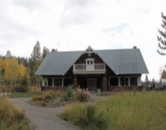 | Big Falls Inn | building | 2002 | 94000131 |
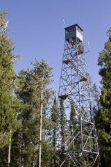 | Bishop Mountain Lookout | district | 1986 | 86001184 |
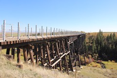 | Conant Creek Pegram Truss Railroad Bridge | structure | 1997 | 97000756 |
| Glen and Addie Crabtree Cabin | building | 2000 | 00000742 | |
 | Fremont County Courthouse | building | 1979 | 79000789 |
 | Idaho State Industrial School Women's Dormitory | building | 1982 | 82000344 |
 | Independent Order of Odd Fellows Hall | building | 1997 | 97000763 |
| Island Park Land and Cattle Company Home Ranch | district | 1996 | 96001508 | |
| Rankin Auto Court | district | 2022 | 100008209 | |
 | Johnny Sack Cabin | building | 1979 | 79000788 |
| Joseph Sherwood House and Store | building | 1994 | 94001452 | |
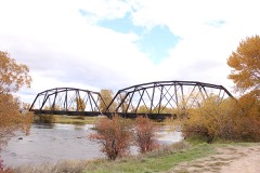 | St. Anthony Pegram Truss Railroad Bridge | structure | 1997 | 97000761 |
 | US Post Office-St. Anthony Main | building | 1989 | 89000136 |
Every wildfire the federal occurrence database records inside this county: 304 of them, burning about 128,293 acres. 168 started naturally and 11 were recorded as arson. Each settlement page carries the fires within five miles of it.
| Reported cause | Fires |
|---|---|
| Natural | 168 |
| Recreation and ceremony | 42 |
| Missing data/not specified/undetermined | 31 |
| Debris and open burning | 21 |
| Arson/incendiarism | 11 |
| Power generation/transmission/distribution | 10 |
| Equipment and vehicle use | 10 |
| Smoking | 5 |
| Misuse of fire by a minor | 3 |
| Railroad operations and maintenance | 2 |
| Fireworks | 1 |
The five largest, by the area the report gives. None of them was recorded as arson.
| Date | Cause | Size | Reported by | Name on the report |
|---|---|---|---|---|
| 26 July 2018 | Natural | 99,502 acres | Idaho Falls District | GRASSY RIDGE |
| 9 September 1994 | Natural | 8,482 acres | Yellowstone National Park | ROBINSON |
| 14 July 2008 | Natural | 5,664 acres | Caribou-Targhee National Forest | WILLOW WFU |
| 16 July 2018 | Natural | 4,353 acres | Idaho Falls District | RED ROAD |
| 6 September 2006 | Natural | 1,692 acres | Idaho Falls District | DUNE |
| 12 April 1994 | Debris and open burning | 1,668 acres | Idaho Falls District | CINDER PIT |
| 4 November 2020 | Debris and open burning | 1,092 acres | Fremont County | NORTH JUNIPER |
| 4 July 2007 | Fireworks | 1,011 acres | Idaho Falls District | SAND DUNES |
Every settlement page carries the fires within five miles of it - see the settlement index below.
The NOAA Storm Events Database holds 153 reports for this county, causing 3 deaths, 1 injury and about $455,900 in recorded property damage. Each settlement page carries the reports that name it.
| Kind of event | Reports |
|---|---|
| Thunderstorm Wind | 81 |
| Hail | 40 |
| Flood | 9 |
| Flash Flood | 7 |
| Tornado | 5 |
| Lightning | 4 |
| Heavy Rain | 3 |
| Funnel Cloud | 3 |
| Dust Devil | 1 |
The most serious of them, by death, then injury, then recorded damage. The accounts are quoted exactly as the forecast office filed them.
| When | Event | Place named | Harm | What the report says |
|---|---|---|---|---|
| April 1986 | Thunderstorm Wind | not stated | 3 killed | no account filed |
| July 2025 | Lightning | Macks Inn | 1 hurt, $100 | One adult male was struck by lightning and injured while cooking along Red Rock Rd. 8 miles north northwest of Macks Inn. Tree next to him was also hit. The strike also blew out all the stitching of a nearby tent occupied by multiple children who were not injured. |
| February 2017 | Flood | Macks Inn | $131,000 | A February warmup caused mainly road damage to Fremont County with some minor flooding. |
| March 2018 | Flood | Macks Inn | $55,000 | Extensive flooding from snow melt and rain occurred in Fremont County. A lot of the flooding came on the 22nd including extensive sand dune wash out at the Saint Anthony Sand Dunes. Some damage to county roads occurred during the month with some field flooding as well. |
| March 2012 | Flood | St Anthony | $55,000 | Extensive sheet flooding occurred in the March 10th to March 20th time frame from St Anthony to Ashton and Chester. In the chester/Hog Hollow area damage occurred to road 3100 East. Serious damage occurred to graveled road 800 North and several county roads in the Hog Hollow area. Major erosion damage at the enterprise Canal Bridge occurred. Private property damage occurred on a private road on 700 North just east of 3100 East. By March 15th county Road 3000 East north of Twin Bridges was closed. A Disaster Declaration was declared in Fremont County on March 15th. Moderate damage occurred on County Road 3200 East due to runoff. Heavy flooding occurred in Chester near County road 1000 North and 3000 East closing those roads. Hog Hollow Road was closed due to significant damage. Several pastures covered with 2 to 3 feet of water. HIghway 32 was flooded but remained open. Extensive flooding in Ashton and damage to the sewage lagoon. Two residences in Ashton had water in basements. |
| August 2024 | Thunderstorm Wind | Newdale | $25,000 | Fremont County Emergency Manager reports multiple power poles down in area of Idaho 33 milepost 108 near Newdale. Rocky Mountain Power reported several thousand customers without power. |
| May 1984 | Tornado (F1) | not stated | $25,000 | no account filed |
| August 2024 | Thunderstorm Wind | Newdale | $15,000 | Fremont County 911 Dispatch reported windows smashed out on one vehicle traveling on ID 33 due to falling power lines and power poles. No injuries occurred. |
| August 2022 | Flash Flood | Macks Inn | $15,000 | One to 3 inches of heavy rain fell in much of Fremont County causing extensive flooding. 15 people were stranded east/southeast of Macks Inn along the Henry's fork River between Big Springs and Macks Inn due to the rain. Many were suffering hypothermia and were treated on scene. Multiple private roads on the Ashton Hill were washing out. A running track was flooded at North Fremont High School. Moving water was filmed across fields and roads in the area of N 3700 E and E 1400 N. Crops and fields suffered damage in the Marysville area. Several sections of the Ashton-Tetonia Rail Trail were flooded, washed out and covered in mud. 3 cabins reported flooded north northwest of Squirrel. The Henrys Fork River rose one half foot between 5:45 Pm MDT and 9 PM MDT. |
| August 2024 | Thunderstorm Wind | Chester | $10,000 | Fremont County 911 Dispatch Center reported multiple trees and wires down across south central Fremont County. |
| June 2022 | Flood | Island Park | $10,000 | One to 2 inches of rain fell in Fremont County over a 48 hour period and caused extensive flooding. A lot of flooding in the Rea area in the Yale Creek estates and Shotgun Complex areas north of Kilgore Yale Road. Flooding reported at Island Park Village Golf Course. Rushing water flooded private roads/driveways i Pine Crest area. Red Rock Pass Road and Forest Service Road 58 washed out near Duck Creek. Yale Creek flooded across S Beaver Sprigs Rd with damage to the road. |
| April 2002 | Thunderstorm Wind | St Anthony | $10,000 | no account filed |
| August 2024 | Thunderstorm Wind | Teton | $8,000 | Eight trees reported downed across a canal in the Wilford area. Reports and photos received via social media. |
| October 2023 | Hail | St Anthony | $8,000 | One to two inches of hail accumulated on roads near St Anthony to near Ashton which resulted in at least two weather related accidents. |
| June 2019 | Thunderstorm Wind | Parker | $8,000 | Large shed and adjacent concrete pad thrown across the road along E 500 N in the area of n 1800 E. Irrigation pivot overturned just sough of e 500 N and just west of N 1800 E. Portion of a sheet metal rood peeled back and damaged on a barn. |
| August 2024 | Thunderstorm Wind | Ashton | $5,000 | Several trees and large tree limbs reported downed in Ashton. |
| June 2019 | Thunderstorm Wind | Parker | $5,000 | Over a dozen trees were down in the area of N 1900 E just north of E 400 N. Many snapped off at various heights. Portion of sheet metal roof and adjacent plywood removed from building and found in ditch. |
| August 2007 | Thunderstorm Wind | Island Park | $5,000 | Four trees were downed by thunderstorm winds in Island Park causing roof damage and power line damage. |
| July 2022 | Thunderstorm Wind | Rea | $4,000 | Fall River Rural Electric reported several trees down on power lines just southwest of Macks Inn resulting in power outages. |
| June 2011 | Flood | St Anthony | $4,000 | The Teton River near St Anthony was above flood stage several times in June beginning on June 7th and continuing off on on through the 30th. The highest crest of 6.61 feet occurred on June 15th. Numerous agricultural fields and low level lands were flooded affecting some farm equipment. Minor bank erosion occurred along the levee. The Henry's Fork at St Anthonywas at flood stage from June 7th through June 9th. The river crested at a record level of 8.84 feet on June 8th. One home 2 miles east of St Anthony was flooded with 3 to 4 feet of water in the basement. Some outbuildings were flooded. Keefer Park in St Anthony flooded and a city water pipe was damaged from debris in the river. Extensive flooding of lowlands and pasturelands occurred near St Anthony. A portion of South River Road was covered with floodwaters. |
| April 2010 | Thunderstorm Wind | St Anthony | $4,000 | Thunderstorm winds blew down a large sign at Simplot in St Anthony. The same storm also blew over a fuel shed on the south side of town near Simplot. |
| August 2024 | Thunderstorm Wind | St Anthony | $3,000 | Multiple trees uprooted in the area of E 500 N and N 2500 E. |
| July 2023 | Thunderstorm Wind | Rea | $3,000 | Tree downed on power lines due to thunderstorm wind gusts. It was near the intersection of S Beaver Springs Rd and Spruce Circle. Fall River Rural Electric reported 71 customers out of service. |
| September 2023 | Thunderstorm Wind | Chester | $3,000 | Trees and power lines were reported downed from thunderstorm winds in Chester. |
| June 2011 | Flash Flood | St Anthony | $3,000 | One mile north of Ashton a potato cellar wit machinery inside was flooded with 3 feet of water. Four cabins at the Log Cabin Motel in Ashton were flooded.; A mudslide temporarily closed one lane of Highwy 20. USFS Wood 1 Road was washed out. 0.50 inches of rain fell in a span of 30 minutes. Rocks and trees were across Highway 20/47 near Ashton/Marysville. |
| May 2006 | Thunderstorm Wind | Parker | $3,000 | no account filed |
| July 2002 | Thunderstorm Wind | Island Park | $3,000 | no account filed |
| September 2023 | Thunderstorm Wind | Ashton | $2,500 | Thunderstorm winds knocked over a large tree in Ashton onto a pickup truck. |
| March 2025 | Hail | Pineview | $2,000 | Accumulating pea sized hail leading to multiple vehicle slide offs along highway 20 north of Ashton near Island Park. |
| April 2024 | Thunderstorm Wind | Macks Inn | $2,000 | Multiple trees downed north of Macks Inn reported by emergency manager. |
| August 2024 | Thunderstorm Wind | St Anthony | $2,000 | Two trees snapped off along N 2600 E reported via social media. |
| August 2024 | Thunderstorm Wind | Ashton | $2,000 | Large tree limbs downed at Ashton Elementary School. Also portions of a wood and sheet metal roof blown off a building in the area. |
| October 2016 | Thunderstorm Wind | Teton | $2,000 | Blown over semi reported by spotter on Hog Hollow Road near Highway 33. |
| April 2014 | Thunderstorm Wind | St Anthony | $2,000 | Damaged and downed power poles reported throughout St Anthony. |
| April 2014 | Thunderstorm Wind | Ashton | $2,000 | Multiple downed and damaged power lines were reported from thunderstorm winds 1 mile south of Ashton. |
| September 2012 | Thunderstorm Wind | Egin | $2,000 | On September 10th winds downed a power line in Egin and 4,300 Fremont County residents lost power for about 4 hours from 3 pm EDT to about 7 pm EDT. |
| July 2025 | Thunderstorm Wind | Ashton | $1,500 | A greenhouse was demolished in Ashton. |
| July 2023 | Thunderstorm Wind | Macks Inn | $1,500 | One large tree and two smaller trees downed across a driveway along Old Highway 191. |
| August 2024 | Thunderstorm Wind | Teton | $1,000 | A tree reported downed blocking E 200 N near N 2300 E. |
| August 2024 | Thunderstorm Wind | Ashton | $1,000 | Fremont County Dispatch reported a tree down on wires along N 3400 E south of E 1000 N. |
| August 2024 | Thunderstorm Wind | Marysville | $1,000 | A tree was downed blocking a road in the area of Idaho Highway 32 and E 1200 N/Reclamation Rd. Received via social media. |
| August 2024 | Thunderstorm Wind | Warm River | $1,000 | Tree downed in Warm River. |
| August 2023 | Thunderstorm Wind | St Anthony | $1,000 | Tree downed in St Anthony. |
| July 2023 | Thunderstorm Wind | Macks Inn | $1,000 | Fall River rural Electric reported 77 customers without power on the US 20 side of Macks Inn. |
| July 2023 | Thunderstorm Wind | Island Park | $1,000 | Large tree down at Elk Creek Estates. |
| July 2023 | Thunderstorm Wind | Macks Inn | $1,000 | One foot diameter tree downed across Cascade Ave between Morrison St and Luke Ln in Macks Inn. |
| July 2023 | Thunderstorm Wind | Warm River | $1,000 | A vehicle was trapped due to a downed tree across the road east of Warm River. |
| May 2018 | Thunderstorm Wind | St Anthony | $1,000 | Thunderstorm winds downed a power pole with wired across a road in St Anthony. |
| October 2016 | Thunderstorm Wind | Chester | $1,000 | Two large cottonwood trees reported downed in Chester along with several tree limbs from other trees. |
| April 1998 | Lightning | Marysville | $1,000 | Lightning struck a home blowing out a window, damaging inside walls and pushing nails halfway out of the sheet rock. Also, it ruined the television, telephone and VCR. |
| July 2025 | Thunderstorm Wind | Parker | $500 | Medium sized tree one foot in diameter blown over in Parker. |
| August 2021 | Thunderstorm Wind | Marysville | $500 | Thunderstorm winds knocked out power to residents south and east of Ashton. |
| June 2019 | Thunderstorm Wind | St Anthony | $500 | Multiple trees were reported downed in St Anthony with one across a power line. 400 customers were without power for a couple of hours. |
| August 2016 | Thunderstorm Wind | Island Park | $500 | Severe thunderstorm winds blew over two pine trees into a power line which started a small fire at East Pie Haven Drive in Island Park. |
| August 2017 | Thunderstorm Wind | Ashton | $200 | Tin siding was torn off an outbuilding by thunderstorm winds in Ashton. |
| August 2024 | Lightning | Parker | $100 | Fremont County Emergency Manager reported lightning strike started a fire on the west side of Red Rd. |
| April 2025 | Tornado (EFU) | Heman | - | The public submitted several photographs of a tornado touched down northwest of the St. Anthony Sand Dunes. It appeared to be a very weak tornado and no damage was found as the tornado was in an open field. |
| May 2025 | Thunderstorm Wind | Ashton | - | A 58 mph wind gust was recorded 2 miles west of Ashton. |
| July 2025 | Flash Flood | St Anthony | - | Flooding reported within St Anthony and too much water overwhelmed the sewer system. |
| September 2025 | Thunderstorm Wind | Teton | - | Rocky Mountain Power reported power outages in Teton due to thunderstorm winds. |
The Survey's mineral resources record lists 74 workings inside this county. 31 still produce and 43 are closed or unrecorded. Each settlement page carries the workings within five miles of it.
| Commodity | Workings |
|---|---|
| Sand and Gravel, Construction | 58 |
| Geothermal | 4 |
| Pumice | 3 |
| Travertine | 2 |
| Stone, Dimension | 1 |
| Iron | 1 |
| Semiprecious Gemstone | 1 |
| Talc-Soapstone | 1 |
| Manganese | 1 |
| Stone, Crushed/Broken | 1 |
| Limestone, General | 1 |
| Magnesite, Dolomite | 1 |
The least common of them first, because a county's hundredth gravel pit says nothing its first ten did not.
| Where | Site | Commodity | Status | Recorded |
|---|---|---|---|---|
| Limestone/Dolomite Deposit | Limestone, General, Magnesite, Dolomite | Occurrence | ||
| Stone Quarry | Stone, Crushed/Broken | Past Producer | ||
| Tanner Manganese Prospect | Manganese | Unknown | ||
| Tick Heaven Talc Prospect | Talc-Soapstone | Occurrence | ||
| Tincup 1-9 Claims | Stone, Dimension | Past Producer | ||
| Turquoise Mountain Mine | Semiprecious Gemstone | Producer | ||
| Unnamed Iron Prospect | Iron | Prospect | ||
| Idaho Driftwood | Travertine | Past Producer | ||
| Idaho Driftwood #1 | Travertine | Past Producer | ||
| Crystal Butte | Pumice | Unknown | ||
| High Point Butte | Pumice | Occurrence | ||
| Wyoming Creek | Pumice | Producer | ||
| Ashton Warm Springs | Geothermal | Occurrence | ||
| Big Springs | Geothermal | Occurrence | ||
| Geothermal Location | Geothermal | Occurrence | ||
| Lily Pad Lake | Geothermal | Occurrence | ||
| Garrett Pit | Sand and Gravel, Construction | Producer | ||
| Gravel Pit | Sand and Gravel, Construction | Producer | ||
| Gravel Pit | Sand and Gravel, Construction | Producer | ||
| Gravel Pit | Sand and Gravel, Construction | Producer | ||
| Gravel Pit | Sand and Gravel, Construction | Past Producer | ||
| Gravel Pit | Sand and Gravel, Construction | Past Producer | ||
| Gravel Pit | Sand and Gravel, Construction | Past Producer | ||
| Gravel Pit | Sand and Gravel, Construction | Producer | ||
| Gravel Pit | Sand and Gravel, Construction | Producer | ||
| Gravel Pit | Sand and Gravel, Construction | Past Producer | ||
| Gravel Pit | Sand and Gravel, Construction | Past Producer | ||
| Gravel Pit | Sand and Gravel, Construction | Past Producer | ||
| Gravel Pit | Sand and Gravel, Construction | Past Producer | ||
| Gravel Pit | Sand and Gravel, Construction | Past Producer | ||
| Gravel Pit | Sand and Gravel, Construction | Past Producer | ||
| Gravel Pit | Sand and Gravel, Construction | Past Producer | ||
| Gravel Pit | Sand and Gravel, Construction | Past Producer | ||
| Gravel Pit | Sand and Gravel, Construction | Past Producer | ||
| Gravel Pit | Sand and Gravel, Construction | Past Producer | ||
| Gravel Pit | Sand and Gravel, Construction | Producer | ||
| Gravel Pit | Sand and Gravel, Construction | Producer | ||
| Gravel Pit | Sand and Gravel, Construction | Past Producer | ||
| Gravel Pit | Sand and Gravel, Construction | Past Producer | ||
| Gravel Pit | Sand and Gravel, Construction | Past Producer | ||
| Gravel Pit | Sand and Gravel, Construction | Producer | ||
| Gravel Pit | Sand and Gravel, Construction | Producer | ||
| Gravel Pit | Sand and Gravel, Construction | Producer | ||
| Gravel Pit | Sand and Gravel, Construction | Producer | ||
| Gravel Pit | Sand and Gravel, Construction | Producer | ||
| Gravel Pit | Sand and Gravel, Construction | Past Producer | ||
| Gravel Pit | Sand and Gravel, Construction | Producer | ||
| Gravel Pit | Sand and Gravel, Construction | Producer | ||
| Gravel Pit | Sand and Gravel, Construction | Past Producer | ||
| Gravel Pit | Sand and Gravel, Construction | Past Producer | ||
| Gravel Pit | Sand and Gravel, Construction | Producer | ||
| Gravel Pit | Sand and Gravel, Construction | Past Producer | ||
| Gravel Pit | Sand and Gravel, Construction | Producer | ||
| Gravel Pit | Sand and Gravel, Construction | Producer | ||
| Gravel Pit | Sand and Gravel, Construction | Producer | ||
| Gravel Pit | Sand and Gravel, Construction | Producer | ||
| Gravel Pit | Sand and Gravel, Construction | Past Producer | ||
| Gravel Pit | Sand and Gravel, Construction | Producer | ||
| Gravel Pit | Sand and Gravel, Construction | Past Producer | ||
| Gravel Pit | Sand and Gravel, Construction | Producer | ||
| Gravel Pit | Sand and Gravel, Construction | Producer | ||
| Gravel Pit | Sand and Gravel, Construction | Producer | ||
| Gravel Pit | Sand and Gravel, Construction | Past Producer | ||
| Gravel Pit | Sand and Gravel, Construction | Past Producer | ||
| Gravel Pit | Sand and Gravel, Construction | Past Producer | ||
| Gravel Pit | Sand and Gravel, Construction | Past Producer | ||
| Gravel Pit | Sand and Gravel, Construction | Producer | ||
| Gravel Pit | Sand and Gravel, Construction | Past Producer | ||
| Gravel Pit | Sand and Gravel, Construction | Past Producer | ||
| Gravel Pit | Sand and Gravel, Construction | Producer | ||
| Gravel Pit | Sand and Gravel, Construction | Past Producer | ||
| Parker Pit and Plant | Sand and Gravel, Construction | Producer | ||
| Parker Pit and Plant | Sand and Gravel, Construction | Producer | ||
| State Pit Fr 51 S | Sand and Gravel, Construction | Producer |
Named settlements recorded in the Geographic Names Information System, each with the topographic sheets covering it. Villages, hamlets and abandoned places alike. Each is shown with the nearest named watercourse or landform and the survey quadrangle it falls on.
Island Park census division · Near Freize Knoll · Pine Butte quadrangle
9 sheets, 1955 to 1989
Island Park census division · 83429 · On Thirsty Creek · Island Park quadrangle
11 sheets, 1955 to 1989
Island Park census division · 83429 · In Box Canyon · Island Park Dam quadrangle
11 sheets, 1955 to 1989
St. Anthony census division · 83421 · On Fall River · Newdale quadrangle
10 sheets, 1949 to 1988
Ashton census division · 83420 · On Squirrel Creek · Drummond quadrangle
9 sheets, 1955 to 1988
Island Park census division · On Eccles Butte · Hatchery Butte quadrangle
10 sheets, 1955 to 1989
Island Park census division · Near Trail Canyon · Snake River Butte quadrangle
9 sheets, 1955 to 1989
Ashton census division · 83420 · Warm River quadrangle
11 sheets, 1955 to 1989
No longer a settlement
Island Park census division · 83429 · On Toms Creek · Island Park quadrangle
11 sheets, 1955 to 1989
Island Park census division · 83445 · Big Grassy Ridge quadrangle
9 sheets, 1955 to 1989
Island Park census division · 83429 · On Blue Spring Creek · Last Chance quadrangle
11 sheets, 1955 to 1989
Ashton census division · 83420 · On Willow Creek · Ashton quadrangle
11 sheets, 1955 to 1989
No longer a settlement
Island Park census division · 83420 · On Spring Creek · Lemon Lake quadrangle
10 sheets, 1955 to 1989
Island Park census division · 83429 · On West Fork Mill Creek · Island Park Dam quadrangle
11 sheets, 1955 to 1989
St. Anthony census division · 83445 · Saint Anthony quadrangle
10 sheets, 1950 to 1988
Island Park census division · 83420 · On Dewitt Creek · Lemon Lake quadrangle
10 sheets, 1955 to 1989
Island Park census division · 83429 · On Timber Creek · Targhee Peak quadrangle
13 sheets, 1955 to 2000
Island Park census division · 83420 · On Robinson Creek · Warm River quadrangle
11 sheets, 1955 to 1989
The vanished settlements of Fremont County: the places named above that are no longer on the map.