Block
From the record
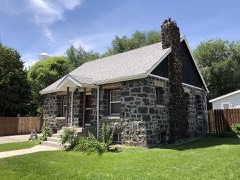
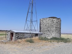
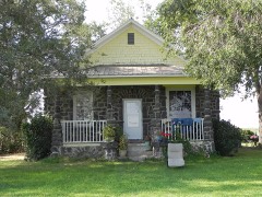
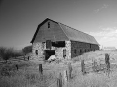
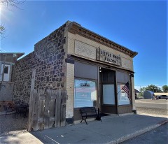
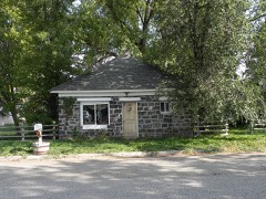
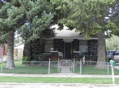
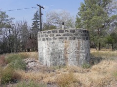
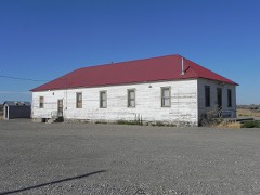
42 National Register listings published here.
Sources: the National Register database, National Park Service
36 topographic sheets cover 10 settlements here, and 42 properties are on the National Register of Historic Places.
42 National Register listings published here.
Sources: the National Register database, National Park Service
Every property in this county listed on the National Register of Historic Places, with the year it was listed and the federal nomination document.
Every wildfire the federal occurrence database records inside this county: 390 of them, burning about 785,040 acres. 87 started naturally and 15 were recorded as arson. Each settlement page carries the fires within five miles of it.
| Reported cause | Fires |
|---|---|
| Equipment and vehicle use | 100 |
| Natural | 87 |
| Missing data/not specified/undetermined | 67 |
| Railroad operations and maintenance | 50 |
| Debris and open burning | 25 |
| Power generation/transmission/distribution | 20 |
| Arson/incendiarism | 15 |
| Fireworks | 9 |
| Smoking | 5 |
| Recreation and ceremony | 5 |
| Other causes | 3 |
| Firearms and explosives use | 2 |
| Misuse of fire by a minor | 2 |
The five largest, by the area the report gives. None of them was recorded as arson.
| Date | Cause | Size | Reported by | Name on the report |
|---|---|---|---|---|
| 3 July 1996 | Natural | 178,459 acres | Twin Falls District | RICHFIELDS |
| 2 August 1992 | Natural | 149,250 acres | Twin Falls District | BLACKRIDGE |
| 5 August 2012 | Natural | 140,954 acres | Twin Falls District | FLAT TOP 2 |
| 4 August 2017 | Missing data/not specified/undetermined | 49,912 acres | Twin Falls District | MAMMOTH CAVE |
| 22 July 2012 | Natural | 34,507 acres | Twin Falls District | OWINZA |
| 9 July 2017 | Natural | 29,493 acres | Twin Falls District | ANTELOPE |
| 7 August 2006 | Natural | 26,622 acres | Twin Falls District | OWINZA |
| 26 July 2012 | Natural | 20,784 acres | Twin Falls District | SID CROSSING |
Every settlement page carries the fires within five miles of it - see the settlement index below.
The NOAA Storm Events Database holds 81 reports for this county, causing no deaths, no injuries and about $3,278,000 in recorded property damage. Each settlement page carries the reports that name it.
| Kind of event | Reports |
|---|---|
| Thunderstorm Wind | 49 |
| Hail | 12 |
| Wildfire | 5 |
| Tornado | 4 |
| Funnel Cloud | 4 |
| Flood | 4 |
| Heavy Rain | 3 |
The most serious of them, by death, then injury, then recorded damage. The accounts are quoted exactly as the forecast office filed them.
| When | Event | Place named | Harm | What the report says |
|---|---|---|---|---|
| February 2017 | Flood | Shoshone | $2,150,000 | A significant warmup caused massive sheet flooding in Lincoln County beginning early in the month and continuing through the end. Significant damage occurred to private homes and especially roadways. The state declared Lincoln county a disaster area. Many roads were closed by the 11th with water over roadways from east of Shoshone to the Minidoka County line. The town of Kimana had significant flooding as well. Some of the road closures were 200 East Highway 24, 270 South between 650-750 East, 330S between 750 and 850, 70 South, 600 North and 1200 North. |
| August 2000 | Wildfire | Dietrich | $750,000 | Lightning triggered the High Point fire, which quickly burned 20,300 total acres. Several silos and nearly 2000 acres of wheat, barley and pasture were destroyed. Caught and killed in the fast moving conflagration on the pasture were some 200 cattle. |
| March 2017 | Flood | Shoshone | $277,000 | Snow melt sheet flooding continued into March in the region with continued road and property damage due to the waters. The last two days of the month release from the Magic Reservoir into the Big Wood River caused some flooding 5 miles north of Shoshone and trapped a many in his home for a couple of days. It washed over the bridge in front of his home blocking his way out. |
| January 2012 | Flood | Shoshone | $37,500 | Several thousand dollars worth of damage due to flooding from extensive rainfall during the week. In Lincoln County two rural houses flooded along with several road washouts. Much of 420N washed out along with 720N 825 E and several BLM roads. Several roads damaged in the city of Shoshone. |
| July 1987 | Tornado (F1) | not stated | $25,000 | no account filed |
| December 2025 | Thunderstorm Wind | Shoshone | $8,000 | Numerous trees and power lines downed. |
| August 2006 | Thunderstorm Wind | Shoshone | $8,000 | no account filed |
| July 2013 | Thunderstorm Wind | Shoshone | $5,000 | Multiple trees downed in Shoshone with power outages reported. 5000 dollars worth of damage reported from tree limbs falling onto a house. |
| August 2012 | Thunderstorm Wind | Richfield | $5,000 | At mile post 169 on highway 26 four trees and 2 power lines were downed by thunderstorm winds. Power lines fell on the highway and only one lane was open for several hours. |
| August 2003 | Thunderstorm Wind | Shoshone | $5,000 | no account filed |
| August 2003 | Thunderstorm Wind | Shoshone | $4,000 | no account filed |
| June 2017 | Thunderstorm Wind | Shoshone | $1,500 | Multiple trees were reported downed in Shoshone due to thunderstorm winds. A roof was also ripped off of a barn. Some power lines were downed and 100 people lost power in the city. |
| July 2013 | Thunderstorm Wind | Dietrich | $1,000 | Numerous downed trees in DIetrich area. One tree limb fell onto RV in Dietrich causing 1 thousand dollars worth of damage. |
| October 2006 | Tornado (F0) | Shoshone | $1,000 | Tornado touched down in Shoshone with several trees reported downed with some branches thrown through windows. |
| May 2025 | Thunderstorm Wind | Richfield | - | A large power outage reported across the city of Richfield due to thunderstorm winds. |
| May 2025 | Thunderstorm Wind | Dietrich | - | Power outages reported from thunderstorm winds in the Dietrich area. |
| May 2024 | Thunderstorm Wind | Shoshone | - | Idaho Power reported 400 customers without power in southwest Lincoln County. |
| July 2024 | Thunderstorm Wind | Owinza | - | A 60 mph wind gust measured 5 miles north of Owinza. |
| July 2022 | Thunderstorm Wind | Owinza | - | A 64 mph thunderstorm outflow wind measured north of Owinza. |
| September 2021 | Thunderstorm Wind | Richfield | - | A 59 mph wind gust near Richfield. |
| July 2020 | Thunderstorm Wind | Richfield | - | A 68 mph wind gust measured at the Richfield mesonet site. |
| July 2020 | Thunderstorm Wind | Shoshone | - | A tree was downed at a residence causing some shingle damage. |
| October 2019 | Thunderstorm Wind | Shoshone | - | Four power poles snapped in half between N Apple St and N Birch St. Large tree downed at W 4th St and N Cherry St. An outside ice storage bin flipped over and reports of multiple trees downed. |
| October 2019 | Thunderstorm Wind | Shoshone | - | Multiple power poles down south of Shoshone along US Route 93. |
| October 2019 | Thunderstorm Wind | Owinza | - | A 64 mph wind gust measured at the Rock Lake RAWS site. |
| October 2019 | Thunderstorm Wind | Dietrich | - | Media reports power outages in Shoshone and Dietrich. |
| April 2017 | Flood | Shoshone | - | Releases form the Magic Reservoir the last two days of March continued into the first week of April and some field flooding along the Big Wood River continued including a washed out bridge on personal property. The man was blocked in his home for a few days. |
| June 2017 | Thunderstorm Wind | Richfield | - | A 59 mph thunderstorm outflow wind was measured in Richfield. |
| September 2017 | Funnel Cloud | Shoshone | - | A thunderstorm north of Shoshone created a funnel cloud at around 3:45 PM MDT on September 30th with photographs of the funnel provided by a Twin Falls television meteorologist. |
| September 2016 | Thunderstorm Wind | Richfield | - | A 62 mph wind gust measured by Richfield. |
| August 2014 | Hail | Richfield | - | Golf ball sized hail reported in Richfield. |
| August 2014 | Funnel Cloud | Dietrich | - | The Lincoln County sheriff reported a funnel cloud near Kinzie Butte. |
| August 2014 | Funnel Cloud | Dietrich | - | The Lincoln County sheriff reported a funnel cloud at mile marker 42 on Highway 24. |
| August 2014 | Thunderstorm Wind | Shoshone | - | Near the Lincoln and Blaine County border the sheriff reported thunderstorm wind gusts blew a car off the road. |
| August 2014 | Hail | Richfield | - | One inch hail reported in the city of Richfield. |
| August 2014 | Heavy Rain | Burmah | - | Farmers and ranchers in Lincoln County were declared by the USDA to qualify for natural disaster assistance due to crop damage from heavy August rains. Eastern Idaho barley crop damage was estimated at 64 million dollars with a portion of that in Lincoln County. |
| August 2013 | Hail | Shoshone | - | One inch hail measured in Shoshone. |
| July 2013 | Thunderstorm Wind | Richfield | - | Mesonet site at Richfield measured a 61 mph wind gust at 8:13 pm MDT. |
| July 2013 | Thunderstorm Wind | Shoshone | - | The Shoshone mesonet site recorded a 64 mph thunderstorm wind gust. |
| October 2006 | Hail | Besslen | - | Nickel sized hail 12 miles north of Shoshone. |
| October 2006 | Tornado (F0) | Shoshone | - | Tornado occurred over open land 9 miles northwest of Shoshone. No damage occurred. |
| October 2006 | Tornado (F0) | Richfield | - | Tornado over open ground near Mammoth Ice Caves. No damage occurred. |
| May 2005 | Hail | Richfield | - | One inch hail in Richfield. |
| September 1995 | Thunderstorm Wind | Shoshone | - | Winds gusted to 66 miles per hour 20 miles northeast of Shoshone. Another storm at Soldier Mountain in Fairfield produced lightning that struck a ski lift control booth setting it on fire, the cable was broken and 15 ski lift chairs were damaged. |
| March 2006 | Thunderstorm Wind | Shoshone | - | no account filed |
| June 2006 | Thunderstorm Wind | Richfield | - | no account filed |
| June 2006 | Thunderstorm Wind | Shoshone | - | no account filed |
| July 2004 | Thunderstorm Wind | Richfield | - | no account filed |
| August 2003 | Thunderstorm Wind | Shoshone | - | no account filed |
| August 2003 | Thunderstorm Wind | Richfield | - | no account filed |
| August 2003 | Thunderstorm Wind | Shoshone | - | no account filed |
| September 2003 | Wildfire | Dietrich | - | no account filed |
| April 2003 | Funnel Cloud | Shoshone | - | no account filed |
| August 2003 | Wildfire | Shoshone | - | no account filed |
| January 1998 | Thunderstorm Wind | Richfield | - | no account filed |
| May 1998 | Hail | Richfield | - | no account filed |
| May 1998 | Hail | Richfield | - | no account filed |
| June 1998 | Hail | Shoshone | - | no account filed |
| June 1996 | Heavy Rain | Dietrich | - | no account filed |
| June 1996 | Heavy Rain | Dietrich | - | no account filed |
The Survey's mineral resources record lists 9 workings inside this county. 5 still produce and 4 are closed or unrecorded. Each settlement page carries the workings within five miles of it.
| Commodity | Workings |
|---|---|
| Sand and Gravel, Construction | 7 |
| Pumice | 1 |
| Stone, Dimension | 1 |
The least common of them first, because a county's hundredth gravel pit says nothing its first ten did not.
| Where | Site | Commodity | Status | Recorded |
|---|---|---|---|---|
| Black Butte | Stone, Dimension | Producer | ||
| Condel Cinder Pit | Pumice | Producer | ||
| Cottonwood Pit | Sand and Gravel, Construction | Producer | ||
| Gravel Pit | Sand and Gravel, Construction | Past Producer | ||
| Lincoln County Pit | Sand and Gravel, Construction | Producer | ||
| Lows Sand & Gravel | Sand and Gravel, Construction | Producer | ||
| Unnamed Location | Sand and Gravel, Construction | Unknown | ||
| Unnamed Location | Sand and Gravel, Construction | Unknown | ||
| Unnamed Location | Sand and Gravel, Construction | Unknown |
Named settlements recorded in the Geographic Names Information System, each with the topographic sheets covering it. Villages, hamlets and abandoned places alike. Each is shown with the nearest named watercourse or landform and the survey quadrangle it falls on.
Shoshone census division · 83352 · On Cottonwood Slough · Richfield quadrangle
8 sheets, 1955 to 1979