 Block
From the record
8 National Register listings published here.
Sources: the National Register database, National Park Service
25 topographic sheets cover 20 settlements here, and 8 properties are on the National Register of Historic Places.
8 National Register listings published here.
Sources: the National Register database, National Park Service
Every property in this county listed on the National Register of Historic Places, with the year it was listed and the federal nomination document.
| Photograph | Property | Type | Listed | Reference |
|---|---|---|---|---|
| American Legion Malad Post 65 | building | 2024 | 100009874 | |
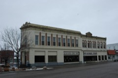 | Co-Op Block and J. N. Ireland Bank | building | 1979 | 79000804 |
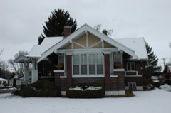 | D. L. Evans Sr. Bungalow | building | 1979 | 79000805 |
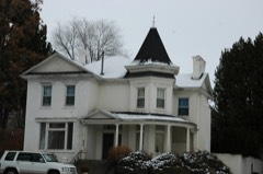 | Jedd Jones House | building | 1979 | 79000806 |
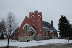 | Malad Second Ward Tabernacle | building | 1979 | 79000803 |
 | Oneida County Courthouse | building | 1987 | 87001588 |
| Samaria Historic District | district | 1979 | 79003740 | |
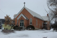 | United Presbyterian Church | building | 1979 | 79000807 |
Every wildfire the federal occurrence database records inside this county: 366 of them, burning about 204,907 acres. 270 started naturally and 3 were recorded as arson. Each settlement page carries the fires within five miles of it.
| Reported cause | Fires |
|---|---|
| Natural | 270 |
| Equipment and vehicle use | 36 |
| Missing data/not specified/undetermined | 34 |
| Power generation/transmission/distribution | 8 |
| Recreation and ceremony | 8 |
| Arson/incendiarism | 3 |
| Fireworks | 3 |
| Debris and open burning | 3 |
| Misuse of fire by a minor | 1 |
The five largest, by the area the report gives. None of them was recorded as arson.
| Date | Cause | Size | Reported by | Name on the report |
|---|---|---|---|---|
| 5 August 2006 | Natural | 31,568 acres | Caribou-Targhee National Forest | STONE 2 |
| 27 July 1994 | Natural | 31,395 acres | Idaho Falls District | ELEVATOR |
| 15 August 2006 | Natural | 19,482 acres | Caribou-Targhee National Forest | BOWEN |
| 20 June 2007 | Equipment and vehicle use | 16,312 acres | Idaho Falls District | COW CANYON |
| 16 September 2000 | Natural | 12,498 acres | Idaho Falls District | TAYLOR |
| 2 August 1992 | Natural | 12,265 acres | Idaho Falls District | MEADOWSDIV |
| 11 August 2007 | Equipment and vehicle use | 9,473 acres | Idaho Falls District | MITCHELL |
| 7 September 1998 | Equipment and vehicle use | 8,594 acres | Idaho Falls District | POCATELLO |
Every settlement page carries the fires within five miles of it - see the settlement index below.
The NOAA Storm Events Database holds 89 reports for this county, causing 1 death, 1 injury and about $732,500 in recorded property damage. Each settlement page carries the reports that name it.
| Kind of event | Reports |
|---|---|
| Thunderstorm Wind | 47 |
| Flash Flood | 14 |
| Hail | 11 |
| Flood | 4 |
| Tornado | 3 |
| Wildfire | 3 |
| Heavy Rain | 3 |
| Funnel Cloud | 3 |
| Debris Flow | 1 |
The most serious of them, by death, then injury, then recorded damage. The accounts are quoted exactly as the forecast office filed them.
| When | Event | Place named | Harm | What the report says |
|---|---|---|---|---|
| August 1997 | Heavy Rain | Malad | 1 killed | no account filed |
| August 1989 | Thunderstorm Wind | not stated | 1 hurt | no account filed |
| February 2017 | Flood | Daniels | $278,000 | Significant warmup in February caused extensive sheet flooding mainly over fields but also some flooding on back roads causing extensive damage. A lot of the roadway damage was due to a very cold and snowy winter as well. |
| May 1986 | Tornado (F1) | not stated | $250,000 | no account filed |
| June 2020 | Thunderstorm Wind | Malad City | $50,000 | Widespread wind damage occurred across the valley west of Malad City with a total of at least 40 trees down from the Pleasantview area and Idaho Highway 38 at southern end, to the west side of Malad City at the eastern extent, to 2800 N at the northern extent. Damage was noted at nearly every property. Maximum winds were estimated at 75 to 90 mph based on observed damage. Multiple homes had roof shingles blown off with wagon wheel irrigation systems blown around and damaged usually be wrapping against trees or power poles. |
| March 2017 | Flood | Daniels | $45,000 | Sheet flooding from snow melt continued throughout March though not as severe as it was in February. Damages to roads and property ...mainly flooded basements continued to add up through the month. On the 17th there was water running over North Highway 1919 between Devil Creek Reservoir and Power House Road on Malad Summit. |
| August 2010 | Thunderstorm Wind | Malad City | $25,000 | Large tree fell on top of a home in Malad City. Residents had to evacuate home. |
| August 1987 | Tornado (F0) | not stated | $25,000 | no account filed |
| March 2006 | Thunderstorm Wind | Malad City | $21,000 | no account filed |
| February 2012 | Flood | (Mld)Malad City Arpt | $10,000 | Sheet flooding reported from Devil Creek Reservoir north to Malad summit along the old highway. Near intersection of State Highway 38 and 17200 West water flowing over readways with several fields flooding. 0.40 inches of rain reported near Holbrook. From Arbon town site south to Highway 38 creeks rising. North Road washed out and South Road under two feet of water. Three feet of standing water in fields near Holbrook. |
| August 2008 | Thunderstorm Wind | Malad City | $10,000 | A severe thunderstorm downed several trees, damaged roofs and tossed debris throughout the city at around 3 am MDT August 10th. |
| January 2012 | Flood | Holbrook | $8,000 | Several thousand dollars worth of damage due to flooding from extensive rainfall during the week. In Oneida County highways 36 and 38 damaged with mud and debris. Old Highway 191 near Malad Summit covered with mud and debris also. |
| May 2018 | Flash Flood | (Mld)Malad City Arpt | $5,000 | A very heavy rainfall of over 2 inches in 30 minutes from a strong thunderstorm caused basements to flood and street flooding in Malad City. |
| July 2004 | Flash Flood | Countywide | $2,500 | no account filed |
| May 2021 | Thunderstorm Wind | Holbrook | $1,000 | A large tree branch was snapped in two along with some roof damage in Holbrook with strong thunderstorm outflow winds. |
| July 2004 | Flash Flood | Daniels | $1,000 | no account filed |
| August 2003 | Thunderstorm Wind | Samaria | $1,000 | no account filed |
| June 2025 | Thunderstorm Wind | Malad City | - | A 62 mph wind gust measured at Malad Summit. |
| August 2025 | Thunderstorm Wind | Black Pine | - | A 66 mph thunderstorm outflow wind gust recorded at the Juniper Interchange on interstate 84. |
| July 2025 | Thunderstorm Wind | Malad City | - | A 78 mph thunderstorm outflow wind gust was recorded at the Station Canyon mesonet station. |
| July 2025 | Thunderstorm Wind | Black Pine | - | A 61 mph thunderstorm outflow wind gust was measured at the Juniper Interchange mesonet station on interstate 84. |
| July 2025 | Thunderstorm Wind | Malad City | - | The Malad Summit mesonet station on interstate 15 recorded a 59 mph thunderstorm outflow wind gust. |
| July 2025 | Thunderstorm Wind | Black Pine | - | A 62 mph thunderstorm outflow wind gust was recorded at the Juniper Interchange mesonet site on interstate 84. |
| July 2025 | Thunderstorm Wind | Holbrook | - | A 61 mph thunderstorm outflow wind recorded at the Holbrook ITD mesonet site. |
| December 2025 | Thunderstorm Wind | Black Pine | - | A 62 mph wind gust measured at the Juniper Interchange mesonet site. |
| June 2023 | Thunderstorm Wind | Juniper | - | A 70 mph thunderstorm outflow wind gust measured at interstate 84 Juniper site. |
| June 2023 | Thunderstorm Wind | Black Pine | - | A 63 mph gust measured north of Black Pine. |
| September 2023 | Flash Flood | Malad City | - | Water ran across Old Highway 191 at several locations between Idaho 36 and Devil Creek Reservoir due to heavy rain. |
| August 2022 | Flash Flood | Holbrook | - | Evidence of flash flooding across Hess Road northeast of Holbrook with minor residual damage. |
| September 2022 | Thunderstorm Wind | Juniper | - | A 59 mph gust measured at Pilot Gold. |
| July 2021 | Flash Flood | Malad City | - | A NWS storm survey found flooding had occurred on Highway 36 with damage to culverts. Idaho Transportation Department was cleaning up debris. |
| June 2021 | Debris Flow | Cherry Creek | - | On June 25th video of debris flow running over north bound interstate 15 just north of the Utah border in Oneida county was seen. Radar estimated 2 inches of rainfall in that area resulting in the debris flow and flooding. |
| May 2020 | Thunderstorm Wind | Holbrook | - | A 71 mph gust measured 4 miles north of Holbrook. Some tin on tops of silos blown off haystacks and some boat damage reported. |
| May 2020 | Thunderstorm Wind | Juniper | - | A 57 mph wind gust measured at the Juniper interchange ITD site. |
| April 2020 | Funnel Cloud | Samaria | - | A funnel cloud photographed in Samaria. |
| June 2020 | Thunderstorm Wind | Stone | - | Large tree limbs downed in Stone with shingles removed from one home. |
| June 2020 | Thunderstorm Wind | Holbrook | - | Trees downed 7 miles northwest of Holbrook from thunderstorm winds. |
| June 2020 | Thunderstorm Wind | Holbrook | - | At least 14 power poles snapped off at various heights along road 009 and attendant power lines were down across road 009 and across Idaho Highway 38. Highway 38 was closed for a 2 mile stretch until the lines were removed. |
| June 2020 | Thunderstorm Wind | Pleasant View | - | Multiple trees and large tree limbs down along S 5400 W between W 3000 S and W 500 S. |
| June 2020 | Thunderstorm Wind | Pleasant View | - | Between the towns of Pleasantview and Malad City numerous trees were uprooted with one damaging a house and multiple power lines damaged and down. |
| June 2020 | Thunderstorm Wind | Pleasant View | - | A tree and power lines were down on a house. Large sections of sheet metal were blown out or peeled off of 2 large barn structures in the area of the intersection of S 5400 W and W 500 S. |
| June 2020 | Thunderstorm Wind | Malad City | - | Multiple trees were down including on a house along N 3100 W. |
| June 2020 | Thunderstorm Wind | Pleasant View | - | Two large trees were uprooted, one of which partially fell on a pickup truck along 5600 W just west of N 5400 W. Trees and tree limbs were down across the area. |
| June 2020 | Thunderstorm Wind | Malad City | - | A roof was blown off a large outbuilding along W 2800 N between N 3900 W and 3100 W. |
| June 2020 | Thunderstorm Wind | Malad | - | The upper half of a large pine tree snapped off along N 500 W south of 8th st N. |
| June 2020 | Thunderstorm Wind | Pleasant View | - | A portion of a well built shingled roof blown off a 2 story residence along W 1000 N west of N 3400 W. Tree limbs were downed as well. |
| June 2020 | Thunderstorm Wind | Malad City | - | N 3400 W was closed by law enforcement from W 2000 N south to W 1000 N due to multiple trees, tree limbs, and power lines down blocking the road at various locations. Several power poses were damaged or leaning. A large tree was uprooted and down on a house along W 2000 N between N 3400 W and 3100 W along with a power line. Numerous trees and tree limbs down across the area with tree debris covering several roads. Tree branches were hanging from power lines. |
| June 2020 | Thunderstorm Wind | Malad City | - | Numerous large trees were downed across Malad City. |
| May 2018 | Funnel Cloud | Stone | - | Several photographs from the public showed a funnel cloud near the Utah and Idaho border near interstate 84 just north of Snowville, Utah. The funnel nearly reached the ground. |
| September 2016 | Funnel Cloud | Malad City | - | A funnel cloud was photographed near Malad on September 14th. |
| June 2015 | Thunderstorm Wind | Black Pine | - | The Juniper interchange mesonet site measured a 60 mph wind gust. |
| August 2014 | Heavy Rain | Stone | - | Farmers and ranchers in Oneida County were declared by the USDA to qualify for natural disaster assistance due to crop damage from heavy August rains. Eastern Idaho barley crop damage was estimated at 64 million dollars with a portion of that in Oneida County. |
| June 2009 | Flash Flood | Holbrook | - | A total of 0.41 inches of rain was measured 4 miles north northeast of Holbrook in a 25 minute period causing flooding on several Oneida County roads. |
| June 2009 | Flash Flood | Holbrook | - | Rural roads flooded north of Holbrook with 0.57 inches of rain in 15 minutes reported. |
| June 2009 | Flash Flood | Holbrook | - | Extremely heavy rainfall at 1.5 inches in 15 minutes caused trees to be uprooted with the Arbon Valley Highway flooded in multiple spots. |
| August 2009 | Flash Flood | Holbrook | - | Rural roads were flooded with as much as 14 inches of water over the roadways. The largest was 12 feet wide. |
| August 2007 | Hail | Cherry Creek | - | A weather spotter reported three-quarter inch hail near Cherry Creek. |
| May 2005 | Tornado (F0) | Stone | - | Tornado touching ground east of Stone over mountains. |
| July 2001 | Flash Flood | East Central Portion | - | Flash flooding occurred in rural portions of central Oneida county. |
| August 1997 | Flash Flood | Juniper | - | 4 to 8 feet of water rushed down normally dry streambeds and channels with Interstate 84 exit 263 underpass flooded. Water also flooded over several bridges, across roads and yards. A Juniper resident commented that this was the worse storm he had seen in 60 years. |
The Survey's mineral resources record lists 34 workings inside this county. 5 still produce and 29 are closed or unrecorded. Each settlement page carries the workings within five miles of it.
| Commodity | Workings |
|---|---|
| Sand and Gravel, Construction | 16 |
| Geothermal | 6 |
| Perlite | 5 |
| Pumice | 3 |
| Stone, Crushed/Broken | 3 |
| Iron | 1 |
| Gold | 1 |
| Stone | 1 |
The least common of them first, because a county's hundredth gravel pit says nothing its first ten did not.
| Where | Site | Commodity | Status | Recorded |
|---|---|---|---|---|
| Quarry | Stone | Past Producer | ||
| Williams Property | Iron, Gold | Occurrence | ||
| Borrow Pit | Stone, Crushed/Broken | Past Producer | ||
| Borrow Pit | Stone, Crushed/Broken | Past Producer | ||
| Borrow Pit | Stone, Crushed/Broken | Past Producer | ||
| M. J. Hess Construction Co. Pit | Pumice, Perlite | Producer | Pumice | |
| Malad Plant | Pumice | Producer | ||
| Wright's Creek Mine | Pumice | Producer | ||
| Hess Et Al Claims | Perlite | Occurrence | ||
| Oneida Perlite Corp. Pit | Perlite | Producer | 1961 | |
| Oneida Perlite Expanding Plant | Perlite | Past Producer | ||
| Oneida Perlite Mine | Perlite | Producer | ||
| Geothermal Location | Geothermal | Occurrence | ||
| Geothermal Location | Geothermal | Occurrence | ||
| Geothermal Location | Geothermal | Occurrence | ||
| Pleasantview Warm Spring | Geothermal | Occurrence | ||
| Price S Hot Spring | Geothermal | Occurrence | ||
| Woodruff Hot Spring | Geothermal | Occurrence | ||
| Gravel Pit | Sand and Gravel, Construction | Past Producer | ||
| Gravel Pit | Sand and Gravel, Construction | Past Producer | ||
| Gravel Pit | Sand and Gravel, Construction | Past Producer | ||
| Gravel Pit | Sand and Gravel, Construction | Past Producer | ||
| Gravel Pit | Sand and Gravel, Construction | Past Producer | ||
| Gravel Pit | Sand and Gravel, Construction | Past Producer | ||
| Gravel Pit | Sand and Gravel, Construction | Past Producer | ||
| Gravel Pit | Sand and Gravel, Construction | Past Producer | ||
| Gravel Pit | Sand and Gravel, Construction | Past Producer | ||
| Gravel Pit | Sand and Gravel, Construction | Past Producer | ||
| Gravel Pit | Sand and Gravel, Construction | Past Producer | ||
| Gravel Pit | Sand and Gravel, Construction | Past Producer | ||
| Gravel Pit | Sand and Gravel, Construction | Past Producer | ||
| Gravel Pit | Sand and Gravel, Construction | Past Producer | ||
| Gravel Pit | Sand and Gravel, Construction | Past Producer | ||
| Quarry | Sand and Gravel, Construction | Past Producer |
Named settlements recorded in the Geographic Names Information System, each with the topographic sheets covering it. Villages, hamlets and abandoned places alike. Each is shown with the nearest named watercourse or landform and the survey quadrangle it falls on.
Malad City census division · 83252 · On West Cherry Creek · Henderson Creek quadrangle
10 sheets, 1954 to 1984
Malad City census division · 83252 · Near Mine Canyon · Dairy Creek quadrangle
9 sheets, 1954 to 1984
Malad City census division · 83252 · On Indian Mill Creek · Daniels quadrangle
10 sheets, 1954 to 1984
Holbrook census division · 83243 · On Rock Creek · Holbrook quadrangle
9 sheets, 1954 to 1984
Malad City census division · 83252 · Near Mansfield Canyon · Ireland Springs quadrangle
9 sheets, 1954 to 1984
Holbrook census division · 83252 · Ireland Springs quadrangle
9 sheets, 1954 to 1984
Holbrook census division · 83342 · Near Glen Canyon · Juniper quadrangle
9 sheets, 1954 to 1984
Malad City census division · 83252 · Near Maple Hollow · Malad City West quadrangle
9 sheets, 1954 to 1984
Holbrook census division · 83243 · Stone quadrangle
9 sheets, 1954 to 1984
No longer a settlement
Malad City census division · 83252 · On Davis Creek · Malad City West quadrangle
9 sheets, 1954 to 1984
Malad City census division · 83252 · On Muddy Creek · Henderson Creek quadrangle
10 sheets, 1954 to 1984
The vanished settlements of Oneida County: the places named above that are no longer on the map.