 Block
Hailey, Idaho
16 topographic sheets cover this place, the earliest surveyed in 1895 and the latest in 1992. It stands in the Hailey-Bellevue census division. It lies in ZIP code area 83333. It stands on Croy Creek. The Survey maps it on the Hailey quadrangle. 9,161 people lived here at the 2020 count. It stands 5,318 feet above sea level.
On record in Hailey
Buildings and businesses the archive holds for this place. Each opens its own page, with the source record it came from.
On the National Register 12 records
 Blaine County Courthouselisted 1978
 Eben S. and Elizabeth S. Chase Houselisted 2009
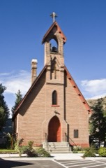 Emmanuel Episcopal Churchlisted 1977
 J. C. Fox Buildinglisted 1983
 Fox-Worswick Houselisted 2011
 Hailey Masonic Lodgelisted 2008
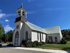 Hailey Methodist Episcopal Churchlisted 2017
 Homer Pound Houselisted 1978
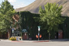 Rialto, Hotel, Thelisted 2009
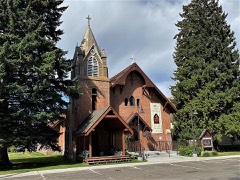 St. Charles of the Valley Catholic Church and Rectorylisted 1982
 W. H. Watt Buildinglisted 1983
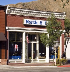 Werthheimer Buildinglisted 1985
Population over time
2 figuresHailey grew from 7,960 to 9,161 between 2010 and 2020. These are the recorded population figures Wikidata holds for this place, reached through the Geographic Names Information System number this page is keyed on rather than by name, so they belong to this place and not to another of the same name. Most are census counts, but not all are: an early figure may be a founding or settlement estimate, and an estimate published within five years of a census is left out. The change column is computed, and is left blank where more than 20 years separate a figure from the one before it, because a gap that long is not a change between two counts.
| Year | People | Change |
|---|---|---|
| 2010 | 7,960 | |
| 2020 | 9,161 | +1,201 (+15%) |
Topographic sheets covering this place
7 surveys from 16 printed sheetsMatched by testing this settlement's coordinate against the published boundary of every sheet in the United States Geological Survey's historical collection. Each opens the scanned sheet at the Survey.
- 1895 USGS Hailey quadrangle1:125000, 2 printings
- 1897 USGS Hailey quadrangle1:125000, 3 printings
- 1955 USGS Hailey quadrangle1:250000, 4 printings
- 1959 USGS Hailey quadrangle1:250000, 2 printings
- 1962 USGS Hailey quadrangle1:250000
- 1967 USGS Hailey quadrangle1:24000, 2 printings
- 1992 USGS Sun Valley quadrangle1:100000, 2 printings
Fires near this place
25 since 1992Regional context, not property-specific evidence. The federal wildfire occurrence database lists 25 fires within 5 miles of Hailey between 1992 and 2020, burning about 2,494 acres in total. 6 started naturally. 2 were recorded as arson. Distance is straight-line from the map coordinates, so a fire counted here may appear on a neighbouring settlement's page as well.
| Reported cause | Fires |
|---|---|
| Natural | 6 |
| Missing data/not specified/undetermined | 5 |
| Misuse of fire by a minor | 3 |
| Fireworks | 3 |
| Arson/incendiarism | 2 |
| Recreation and ceremony | 2 |
| Equipment and vehicle use | 1 |
| Debris and open burning | 1 |
| Firearms and explosives use | 1 |
| Other causes | 1 |
The most recent of them, most recent first, with the day each was reported and the service that recorded it.
| Date | Cause | Size | Reported by | Name on the report |
|---|---|---|---|---|
| 2 September 1999 | Fireworks | 18 acres | Twin Falls District | WOODSIDE |
| 15 September 1999 | Arson/incendiarism | 14 acres | Twin Falls District | SLAUGHTER |
| 5 August 1994 | Missing data/not specified/undetermined | 154 acres | Twin Falls District | CROY CREEK |
| 3 August 1999 | Natural | 1.0 acres | Twin Falls District | INDIANCR |
| 2 August 2011 | Natural | 1.5 acres | Twin Falls District | INDIAN CREEK |
| 18 August 2004 | Natural | under an acre | Twin Falls District | WATERGULCH |
| 18 August 2002 | Misuse of fire by a minor | 1,046 acres | Twin Falls District | CHERRY CK |
| 15 August 2002 | Arson/incendiarism | 5.0 acres | Twin Falls District | SLAUGHTER |
Settlements close enough to share some of these fires:
Mines and quarries near this place
10 of 132 shownRegional context, not property-specific evidence. The federal mineral resources record lists 132 workings within 5 miles of Hailey: 52 past producers, 45 occurrences, 26 unknowns, 5 prospects. 4 still produce. What was taken out: Lead, Gold, Silver, Lead, Silver. Distance is straight-line from the map coordinates, so a quarry counted here may appear on a neighbouring settlement's page as well.
| Where | Site | Commodity | Status | Recorded |
|---|---|---|---|---|
| Ada Jane and Bismuth Claims | Arsenic, Molybdenum | Unknown | ||
| Arizona Group | Silver, Copper, Lead, Gold | Past Producer | ||
| Arizona Group Mine | Copper, Lead, Silver | Past Producer | Vein | |
| Arkoosh Group | Silver, Lead, Gold, Copper | Past Producer | ||
| Chicago Mine | Silver, Copper | Past Producer | Vein | |
| Climax | Lead, Gold, Copper, Silver | Past Producer | ||
| Climax Mine | Copper, Silver, Lead, Gold, Zinc | Past Producer | 1882 | |
| Comet Mine | Gold, Silver, Copper, Lead, Zinc | Past Producer | 1883 | |
| Eureka Mine | Gold, Copper, Silver, Lead, Zinc | Producer | Galena, Sphalerite | |
| Fifty-Fifty Claim | Lead, Zinc, Silver | Past Producer |
Storms near this place
21 since 1995Regional context, not property-specific evidence. The National Weather Service names Hailey in 21 storm reports between 1995 and 2023: 10 thunderstorm wind, 7 flood, 3 flash flood, 1 hail. No death or injury is recorded in these reports. Each account below is quoted exactly as the forecast office filed it, from the NOAA Storm Events Database, and each date opens the federal record of that event.
| When | Event | Place named | Harm | What the report says |
|---|---|---|---|---|
| June 2023 | Flood | Hailey | $1,900,000 | Flooding due to the rise of the Big Wood River due to snowmelt and spring rains flooded parts of Hailey including War Eagle Drive, Flat Top Road, and Camp Creek Road. Damages were estimated at 1.9 million dollars on Flat Top Road and Camp Creek Road. |
| June 2018 | Flood | Hailey | $950,000 | Flooding of the Big Wood River for several months occurred in the Della View neighborhood of Hailey. It finally ended in June but the total cost of the extensive flooding period resulted in $750,000 of insurance claims in the neighborhood and $200,000 for flood response and public property cleanup. |
| August 2000 | Thunderstorm Wind | Hailey | $15,000 | Strong thunderstorm winds swept through a suburb of Hailey toppling numerous cottonwood trees up to 40 feet tall. One tree fell on a garage, damaging its roof, while another crushed a pump house. A camper trailer was forced off its legs; crushing one end. |
| April 2009 | Thunderstorm Wind | Hailey | $13,000 | The Blaine County Emergency Manager reported several tree limbs down in the city of Hailey. This occurred along with downed power lines and roof damages to residences. |
| August 2008 | Thunderstorm Wind | Hailey | $2,000 | Thunderstorm winds toppled trees into a power line downing it in the city of Hailey. |
| September 2022 | Thunderstorm Wind | Hailey | - | A 58 mph wind gust measured at Ohio Gulch RAWS. |
| April 2020 | Thunderstorm Wind | Hailey | - | A large tree fell on the hood of a car on Main Street in downtown Hailey near the northwest corner of Silver Street. It fell on the hood of a car and closed main street for about 60 minutes as crews worked on removal. |
| April 2019 | Flood | Hailey | - | Several roads were closed by Blaine County Road and Bridge on April 8th in Hailey due to heavy snow melt. They were Parker Gulch, Rock Creek Rd, W. Glendale Rd, Road Canyon, Meacham Lane, and Dry Creek Rd. |
| April 2019 | Flood | Hailey | - | Minor flooding began April 21st on War Eagle Drive in Hailey. Through access through the Della View neighborhood was shut down in western Hailey. |
| June 2019 | Flood | Hailey | - | Some minor flooding occurred for several days in the Della area in Hailey with water reaching housed and some roads closed. Significant damage was not reported. The City of Hailey has placed hard road closures in the Della area from the West end of Cedar Street past Della Vista Dr ending at Triumph Dr. Water is running from the Draper Preserve area from the river. |
| May 2018 | Thunderstorm Wind | Hailey | - | A tree snapped at the tip with a second tree downed on house but no damage reported in Hailey. |
| June 2015 | Flash Flood | Hailey | - | By the morning of June 10th the Big Wood River was running across Colorado Gulch Road making it impassable. Colorado Gulch Rd. was closed on the East end at the vehicle gate. |
| September 2013 | Flash Flood | Hailey | - | Heavy rains over the Beaver Creek Fire area caused mudslides in the Hailey area with four mudslides across Croy Creek Road and another which damaged the Animal Shelter of the Wood River Valley. The slides were as deep as a foot and a half on the north side of Croy Creek Road about a half mile west of the bridge over the Big Wood River in Hailey. 10 of the kennels of the animal shelter and 8 inches of mud in them. The mudslides began very late in the evening on September 2nd and were cleared by 7:30 AM on the 3rd. |
| September 2013 | Flash Flood | Hailey | - | Rainfall amounts up to 1 inch in one hour caused debris flow in the Timber Gulch area and in the Greenhorn area near Hailey. The rains over the Beaver Creek fire burn scar contributed to the flooding. |
| April 2009 | Thunderstorm Wind | Hailey | - | Thunderstorm wind gusts of 60 mph reported 9 miles northeast of Hailey. |
| May 2005 | Thunderstorm Wind | Hailey | - | Thunderstorm winds blew down several power lines in Hailey. |
| May 2006 | Flood | Hailey | - | no account filed |
| June 2006 | Flood | Hailey | - | no account filed |
| August 2003 | Thunderstorm Wind | Hailey | - | no account filed |
| July 1995 | Hail | Hailey | - | no account filed |
| July 1995 | Thunderstorm Wind | Hailey | - | no account filed |
Nearest settlements
The eight closest, with where each one stands in the county. Distances are straight-line, computed from the Geographic Names Information System coordinates.
| Map | Place | Distance | Sheets |
|---|---|---|---|
| Barite | 2.6 miles | 16 | |
| Broadford | 3.9 miles | 12 | |
| Bullion | 4.6 miles | 10 | |
| Bellevue | 4.8 miles | 12 | |
| Clarendon Hot Springs | 6.0 miles | 17 | |
| Gimlet | 6.1 miles | 16 | |
| Triumph | 9.2 miles | 17 | |
| Elkhorn Village | 11.1 miles | 17 |
Elsewhere
Matched on this settlement's Geographic Names Information System number rather than its name, so it cannot be a different place of the same name in another state.
| Wikipedia article on Hailey | An encyclopaedic summary. Its text is share-alike, so it is linked here rather than copied. |
| Wikidata item Q1517614 | The structured record the population and elevation above come from. Public domain (CC0). |
Provenance
This settlement is recorded in the Geographic Names Information System as feature 396603. The sheet list is computed by point-in-boundary test against the United States Geological Survey's historical topographic inventory. Both are works of the United States government and carry no copyright under 17 U.S.C. 105.
Wildfire. Short, Karen C. 2022. Spatial wildfire occurrence data for the United States, 1992-2020 [FPA_FOD_20221014]. 6th Edition. Fort Collins, CO: Forest Service Research Data Archive. https://doi.org/10.2737/RDS-2013-0009.6 Collected with United States Government funding and usable without additional permissions or fees.
Mines and quarries. USGS Mineral Resources Data System (MRDS) https://mrdata.usgs.gov/mrds/ A work of the United States government, no copyright under 17 U.S.C. 105.
Storms. NOAA National Centers for Environmental Information, Storm Events Database https://www.ncei.noaa.gov/stormevents/ A work of the United States government, no copyright under 17 U.S.C. 105. Narratives are quoted verbatim from the National Weather Service report and are not edited or summarised.