 Block
Stanley, Idaho
16 topographic sheets cover this place, the earliest surveyed in 1919 and the latest in 1989. It stands in the Stanley census division. It lies in ZIP code area 83278. It stands on Goat Creek. The Survey maps it on the Stanley quadrangle. 116 people lived here at the 2020 count. It stands 6,253 feet above sea level.
Research this city
On record in Stanley
Buildings and businesses the archive holds for this place. Each opens its own page, with the source record it came from.
On the National Register 5 records
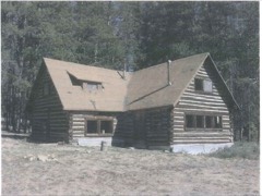 Ivan W. Day Houselisted 1986
- Idaho Rocky Mountain Clublisted 1994
- Niece Brothers' Storelisted 1995
- Stanley Ranger Stationlisted 1982
- Yankee Fork Gold Dredgelisted 2021
Population over time
2 figuresStanley grew from 63 to 116 between 2010 and 2020. These are the recorded population figures Wikidata holds for this place, reached through the Geographic Names Information System number this page is keyed on rather than by name, so they belong to this place and not to another of the same name. Most are census counts, but not all are: an early figure may be a founding or settlement estimate, and an estimate published within five years of a census is left out. The change column is computed, and is left blank where more than 20 years separate a figure from the one before it, because a gap that long is not a change between two counts.
| Year | People | Change |
|---|---|---|
| 2010 | 63 | |
| 2020 | 116 | +53 (+84%) |
Topographic sheets covering this place
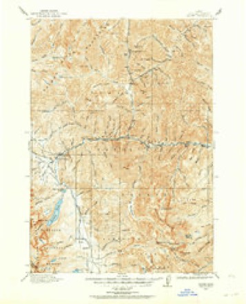
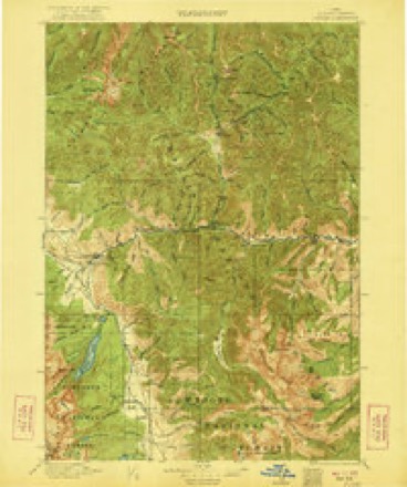
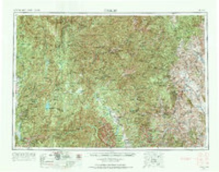
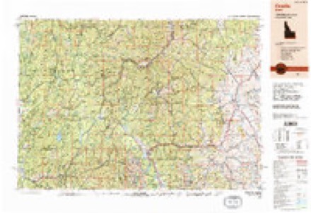
8 surveys from 16 printed sheetsMatched by testing this settlement's coordinate against the published boundary of every sheet in the United States Geological Survey's historical collection. Each opens the scanned sheet at the Survey.
- 1919 USGS Custer quadrangle1:125000
- 1922 USGS Custer quadrangle1:125000, 3 printings
- 1957 USGS Challis quadrangle1:250000, 3 printings
- 1960 USGS Challis quadrangle1:250000
- 1963 USGS Challis quadrangle1:250000
- 1963 USGS Stanley quadrangle1:24000, 3 printings
- 1982 USGS White Cloud Peaks quadrangle1:100000, 2 printings
- 1989 USGS Challis quadrangle1:250000, 2 printings
Fires near this place
57 since 1992Regional context, not property-specific evidence. The federal wildfire occurrence database lists 57 fires within 5 miles of Stanley between 1992 and 2020, burning about 217 acres in total. 17 started naturally. 1 was recorded as arson. Distance is straight-line from the map coordinates, so a fire counted here may appear on a neighbouring settlement's page as well.
| Reported cause | Fires |
|---|---|
| Recreation and ceremony | 19 |
| Natural | 17 |
| Smoking | 8 |
| Missing data/not specified/undetermined | 6 |
| Debris and open burning | 3 |
| Power generation/transmission/distribution | 2 |
| Arson/incendiarism | 1 |
| Equipment and vehicle use | 1 |
The most recent of them, most recent first, with the day each was reported and the service that recorded it.
| Date | Cause | Size | Reported by | Name on the report |
|---|---|---|---|---|
| 5 September 2009 | Missing data/not specified/undetermined | under an acre | Sawtooth National Forest | HAZARD |
| 30 September 2001 | Recreation and ceremony | under an acre | Sawtooth National Forest | LITTLE REDFISH |
| 29 September 1997 | Arson/incendiarism | under an acre | Sawtooth National Forest | CROOKED CREEK |
| 23 September 1997 | Smoking | under an acre | Sawtooth National Forest | BUCKHORN |
| 19 September 2000 | Recreation and ceremony | under an acre | Salmon-Challis National Forest | NOHO |
| 15 September 2019 | Recreation and ceremony | under an acre | Sawtooth National Forest | MARSHALL |
| 10 September 2011 | Recreation and ceremony | under an acre | Sawtooth National Forest | GOAT FALLS |
| 9 August 2005 | Recreation and ceremony | under an acre | Sawtooth National Forest | REPEATER |
Settlements close enough to share some of these fires:
Mines and quarries near this place
10 of 64 shownRegional context, not property-specific evidence. The federal mineral resources record lists 64 workings within 5 miles of Stanley: 23 prospects, 20 past producers, 19 occurrences, 1 producer. 1 still produces. What was taken out: Gold, Silver, Geothermal, Silver, Gold. Distance is straight-line from the map coordinates, so a quarry counted here may appear on a neighbouring settlement's page as well.
| Where | Site | Commodity | Status | Recorded |
|---|---|---|---|---|
| Aspen Prospect | Gold, Copper, Zinc, Silver, Lead | Prospect | Vein | |
| Blind Ledge Prospect | Gold, Lead, Silver, Copper | Occurrence | ||
| Bright Star Mine | Gold, Silver, Uranium, Tellurium, Fluorine-Fluorite | Past Producer | 1895 | |
| Bronco Mine | Lead, Silver, Gold, Copper, Zinc | Past Producer | 1895 | |
| Doran Gulch Placer | Gold, Mercury | Past Producer | Placer | |
| East Storlie Prospect | Silver, Lead, Copper, Gold | Prospect | Vein | |
| Elizabeth | Silver, Gold, Fluorine-Fluorite | Occurrence | ||
| Four Aces Placer | Gold, Garnet, Zirconium, Titanium, REE, Iron | Past Producer | Placer | |
| Fran Clara Prospect | Lead, Copper, Zinc | Prospect | Vein | |
| Grand Prize Prospect | Silver, Zinc, Gold, Copper, Lead | Past Producer | Vein |
Storms near this place
16 since 2002Regional context, not property-specific evidence. The National Weather Service names Stanley in 16 storm reports between 2002 and 2025: 8 thunderstorm wind, 5 flood, 2 wildfire, 1 debris flow. The reports record 3 injuries. Each account below is quoted exactly as the forecast office filed it, from the NOAA Storm Events Database, and each date opens the federal record of that event.
| When | Event | Place named | Harm | What the report says |
|---|---|---|---|---|
| July 2008 | Thunderstorm Wind | Stanley | 3 hurt, $420,000 | Microburst winds estimated to be as high as 95 mph did extensive damage at the Redfish Lake campgrounds. Up to 1,000 Lodge-pole pine trees were uprooted with several snapped 3 to 5 feet above ground level. Twenty to forty Douglas Firs uprooted as well. The average diameter of the snapped Lodge-pole pine trees was 5 to 14 inches and the average Douglas Fir diameter was 10 to 24 inches. At the Glacier View Campground, 3 people camping were injured including one sustaining a broken leg. All of those injured were taken by ambulance to care facilities. Campground facilities were damaged with multiple vehicles damaged from the trees falling as well. |
| May 2017 | Flood | Stanley | $3,500,000 | The Salmon River in Salmon reached moderate flood stage in May and this caused flooding from the headwaters of the Salmon south through Challis into Custer County. Trail Creek, Valley Creek, Garden Creek and Antelope Creek all overflowed banks with flood warnings throughout the month continuing in Custer County. Major damage occurred to backcountry roads and campgrounds. Significant agriculture damage occurred due to flooded fields. Road and bridge damage required significant repair along with significant USFS infrastructure damage. The cost of damage and flood protection rose above 3 million dollars for the month. |
| June 2017 | Flood | Stanley | $900,000 | The Salmon River in Salmon had reached moderate flood stage in May and stayed at flood stage into June and this caused flooding from the headwaters of the Salmon south through Challis into Custer County. The Yankee Fork and East fork of the Salmon River flooded along with Thompson Creek, Squaw Creek, Kinnikinic Cerek and Bayhorse and Garden Creek. Most side tributaries recorded record flows. The Valley Creek in Stanley flooded with the peak flow on June 5th. The Big Lost River at Howell Ranch recorded its second highest peak ever and the Big Lost below Mackay Dam reached minor flood stage as well with peak flows continuing through the end of June. Homes, businesses, roads and bridges continued to suffer damage due to the flooding along with agricultural fields and USFS infrastructure. |
| February 2017 | Flood | Stanley | $195,000 | The combination of record or near record snows in December and January with a warmup in February caused sheet flooding and some ice jam flooding as well. An ice jam on the Lost River near Darlington caused flooding to some homes on that river. Extensive road damage occurred throughout the county with the snow and snow melt combinations. And the warmup aided in weight on roofs and collapses in many cases throughout Custer County. The county declared a county disaster due to the damages. |
| March 2017 | Flood | Stanley | $90,000 | Road damage from melting of heavy winter snows continued throughout the county along with mainly minor field flooding and occasional ice jams near the Butte County border. |
| June 2010 | Flood | Stanley | $60,000 | Valley Creek came out of its banks due to heavy rains and several campsites, homes and farms were flooded. Local roads were covered with water as well. Flooding occurred near Stanley Lake at campsites as well. Flooding was reported of backcountry roads and campgrounds from Stanley south to Alturus Lake and Beaver Creek areas. A rock slide also occurred on route 75 between Clayton and Sunbeam. Fifty miles of road were damaged with two culverts and two roads washed out. |
| July 2008 | Thunderstorm Wind | Stanley | $8,000 | Fifty to 100 Lodge-pole pines were uprooted at the Stanley Lake Campground with an average diameter of 3 to 8 inches. No deaths or injuries were reported. |
| September 2004 | Thunderstorm Wind | Stanley | $8,000 | no account filed |
| July 2008 | Thunderstorm Wind | Stanley | $5,000 | Fifty to 100 lodge-pole pines were uprooted at the Iron Creek Campground. The average diameter was 4 to 10 inches. No injuries were reported. |
| July 2008 | Thunderstorm Wind | Stanley | $1,000 | Trees downed in Redfish Lake Area on power lines causing power outages. |
| June 2025 | Thunderstorm Wind | Stanley | - | A 60 mph wind gust measured at the Stanley RAWS. |
| August 2025 | Debris Flow | Stanley | - | The Idaho Transportation Department closed a 12-mile stretch of state Highway 21, from Banner Summit to Grandjean Road, due to a landslide on on August 26th. |ITD stated on Facebook around 5:30 p.m. Tuesday that the section of highway will be potentially closed for the next two days.|The closure came shortly before the National Weather Service issued a flash flood warning for the Highway 21 corridor south of Banner Summit. |
| August 2003 | Thunderstorm Wind | Stanley | - | no account filed |
| August 2003 | Wildfire | Stanley | - | no account filed |
| July 2003 | Wildfire | Stanley | - | no account filed |
| July 2002 | Thunderstorm Wind | Stanley | - | no account filed |
Nearest settlements
The eight closest, with where each one stands in the county. Distances are straight-line, computed from the Geographic Names Information System coordinates.
| Map | Place | Distance | Sheets |
|---|---|---|---|
| Lower Stanley | 0.8 miles | 16 | |
| Obsidian | 10.7 miles | 16 | |
| Sunbeam | 11.4 miles | 16 | |
| Grandjean | 12.8 miles | 17 | |
| Robinson Bar | 14.0 miles | 15 | |
| Bonanza | 15.4 miles | 16 | |
| Custer | 17.4 miles | 15 | |
| Cape Horn (historical) | 17.8 miles | 17 |
Elsewhere
Matched on this settlement's Geographic Names Information System number rather than its name, so it cannot be a different place of the same name in another state.
| Wikipedia article on Stanley | An encyclopaedic summary. Its text is share-alike, so it is linked here rather than copied. |
| Wikidata item Q1513555 | The structured record the population and elevation above come from. Public domain (CC0). |
Provenance
This settlement is recorded in the Geographic Names Information System as feature 398179. The sheet list is computed by point-in-boundary test against the United States Geological Survey's historical topographic inventory. Both are works of the United States government and carry no copyright under 17 U.S.C. 105.
Wildfire. Short, Karen C. 2022. Spatial wildfire occurrence data for the United States, 1992-2020 [FPA_FOD_20221014]. 6th Edition. Fort Collins, CO: Forest Service Research Data Archive. https://doi.org/10.2737/RDS-2013-0009.6 Collected with United States Government funding and usable without additional permissions or fees.
Mines and quarries. USGS Mineral Resources Data System (MRDS) https://mrdata.usgs.gov/mrds/ A work of the United States government, no copyright under 17 U.S.C. 105.
Storms. NOAA National Centers for Environmental Information, Storm Events Database https://www.ncei.noaa.gov/stormevents/ A work of the United States government, no copyright under 17 U.S.C. 105. Narratives are quoted verbatim from the National Weather Service report and are not edited or summarised.