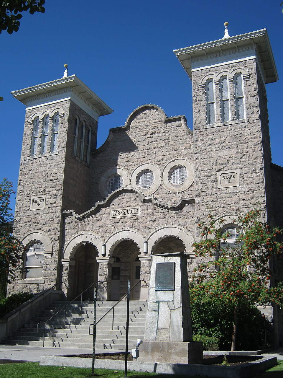
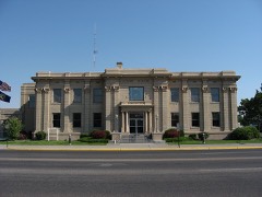
Listed on the National Register of Historic Places in 1974.
From the record
“The Rexburg Stake Tabernacle, also known as the Fremont Stake Tabernacle, is a building located in Rexburg, Idaho that formerly served as tabernacle for large gatherings of members of the Church of Jesus Christ of Latter-day Saints. The tabernacle was designed by architect Otto Erlandsen and completed in 1911 at a cost of $31,000.”
Wikipedia article Rexburg Stake Tabernacle, CC BY-SA 4.0.
One of 3 National Register listings published here for Madison County · listed in 1974 · category: Building.
National Register reference number.74000745- the number the National Park Service assigned this property when it was listed, and the key its nomination file is catalogued under at the National Archives.
Fires near this property
1 since 2020
Regional context, not property-specific
evidence. The
federal wildfire occurrence database
lists 1 fire within 5 miles of Rexburg Stake Tabernacle
in 2020, burning about 3 acres in total. None started naturally. None was recorded as arson.
Distance is straight-line from the map coordinates, so a fire counted
here may appear on a neighbouring settlement's page as well.
Reported cause
Fires
Missing data/not specified/undetermined
1
The most recent of
them, most recent first, with the day each was reported and the service
that recorded it.
Regional context, not property-specific
evidence. The federal mineral resources record lists
5 workings within 5 miles of Rexburg Stake Tabernacle: 4 producers, 1 past producer.
4 still produce. What was taken out: Sand and Gravel, Construction. Distance is straight-line from the
map coordinates, so a quarry counted here may appear on a neighbouring
settlement's page as well.
Regional context, not property-specific
evidence. The National Weather Service names
Rexburg, the town this property stands in, in 42 storm reports between 1996 and 2023: 10 thunderstorm wind, 9 hail, 7 flood, 5 funnel cloud.
No death or injury is recorded in these reports. Each account below is quoted exactly as the forecast office
filed it, from the NOAA Storm Events Database, and each date
opens the federal record of that event.
A thunderstorm dropped anywhere from 1 to 3 inches in the city of Rexburg. A single thunderstorm cell moved over the city and heavy rain began at around 5:30 pm MDT. Main Street was shut down with over a foot of running water on it. Businesses on Main Street suffered damage. 15 businesses on the south side of Main Street and south 2nd West received minor flood damage consisting of a few inches of water entering their businesses. ||The Hidden Valley neighborhood in northeast Rexburg had approximately 20 homes from a few inches in a basement up to a basement full in 2 of them. The Mill Hollow subdivision had 20 homes reported having water damage. A few homes had 1 to 3 feet of water in their basements. ||The BYU Idaho campus was hit hard by the flooding. Three-quarters of the buildings on campus had water in them. Apartments on campus had up to 6 feet of standing water in them. Birch Plaza and Birchwood Apartments were the worst hit on campus. Water was high enough that furniture was floating in the buildings. ||Total damages of the flooding were estimated at $600,000.
Heavy rainfall in the range of 1 to 2 inches in less than two hours caused flash flooding in Rexburg with sandbagging occurring and several basements of homes occurring. Street flooding occurred with flooding along Yale Avenue and the Trejo and Mariah area.
The beginning of snowmelt caused some flooding and county roads to wash away east of Rexburg. Madison County closed two roads due to wash out and one due to two mud slides near each other. The mud slides occurred on 6000 East. The roads are in largely agricultural areas. Few homes were in the areas and had secondary means of access to their properties. We also had a canal fill with water and the canal side fail. Water from this failure ran past a neighborhood, with little damage to driveways reported. Road damage was estimated at 100 thousand dollars.
The Henry's Fork near Rexburg was above flood stage from June 1st through June 30th with the exception of the period from June 4th through the morning of June 7th. Major flood stage was reached and crested at 11.85 feet on June 9th. Extensive flooding of agricultural and low lands occurred. Beaver Dick Park flooded, river access recreation areas flooded as did portions of county roads. Water covered a road in the Warm Slough Access to a depth of over one foot. Water flooded the crawl space to one home.
Extremely heavy rain caused mud slides and flooding mainly across the Squired Dugway area. A lot of gravel roads suffered damage. The Squired Dugway area had three homes and several outbuildings damages with livestock threatened.
The Henry's Fork River near Rexburg reached flood stage of 9.5 feet on May 15th and remained above through the end of the month. The river peaked at 10.96 feet on May 26th. Extensive low land flooding occurred. Beaver Dick Park was flooded as were some river access recreational areas. Water covered portions of the road in the Warm Slough Access to a depth of around one foot.
The Henry's Fork River near Rexburg was above flood stage to start July and remained above flood stage until July 8th. The river crested at 9.92 feet on July 2nd. Minor floodign of farmland and lowland occurred. Portions of Beaver Dick Park were flooded as well as some recreational river access sites.
The Henry's Fork River near Rexburg was above flood stage in the latter portion of May through June 7th. The river crested at 9.68 feet on June 6th with a maximum stage of 10.43 feet on May 23rd. No property damage occurred and no injuries or fatalities occurred.
The Ricks College Livestock Center and the Ferguson Farms reported a prolonged period of extremely heavy rain with considerable ponding and low area flooding from Highway 33 north to near Plano area.
No historic map-sheet match is published
for this property yet. That does not mean no map exists. This record needs
a coordinate-quality review before it can be joined to a sheet boundary.
Browse the county's mapped places while that work is
pending.
Listed places nearby
2 within 8 miles
Other National Register properties close
enough to walk or drive between, ordered by distance from this one. Both
positions come from the same geocoding pass that matched these properties
to their map sheets.
Listing record. National Park Service National Register of Historic Places, listed-properties dataset, current to 2026-05-22.
Map join. Address geocoded through the United States Census geocoder, then tested against the published boundary of every sheet in the USGS Historical Topographic Map Collection.
How this page is made. Listing fields come from federal records; map-sheet coverage is a labelled coordinate-to-boundary calculation, not a source-field claim.
Wildfire. Short, Karen C. 2022. Spatial wildfire occurrence data for the United States, 1992-2020 [FPA_FOD_20221014]. 6th Edition. Fort Collins, CO: Forest Service Research Data Archive. https://doi.org/10.2737/RDS-2013-0009.6 Collected with United States Government funding and usable without additional permissions or fees.
Mines and quarries. USGS Mineral Resources Data System (MRDS) https://mrdata.usgs.gov/mrds/ A work of the United States government, no copyright under 17 U.S.C. 105.
Storms. NOAA National Centers for Environmental Information, Storm Events Database https://www.ncei.noaa.gov/stormevents/ A work of the United States government, no copyright under 17 U.S.C. 105. Narratives are quoted verbatim from the National Weather Service report and are not edited or summarised.
 Block