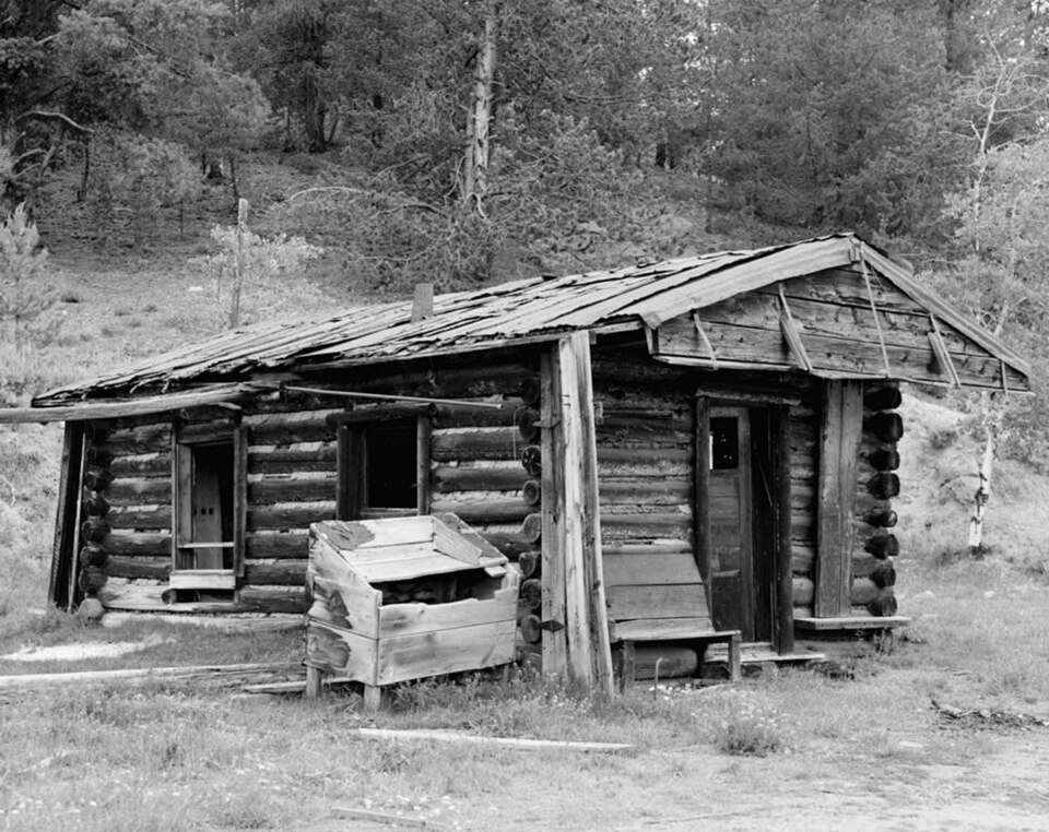
Listed on the National Register of Historic Places in 1975.
From the record
“Leesburg is an unincorporated community in Lemhi County, Idaho, United States. It lies at along Napias Creek in the Salmon National Forest, west of Salmon.”
Wikipedia article Leesburg, Idaho, CC BY-SA 4.0.
One of 13 National Register listings published here for Lemhi County · listed in 1975 · category: District.
National Register reference number.75000634- the number the National Park Service assigned this property when it was listed, and the key its nomination file is catalogued under at the National Archives.
Fires near this property
28 since 1992
Regional context, not property-specific
evidence. The
federal wildfire occurrence database
lists 28 fires within 5 miles of Leesburg
between 1992 and 2018, burning about 51 acres in total. 24 started naturally. None was recorded as arson.
Distance is straight-line from the map coordinates, so a fire counted
here may appear on a neighbouring settlement's page as well.
Reported cause
Fires
Natural
24
Equipment and vehicle use
3
Recreation and ceremony
1
The most recent of
them, most recent first, with the day each was reported and the service
that recorded it.
Regional context, not property-specific
evidence. The federal mineral resources record lists
37 workings within 5 miles of Leesburg: 17 occurrences, 12 past producers, 4 unknowns, 3 producers.
3 still produce. What was taken out: Gold, Silver, Zinc, Lead, Lead, Zinc, Copper, Silver. Distance is straight-line from the
map coordinates, so a quarry counted here may appear on a neighbouring
settlement's page as well.
Regional context, not property-specific
evidence. The National Weather Service names
Salmon, the town this property stands in, in 32 storm reports between 1998 and 2024: 21 thunderstorm wind, 6 hail, 2 flash flood, 2 flood.
No death or injury is recorded in these reports. Each account below is quoted exactly as the forecast office
filed it, from the NOAA Storm Events Database, and each date
opens the federal record of that event.
A very large right-moving & long-lived supercell developed across south-central Idaho and tracked north and east across northeastern Lemhi county. A trained spotter in Salmon, Idaho reported quarter size hail. Insurance companies reported at least 200 damage claims to both vehicles and homes from downtown, northwest Salmon and between Salmon and Carmen. An auto body reported fixing 15 passenger vehicles and 20 recreation vehicles caused by hail damage. The hail fell for at least 15 minutes damaging roofs, siding, stucco and windows. One person reported this was the worst storm she had seen in 42 years.
Temperatures up to 48 F on February 6th, 2015 and above-freezing temperatures near 44 F overnight led to rapid snow melt which caused Salmon, ID area creeks and rivers to rise rapidly on February 7th. Temperatures reached up to 56 F that day, with rain runoff further complicating issues. The main flooding occurred near Kitz Creek and its confluence with the Salmon River. Four homes sustained minor flood damage in Salmon, ID. Additionally, the Salmon County Airport was shutdown for the day due to water on the runway.
A RAWS station above the city of Salmon recorded a wind gust to 66 mph. There was extensive damage within Salmon, mainly centered on the southern side of the city. Damage included damage to roofs, RVs blown over, and high school bleachers blown over.
A trained spotter in Salmon, Idaho reported trees down over roadways, power lines down in three different areas with power outages and a roof over a patio blew off.
The Salmon RAWS located 3 miles southwest of the city of Salmon at 5,100 feet reported a strong wind gust to 69 mph that occurred sometime between 5:36 and 6:00 pm MDT. Weather spotters reported trees down and a power outage in Salmon. A television news station reported on Facebook that over 5,000 people were affected. A person from the public in Salmon commented on this post that power was still out in parts of Salmon at 9 am MDT on September 6th.
A strong cold front initiated a thunderstorm over the mountains to the west. Radar imagery revealed the thunderstorm dropped its core by 6:13 pm which triggered the high winds. No storm damage noted around the town of Salmon.
The USGS river gauge Salmon River at Salmon reported minor flooding on May 31st. The river continued to rise and reached moderate flood stage in the first half of June. See June storm data report for more information.
The Salmon RAWS, located at 5,100 ft. MSL, reported 0.58 of rainfall in one hour. According to radar storm echo trends, the rain could have fallen in less than 30 minutes time.
A square 16 by 16 cinder block was moved completely off a plywood sheet and the plywood was blown away. Gutters were blown down. Some metal lawn furniture was blown off the porch. Several bails of peat moss were blown around.
Trained spotter reported several debris flows which resulted in closing of a 10 mile stretch along Highway 93 between Salmon and Ellis from a half inch of rainfall in 30 minutes.
No historic map-sheet match is published
for this property yet. That does not mean no map exists. This record needs
a coordinate-quality review before it can be joined to a sheet boundary.
Browse the county's mapped places while that work is
pending.
Listing record. National Park Service National Register of Historic Places, listed-properties dataset, current to 2026-05-22.
Map join. Address geocoded through the United States Census geocoder, then tested against the published boundary of every sheet in the USGS Historical Topographic Map Collection.
How this page is made. Listing fields come from federal records; map-sheet coverage is a labelled coordinate-to-boundary calculation, not a source-field claim.
Wildfire. Short, Karen C. 2022. Spatial wildfire occurrence data for the United States, 1992-2020 [FPA_FOD_20221014]. 6th Edition. Fort Collins, CO: Forest Service Research Data Archive. https://doi.org/10.2737/RDS-2013-0009.6 Collected with United States Government funding and usable without additional permissions or fees.
Mines and quarries. USGS Mineral Resources Data System (MRDS) https://mrdata.usgs.gov/mrds/ A work of the United States government, no copyright under 17 U.S.C. 105.
Storms. NOAA National Centers for Environmental Information, Storm Events Database https://www.ncei.noaa.gov/stormevents/ A work of the United States government, no copyright under 17 U.S.C. 105. Narratives are quoted verbatim from the National Weather Service report and are not edited or summarised.
 Block