 Block
Barry, Illinois
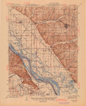
14 topographic sheets cover this place, the earliest surveyed in 1931 and the latest in 1998. It stands in Barry Township. It lies in ZIP code area 62312. The Survey maps it on the Barry quadrangle. 1,303 people lived here at the 2020 count. It stands 732 feet above sea level.
On record in Barry
Buildings and businesses the archive holds for this place. Each opens its own page, with the source record it came from.
On the National Register 2 records
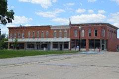 Barry Historic Districtlisted 1979
- Free Frank McWorter Grave Sitelisted 1988
Population over time
2 figuresBarry fell from 1,318 to 1,303 between 2010 and 2020. These are the recorded population figures Wikidata holds for this place, reached through the Geographic Names Information System number this page is keyed on rather than by name, so they belong to this place and not to another of the same name. Most are census counts, but not all are: an early figure may be a founding or settlement estimate, and an estimate published within five years of a census is left out. The change column is computed, and is left blank where more than 20 years separate a figure from the one before it, because a gap that long is not a change between two counts.
| Year | People | Change |
|---|---|---|
| 2010 | 1,318 | |
| 2020 | 1,303 | -15 (-1%) |
Topographic sheets covering this place
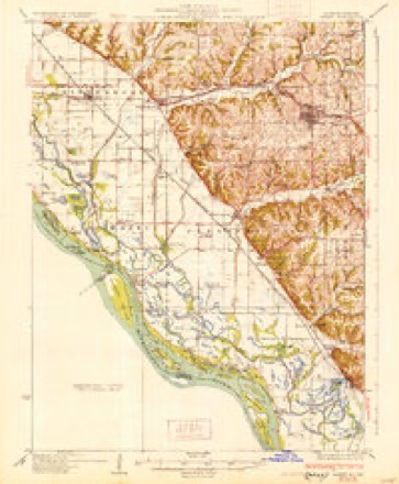
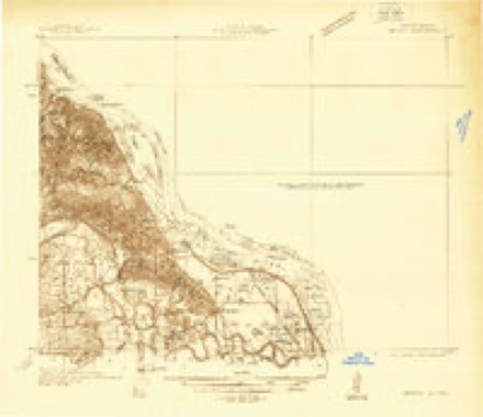
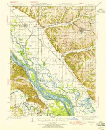
9 surveys from 14 printed sheetsMatched by testing this settlement's coordinate against the published boundary of every sheet in the United States Geological Survey's historical collection. Each opens the scanned sheet at the Survey.
- 1931 USGS Barry quadrangle1:62500
- 1936 USGS Barry quadrangle1:48000
- 1936 USGS Barry quadrangle1:62500
- 1944 USGS Barry quadrangle1:62500, 2 printings
- 1948 USGS Quincy quadrangle1:250000, 2 printings
- 1956 USGS Quincy quadrangle1:250000, 3 printings
- 1978 USGS Barry quadrangle1:24000
- 1986 USGS Quincy quadrangle1:100000, 2 printings
- 1998 USGS Barry quadrangle1:24000


In the county-history sources
1,151 words on this townshipWith The Colors in Pike County, Illinois, published 1920 names this settlement in its chapter on Barry Township. These are the passages that mention it, exactly as the scans read.
The Barry Township Branch of the Pike County Chapter, American Red Cross, was organized May 28, 1917, with the following temporary officers: Chairman, Mrs. Rose Weber; vice-chairman, Mrs. Julia Gille; secretary, Dr. R. H. Main; treasurer, Miss Bessie Stearns.
Passage source: With The Colors in Pike County, Illinois, published 1920.
The work done in the work room during the period of activity totals as follows: Hospital Supply Articles, 1,071; Articles for Refugee Relief, 174; 2 boxes clothing for Belgian Relief: 196 sweaters; 57 helmets; 163 pairs wristlets ; A scarfs; 90 pairs socks. About 100 of the sweaters were given to the boys from Barry when they went into service or were sent to them after they arrived in camp.
Passage source: With The Colors in Pike County, Illinois, published 1920.
Machine-read from a century-old scan, so expect the errors a machine makes: misspelled names, dropped words, stray characters.
Read the whole chapter on Barry Township - it names this place 3 more 3 times.
Fires near this place
4 since 2008Regional context, not property-specific evidence. The federal wildfire occurrence database lists 4 fires within 5 miles of Barry between 2008 and 2010, burning about 1 acre in total. None started naturally. None was recorded as arson. Distance is straight-line from the map coordinates, so a fire counted here may appear on a neighbouring settlement's page as well.
| Reported cause | Fires |
|---|---|
| Missing data/not specified/undetermined | 3 |
| Debris and open burning | 1 |
The most recent of them, most recent first, with the day each was reported and the service that recorded it.
| Date | Cause | Size | Reported by | Name on the report |
|---|---|---|---|---|
| 20 May 2008 | Missing data/not specified/undetermined | under an acre | Illinois Division of Forestry Resources | 4284 |
| 16 March 2009 | Missing data/not specified/undetermined | 1.0 acres | Illinois Division of Forestry Resources | HOSKINS |
| 15 March 2009 | Debris and open burning | under an acre | Illinois Division of Forestry Resources | LAGOON |
| 7 November 2010 | Missing data/not specified/undetermined | under an acre | Illinois Division of Forestry Resources | 108811 |
Settlements close enough to share some of these fires:
Mines and quarries near this place
4 within 5 milesRegional context, not property-specific evidence. The federal mineral resources record lists 4 workings within 5 miles of Barry: 3 past producers, 1 plant. 1 still produces. What was taken out: Stone, Crushed/Broken, Sand and Gravel, Construction. Distance is straight-line from the map coordinates, so a quarry counted here may appear on a neighbouring settlement's page as well.
| Where | Site | Commodity | Status | Recorded |
|---|---|---|---|---|
| Barry Plant No. 8, Dredge | Sand and Gravel, Construction | Plant | ||
| Foster Quarry #14w. Ill. Stone | Stone, Crushed/Broken | Past Producer | ||
| Hadley Plant No. 22 Quarry | Stone, Crushed/Broken | Past Producer | ||
| Kinderhook Pit No. 2 | Stone, Crushed/Broken | Past Producer |
Storms near this place
32 since 1995Regional context, not property-specific evidence. The National Weather Service names Barry in 32 storm reports between 1995 and 2015: 21 thunderstorm wind, 10 hail, 1 tornado. No death or injury is recorded in these reports. Each account below is quoted exactly as the forecast office filed it, from the NOAA Storm Events Database, and each date opens the federal record of that event.
| When | Event | Place named | Harm | What the report says |
|---|---|---|---|---|
| July 2011 | Thunderstorm Wind | Barry | $10,000 | Thunderstorm winds blew part of the roof off of the library, causing some water damage to the museum that is on the second floor of the building. Also, numerous tree limbs and power lines were blown down. |
| July 2003 | Thunderstorm Wind | Barry | $5,000 | Thunderstorm wind gusts downed trees and power lines in Barry. A couple of cars received minor damage from falling trees and branches. |
| June 1995 | Thunderstorm Wind | Barry | $200 | Numerous large trees were blown over damaging homes and parked vehicles in Barry. Winds as high as 70 mph were also reported in Pittsfield knocking down numerous trees across town. Reported by local newspapers. |
| July 2015 | Thunderstorm Wind | Barry | - | A wide swath of damaging winds occurred across the northern half of Pike County. Numerous trees, tree limbs, power poles and power lines were blown down in Barry, Griggsville and northeast of Pittsfield. A couple of homes in Griggsville and Barry sustained minor roof and siding damage. |
| June 2014 | Thunderstorm Wind | Barry | - | Thunderstorm winds split a large tree with parts of it blocking the nearby road in Barry. |
| June 2011 | Thunderstorm Wind | Barry | - | Thunderstorm winds blew down several large tree limbs. |
| December 2008 | Thunderstorm Wind | Barry | - | Thunderstorm winds blew down several large tree limbs and a few power lines in Barry. |
| July 2008 | Thunderstorm Wind | Barry | - | Thunderstorm winds blew down numerous trees 11 miles west of Barry. In Barry, numerous large tree limbs and power lines were blown down. |
| March 2007 | Thunderstorm Wind | Barry | - | Thunderstorm winds caused minor damage in Barry. A metal storage shed was blown over and a large tree was blown down. The tree landed on a mobile home causing minor roof damage. |
| August 2007 | Thunderstorm Wind | Barry | - | Numerous large trees, tree limbs, power poles and power lines were blown down around town. |
| March 2006 | Tornado (F1) | Barry | - | The first Pike County tornado touched down 1.2 miles south of Barry, at the intersection of 1850N and 1750E. The tornado damaged a house at this location that was made of prefabricated panels of compressed Styrofoam insulation. The roof was completely lifted off with some of the panels being deposited 250 yards to the north. The entire north wall fell away from the structure. Debris was scattered across an open field up to one mile to the northeast. At this location, the tornado was 100 yards wide and produced F0 damage. Further to the northeast along the track on 1900N, several outbuildings were damaged and a two foot diameter walnut tree was blown over. The residence had minor shingle, siding and trim damage. The tornado was 200 yards wide and produced F0 damage at this location. The tornado continued northeast 3.5 miles toward Hadley, crossing I-72 near mile marker 22. Along this portion of the track, the tornado caused minor exterior damage to residences and produced minor tree damage. The tornado ranged from 50 to 100 yards wide and produced F0 damage. In Hadley, a two story brick home sustained extensive damage. The roof was lifted off and destroyed. The back half of the second story was completely demolished. Extensive tree damage also occurred. A grain wagon and auger were tipped over. A barn lost some of its tin roof and two wooden telephone poles were leaning east. Debris was scattered northeast for about half a mile. At this location, the tornado was 150 yards wide and produced F1 damage. The tornado dissipated one mile northeast of Hadley. |
| July 2006 | Thunderstorm Wind | Barry | - | Several trees and large tree limbs were blown down in Barry. |
| June 2005 | Thunderstorm Wind | Barry | - | Some power lines were reported down in Barry. |
| April 2003 | Hail | Barry | - | The Pike County Sheriff reported 3/4 inch hail. |
| May 2002 | Hail | Barry | - | The Sheriff Department reported golfball size hail south of Barry. |
| September 2001 | Hail | Barry | - | A storm spotter reported that golfball size hail fell for about 1 minute in Barry. |
| June 2000 | Hail | Barry | - | Local law enforcement reported golfball size hail. |
| August 2000 | Thunderstorm Wind | Barry | - | Thunderstorm wind gusts caused scattered damage in Barry. A few trees and power lines were downed, the chimney on a home was blown down, and a trailer at a service station was blown over. |
| September 2000 | Thunderstorm Wind | Barry | - | The Sheriff's office reported power lines down in Barry. |
| July 1997 | Thunderstorm Wind | Barry | - | The County Sheriff reported trees down in Barry. |
| May 2011 | Hail | Barry | - | no account filed |
| June 2011 | Hail | Barry | - | no account filed |
| June 2010 | Thunderstorm Wind | Barry | - | no account filed |
| April 2008 | Hail | Barry | - | no account filed |
| May 2008 | Hail | Barry | - | no account filed |
| March 2006 | Hail | Barry | - | no account filed |
| May 2004 | Thunderstorm Wind | Barry | - | no account filed |
| April 2002 | Hail | Barry | - | no account filed |
| June 2002 | Thunderstorm Wind | Barry | - | no account filed |
| July 2002 | Thunderstorm Wind | Barry | - | no account filed |
| May 1998 | Thunderstorm Wind | Barry | - | no account filed |
| May 1996 | Thunderstorm Wind | Barry | - | no account filed |
Nearest settlements
The eight closest, with where each one stands in the county. Distances are straight-line, computed from the Geographic Names Information System coordinates.
| Map | Place | Distance | Sheets |
|---|---|---|---|
| Hadley | 3.6 miles | 12 | |
| New Philadelphia | 4.3 miles | 12 | |
| New Canton | 5.0 miles | 14 | |
| El Dara | 5.5 miles | 11 | |
| Kinderhook | 6.1 miles | 14 | |
| Shinn | 6.9 miles | 14 | |
| Baylis | 7.3 miles | 12 | |
| Taylor | 7.6 miles | 11 |
Elsewhere
Matched on this settlement's Geographic Names Information System number rather than its name, so it cannot be a different place of the same name in another state.
| Wikipedia article on Barry | An encyclopaedic summary. Its text is share-alike, so it is linked here rather than copied. |
| Wikidata item Q575875 | The structured record the population and elevation above come from. Public domain (CC0). |
Provenance
This settlement is recorded in the Geographic Names Information System as feature 403933. The sheet list is computed by point-in-boundary test against the United States Geological Survey's historical topographic inventory. Both are works of the United States government and carry no copyright under 17 U.S.C. 105.
Wildfire. Short, Karen C. 2022. Spatial wildfire occurrence data for the United States, 1992-2020 [FPA_FOD_20221014]. 6th Edition. Fort Collins, CO: Forest Service Research Data Archive. https://doi.org/10.2737/RDS-2013-0009.6 Collected with United States Government funding and usable without additional permissions or fees.
Mines and quarries. USGS Mineral Resources Data System (MRDS) https://mrdata.usgs.gov/mrds/ A work of the United States government, no copyright under 17 U.S.C. 105.
Storms. NOAA National Centers for Environmental Information, Storm Events Database https://www.ncei.noaa.gov/stormevents/ A work of the United States government, no copyright under 17 U.S.C. 105. Narratives are quoted verbatim from the National Weather Service report and are not edited or summarised.