 Block
Belleville, Illinois
17 topographic sheets cover this place, the earliest surveyed in 1907 and the latest in 1991. It stands in Belleville City. It lies in ZIP code area 62220. It stands on Wolf Branch. The Survey maps it on the O'Fallon quadrangle. 42,404 people lived here at the 2020 count. It stands 515 feet above sea level.
Research this city
On record in Belleville
Buildings and businesses the archive holds for this place. Each opens its own page, with the source record it came from.
On the National Register 6 records
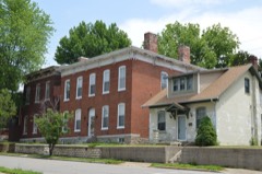 Belleville Historic Districtlisted 1976
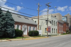 Blair Historic Districtlisted 2015
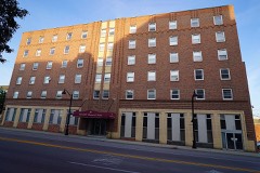 Hotel Bellevillelisted 2018
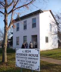 Gustave Koerner Houselisted 2004
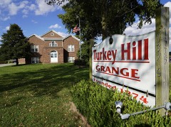 Turkey Hill Grange Halllisted 2016
- Town of West Belleville Historic Districtlisted 2014
Population over time
2 figuresBelleville fell from 44,478 to 42,404 between 2010 and 2020. These are the recorded population figures Wikidata holds for this place, reached through the Geographic Names Information System number this page is keyed on rather than by name, so they belong to this place and not to another of the same name. Most are census counts, but not all are: an early figure may be a founding or settlement estimate, and an estimate published within five years of a census is left out. The change column is computed, and is left blank where more than 20 years separate a figure from the one before it, because a gap that long is not a change between two counts.
| Year | People | Change |
|---|---|---|
| 2010 | 44,478 | |
| 2020 | 42,404 | -2,074 (-5%) |
Topographic sheets covering this place
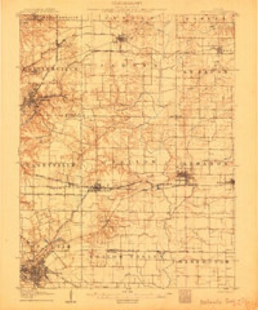
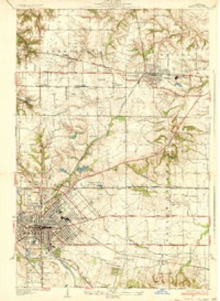
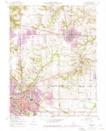
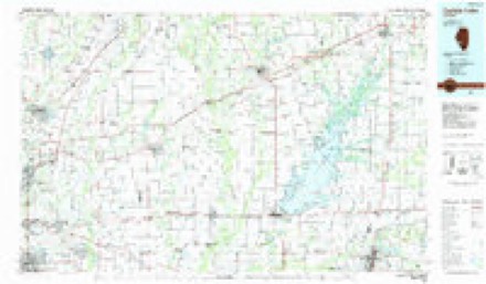
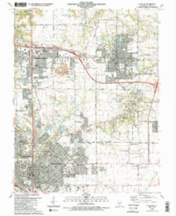
7 surveys from 17 printed sheetsMatched by testing this settlement's coordinate against the published boundary of every sheet in the United States Geological Survey's historical collection. Each opens the scanned sheet at the Survey.
- 1907 USGS Belleville quadrangle1:62500, 3 printings
- 1937 USGS O'Fallon quadrangle1:24000, 2 printings
- 1954 USGS O'Fallon quadrangle1:24000, 4 printings
- 1958 USGS Belleville quadrangle1:250000, 3 printings
- 1962 USGS Belleville quadrangle1:250000
- 1985 USGS Carlyle Lake quadrangle1:100000, 2 printings
- 1991 USGS O'Fallon quadrangle1:24000, 2 printings


What happened here
An account from the chapter on Belleville city. The inset identifies its exact source book and publication year.
The People 1 Timothy Bennett
Thereupon it was ordered that process i.ssue to the sheriff of St. Clair county commanding him that he have the body of Timothy Bennett, a prisoner now in the gaol of the county aforesaid under safe and secure conduct before the court here immediately to an.swer an indictment against him for murder.
In the county-history sources
15,756 words on this townshipHistory of St. Clair County, Illinois. With Illustrations ... and Biographical Sketches of Some of Its Prominent Men and Pioneers, published 1881 names this settlement in its chapter on Belleville City. These are the passages that mention it, exactly as the scans read.
JHE site of Belleville was selected as the county seat of St. Clair county in the year 1814. As the American settlers on the highlands east of the American Bottom began to outnumber the old French residents along the Mississippi, the idea was entertained of removing the county tt -«««gm5«=sw s^*t to ^ more eligible and central location K >wr than the village of Cahokia. This question was one of the issues which entered into the election of members of the legislature in 1813. In December, 1813, the legislature, in session at Kaskaskia, appointed John Hay, James Lemen, Isaac Enochs, William Scott, Jr., Nathan Chambers, Jacob Short and Caldwell Cains, commissioners to select a new seat of justice. The commissioners met at the dwelling-house of Col. William Whiteside on the twenty-fifth of January, 1814, but, by reason of not being thoroughly informed as to their legal duties, and that no proper officer was present to administer the necessary oaths," they adjourned to meet at Cahokia on the following fourteenth of February. At the latter meeting no decision was reached. The commissioners desired further consideration of the subject, and a personal view of the proposed location. Their next meeting was at the house of Geo. Blair, on the site of the present city of Belleville. At this meeting considerable diversity of opinion was shown, and they adjourned without being able to come to any conclusion. At a subsequent meeting held at Blair's house on the tenth of March, 1814, all the commissioners being present, the majority fixed the county seat on Blair's land, and a site for the county buildings was marked in Blair's corn-field, about twenty-five rods north-east of his dwelling-house. Blair agreed to give one acre of land for a public square, on which to erect the public buildings, and to relinquish twenty-five acres adjoining, of which every fifth lot of land, exclusive of the streets, he gave as a donation for the use and benefit of the county of St. Clair. The report was signed by all the commissioners except William Scott, Jr., and Caldwell Cains. Blair agreed to have suitable arrangements made so that the June term of court, 1814, could be held at the new county seat.
Passage source: History of St. Clair County, Illinois. With Illustrations ... and Biographical Sketches of Some of Its Prominent Men and Pioneers, published 1881.
Such was the beginning of Belleville. The locality was previously known as Compton Hill. It is said that the name of Belleville, " beautiful city," was given to the place by George Blair. A survey was made in the summer of 1814, by John Messenger. This survey was completed some years afterward by Gov. Niniaa Edwards, who placed it on record. An old plat is now on file made on a scale of four chains to the inch. The names of the streets were given by Mr. Blair. The most eastward street was called
Passage source: History of St. Clair County, Illinois. With Illustrations ... and Biographical Sketches of Some of Its Prominent Men and Pioneers, published 1881.
Church street, and westward were Jackson, High, Illinois, Spring and Hill streets. North and south from the public square the streets were numbered First, Second and Third. The street extending east and west through the public square was called St. Clair street, but by common usage, it has become known as Main street. This and Illinois streets were laid off sixty-six feet wide, and all the others forty-nine and a half feet. In the summer of 1814, Etienne Pensoneau was given the contract to build a courthouse. This was an unpainted frame building, two stories high, and stood in the public square east of the site of the National He. tel, and north of the present court-house. The court room occupied the whole lower floor, and in the upper story were the clerk's offices and jury rooms. The records show that for hauling to Belleville the benches, seats and tables, from the old court-house, at Cahokia, Mr. Blair was paid six dollars. A new brick court-house was begun in the year 1829, and finished in 1831. It stood in the public square north-east of the old building. This in turn gave place to the present court-house, which was erected about 1859. The first jail, of which a man named Henry Sharp was the architect, was built of logs, and stood in the public square, about one hundred feet south-east of the site of Hinckley's bank. The second jail was a two story brick building on Illinois street, east of the old log jail. The third jail was built on Illinois street, above First North street, and the building is still standing. It was used for the confinement of prisoners till the erection of the present jail.
Passage source: History of St. Clair County, Illinois. With Illustrations ... and Biographical Sketches of Some of Its Prominent Men and Pioneers, published 1881.
Machine-read from a century-old scan, so expect the errors a machine makes: misspelled names, dropped words, stray characters.
Read the whole chapter on Belleville City - it names this place 69 more 69 times.
Fires near this place
5 since 2008Regional context, not property-specific evidence. The federal wildfire occurrence database lists 5 fires within 5 miles of Belleville between 2008 and 2012, burning about 4 acres in total. None started naturally. None was recorded as arson. Distance is straight-line from the map coordinates, so a fire counted here may appear on a neighbouring settlement's page as well.
| Reported cause | Fires |
|---|---|
| Missing data/not specified/undetermined | 4 |
| Debris and open burning | 1 |
The most recent of them, most recent first, with the day each was reported and the service that recorded it.
| Date | Cause | Size | Reported by | Name on the report |
|---|---|---|---|---|
| 20 April 2008 | Debris and open burning | 1.0 acres | Illinois Division of Forestry Resources | WINSLOW |
| 13 April 2010 | Missing data/not specified/undetermined | 1.0 acres | Illinois Division of Forestry Resources | BELVDER |
| 7 March 2009 | Missing data/not specified/undetermined | 1.0 acres | Illinois Division of Forestry Resources | WINSLOW |
| 7 March 2009 | Missing data/not specified/undetermined | 1.0 acres | Illinois Division of Forestry Resources | CASEYVILLE |
| 30 November 2012 | Missing data/not specified/undetermined | under an acre | Illinois Division of Forestry Resources | ST CLAIR1 |
Settlements close enough to share some of these fires:
Mines and quarries near this place
5 within 5 milesRegional context, not property-specific evidence. The federal mineral resources record lists 5 workings within 5 miles of Belleville: 5 past producers. None of them still produces. What was taken out: Stone, Crushed/Broken, Clay, Sand and Gravel, Construction. Distance is straight-line from the map coordinates, so a quarry counted here may appear on a neighbouring settlement's page as well.
| Where | Site | Commodity | Status | Recorded |
|---|---|---|---|---|
| St. Clair County Highway Department | Sand and Gravel, Construction | Past Producer | ||
| Belleville City Quarry | Stone, Crushed/Broken | Past Producer | ||
| Hill Brick Co. Shale Pit | Clay | Past Producer | ||
| Hydraulic-Press Brick Co.Clay Pit 2 | Clay | Past Producer | ||
| Quality Stone Quarry and Mill No. 1 | Stone, Crushed/Broken | Past Producer |
Storms near this place
60 of 100 shownRegional context, not property-specific evidence. The National Weather Service names Belleville in 100 storm reports between 1993 and 2026: 51 thunderstorm wind, 40 hail, 3 lightning, 2 flash flood. The reports record 4 injuries. Each account below is quoted exactly as the forecast office filed it, from the NOAA Storm Events Database, and each date opens the federal record of that event.
| When | Event | Place named | Harm | What the report says |
|---|---|---|---|---|
| April 2026 | Thunderstorm Wind | Belleville | 3 hurt | Thunderstorm winds blew a tree onto a home 2 miles southeast of Belleville. Three individuals sustained injuries. Near Swansea and at Scott Air Force Base, winds downed large tree limbs. A report of an estimated 55 mph wind gust was reported in Swansea, but winds were likely stronger based on the damage. |
| June 2002 | Lightning | Belleville | 1 hurt | A man suffered minor injuries from a lightning strike. The lightning apparently struck a power pole he was walking by. He suffered minor bruises and burns on his neck. Power was knocked out to several nearby businesses. |
| May 2022 | Thunderstorm Wind | Belleville | $60,000 | Thunderstorm winds blew off part of the roof of a church on East Main Street near intersection with Walnut Street. Also, numerous tree limbs were blown down around Belleville. A large tree was blown onto a house in Shiloh causing moderate roof damage. |
| August 1993 | Thunderstorm Wind | Belleville | $50,000 | County officials reported trees and power lines down in Cahokia. A large warehouse roof was later damaged from high wind. |
| July 1996 | Lightning | Belleville | $20,000 | no account filed |
| May 2022 | Thunderstorm Wind | Belleville | $5,000 | Thunderstorm winds snapped a large tree at its base. |
| April 1994 | Thunderstorm Wind | Belleville | $5,000 | Several large trees were knocked down in Dupo and wind gusts as high as 70 mph were reported by ham radio spotters in Belleville. Quarter-size hail was also reported in Freeburg and dime-size hail was reported in Mascoutah. |
| April 1994 | Thunderstorm Wind | Belleville | $5,000 | Ham radio spotters reported dime-size hail in Centreville. The county sheriff reported trees and power lines down in Belleville several minutes later, followed by golf ball-size hail. |
| May 1993 | Thunderstorm Wind | Belleville | $5,000 | County officials reported power lines blown down in Belleville with some flash flooding on city streets. Streets flooded quickly in Swansea after nearly 2.50 inches of rain fell. |
| June 1997 | Thunderstorm Wind | Belleville | $4,000 | Thunderstorm wind gusts downed some trees and power lines across the area. One car has minor damage from a dpwned tree. About 4000 customers of Illinois Power were without power for a couple of horus across the metro east area. |
| May 1995 | Thunderstorm Wind | Belleville | $1,500 | Numerous power lines and large trees were knocked down across the county. |
| April 1994 | Hail | Belleville | $500 | Ham radio spotters reported dime-size hail in Centreville. The county sheriff reported trees and power lines down in Belleville several minutes later, followed by golf ball-size hail. |
| April 2025 | Thunderstorm Wind | Belleville | - | Thunderstorm winds downed trees crossing Illinois Route 15. |
| August 2023 | Thunderstorm Wind | Belleville | - | Thunderstorm winds blew down several trees, tree limbs and power lines on the southeast side of Belleville. |
| April 2023 | Tornado (EF0) | Belleville | - | A tornado touched down at 7:03 PM CDT at the intersection of West E Street and N 7th Street and tracked to the north northeast. Damage was limited to trees and power lines. The tornado lifted and dissipated on Anna Street just east of Helen Street. The tornado was rated EF0 with a max wind speed of 85 mph. The path length was 1.12 miles and a max path width of 90 yards. No deaths or injuries were reported. |
| April 2023 | Tornado (EF1) | Belleville | - | A tornado touched down at 7:03 PM CDT just south of the intersection of N 2nd Street and West F Street and tracked to the northeast. It initially caused minor tree and power line damage. Then as it moved through moved through the Forest Hill Drive area, it briefly intensified either snapping off or uprooting several very large trees. Several of the trees fell onto homes, causing more significant structural damage. Further to the northeast there was minor structural damage to a couple of homes, apartment buildings and businesses. Then the tornado lifted and dissipated on Adeline Drive just west of Sierra Drive at 7:07 PM CDT. The tornado was rated EF1 with a max wind speed of 98 mph. The path length was 3.04 miles and a max path width of 200 yards. No deaths or injuries were reported. |
| May 2016 | Thunderstorm Wind | Belleville | - | Thunderstorm winds blew down a large tree onto a garage on the east side of Belleville, causing moderate damage. Also, numerous tree limbs were blown down and a large trampoline was blown about 100 yards from original location. |
| May 2015 | Thunderstorm Wind | Belleville | - | Several large tree limbs were blown down. Also, a tree was blown over and it snapped a nearby power pole as it fell. |
| April 2014 | Thunderstorm Wind | Belleville | - | Thunderstorm winds blew down several large trees as well as numerous tree limbs and power lines. One tree fell onto a house causing moderate damage. Another tree fell onto an unoccupied car crushing it. A two and a half foot diameter pine tree was snapped. |
| April 2011 | Thunderstorm Wind | Belleville | - | Thunderstorm winds blew down several trees and numerous tree limbs in Belleville. In Swansea, numerous large tree limbs and a couple of large trees were blown down. A few of the trees were blown down onto roads. In Belleville, one of the fallen trees landed on a house damaging the second story and several large limbs landed on unoccupied vehicles causing minor to moderate damage. |
| December 2010 | Thunderstorm Wind | Belleville | - | Thunderstorm winds blew down several power poles around town. |
| June 2010 | Thunderstorm Wind | Belleville | - | Thunderstorm winds caused some minor shingle damage to a building in town. |
| August 2010 | Thunderstorm Wind | Belleville | - | Thunderstorm winds blew down numerous large tree limbs around town. |
| March 2008 | Flash Flood | Belleville | - | Two to three inches of rain fell onto already saturated soils in St. Clair county from the evening hours of March 17th through March 18th. Several roads had water flowing over them including Jefferson Road between Illinois Routes 13/15 and Illinois Route 4. |
| June 2008 | Thunderstorm Wind | Belleville | - | Numerous large tree limbs were blown down across town. One large tree limb caused moderate damage to a portion of a church building roof. |
| May 2008 | Hail | Belleville | - | Storm spotters reported 1 inch hail west of Belleville. |
| May 2008 | Hail | Belleville | - | Storm spotters reported nickel size hail northwest of Belleville. |
| May 2008 | Heavy Rain | Belleville | - | Rainfall of 2 to 4 inches caused localized flooding of roads and some small streams across much of central St. Clair County. Water was reported over roads in Belleville, Shiloh, and Smithton. |
| May 2008 | Thunderstorm Wind | Belleville | - | Amateur radio spotters reported a four inch diameter tree limb down on Centerville Ave. |
| May 2008 | Hail | Belleville | - | Amateur radio spotters reported hail from nickel to quarter size at Route 13 and 159. |
| May 2008 | Hail | Belleville | - | Amateur radio spotters reported hail up to golfball size. |
| July 2007 | Hail | Belleville | - | Storm spotters reported 1 inch hail. |
| August 2007 | Thunderstorm Wind | Belleville | - | Numerous tree limbs were blown down around the intersection of Illinois Route 13 and Warrensburg Road. |
| June 2006 | Thunderstorm Wind | Belleville | - | Thunderstorm winds blew down several large trees and power lines on the north side of Belleville and in Swansea. |
| June 2005 | Funnel Cloud | Belleville | - | A storm spotter reported 2 funnel clouds from a developing thunderstorm. The storm later produced wind gusts around 70 mph. |
| June 2005 | Thunderstorm Wind | Belleville | - | A storm spotter measured a 71 mph wind gust. Some large tree limbs were down in the area. |
| May 2004 | Lightning | Belleville | - | Lightning was blamed for a fire at a two-story house in Belleville. |
| April 2003 | Hail | Belleville | - | The County Sheriff reported silver dollar size hail. |
| April 2003 | Hail | Belleville | - | Amateur radio spotters reported golfball size hail. |
| September 2003 | Thunderstorm Wind | Belleville | - | Amateur radio spotters reported trees and power lines down in the western part of Belleville. |
| July 2003 | Thunderstorm Wind | Belleville | - | The County Sheriff reported trees and power lines down. |
| April 2001 | Thunderstorm Wind | Belleville | - | A 60-foot oak tree was blown onto a home by thunderstorm winds in Belleville. The roof and one wall were damaged. |
| September 2001 | Thunderstorm Wind | Belleville | - | Thunderstorm wind gusts downed trees and power lines in the Belleville area. Illinois Power estimated power was knocked out to 7000 customers. |
| October 2001 | Thunderstorm Wind | Belleville | - | Storm spotters reported trees and power lines down. |
| April 2000 | Hail | Belleville | - | Storm spotters reported 1 inch hail. |
| June 2000 | Thunderstorm Wind | Belleville | - | The County Sheriff reported trees down and a couple of storage buildings damaged east of town. |
| May 1995 | Hail | Belleville | - | Reported by county officials. |
| April 1994 | Hail | Belleville | - | Ham radio spotters reported 0.75-inch diameter hail at the intersection of Highways 159 and 15 on the south end of Belleville. |
| April 2026 | Hail | Belleville | - | no account filed |
| March 2023 | Thunderstorm Wind | Belleville | - | no account filed |
| July 2017 | Hail | Belleville | - | no account filed |
| April 2017 | Hail | Belleville | - | no account filed |
| December 2010 | Hail | Belleville | - | no account filed |
| May 2010 | Hail | Belleville | - | no account filed |
| May 2009 | Hail | Belleville | - | no account filed |
| June 2008 | Hail | Belleville | - | no account filed |
| May 2008 | Hail | Belleville | - | no account filed |
| May 2008 | Hail | Belleville | - | no account filed |
| May 2008 | Hail | Belleville | - | no account filed |
| August 2007 | Hail | Belleville | - | no account filed |
Nearest settlements
The eight closest, with where each one stands in the county. Distances are straight-line, computed from the Geographic Names Information System coordinates.
| Map | Place | Distance | Sheets |
|---|---|---|---|
| Swansea | 1.0 miles | 17 | |
| Royal Heights | 2.3 miles | 21 | |
| Summit | 2.4 miles | 21 | |
| Miller | 2.7 miles | 17 | |
| Gartside | 3.2 miles | 21 | |
| Avery Hill | 3.2 miles | 21 | |
| Notre Dame | 3.8 miles | 21 | |
| Birkner | 3.8 miles | 21 |
Elsewhere
Matched on this settlement's Geographic Names Information System number rather than its name, so it cannot be a different place of the same name in another state.
| Wikipedia article on Belleville | An encyclopaedic summary. Its text is share-alike, so it is linked here rather than copied. |
| Wikidata item Q79892 | The structured record the population and elevation above come from. Public domain (CC0). |
Provenance
This settlement is recorded in the Geographic Names Information System as feature 426266. The sheet list is computed by point-in-boundary test against the United States Geological Survey's historical topographic inventory. Both are works of the United States government and carry no copyright under 17 U.S.C. 105.
Wildfire. Short, Karen C. 2022. Spatial wildfire occurrence data for the United States, 1992-2020 [FPA_FOD_20221014]. 6th Edition. Fort Collins, CO: Forest Service Research Data Archive. https://doi.org/10.2737/RDS-2013-0009.6 Collected with United States Government funding and usable without additional permissions or fees.
Mines and quarries. USGS Mineral Resources Data System (MRDS) https://mrdata.usgs.gov/mrds/ A work of the United States government, no copyright under 17 U.S.C. 105.
Storms. NOAA National Centers for Environmental Information, Storm Events Database https://www.ncei.noaa.gov/stormevents/ A work of the United States government, no copyright under 17 U.S.C. 105. Narratives are quoted verbatim from the National Weather Service report and are not edited or summarised.