 Block
Carterville, Illinois
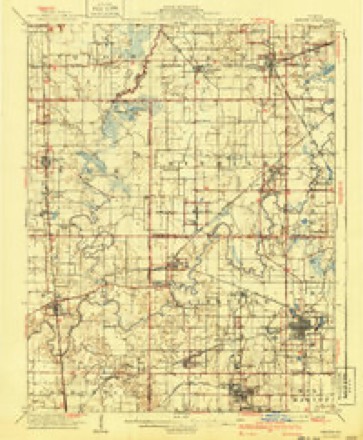
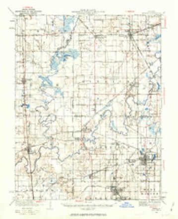
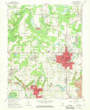
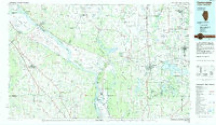
18 topographic sheets cover this place, the earliest surveyed in 1910 and the latest in 1987. It stands in Carterville precinct. It lies in ZIP code area 62918. The Survey maps it on the Herrin quadrangle. 5,848 people lived here at the 2020 count. It stands 443 feet above sea level.
Population over time
3 figuresCarterville grew from 692 to 5,848 between 1880 and 2020. These are the recorded population figures Wikidata holds for this place, reached through the Geographic Names Information System number this page is keyed on rather than by name, so they belong to this place and not to another of the same name. Most are census counts, but not all are: an early figure may be a founding or settlement estimate, and an estimate published within five years of a census is left out. The change column is computed, and is left blank where more than 20 years separate a figure from the one before it, because a gap that long is not a change between two counts.
| Year | People | Change |
|---|---|---|
| 1880 | 692 | |
| 2010 | 5,496 | |
| 2020 | 5,848 | +352 (+6%) |
Topographic sheets covering this place
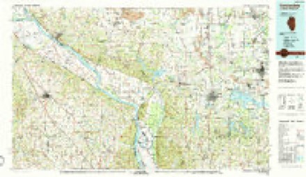
11 surveys from 18 printed sheetsMatched by testing this settlement's coordinate against the published boundary of every sheet in the United States Geological Survey's historical collection. Each opens the scanned sheet at the Survey.
- 1910 USGS Herrin quadrangle1:62500, 2 printings
- 1936 USGS Herrin quadrangle1:62500, 2 printings
- 1949 USGS Paducah quadrangle1:250000, 2 printings
- 1950 USGS Paducah quadrangle1:250000
- 1954 USGS Paducah quadrangle1:250000, 2 printings
- 1961 USGS Paducah quadrangle1:250000, 2 printings
- 1964 USGS Paducah quadrangle1:250000, 2 printings
- 1968 USGS Herrin quadrangle1:24000, 2 printings
- 1984 USGS Carbondale quadrangle1:100000
- 1986 USGS Carbondale quadrangle1:100000
- 1987 USGS Paducah quadrangle1:250000






Fires near this place
85 since 1992Regional context, not property-specific evidence. The federal wildfire occurrence database lists 85 fires within 5 miles of Carterville between 1992 and 2020, burning about 408 acres in total. 1 started naturally. 6 were recorded as arson. Distance is straight-line from the map coordinates, so a fire counted here may appear on a neighbouring settlement's page as well.
| Reported cause | Fires |
|---|---|
| Missing data/not specified/undetermined | 43 |
| Smoking | 16 |
| Debris and open burning | 11 |
| Arson/incendiarism | 6 |
| Recreation and ceremony | 4 |
| Equipment and vehicle use | 3 |
| Other causes | 1 |
| Natural | 1 |
The most recent of them, most recent first, with the day each was reported and the service that recorded it.
| Date | Cause | Size | Reported by | Name on the report |
|---|---|---|---|---|
| 6 September 1999 | Arson/incendiarism | 14 acres | Crab Orchard National Wildlife Refuge | GOBPOINT |
| 5 September 1999 | Smoking | under an acre | Crab Orchard National Wildlife Refuge | GREENBRIAR |
| 30 September 2019 | Debris and open burning | 97 acres | Crab Orchard National Wildlife Refuge | MONROE |
| 28 September 2010 | Missing data/not specified/undetermined | 2.0 acres | Illinois Division of Forestry Resources | 10217 |
| 25 September 1999 | Smoking | under an acre | Crab Orchard National Wildlife Refuge | PROPELLER2 |
| 8 August 1997 | Smoking | under an acre | Crab Orchard National Wildlife Refuge | COSPILLWAY |
| 7 August 2014 | Natural | under an acre | Crab Orchard National Wildlife Refuge | LIGHTNING SNAG 148 |
| 3 August 2010 | Missing data/not specified/undetermined | under an acre | Illinois Division of Forestry Resources | 10163 |
Settlements close enough to share some of these fires:
Storms near this place
33 since 1996Regional context, not property-specific evidence. The National Weather Service names Carterville in 33 storm reports between 1996 and 2025: 13 thunderstorm wind, 10 hail, 3 flash flood, 2 flood. The reports record 1 injury. Each account below is quoted exactly as the forecast office filed it, from the NOAA Storm Events Database, and each date opens the federal record of that event.
| When | Event | Place named | Harm | What the report says |
|---|---|---|---|---|
| May 2009 | Thunderstorm Wind | Carterville | 1 hurt, $175,000,000 | Widespread wind damage occurred countywide. Extensive tree and power line damage resulted in power outages up to several days long. Many power poles were snapped. Countywide, efforts to restore power were complicated by swampy fields, mud, and downed trees. Ninety-five percent of the county was without power at the peak of the outages. Numerous permanent structures were damaged, including major businesses in downtown Marion and Herrin. A total of 33 homes were heavily damaged or destroyed. It is estimated that over 10,000 homes in the county received minor damage (less than 50,000 dollars per house). Gas leaks were common. Most communication by phone was impossible, including cell phones. Stores were closed, making groceries and gas very difficult to obtain locally in the immediate aftermath of the storm. Travel was nearly impossible due to debris and trees blocking roads. While about two dozen people were treated for storm-related injuries at local hospitals, all but one of them was due to post-storm cleanup. Many school facilities were damaged. The roof of Carterville High School was severely damaged. Several windows were blown out of the school. Minor damage occurred at athletic facilities, including the roof blown off a baseball dugout. Many outbuildings and small structures were destroyed across the county. In Carterville, a garage was lifted and dropped on a vehicle. Many vehicles countywide were damaged or destroyed by falling tree and building debris. A state disaster declaration was granted. A dusk-to-dawn curfew was imposed, and a state of emergency was declared. The Williamson County airport near Marion reported a peak gust of 86 mph. Based on the most severe structural damage east of the airport, peak winds were estimated by storm surveyors close to 100 mph. There was extensive damage at the airport, including hangar buildings. A television station on Route 13 was knocked off the air due to structural and roof damage. All along Route 13, signs were blown down, power poles were down, and windows were smashed. Car dealerships along Route 13 sustained damage due to signs falling on vehicles and windows being blown out. Numerous structures sustained varying degrees of roof damage. A large hotel near the Interstate 57 interchange sustained major roof damage. Many trees were down along Interstate 57 from the Route 13 interchange northward, blocking the southbound lanes. Semis on the interstate were overturned or blown off the highway, causing extended traffic delays. One of the drivers of the semis was seriously injured. A tree fell on a van on the interstate. Damaged or destroyed trees were too numerous to count. Cleanup was expected to last through Labor Day, according to the Mayor of Marion. |
| June 2011 | Lightning | Carterville | $80,000 | A local television station was knocked off the air for about eight hours by a lightning strike. Besides damaging the broadcast equipment, the lightning disrupted internet and phone service. |
| April 2017 | Tornado (EF1) | Carterville | $35,000 | A brief EF-1 tornado touched down, damaging two residences and taking down a few trees. The first residence received minor shingle damage, and there was substantial roof damage at the second residence. Insulation and building debris was blown several hundred yards. The small tornado was captured on security camera video at a very close distance, less than 50 yards away. Peak winds were estimated near 105 mph. A trained spotter reported a rotating wall cloud south of Carbondale shortly before the tornado occurred. |
| June 2019 | Thunderstorm Wind | Carterville | $30,000 | Widespread damaging winds entered northwestern Williamson County. Trees were snapped in Herrin, causing power outages. A tree landed on a home. In Carterville, trees were blown down along Grand Avenue. |
| May 2011 | Flood | Carterville | $30,000 | no account filed |
| July 2023 | Flash Flood | Carterville | $25,000 | no account filed |
| July 2023 | Thunderstorm Wind | Carterville | $10,000 | Large trees were downed. |
| July 2022 | Thunderstorm Wind | Carterville | $10,000 | Several trees and large limbs were blown down. A tree fell on a home. |
| June 2013 | Thunderstorm Wind | Carterville | $10,000 | Winds gusted to 60 mph from Carterville across southwest Williamson County, resulting in downed tree limbs and power outages. |
| June 2008 | Thunderstorm Wind | Carterville | $6,000 | An electrical pole was down across an auto dealership. A one-foot diameter tree was blown down. |
| October 2010 | Thunderstorm Wind | Carterville | $3,000 | A few trees were blown down, including two on County Road 26 just southwest of Crab Orchard Lake. Another tree was down just north of Carterville. Power lines were down near Cambria. At a car dealership, a fence was blown down. |
| June 2009 | Thunderstorm Wind | Carterville | $3,000 | Several trees were blown down. |
| May 2025 | Hail | Carterville | - | Hail to the size of quarters fell in Carterville. |
| May 2025 | Hail | Carterville | - | Hail up to the size of nickels fell in Crainville. |
| May 2024 | Hail | Carterville | - | Golf ball size hail was reported in Carterville from a supercell storm moving eastward across Williamson County. As this cell continued eastward, nickel size hail was reported in Marion by emergency management. |
| April 2019 | Flood | Carterville | - | Some minor flooding problems were reported on area roads throughout the county. |
| May 2019 | Hail | Carterville | - | Wind gusts to 55 mph were also reported. |
| May 2016 | Hail | Carterville | - | A television news crew videotaped quarter-size hail. |
| August 2016 | Flash Flood | Carterville | - | Some roads were closed in and near Carterville and Crainville. A Carterville city street just north of Illinois Route 13 was under six inches of water. A manhole cover popped off, and water was filling up yards. A television station in Carterville measured 4.11 inches from midnight through 7:30 P.M. CST. |
| December 2015 | Heavy Rain | Carterville | - | A 12-hour rainfall of 2.25 inches was recorded between midnight and noon on the 28th. Countywide, about eight roads were closed that often become covered with water in heavy rain events. |
| November 2013 | Thunderstorm Wind | Carterville | - | Ham radio operators reported a wind gust to 70 mph. |
| April 2011 | Thunderstorm Wind | Carterville | - | A wind gust to 60 mph was measured at Marion. A trained spotter estimated a wind gust to 70 mph at Carterville. |
| September 2011 | Heavy Rain | Carterville | - | A trained spotter measured about 5 inches of rain since the evening of the 24th. |
| August 2005 | Thunderstorm Wind | Carterville | - | Three to four medium size trees were blown down on Route 148. |
| November 2005 | Funnel Cloud | Carterville | - | The funnel cloud was reported by sheriff deputies along Route 13 southwest of Carterville, and then along Route 37 south of Johnston City. |
| April 2023 | Hail | Carterville | - | no account filed |
| March 2020 | Hail | Carterville | - | no account filed |
| April 2011 | Hail | Carterville | - | no account filed |
| June 2009 | Hail | Carterville | - | no account filed |
| April 2006 | Hail | Carterville | - | no account filed |
| May 2004 | Thunderstorm Wind | Carterville | - | no account filed |
| September 1996 | Thunderstorm Wind | Carterville | - | no account filed |
| April 1996 | Flash Flood | Carterville | - | no account filed |
Nearest settlements
The eight closest, with where each one stands in the county. Distances are straight-line, computed from the Geographic Names Information System coordinates.
| Map | Place | Distance | Sheets |
|---|---|---|---|
| Crainville | 0.7 miles | 18 | |
| Dewmaine | 1.4 miles | 18 | |
| Fredonia (historical) | 2.3 miles | 18 | |
| Fredonia | 2.4 miles | 18 | |
| Cambria | 2.7 miles | 18 | |
| Eden Park | 2.8 miles | 18 | |
| Energy | 2.9 miles | 18 | |
| Colp | 3.1 miles | 18 |
Elsewhere
Matched on this settlement's Geographic Names Information System number rather than its name, so it cannot be a different place of the same name in another state.
| Wikipedia article on Carterville | An encyclopaedic summary. Its text is share-alike, so it is linked here rather than copied. |
| Wikidata item Q578659 | The structured record the population and elevation above come from. Public domain (CC0). |
Provenance
This settlement is recorded in the Geographic Names Information System as feature 405657. The sheet list is computed by point-in-boundary test against the United States Geological Survey's historical topographic inventory. Both are works of the United States government and carry no copyright under 17 U.S.C. 105.
Wildfire. Short, Karen C. 2022. Spatial wildfire occurrence data for the United States, 1992-2020 [FPA_FOD_20221014]. 6th Edition. Fort Collins, CO: Forest Service Research Data Archive. https://doi.org/10.2737/RDS-2013-0009.6 Collected with United States Government funding and usable without additional permissions or fees.
Storms. NOAA National Centers for Environmental Information, Storm Events Database https://www.ncei.noaa.gov/stormevents/ A work of the United States government, no copyright under 17 U.S.C. 105. Narratives are quoted verbatim from the National Weather Service report and are not edited or summarised.