 Block
Flagg, Illinois
10 topographic sheets cover this place, the earliest surveyed in 1952 and the latest in 1985. It stands in Flagg Township. It lies in ZIP code area 61068. It stands on Beach Creek. The Survey maps it on the Chana quadrangle. It stands 781 feet above sea level.
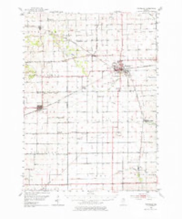
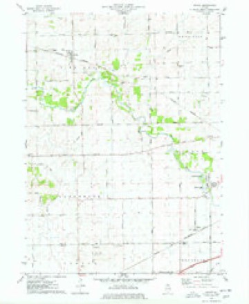
Topographic sheets covering this place
5 surveys from 10 printed sheetsMatched by testing this settlement's coordinate against the published boundary of every sheet in the United States Geological Survey's historical collection. Each opens the scanned sheet at the Survey.
- 1952 USGS Rochelle quadrangle1:62500, 3 printings
- 1958 USGS Aurora quadrangle1:250000, 3 printings
- 1961 USGS Aurora quadrangle1:250000
- 1975 USGS Chana quadrangle1:24000
- 1985 USGS Dixon quadrangle1:100000, 2 printings



In the county-history sources
16,079 words on this townshipThe History of Ogle County, Illinois, Containing a History of the County, Its Cities, Towns, Etc., a Biographical Directory of Its Citizens, War Record of Its Volunteers in the Late Rebellion, General and Local Statistics ... History of the Northwest, History of Illinois ... Etc, published 1878 names this settlement in its chapter on Flagg Township. These are the passages that mention it, exactly as the scans read.
ADDY GEORGE, Butter, Eggs and Poultry; res. cor. Main and Chase Sts.; born in Ireland March 8, 1837; came to Canada when an infant, then came to Ogle Co., and in 1859 engaged in general merchandising for about nine years, and then commenced his present business ; married Sarah A. Stinson, who is now dead ; married Caroline E. Whitcomb April 10, 1868 ; she was born in Canada May 22, 1837 ; they have three children : Robert F., Sarah E and Arian J.
Passage source: The History of Ogle County, Illinois, Containing a History of the County, Its Cities, Towns, Etc., a Biographical Directory of Its Citizens, War Record of Its Volunteers in the Late Rebellion, General and Local Statistics ... History of the Northwest, History of Illinois ... Etc, published 1878.
BliACKMAN E. H. Farmer; Sec. 4; P. O. Rochelle ; born April 2, 1826, in Bradford Co., Pa.; in 1853 came to his present homestead; owns 160 acres valued at $10,000; married Fannie Horton, Feb. 12,1850; she was born Sept. 26, 1829, in Bradford Co , Pa. ; they have six children : David W., born June 25, 1851 ; Lydia L. (now Mrs. W. Banks), April 17, 1854; Isabel, Feb. 1, 1856; Elijah Dallas, Oct. 4, 1858; Grant, July 9, 1864; Frank, Jan. 12, 1869; enlisted in Co. H., 46th Regt. I. V. I.; served one year; was wounded at the Battle of Shiloh, and was honorably discharged the following Oct. at Fort Donelson; they are members of the Baptist Church; Mrs. B.'s father, J. Horton, died at the advanced age of ninety-two years in Pa. ; Mrs. Horton died at the age of fiftytwo in Pa.
Passage source: The History of Ogle County, Illinois, Containing a History of the County, Its Cities, Towns, Etc., a Biographical Directory of Its Citizens, War Record of Its Volunteers in the Late Rebellion, General and Local Statistics ... History of the Northwest, History of Illinois ... Etc, published 1878.
BRAIDFiR M. J. Lumber, Coal, Cement, etc. ; res. at Brackett House ; born in Wyoming Co., N. Y., Oct. 10, 1835; came to Illinois May, 1850, and in 1856 came to Roclielle; he engaged in the grain business with H. Burlington for a term of about four years, and then commenced farming about seven miles west, which he continued for about twelve years ; then returned to Roclielle, and commenced his present business in 1872; married Julia P. Flagg July 28, 1857; she was born in Rochelle May 3, 1840 ; they have had four children; May C, Nettie C, Lulu and "Wilbur; Nettie is the only child now living,
Passage source: The History of Ogle County, Illinois, Containing a History of the County, Its Cities, Towns, Etc., a Biographical Directory of Its Citizens, War Record of Its Volunteers in the Late Rebellion, General and Local Statistics ... History of the Northwest, History of Illinois ... Etc, published 1878.
Machine-read from a century-old scan, so expect the errors a machine makes: misspelled names, dropped words, stray characters.
Read the whole chapter on Flagg Township - it names this place 15 more 15 times.
Mines and quarries near this place
3 within 5 milesRegional context, not property-specific evidence. The federal mineral resources record lists 3 workings within 5 miles of Flagg: 2 past producers, 1 plant. 1 still produces. What was taken out: Stone, Crushed/Broken. Distance is straight-line from the map coordinates, so a quarry counted here may appear on a neighbouring settlement's page as well.
| Where | Site | Commodity | Status | Recorded |
|---|---|---|---|---|
| Rochelle Quarry & Mill | Stone, Crushed/Broken | Plant | ||
| Unnamed Limestone Quarry | Stone, Crushed/Broken | Past Producer | ||
| Unnamed Limestone Quarry | Stone, Crushed/Broken | Past Producer |
Storms near this place
2 since 2009Regional context, not property-specific evidence. The National Weather Service names Flagg in 2 storm reports between 2009 and 2025: 1 funnel cloud, 1 thunderstorm wind. No death or injury is recorded in these reports. Each account below is quoted exactly as the forecast office filed it, from the NOAA Storm Events Database, and each date opens the federal record of that event.
Nearest settlements
The eight closest, with where each one stands in the county. Distances are straight-line, computed from the Geographic Names Information System coordinates.
| Map | Place | Distance | Sheets |
|---|---|---|---|
| Childers Acres | 1.6 miles | 10 | |
| Woodland Acres | 1.8 miles | 10 | |
| Crestwood Acres | 2.6 miles | 10 | |
| Kyte Side Estates | 2.7 miles | 10 | |
| Frahms Country Acres | 2.9 miles | 10 | |
| Prairieview Estates | 3.0 miles | 10 | |
| Ramsey Acres | 3.2 miles | 11 | |
| Flagg Center | 3.2 miles | 11 |
Elsewhere
Matched on this settlement's Geographic Names Information System number rather than its name, so it cannot be a different place of the same name in another state.
| Wikipedia article on Flagg | An encyclopaedic summary. Its text is share-alike, so it is linked here rather than copied. |
| Wikidata item Q5456924 | The structured record the population and elevation above come from. Public domain (CC0). |
Provenance
This settlement is recorded in the Geographic Names Information System as feature 408425. The sheet list is computed by point-in-boundary test against the United States Geological Survey's historical topographic inventory. Both are works of the United States government and carry no copyright under 17 U.S.C. 105.
Mines and quarries. USGS Mineral Resources Data System (MRDS) https://mrdata.usgs.gov/mrds/ A work of the United States government, no copyright under 17 U.S.C. 105.
Storms. NOAA National Centers for Environmental Information, Storm Events Database https://www.ncei.noaa.gov/stormevents/ A work of the United States government, no copyright under 17 U.S.C. 105. Narratives are quoted verbatim from the National Weather Service report and are not edited or summarised.