 Block
Fountain Green, Illinois
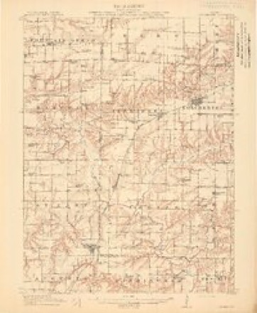
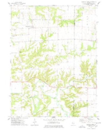
14 topographic sheets cover this place, the earliest surveyed in 1913 and the latest in 1990. It stands in Fountain Green Township. It lies in ZIP code area 62321. The Survey maps it on the Fountain Green quadrangle.
Topographic sheets covering this place
8 surveys from 14 printed sheetsMatched by testing this settlement's coordinate against the published boundary of every sheet in the United States Geological Survey's historical collection. Each opens the scanned sheet at the Survey.
- 1913 USGS Colchester quadrangle1:62500, 3 printings
- 1958 USGS Burlington quadrangle1:250000, 4 printings
- 1961 USGS Burlington quadrangle1:250000
- 1963 USGS Burlington quadrangle1:250000
- 1974 USGS Fountain Green quadrangle1:24000
- 1985 USGS Macomb quadrangle1:100000
- 1989 USGS Macomb quadrangle1:100000
- 1990 USGS Burlington quadrangle1:250000, 2 printings




In the county-history sources
10,015 words on this townshipHistory of Hancock County, Illinois, Together with an Outline History of the State, and a Digest of State Laws, published 1880 names this settlement in its chapter on Fountain Green Township. These are the passages that mention it, exactly as the scans read.
The village of Fountain Green was laid out in 1835, by Jabez A. Beebe and Stephen G. Ferris, two of its early and enterprising settlers. The township also contains the town of Webster. This was originally a Mormon town, laid out in 1840 by Wm. Wightman, and called Ramus, or Macedonia. After they left, its name was changed to Webster. Its population in 1815 had reached about 600, mostly Mormons. The villages are only about a mile apart; the first is much better built than the latter, and seems to be in a more flourishing condition.
Passage source: History of Hancock County, Illinois, Together with an Outline History of the State, and a Digest of State Laws, published 1880.
Daniel Prentis, still living in the village, was a native of Vermont, son of a Revolutionary soldier, and was born in 1799; came to Fountain Green and settled in 1833; was engaged in merchandising in Carthage about 1835, and under the wild scheme of internal improvements had a contract with the State for grading a portion of the Warsaw & Peoria Railroad, in 1838-'9. "Prentis' Shanty," on the line of said road, was for years a well-known landmark.
Passage source: History of Hancock County, Illinois, Together with an Outline History of the State, and a Digest of State Laws, published 1880.
Revs. Abell, Logan and Lawton are remembered as among the earliest gospel ministers in Fountain Green. There were a number of Catholic families in the neighborhood, and a Catholic Society was organized at an early day, and a house of worship erected about the year 1838. The organization was kept up but for a few years, when the edifice was sold. This organization was eflected through the instrumentality of Rev. Mr. St. Cyr. ,
Passage source: History of Hancock County, Illinois, Together with an Outline History of the State, and a Digest of State Laws, published 1880.
Machine-read from a century-old scan, so expect the errors a machine makes: misspelled names, dropped words, stray characters.
Read the whole chapter on Fountain Green Township - it names this place 20 more 20 times.
Fires near this place
1 since 2003Regional context, not property-specific evidence. The federal wildfire occurrence database lists 1 fire within 5 miles of Fountain Green in 2003, burning about 1 acre in total. None started naturally. None was recorded as arson. Distance is straight-line from the map coordinates, so a fire counted here may appear on a neighbouring settlement's page as well.
| Reported cause | Fires |
|---|---|
| Debris and open burning | 1 |
The most recent of them, most recent first, with the day each was reported and the service that recorded it.
| Date | Cause | Size | Reported by | Name on the report |
|---|---|---|---|---|
| 22 June 2003 | Debris and open burning | 1.0 acres | Illinois State Fire Marshal's Office | not named |
Settlements close enough to share some of these fires:
Mines and quarries near this place
2 within 5 milesRegional context, not property-specific evidence. The federal mineral resources record lists 2 workings within 5 miles of Fountain Green: 2 producers. All of them still produce. What was taken out: Stone, Crushed/Broken, Sand and Gravel, Construction. Distance is straight-line from the map coordinates, so a quarry counted here may appear on a neighbouring settlement's page as well.
| Where | Site | Commodity | Status | Recorded |
|---|---|---|---|---|
| Carthage Plant #52 & Quarry | Stone, Crushed/Broken | Producer | ||
| Tennessee Sand & Gravel Pit | Sand and Gravel, Construction | Producer |
Storms near this place
8 since 1993Regional context, not property-specific evidence. The National Weather Service names Fountain Green in 8 storm reports between 1993 and 2021: 8 hail. No death or injury is recorded in these reports. Each account below is quoted exactly as the forecast office filed it, from the NOAA Storm Events Database, and each date opens the federal record of that event.
| When | Event | Place named | Harm | What the report says |
|---|---|---|---|---|
| August 2004 | Hail | Fountain Green | $1,000 | no account filed |
| July 2021 | Hail | Fountain Green | - | Broadcast media relayed a report of 3.0 inch hail 2 miles north of Fountain Green. Crops were destroyed with damage to a building. |
| April 2020 | Hail | Fountain Green | - | Received through social media. |
| August 2009 | Hail | Fountain Green | - | Half dollar-sized hail fell about 2 miles east of Fountain Green, IL around 435 am August 4. |
| August 1993 | Hail | Fountain Green | - | Wind gusts to 60 mph were reported at Carthage. |
| May 1998 | Hail | Fountain Green | - | no account filed |
| April 1996 | Hail | Fountain Green | - | no account filed |
| April 1995 | Hail | Fountain Green | - | no account filed |
Nearest settlements
The eight closest, with where each one stands in the county. Distances are straight-line, computed from the Geographic Names Information System coordinates.
| Map | Place | Distance | Sheets |
|---|---|---|---|
| Webster | 1.8 miles | 14 | |
| Joetta | 3.5 miles | 14 | |
| La Crosse | 4.6 miles | 15 | |
| Burnside | 7.2 miles | 15 | |
| La Harpe | 7.4 miles | 16 | |
| Middle Creek | 7.7 miles | 14 | |
| Saint Mary | 9.1 miles | 14 | |
| Carthage | 9.8 miles | 14 |
Provenance
This settlement is recorded in the Geographic Names Information System as feature 408584. The sheet list is computed by point-in-boundary test against the United States Geological Survey's historical topographic inventory. Both are works of the United States government and carry no copyright under 17 U.S.C. 105.
Wildfire. Short, Karen C. 2022. Spatial wildfire occurrence data for the United States, 1992-2020 [FPA_FOD_20221014]. 6th Edition. Fort Collins, CO: Forest Service Research Data Archive. https://doi.org/10.2737/RDS-2013-0009.6 Collected with United States Government funding and usable without additional permissions or fees.
Mines and quarries. USGS Mineral Resources Data System (MRDS) https://mrdata.usgs.gov/mrds/ A work of the United States government, no copyright under 17 U.S.C. 105.
Storms. NOAA National Centers for Environmental Information, Storm Events Database https://www.ncei.noaa.gov/stormevents/ A work of the United States government, no copyright under 17 U.S.C. 105. Narratives are quoted verbatim from the National Weather Service report and are not edited or summarised.