 Block
Havana, Illinois
19 topographic sheets cover this place, the earliest surveyed in 1925 and the latest in 1990. It stands in Havana Township. It lies in ZIP code area 62644. It lies near Island of Canton. The Survey maps it on the Havana quadrangle. 2,963 people lived here at the 2020 count. It stands 476 feet above sea level.
Research this city
On record in Havana
Buildings and businesses the archive holds for this place. Each opens its own page, with the source record it came from.
On the National Register 2 records
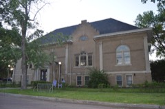 Havana Public Librarylisted 1994
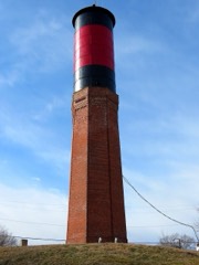 Havana Water Towerlisted 1993
Population over time
2 figuresHavana fell from 3,301 to 2,963 between 2010 and 2020. These are the recorded population figures Wikidata holds for this place, reached through the Geographic Names Information System number this page is keyed on rather than by name, so they belong to this place and not to another of the same name. Most are census counts, but not all are: an early figure may be a founding or settlement estimate, and an estimate published within five years of a census is left out. The change column is computed, and is left blank where more than 20 years separate a figure from the one before it, because a gap that long is not a change between two counts.
| Year | People | Change |
|---|---|---|
| 2010 | 3,301 | |
| 2020 | 2,963 | -338 (-10%) |
Topographic sheets covering this place
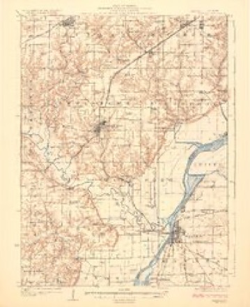
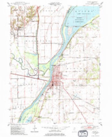
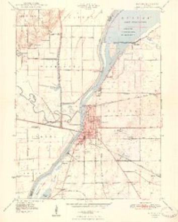
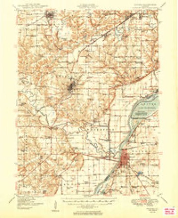
10 surveys from 19 printed sheetsMatched by testing this settlement's coordinate against the published boundary of every sheet in the United States Geological Survey's historical collection. Each opens the scanned sheet at the Survey.
- 1925 USGS Havana quadrangle1:62500, 3 printings
- 1947 USGS Havana quadrangle1:24000
- 1948 USGS Havana quadrangle1:24000, 2 printings
- 1949 USGS Havana quadrangle1:62500, 3 printings
- 1958 USGS Burlington quadrangle1:250000, 4 printings
- 1961 USGS Burlington quadrangle1:250000
- 1963 USGS Burlington quadrangle1:250000
- 1985 USGS Macomb quadrangle1:100000
- 1989 USGS Macomb quadrangle1:100000
- 1990 USGS Burlington quadrangle1:250000, 2 printings




In the county-history sources
6,158 words on this townshipCentennial History of Mason County, Including a Sketch of the Early History of Illinois, Its Physical Peculiarities, Soils, Climate, Production, Etc., published 1876 names this settlement in its chapter on Havana Township. These are the passages that mention it, exactly as the scans read.
Havana is beautifully situated on the east bank of the Illinois river, and is the county seat of the county. The situation is somewhat elevated, perhaps an average of forty feet above the river. It contains many fine residences and pleasant homes, and more than ordinary taste is exhibited in the improvement and ornamentation of grounds.
Passage source: Centennial History of Mason County, Including a Sketch of the Early History of Illinois, Its Physical Peculiarities, Soils, Climate, Production, Etc., published 1876.
The details of the early settlement of Havana are so fully set forth in the biographies of Pulaski Scovil, A. W. Kemp, N. J. Rockwell, O. E. Foster, J. H. Neteler, and others, that a repetition here would be a work of superogation. In lieu there of, we will refer the reader to the biographies above named, to the extracts from early newspapers, and the railroad department.
Passage source: Centennial History of Mason County, Including a Sketch of the Early History of Illinois, Its Physical Peculiarities, Soils, Climate, Production, Etc., published 1876.
Havana contains many substantial business houses, warehouses, steam elevators, and three hotels ; and her trade, though not as flourishing as many towns, has had a slow, healthful growth. In 1856 there was no brick building in Havana. In 1857 J. H. & D. P. Hole built the first brick store, and in the same year Wm. Walker built the first brick dwelling.
Passage source: Centennial History of Mason County, Including a Sketch of the Early History of Illinois, Its Physical Peculiarities, Soils, Climate, Production, Etc., published 1876.
Machine-read from a century-old scan, so expect the errors a machine makes: misspelled names, dropped words, stray characters.
Read the whole chapter on Havana Township - it names this place 4 more 4 times.
Fires near this place
5 since 1999Regional context, not property-specific evidence. The federal wildfire occurrence database lists 5 fires within 5 miles of Havana between 1999 and 2004, burning about 284 acres in total. None started naturally. None was recorded as arson. Distance is straight-line from the map coordinates, so a fire counted here may appear on a neighbouring settlement's page as well.
| Reported cause | Fires |
|---|---|
| Missing data/not specified/undetermined | 2 |
| Recreation and ceremony | 2 |
| Debris and open burning | 1 |
The most recent of them, most recent first, with the day each was reported and the service that recorded it.
| Date | Cause | Size | Reported by | Name on the report |
|---|---|---|---|---|
| 4 April 2004 | Missing data/not specified/undetermined | 28 acres | Illinois River National Wildlife Refuge | KNOTT FIRE 4-5-04 |
| 3 April 2003 | Missing data/not specified/undetermined | 6.0 acres | Illinois River National Wildlife Refuge | SPOON RIVER 01 04-03 |
| 14 October 1999 | Debris and open burning | 250 acres | Illinois River National Wildlife Refuge | CANTERBERR |
| 25 January 2004 | Recreation and ceremony | under an acre | Illinois River National Wildlife Refuge | GUDAT 1 |
| 25 January 2004 | Recreation and ceremony | under an acre | Illinois River National Wildlife Refuge | GUDAT 2 |
Settlements close enough to share some of these fires:
Mines and quarries near this place
2 within 5 milesRegional context, not property-specific evidence. The federal mineral resources record lists 2 workings within 5 miles of Havana: 2 past producers. None of them still produces. What was taken out: Sand and Gravel, Construction, Stone. Distance is straight-line from the map coordinates, so a quarry counted here may appear on a neighbouring settlement's page as well.
| Where | Site | Commodity | Status | Recorded |
|---|---|---|---|---|
| Holle Pit #1 | Sand and Gravel, Construction | Past Producer | ||
| Mason County Pit | Stone | Past Producer |
Storms near this place
60 of 61 shownRegional context, not property-specific evidence. The National Weather Service names Havana in 61 storm reports between 1994 and 2026: 34 thunderstorm wind, 17 hail, 3 tornado, 3 flash flood. No death or injury is recorded in these reports. Each account below is quoted exactly as the forecast office filed it, from the NOAA Storm Events Database, and each date opens the federal record of that event.
| When | Event | Place named | Harm | What the report says |
|---|---|---|---|---|
| April 2013 | Flood | Havana | $5,000,000 | Hundreds of cabins and sheds in wildlife areas along the Illinois River were severely damaged. In addition, 25 homes and several other structures were damaged near Bath, Snicarte, Havana and Goofy Ridge. Nearly 15 miles of roads will need to be rebuilt due to the flooding. The river stage at Havana climbed to a record level of 27.78 feet on April 25th at 19:15 local time, which was nearly 14 feet above flood stage. High impact flooding continued into the month of May 2013. |
| June 1999 | Tornado (F1) | Havana | $500,000 | no account filed |
| August 2008 | Lightning | Havana | $150,000 | Lightning struck a house in the city of Havana setting the roof and attic ablaze. The residents of the house were able to flee uninjured. The house burned to the ground. |
| August 2020 | Thunderstorm Wind | Havana | $50,000 | Several trees were blown down in Havana. |
| May 2017 | Thunderstorm Wind | Havana | $50,000 | Numerous trees were blown down. |
| June 2016 | Thunderstorm Wind | Havana | $35,000 | Several tree limbs and power lines were blown down in Havana. |
| August 2009 | Thunderstorm Wind | Havana | $35,000 | Several power lines and large tree limbs were blown down in Havana. |
| June 2016 | Thunderstorm Wind | Havana | $30,000 | Five power poles were snapped off west of IL-97 on 1550E near the power station. |
| June 2008 | Thunderstorm Wind | Havana | $25,000 | Numerous trees and power lines were blown down in Havana and across much of Mason County. |
| August 2020 | Thunderstorm Wind | Havana | $20,000 | Downed power lines caused a 4-acre field fire northeast of Havana. |
| June 2010 | Thunderstorm Wind | Havana | $20,000 | Power lines were blown down in Havana. |
| June 2009 | Thunderstorm Wind | Havana | $20,000 | Several trees were uprooted in Havana. |
| June 2015 | Thunderstorm Wind | Havana | $10,000 | Several large tree limbs were blown down. |
| July 2009 | Thunderstorm Wind | Havana | $10,000 | Numerous trees were blown down in Havana. |
| May 2016 | Thunderstorm Wind | Havana | $6,000 | Four trees were blown down just northeast of Havana. |
| July 2010 | Thunderstorm Wind | Havana | $6,000 | Two trees were blown down. |
| May 2015 | Lightning | Havana | $5,000 | Lightning struck a tree, which fell on a building behind the fire department in Havana. |
| June 1994 | Thunderstorm Wind | Havana | $5,000 | Power lines were blown down. |
| June 2015 | Thunderstorm Wind | Havana | $2,000 | A tree was blown down in Havana. |
| March 2026 | Thunderstorm Wind | Havana | - | Several trees, power lines, and traffic lights were blown down across Havana as a result of a downburst. |
| July 2024 | Thunderstorm Wind | Havana | - | Minor damage occurred to shingles and siding of a house. |
| July 2024 | Thunderstorm Wind | Havana | - | Several large tree branches were blown down in Riverfront Park. |
| October 2021 | Thunderstorm Wind | Havana | - | A large tree limb was blown down. |
| July 2020 | Thunderstorm Wind | Havana | - | Several tree limbs were blown down across Havana. |
| July 2020 | Flash Flood | Havana | - | Several streets were flooded and barricaded in Havana. |
| July 2017 | Thunderstorm Wind | Havana | - | A flag pole was snapped. |
| June 2015 | Flash Flood | Havana | - | A narrow band of thunderstorms produced 2.00 to 3.00 of rain on very saturated ground in west central and northern Mason County. Many streets were flooded in Havana and Manito. Numerous rural roads were also impassable from Havana to Manito during the afternoon hours of June 26th. |
| May 2013 | Flood | Havana | - | High impact flooding on the Illinois River continued from April.||Hundreds of cabins and sheds in wildlife areas along the Illinois River were severely damaged by the floodwaters. In addition, 25 homes and several other structures were damaged near Bath, Snicarte, Havana and Goofy Ridge. Nearly 15 miles of roads were destroyed due to the flooding. High impact flooding subsided when the river level at Havana fell below a stage of 17 feet on May 19th.||Damage estimates were reported in the April Storm Data for this event. |
| April 2006 | Hail | Havana | - | Hail covered the ground. |
| September 2006 | Thunderstorm Wind | Havana | - | No damage was reported. |
| September 2006 | Thunderstorm Wind | Havana | - | Tree limbs and corn were blown down. |
| July 2006 | Thunderstorm Wind | Havana | - | Numerous trees and power lines were blown down. |
| September 2006 | Flash Flood | Havana | - | Numerous roads flooded in Havana. Route 136 had 1 to 2 feet of water flowing across it for a time. |
| May 2004 | Thunderstorm Wind | Havana | - | Several trees and a road sign were blown over. |
| May 2003 | Tornado (F1) | Havana | - | A tornado touched down in the Quiver Beach area. It destroyed a travel trailer and a garage. As the tornado traveled to the northeast it blew down numerous trees and power lines before lifting and dissipating. No injuries were reported. |
| April 2001 | Thunderstorm Wind | Havana | - | Tree limbs and power lines were reported down across the area. |
| August 2001 | Thunderstorm Wind | Havana | - | Trees and power lines were reported down in Havana, as well as on the southern end of Easton. |
| August 2001 | Thunderstorm Wind | Havana | - | Several trees, tree limbs and power lines were blown down. |
| August 2000 | Thunderstorm Wind | Havana | - | Several large trees were blown down in Matanza Beach. |
| June 1999 | Hail | Havana | - | Golfball sized hail fell one mile south of Havana and in Kilbourne. Dime size hail fell in San Jose. |
| November 1998 | Thunderstorm Wind | Havana | - | In Mason City, a steel roofing system was blown off of an IDOT garage and numerous trees were blown down. Five miles north of Mason City, a tandem truck was blown off of Highway 136. The driver was not injured. In rural Mason City, a 2x4 was thrown through a bathroom window on a farm house and the roof was blown off of a machine shed. |
| April 1998 | Tornado (F0) | Havana | - | A tornado briefly touched down in a field 3 miles southwest of Havana. No injuries or damage were reported. |
| July 1998 | Thunderstorm Wind | Havana | - | Thunderstorm winds blew down trees and power lines down in Bath, along Route 78 between Bath and Havana, and in Havana. Also, a grain wagon was blown across the road in Havana and the shed doors were blown in at the Havana city disposal plant. No injuries were reported. |
| July 1997 | Thunderstorm Wind | Havana | - | A series of severe thunderstorms moved through the Havana area. Numerous trees were blown down, one of which fell onto the roof of a house 2 miles south of Havana. Also, some minor street flooding was reported due to the heavy amounts of rain in a short period of time. No injuries were reported and no damage estimate was available. |
| February 2026 | Hail | Havana | - | no account filed |
| March 2024 | Hail | Havana | - | no account filed |
| May 2019 | Hail | Havana | - | no account filed |
| June 2015 | Hail | Havana | - | no account filed |
| July 2006 | Hail | Havana | - | no account filed |
| April 2004 | Hail | Havana | - | no account filed |
| May 2004 | Hail | Havana | - | no account filed |
| May 2004 | Hail | Havana | - | no account filed |
| August 2003 | Hail | Havana | - | no account filed |
| May 2003 | Hail | Havana | - | no account filed |
| May 2001 | Hail | Havana | - | no account filed |
| April 2000 | Hail | Havana | - | no account filed |
| August 2000 | Hail | Havana | - | no account filed |
| April 1998 | Hail | Havana | - | no account filed |
| April 1997 | Thunderstorm Wind | Havana | - | no account filed |
| October 1996 | Thunderstorm Wind | Havana | - | no account filed |
Nearest settlements
The eight closest, with where each one stands in the county. Distances are straight-line, computed from the Geographic Names Information System coordinates.
| Map | Place | Distance | Sheets |
|---|---|---|---|
| Chautauqua Park | 1.6 miles | 19 | |
| Quiver Beach | 2.2 miles | 19 | |
| Baldwin Beach | 3.5 miles | 19 | |
| Lakewood | 3.9 miles | 15 | |
| Kelsey | 4.0 miles | 15 | |
| Eckard | 4.0 miles | 14 | |
| Matanzas Beach | 4.5 miles | 15 | |
| Matanzas | 5.2 miles | 15 |
Elsewhere
Matched on this settlement's Geographic Names Information System number rather than its name, so it cannot be a different place of the same name in another state.
| Wikipedia article on Havana | An encyclopaedic summary. Its text is share-alike, so it is linked here rather than copied. |
| Wikidata item Q575599 | The structured record the population and elevation above come from. Public domain (CC0). |
Provenance
This settlement is recorded in the Geographic Names Information System as feature 409929. The sheet list is computed by point-in-boundary test against the United States Geological Survey's historical topographic inventory. Both are works of the United States government and carry no copyright under 17 U.S.C. 105.
Wildfire. Short, Karen C. 2022. Spatial wildfire occurrence data for the United States, 1992-2020 [FPA_FOD_20221014]. 6th Edition. Fort Collins, CO: Forest Service Research Data Archive. https://doi.org/10.2737/RDS-2013-0009.6 Collected with United States Government funding and usable without additional permissions or fees.
Mines and quarries. USGS Mineral Resources Data System (MRDS) https://mrdata.usgs.gov/mrds/ A work of the United States government, no copyright under 17 U.S.C. 105.
Storms. NOAA National Centers for Environmental Information, Storm Events Database https://www.ncei.noaa.gov/stormevents/ A work of the United States government, no copyright under 17 U.S.C. 105. Narratives are quoted verbatim from the National Weather Service report and are not edited or summarised.