 Block
Herrin, Illinois
18 topographic sheets cover this place, the earliest surveyed in 1910 and the latest in 1987. It stands in Herrin precinct. It lies in ZIP code area 62948. The Survey maps it on the Herrin quadrangle. 12,352 people lived here at the 2020 count. It stands 420 feet above sea level.
Population over time
2 figuresHerrin fell from 12,501 to 12,352 between 2010 and 2020. These are the recorded population figures Wikidata holds for this place, reached through the Geographic Names Information System number this page is keyed on rather than by name, so they belong to this place and not to another of the same name. Most are census counts, but not all are: an early figure may be a founding or settlement estimate, and an estimate published within five years of a census is left out. The change column is computed, and is left blank where more than 20 years separate a figure from the one before it, because a gap that long is not a change between two counts.
| Year | People | Change |
|---|---|---|
| 2010 | 12,501 | |
| 2020 | 12,352 | -149 (-1%) |
Topographic sheets covering this place
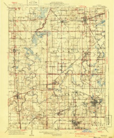
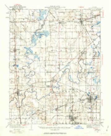
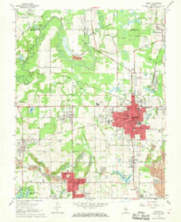
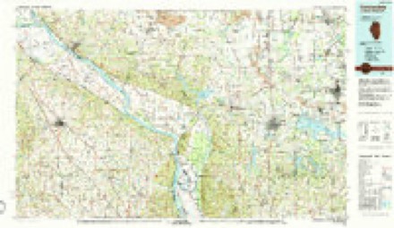
11 surveys from 18 printed sheetsMatched by testing this settlement's coordinate against the published boundary of every sheet in the United States Geological Survey's historical collection. Each opens the scanned sheet at the Survey.
- 1910 USGS Herrin quadrangle1:62500, 2 printings
- 1936 USGS Herrin quadrangle1:62500, 2 printings
- 1949 USGS Paducah quadrangle1:250000, 2 printings
- 1950 USGS Paducah quadrangle1:250000
- 1954 USGS Paducah quadrangle1:250000, 2 printings
- 1961 USGS Paducah quadrangle1:250000, 2 printings
- 1964 USGS Paducah quadrangle1:250000, 2 printings
- 1968 USGS Herrin quadrangle1:24000, 2 printings
- 1984 USGS Carbondale quadrangle1:100000
- 1986 USGS Carbondale quadrangle1:100000
- 1987 USGS Paducah quadrangle1:250000






Fires near this place
42 since 2008Regional context, not property-specific evidence. The federal wildfire occurrence database lists 42 fires within 5 miles of Herrin between 2008 and 2019, burning about 193 acres in total. 1 started naturally. 1 was recorded as arson. Distance is straight-line from the map coordinates, so a fire counted here may appear on a neighbouring settlement's page as well.
| Reported cause | Fires |
|---|---|
| Missing data/not specified/undetermined | 34 |
| Debris and open burning | 5 |
| Recreation and ceremony | 1 |
| Arson/incendiarism | 1 |
| Natural | 1 |
The most recent of them, most recent first, with the day each was reported and the service that recorded it.
| Date | Cause | Size | Reported by | Name on the report |
|---|---|---|---|---|
| 30 September 2019 | Debris and open burning | 97 acres | Crab Orchard National Wildlife Refuge | MONROE |
| 28 September 2010 | Missing data/not specified/undetermined | 2.0 acres | Illinois Division of Forestry Resources | 10217 |
| 25 September 2010 | Missing data/not specified/undetermined | under an acre | Illinois Division of Forestry Resources | 10211 |
| 3 August 2010 | Missing data/not specified/undetermined | under an acre | Illinois Division of Forestry Resources | 10163 |
| 7 July 2010 | Missing data/not specified/undetermined | under an acre | Illinois Division of Forestry Resources | 10137 |
| 4 July 2010 | Missing data/not specified/undetermined | 5.0 acres | Illinois Division of Forestry Resources | 10136 |
| 8 June 2013 | Natural | 1.0 acres | Illinois Division of Forestry Resources | 13111 |
| 5 April 2010 | Missing data/not specified/undetermined | under an acre | Illinois Division of Forestry Resources | 10077 |
Settlements close enough to share some of these fires:
Storms near this place
52 since 1995Regional context, not property-specific evidence. The National Weather Service names Herrin in 52 storm reports between 1995 and 2025: 20 thunderstorm wind, 19 hail, 6 flood, 4 flash flood. No death or injury is recorded in these reports. Each account below is quoted exactly as the forecast office filed it, from the NOAA Storm Events Database, and each date opens the federal record of that event.
| When | Event | Place named | Harm | What the report says |
|---|---|---|---|---|
| May 2002 | Hail | Herrin | $300,000 | no account filed |
| June 2018 | Thunderstorm Wind | Herrin | $100,000 | Widespread wind damage occurred throughout the county. Numerous trees and power lines were down, causing widespread power outages. Some structural damage was reported, mainly due to trees falling on structures. Shingles were blown off a roof in Carterville. A boat dock was damaged at Lake of Egypt, near the Johnson County line. |
| July 2010 | Thunderstorm Wind | Herrin | $100,000 | A microburst averaging about one mile wide tracked seven miles from the southeast side of Herrin eastward across the Johnston City area. The primary damage consisted of numerous trees and tree limbs down, along with some power lines. Several power poles were broken just east of Herrin. One of the downed power poles caused power lines to fall on a moving car, trapping the occupants of the car until the power company arrived. Rail traffic was halted by a tree across a railroad track. A porch roof was damaged between Herrin and Johnston City. There were numerous power outages, prompting a nighttime curfew for Johnston City. Trees were down across streets. There was minor damage to a few homes in Johnston City, primarily due to downed trees and limbs. A chimney was blown onto a pickup truck in Johnston City, shattering the windshield and denting it. Peak winds were estimated near 75 mph. |
| April 2011 | Thunderstorm Wind | Herrin | $50,000 | Trees were snapping, and power was out. Two trees landed on houses. Two trees in the front yards of houses landed on a chain link fence. |
| June 2013 | Thunderstorm Wind | Herrin | $25,000 | Shingles were blown off roofs. Three to six-inch diameter limbs were blown out of trees at the north end of town. |
| July 2012 | Thunderstorm Wind | Herrin | $20,000 | Tree limbs and some trees fell into power lines. A trained spotter estimated winds gusted to 70 mph. |
| May 2011 | Thunderstorm Wind | Herrin | $20,000 | A half dozen trees were blown down. Widespread power outages were reported throughout the community due to blown transformers. |
| May 2025 | Thunderstorm Wind | Herrin | $12,000 | A tree was blown down onto a car in Herrin. |
| January 2013 | Thunderstorm Wind | Herrin | $10,000 | Radio antennas were damaged. |
| April 2006 | Thunderstorm Wind | Herrin | $10,000 | Widespread downed trees and power lines were reported in Herrin. Shingle damage was reported two miles north of town. |
| July 2004 | Thunderstorm Wind | Herrin | $10,000 | A 119-year-old tree fell on a house in Marion. A large tree limb 6 to 8 inches in diameter fell on a house in Energy. A 4-inch limb fell on a house in Herrin. |
| January 2013 | Thunderstorm Wind | Herrin | $8,000 | Numerous tree limbs were down in Herrin, where a trained spotter estimated the wind gusted to 70 mph. In Johnston City, a trained spotter estimated a wind gust to 70 mph. |
| May 2024 | Thunderstorm Wind | Herrin | $5,000 | Trees were uprooted in Herrin as a result of thunderstorm downdraft winds. |
| May 2023 | Thunderstorm Wind | Herrin | $5,000 | Tree limbs were down, and power outages were reported. |
| November 2017 | Thunderstorm Wind | Herrin | $5,000 | Power lines were down across Highway 166. The highway was closed to traffic. Tree limbs were blown down between Herrin and Colp. |
| August 2023 | Thunderstorm Wind | Herrin | $4,000 | Trees were down. |
| July 2012 | Thunderstorm Wind | Herrin | $4,000 | A trained spotter reported downed tree limbs. Wind gusts were estimated near 60 mph. |
| December 2015 | Thunderstorm Wind | Herrin | $3,000 | A power line was blown down near Herrin. |
| July 2023 | Thunderstorm Wind | Herrin | $2,000 | Tree limbs were broken. |
| July 2006 | Flash Flood | Herrin | $2,000 | Major street flooding occurred in Herrin, where water washed over a two-block area along 17th and 18th Streets. The water entered at least one house. The flooding was videotaped and broadcast on local television news. In nearby Marion, 2.47 inches of rain was measured from thunderstorms. |
| January 2020 | Thunderstorm Wind | Herrin | $1,000 | Small tree limbs were broken. The report was received via the mping (Meteorological Phenomena Identification Near the Ground) app. |
| March 2022 | Flood | Herrin | - | Street flooding was reported in several locations in Williamson County, mainly along and northwest of a line from Herrin to Carterville. The water was six to eight inches deep. |
| February 2018 | Flood | Herrin | - | Several secondary roads were closed due to flooding within the county. |
| July 2017 | Flood | Herrin | - | Near the Herrin city hall, Highway 148 was flooded at the intersection with a city street. Local authorities reported this is an intersection that typically floods during heavy rain. |
| May 2016 | Hail | Herrin | - | Dime to nickel-size hail was reported in Herrin and just north of town. |
| April 2014 | Flood | Herrin | - | Numerous roads remained underwater due to the heavy rain over the previous 24 hours. |
| July 2012 | Hail | Herrin | - | The hail was accompanied by winds estimated near 50 mph. |
| September 2012 | Flood | Herrin | - | Flooding occurred in Herrin, especially on a few residential streets east of Highway 148. Yards were flooded. |
| April 2011 | Flash Flood | Herrin | - | At least a foot of water was over four to five intersections in Herrin. |
| June 2011 | Heavy Rain | Herrin | - | Some localized street flooding occurred in low areas. |
| May 2010 | Heavy Rain | Herrin | - | Six to eight inches of water covered Highway 148 just north of city hall. Water was over the curb of a side street. |
| May 2008 | Hail | Herrin | - | There were numerous reports of dime to quarter size hail throughout the county. Most of the hail was along a path from Herrin southeast across Marion. Dime size hail was reported in downtown Marion. Strong winds were reported several miles north of Marion. |
| April 2008 | Flash Flood | Herrin | - | Water was over roads. A few roads were closed. |
| February 2007 | Heavy Rain | Herrin | - | Water was rising out of ditches and onto a road. |
| June 2004 | Hail | Herrin | - | Penny to nickel size hail fell on the northwest side of Herrin. |
| August 2001 | Flash Flood | Herrin | - | Thunderstorms with very heavy rain persisted over the city of Herrin for over an hour. Spotters reported water over 17th, 18th, and 19th Streets on the northwest side of Herrin. Water was up to the grill of a pickup truck. |
| June 1998 | Thunderstorm Wind | Herrin | - | Wind gusts up to 65 MPH were observed. |
| June 1995 | Hail | Herrin | - | The large hail fell for 10 minutes and covered the ground. A weather observer recorded 1.88 inches of rain in this storm. |
| April 2020 | Hail | Herrin | - | no account filed |
| April 2018 | Hail | Herrin | - | no account filed |
| April 2017 | Hail | Herrin | - | no account filed |
| November 2017 | Hail | Herrin | - | no account filed |
| April 2015 | Hail | Herrin | - | no account filed |
| July 2012 | Hail | Herrin | - | no account filed |
| April 2011 | Hail | Herrin | - | no account filed |
| June 2011 | Hail | Herrin | - | no account filed |
| June 2009 | Hail | Herrin | - | no account filed |
| June 2008 | Hail | Herrin | - | no account filed |
| May 2004 | Hail | Herrin | - | no account filed |
| April 2002 | Hail | Herrin | - | no account filed |
| January 1999 | Hail | Herrin | - | no account filed |
| June 1996 | Flood | Herrin | - | no account filed |
Nearest settlements
The eight closest, with where each one stands in the county. Distances are straight-line, computed from the Geographic Names Information System coordinates.
| Map | Place | Distance | Sheets |
|---|---|---|---|
| Sunnyside | 1.4 miles | 18 | |
| Paineville | 1.4 miles | 18 | |
| Herrin Junction | 1.7 miles | 18 | |
| Chittyville | 1.8 miles | 18 | |
| Energy | 2.0 miles | 18 | |
| Colp | 2.8 miles | 18 | |
| Clifford | 3.0 miles | 18 | |
| Dewmaine | 3.0 miles | 18 |
Elsewhere
Matched on this settlement's Geographic Names Information System number rather than its name, so it cannot be a different place of the same name in another state.
| Wikipedia article on Herrin | An encyclopaedic summary. Its text is share-alike, so it is linked here rather than copied. |
| Wikidata item Q577950 | The structured record the population and elevation above come from. Public domain (CC0). |
Provenance
This settlement is recorded in the Geographic Names Information System as feature 410105. The sheet list is computed by point-in-boundary test against the United States Geological Survey's historical topographic inventory. Both are works of the United States government and carry no copyright under 17 U.S.C. 105.
Wildfire. Short, Karen C. 2022. Spatial wildfire occurrence data for the United States, 1992-2020 [FPA_FOD_20221014]. 6th Edition. Fort Collins, CO: Forest Service Research Data Archive. https://doi.org/10.2737/RDS-2013-0009.6 Collected with United States Government funding and usable without additional permissions or fees.
Storms. NOAA National Centers for Environmental Information, Storm Events Database https://www.ncei.noaa.gov/stormevents/ A work of the United States government, no copyright under 17 U.S.C. 105. Narratives are quoted verbatim from the National Weather Service report and are not edited or summarised.