 Block
Lanark, Illinois
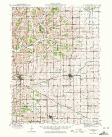
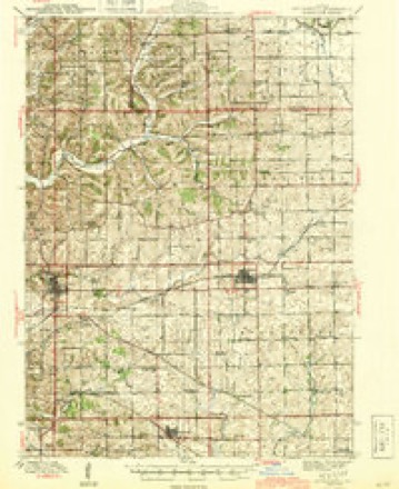
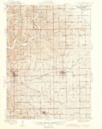
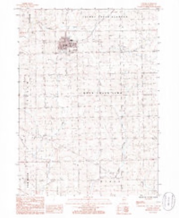
14 topographic sheets cover this place, the earliest surveyed in 1942 and the latest in 1985. It stands in Rock Creek-Lima Township. It lies in ZIP code area 61046. The Survey maps it on the Lanark quadrangle.
On record in Lanark
Buildings and businesses the archive holds for this place. Each opens its own page, with the source record it came from.
On the National Register 1 record
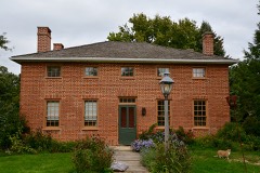 Charles Franks Houselisted 1998
Topographic sheets covering this place
9 surveys from 14 printed sheetsMatched by testing this settlement's coordinate against the published boundary of every sheet in the United States Geological Survey's historical collection. Each opens the scanned sheet at the Survey.
- 1942 USGS Mt Carroll quadrangle1:62500, 2 printings
- 1944 USGS Mt Carroll quadrangle1:62500
- 1944 USGS Mt. Carroll quadrangle1:62500
- 1954 USGS Rockford quadrangle1:250000
- 1955 USGS Rockford quadrangle1:250000
- 1958 USGS Rockford quadrangle1:250000, 4 printings
- 1963 USGS Rockford quadrangle1:250000
- 1981 USGS Rockford quadrangle1:100000, 2 printings
- 1985 USGS Lanark quadrangle1:24000





Mines and quarries near this place
6 within 5 milesRegional context, not property-specific evidence. The federal mineral resources record lists 6 workings within 5 miles of Lanark: 4 past producers, 2 producers. 2 still produce. What was taken out: Stone, Crushed/Broken. Distance is straight-line from the map coordinates, so a quarry counted here may appear on a neighbouring settlement's page as well.
| Where | Site | Commodity | Status | Recorded |
|---|---|---|---|---|
| Heldt Quarry | Stone, Crushed/Broken | Producer | ||
| Jones Quarry | Stone, Crushed/Broken | Past Producer | ||
| L. Poffenberger Quarry | Stone, Crushed/Broken | Past Producer | ||
| Lake Carroll Quarry | Stone, Crushed/Broken | Producer | ||
| McKenna Quarry | Stone, Crushed/Broken | Past Producer | ||
| Witt Quarry | Stone, Crushed/Broken | Past Producer |
Storms near this place
34 since 1999Regional context, not property-specific evidence. The National Weather Service names Lanark in 34 storm reports between 1999 and 2026: 20 thunderstorm wind, 8 hail, 2 tornado, 2 flash flood. No death or injury is recorded in these reports. Each account below is quoted exactly as the forecast office filed it, from the NOAA Storm Events Database, and each date opens the federal record of that event.
| When | Event | Place named | Harm | What the report says |
|---|---|---|---|---|
| July 2010 | Flash Flood | Lanark | $10,000,000 | After about a foot of rain in 2 days, creek and small river basins rose rapidly Saturday morning. Numerous rural roads throughout the county suffered from washouts and excessive erosion. Near Argo Fay, Johnson Creek overflowed its banks and closed Big Cut Road.||In Mount Carroll, flooding of the Waukarusa River forced evacuations of about 80 homes, mainly on or near Mill Street. The local fire chief estimated that 80% of Mount Carroll residences had water in their basements.||The Plum River overflowed its banks between Lake Carroll and Savanna, causing extensive and severe damage. Just west of Lake Carroll, a farm house on Polsgrove Road flooded. The resident of the home described the event, saying that around 5 am there was no sign of flooding nearby, and by 7 am water was in the house. ||As the flood waters approached Savanna, the Plum River either overflowed or breached (it is unclear which) a high bank along Scenic Bluff Road, flowing then through the railroad yard to the Mississippi River. Local residents describe water rising about 4 feet in literally a few minutes. In Savanna, an estimated 625 people were evacuated, mainly from the eastern and southern portions of town. Due to the rapidly rising water, first responders in Savanna rescued more than 60 people from their homes. At least 12 homes suffered water up to the first floor and a Swiss Colony factory had several feet of water throughout its facility. Emergency management estimated 10 homes completely destroyed and 75 seriously damaged in Savanna alone. The raging flood waters washed away more than 30 yards of embankment supporting an overpass on the Highway 84 viaduct, washing away two rows of pylons that were supporting the bridge and closing the primary access route south of Savanna indefinitely. Numerous rail cars in the train yard were overturned, some of them washed up against bridges. Both DM&E and Burlington Northern suffered damage to their rail lines. |
| April 2010 | Lightning | Lanark | $50,000 | A house caught on fire due to a lightning strike in Lanark, IL around 859 pm April 5. |
| June 2010 | Thunderstorm Wind | Lanark | $5,000 | Wind gusts downed tree limbs in Lanark. |
| May 2009 | Flash Flood | Lanark | $5,000 | Heavy rains caused some flash flooding of some roads near Lanark, IL during the evening of May 13. Some roads on the south side of town eroded. |
| May 2004 | Thunderstorm Wind | Lanark | $5,000 | Six trees down with several power lines. Trees of sufficient size to block several roads. |
| July 2006 | Thunderstorm Wind | Lanark | $3,000 | trees down blocking the road |
| March 2005 | Thunderstorm Wind | Lanark | $1,500 | Trees down on IL 64 just west of Otter Creek Road. |
| March 2024 | Hail | Lanark | - | Time estimated by radar, lasted 10 minutes. |
| June 2024 | Thunderstorm Wind | Lanark | - | Tree downed by thunderstorm winds. |
| March 2023 | Tornado (EF1) | Lanark | - | This tornado began southeast of Lanark in Carroll County and tracked to the northeast before moving into Ogle County about a quarter mile north of the intersection of W White Oak Road and N Brookville Road. The tornado path then continued for about 5 miles through Ogle County (see NWS Chicago StormData). The tornado then crossed into Stephenson County, just east of the intersection of N Mt. Vernon Road and Montague Road. This tornado caused extensive damage to several farm buildings and also downed a few trees along its path. The tornado was rated EF-1 in Carroll and Ogle Counties. In Stephenson County, there was no observable damage so the rating is |EF-U. |
| November 2022 | Thunderstorm Wind | Lanark | - | Law Enforcement reported wires pulled down from a house in Lanark. the time of the evnt was estimated using radar. |
| July 2021 | Thunderstorm Wind | Lanark | - | Large tree branch down just outside of town. |
| August 2021 | Thunderstorm Wind | Lanark | - | Small tree limb damage also reported. |
| August 2021 | Thunderstorm Wind | Lanark | - | A 1 foot diameter tree blown over, with another 4 inch diameter branch down as well. |
| June 2021 | Thunderstorm Wind | Lanark | - | A 7-8 inch diameter tree branch blown down at Franklin and High Street. |
| October 2019 | Flood | Lanark | - | Several roads were impassable, including the Spur Road, north of Mt Carroll, and the Old Galena Trail Road, due to stream flooding and flooding on the Plum River. Other roads were also impacted. |
| June 2019 | Thunderstorm Wind | Lanark | - | The Emergency Manager reported trees and power lines down. |
| July 2018 | Thunderstorm Wind | Lanark | - | Time of the event was estimated using radar. |
| May 2016 | Thunderstorm Wind | Lanark | - | A trained spotter reported 3 to 6 inch diameter tree limbs down. |
| July 2014 | Thunderstorm Wind | Lanark | - | A trained spotter estimated thunderstorm winds gusting to 60 mph. |
| August 2011 | Hail | Lanark | - | Time of hail fall was estimated from radar. |
| May 2011 | Thunderstorm Wind | Lanark | - | Wind gusts measured to be 60 mph were recorded about 5 miles northwest of Lanark, IL at 554 pm CDT May 22. |
| June 2009 | Thunderstorm Wind | Lanark | - | Wind gusts were estimated to be 60 mph about 3 miles north of Lanark, IL around 537 pm June 27. |
| July 2008 | Thunderstorm Wind | Lanark | - | Wind gusts estimated to be 65 mph were observed just north of Lanark, IL at 12:40 pm July 31. |
| June 2007 | Hail | Lanark | - | Nickel size hail accompanied a line of thunderstorms as they moved southeast across Carroll County. |
| July 2004 | Hail | Lanark | - | Lasted 4 minutes |
| June 2003 | Tornado (F0) | Lanark | - | Near Jct US 52/IL 64 & Dame Rd |
| July 2002 | Thunderstorm Wind | Lanark | - | Numerous trees blown down. |
| June 1999 | Thunderstorm Wind | Lanark | - | Thunderstorm winds dumped a grain leg, a grain transport device, onto a large storage bin. Numerous reports of tree limbs down. |
| April 2026 | Thunderstorm Wind | Lanark | - | no account filed |
| August 2022 | Hail | Lanark | - | no account filed |
| July 2004 | Hail | Lanark | - | no account filed |
| April 2002 | Hail | Lanark | - | no account filed |
| May 1999 | Hail | Lanark | - | no account filed |
Nearest settlements
The eight closest, with where each one stands in the county. Distances are straight-line, computed from the Geographic Names Information System coordinates.
| Map | Place | Distance | Sheets |
|---|---|---|---|
| Georgetown | 2.6 miles | 14 | |
| Kittredge | 3.6 miles | 14 | |
| Zier Cors | 3.6 miles | 14 | |
| Ashdale Junction | 5.0 miles | 14 | |
| Lake Carroll | 5.3 miles | 14 | |
| Shannon | 6.1 miles | 14 | |
| Chadwick | 6.8 miles | 14 | |
| Mount Carroll | 7.7 miles | 14 |
Provenance
This settlement is recorded in the Geographic Names Information System as feature 411788. The sheet list is computed by point-in-boundary test against the United States Geological Survey's historical topographic inventory. Both are works of the United States government and carry no copyright under 17 U.S.C. 105.
Mines and quarries. USGS Mineral Resources Data System (MRDS) https://mrdata.usgs.gov/mrds/ A work of the United States government, no copyright under 17 U.S.C. 105.
Storms. NOAA National Centers for Environmental Information, Storm Events Database https://www.ncei.noaa.gov/stormevents/ A work of the United States government, no copyright under 17 U.S.C. 105. Narratives are quoted verbatim from the National Weather Service report and are not edited or summarised.