 Block
Marion, Illinois
20 topographic sheets cover this place, the earliest surveyed in 1925 and the latest in 1996. It stands in West Marion precinct. It lies in ZIP code area 62959. The Survey maps it on the Marion quadrangle. 16,855 people lived here at the 2020 count. It stands 518 feet above sea level.
Research this city
On record in Marion
Buildings and businesses the archive holds for this place. Each opens its own page, with the source record it came from.
On the National Register 5 records
 Willis Allen Houselisted 1982
 Goddard Chapellisted 1986
 Marion Veterans Administration Hospital Historic Districtlisted 2013
 Ed. M. Stotlar Houselisted 2002
 Williamson County Jaillisted 2007
Population over time
2 figuresMarion fell from 17,193 to 16,855 between 2010 and 2020. These are the recorded population figures Wikidata holds for this place, reached through the Geographic Names Information System number this page is keyed on rather than by name, so they belong to this place and not to another of the same name. Most are census counts, but not all are: an early figure may be a founding or settlement estimate, and an estimate published within five years of a census is left out. The change column is computed, and is left blank where more than 20 years separate a figure from the one before it, because a gap that long is not a change between two counts.
| Year | People | Change |
|---|---|---|
| 2010 | 17,193 | |
| 2020 | 16,855 | -338 (-2%) |
Topographic sheets covering this place
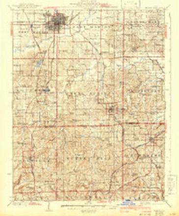
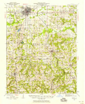
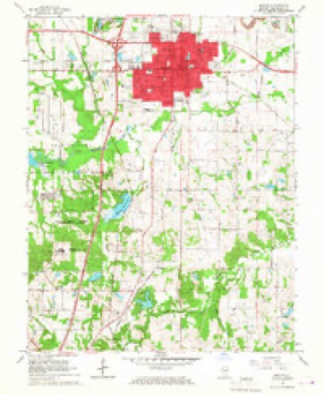
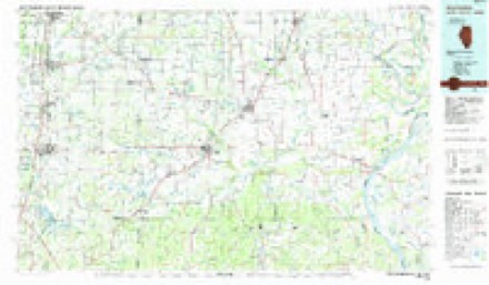
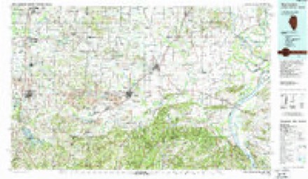
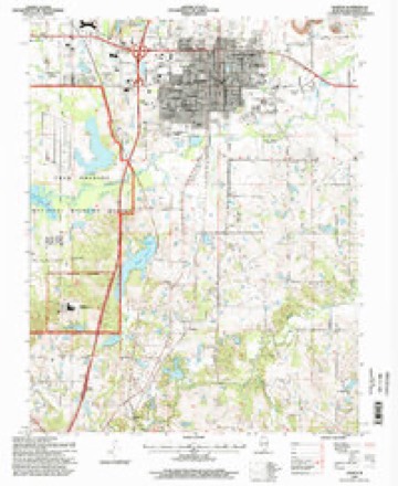
12 surveys from 20 printed sheetsMatched by testing this settlement's coordinate against the published boundary of every sheet in the United States Geological Survey's historical collection. Each opens the scanned sheet at the Survey.
- 1925 USGS Marion quadrangle1:62500, 3 printings
- 1940 USGS Marion quadrangle1:62500
- 1949 USGS Paducah quadrangle1:250000, 2 printings
- 1950 USGS Paducah quadrangle1:250000
- 1954 USGS Paducah quadrangle1:250000, 2 printings
- 1961 USGS Paducah quadrangle1:250000, 2 printings
- 1964 USGS Paducah quadrangle1:250000, 2 printings
- 1966 USGS Marion quadrangle1:24000, 3 printings
- 1984 USGS West Frankfort quadrangle1:100000
- 1987 USGS Paducah quadrangle1:250000
- 1987 USGS West Frankfort quadrangle1:100000
- 1996 USGS Marion quadrangle1:24000






Fires near this place
24 since 1994Regional context, not property-specific evidence. The federal wildfire occurrence database lists 24 fires within 5 miles of Marion between 1994 and 2014, burning about 158 acres in total. 2 started naturally. 1 was recorded as arson. Distance is straight-line from the map coordinates, so a fire counted here may appear on a neighbouring settlement's page as well.
| Reported cause | Fires |
|---|---|
| Missing data/not specified/undetermined | 17 |
| Natural | 2 |
| Debris and open burning | 2 |
| Equipment and vehicle use | 1 |
| Recreation and ceremony | 1 |
| Arson/incendiarism | 1 |
The most recent of them, most recent first, with the day each was reported and the service that recorded it.
| Date | Cause | Size | Reported by | Name on the report |
|---|---|---|---|---|
| 21 September 2010 | Missing data/not specified/undetermined | 60 acres | Illinois Division of Forestry Resources | 10206 |
| 7 August 2014 | Natural | under an acre | Crab Orchard National Wildlife Refuge | LIGHTNING SNAG 148 |
| 11 August 2010 | Missing data/not specified/undetermined | under an acre | Illinois Division of Forestry Resources | 10171 |
| 11 August 1994 | Equipment and vehicle use | under an acre | Crab Orchard National Wildlife Refuge | AREA6 |
| 14 June 2013 | Missing data/not specified/undetermined | 1.0 acres | Illinois Division of Forestry Resources | 13107 |
| 14 June 2011 | Natural | under an acre | Crab Orchard National Wildlife Refuge | AREA 6 |
| 4 April 2011 | Missing data/not specified/undetermined | 3.0 acres | Crab Orchard National Wildlife Refuge | EMA |
| 22 April 2010 | Missing data/not specified/undetermined | 1.0 acres | Illinois Division of Forestry Resources | 10096 |
Settlements close enough to share some of these fires:
Mines and quarries near this place
1 within 5 milesRegional context, not property-specific evidence. The federal mineral resources record lists 1 working within 5 miles of Marion: 1 past producer. None of them still produces. What was taken out: Stone, Crushed/Broken. Distance is straight-line from the map coordinates, so a quarry counted here may appear on a neighbouring settlement's page as well.
| Where | Site | Commodity | Status | Recorded |
|---|---|---|---|---|
| Williamson Co. Hwy. Dept. | Stone, Crushed/Broken | Past Producer |
Storms near this place
60 of 98 shownRegional context, not property-specific evidence. The National Weather Service names Marion in 98 storm reports between 1993 and 2025: 35 hail, 32 thunderstorm wind, 14 flash flood, 8 heavy rain. The reports record 1 death. Each account below is quoted exactly as the forecast office filed it, from the NOAA Storm Events Database, and each date opens the federal record of that event.
| When | Event | Place named | Harm | What the report says |
|---|---|---|---|---|
| August 2000 | Flood | Marion | 1 killed | Very heavy rain from a slow-moving thunderstorm caused streets to flood and ditches to run full. A 9-year-old boy attempting to retrieve an object from a culvert was swept into it by rushing water. He later died at a hospital in St. Louis. |
| May 2002 | Hail | Marion | $2,000,000 | no account filed |
| May 1996 | Flash Flood | Marion | $1,000,000 | no account filed |
| April 1996 | Flash Flood | Marion | $500,000 | no account filed |
| July 2023 | Thunderstorm Wind | Marion | $125,000 | Several miles east-southeast of Marion, six homes were damaged, power poles were snapped, and large tree branches were snapped. Around 600 utility customers were without power. A trained spotter three miles south of Marion estimated the wind gusted to 70 mph. |
| August 2022 | Flash Flood | Marion | $100,000 | There were numerous reports of street flooding in Marion. Significant street flooding occurred across the city of Johnston City, where over four inches of rain fell from midnight to late morning. Poor Farm Road was washed out north of Johnston City, leaving a trench large enough to swallow a car. On the north side of Marion, fire and rescue crews assisted residents of a flooded trailer park. The park was entirely flooded, and some residents were advised to remain indoors. Main Street on the east side of the Marion square was nearly impassable. A Marion day care center was evacuated due to flooding. Several inches of water were in the classrooms and hallway. A Cocorahs observer at Marion measured 5.63 inches in a 48-hour period. |
| January 2000 | Thunderstorm Wind | Marion | $100,000 | A thunderstorm microburst caused extensive damage to a machinery company in Marion. A wind gust estimated near 100 MPH damaged roof sections of two buildings. A survey by National Weather Service personnel indicated the damage path was only about 150 feet long. One employee sustained minor back injuries. The main damage area was in the middle of the roof of a warehouse building. A smaller building adjacent to the warehouse had roofing peeled off. The damage area on the roof of the smaller building was roughly 16 by 20 feet and consisted of roofing and steel I beams. The damage to the roof of the larger building was about 30 by 50 feet in area. |
| June 1998 | Tornado (F1) | Marion | $100,000 | The tornado touched down half a mile east of Illinois Route 37 in the community of Hudgens and moved east-southeast for 2 miles. Damage occurred at several residences in Hudgens. At the first residence, several trees were uprooted, a couple of which were 50 feet tall. Siding on a barn was damaged by flying debris. At a second residence, decking was ripped off a porch, and shingles were blown off. Several large trees were snapped, and a dog house was blown about 40 feet. At a third residence, a barn was demolished with debris scattered in all directions. A vehicle was damaged by flying lawn furniture. At a fourth residence, the fascia on the west eave of the house was found about 300 feet northwest of the house wrapped around a tree trunk. At the fifth residence in Hudgens, a huge oak tree fell on top of a camper, and two other large oak trees were snapped. The only other damage, which occurred at a residence near the end of the track, was significant. A tree caused major roof damage to the house, and a nearby barn lost siding and roofing. Loose objects such as trash cans, lawn chairs, and child's toys were found up to a quarter mile away. Witnesses reported seeing rotating clouds about the time the damage occurred. Peak wind speeds were estimated between 90 and 100 MPH. |
| September 2012 | Thunderstorm Wind | Marion | $80,000 | On the east edge of Marion near the fairgrounds, a roof was blown off a plumbing business. Metal roof debris was entangled in power lines. The plumbing business was in a large metal shed-type structure. Trees were blown down on a street on the south end of town. Numerous power outages were reported. Portable stop signs were placed at intersections where traffic lights were not functioning. A power pole fell on a car on Old Route 13. About 3,500 utility customers were without power at the peak of the storm. |
| June 2011 | Lightning | Marion | $50,000 | In Marion, a lightning strike shattered an antenna into three pieces. The antenna was located on top of a tower at the sheriff's department. The sheriff office's 911 telephone capability and radio system were both damaged. |
| May 1999 | Thunderstorm Wind | Marion | $35,000 | Numerous tree limbs and a few large trees were blown down. One large tree fell on a house. Streets and roads were blocked by fallen trees, mainly in the southern and eastern portions of the city. Several thousand utility customers were without power for 24 hours or more. |
| May 2024 | Thunderstorm Wind | Marion | $30,000 | Power lines were downed by thunderstorm winds in Marion and around the county. |
| July 2022 | Thunderstorm Wind | Marion | $30,000 | Several miles southeast of Marion, trees and large limbs were down. There was shingle damage to a house. Several trees were snapped. A greenhouse was flipped and rolled. The hvac unit of a house was moved off its concrete pad a few feet. |
| October 2007 | Thunderstorm Wind | Marion | $25,000 | Downed trees were reported in Johnston City. Winds were measured at 62 mph. In Marion, a storm chaser reported limbs down due to estimated wind gusts around 60 mph. |
| June 1998 | Thunderstorm Wind | Marion | $25,000 | Numerous large trees were blown down along Illinois Route 37. A metal roof was completely torn off an antique shop. A retired airline pilot estimated gusts were up to 70 MPH. |
| May 2015 | Thunderstorm Wind | Marion | $20,000 | Several trees and cable television lines were down near Route 37. A very large tree limb landed on a house. |
| April 2023 | Thunderstorm Wind | Marion | $15,000 | Several trees were damaged. A section of roof was torn off a large pole barn. |
| July 2023 | Thunderstorm Wind | Marion | $15,000 | A tree fell down onto a home. Tree limbs were blown down throughout the county. |
| July 2017 | Thunderstorm Wind | Marion | $15,000 | Widespread tree damage was reported across the north side of the city of Marion. Multiple large trees were blown down. A few corn fields north of town were flattened. |
| May 2024 | Thunderstorm Wind | Marion | $10,000 | Multiple vinyl fences blown over at the corner of Cardinal Dr and Mulligan Dr. Pieces of vinyl embedded in neighbor's siding. |
| July 2009 | Thunderstorm Wind | Marion | $10,000 | Trees were blown down on the Veterans Administration Hospital campus and elsewhere in the city. |
| April 2017 | Thunderstorm Wind | Marion | $8,000 | Several trees were blown down, and a few shingles were off of homes. |
| December 2015 | Thunderstorm Wind | Marion | $7,000 | Several trees were blown down in the Marion area. One tree was blocking a portion of southbound Interstate 57. A couple of others were southeast of Marion in the New Denison area. |
| June 1999 | Thunderstorm Wind | Marion | $7,000 | The roof of a shed was blown off along Old Route 13. |
| May 2015 | Thunderstorm Wind | Marion | $6,000 | Trees were blown down onto power lines. |
| March 2021 | Flash Flood | Marion | $5,000 | A broadcast tv meteorologist reported a vehicle stalled in high water on city streets in Marion. Street flooding was reported across the south part of Marion. |
| July 2012 | Thunderstorm Wind | Marion | $5,000 | Power lines were blown down. |
| July 1997 | Thunderstorm Wind | Marion | $5,000 | Lots of power lines were down. High winds collapsed part of a wall on a building. |
| July 2006 | Thunderstorm Wind | Marion | $3,000 | Some tree damage was visible from Interstate 57 as far south as Marion. Downed trees and lines caused power outages in Marion and Carterville. |
| October 2001 | Thunderstorm Wind | Marion | $3,000 | Along the Jackson County border, several power poles and trees were blown down. The strong winds were caused by showers or thunderstorms enhancing gradient winds of around 30 mph. |
| July 1996 | Thunderstorm Wind | Marion | $2,000 | no account filed |
| May 2019 | Thunderstorm Wind | Marion | $1,000 | Large maple tree limbs were blown down on the north side of Marion. |
| March 2004 | Thunderstorm Wind | Marion | $1,000 | no account filed |
| May 2025 | Hail | Marion | - | Hail measured to nickel size occurred on the south side of Marion as a supercell storm tracked eastward. |
| May 2024 | Hail | Marion | - | A WSIL meteorologist reported lots of hail with some stones up to penny size in Marion with a thunderstorm moving eastward across the county. |
| February 2022 | Flash Flood | Marion | - | A vehicle nearly stalled out on a flooded section of road a few miles south of Herrin. Near Energy, several locations were under water on secondary roads. |
| March 2020 | Hail | Marion | - | Numerous reports were received of half-dollar size hail in Marion. |
| July 2020 | Flash Flood | Marion | - | Multiple roads were closed in Marion. |
| June 2019 | Flash Flood | Marion | - | Significant creek flooding was reported near Crab Orchard Lake after 2.22 inches of rain fell in two hours. Reports of possible road closures were received along portions of Route 13. |
| February 2018 | Flash Flood | Marion | - | Numerous roads were flooded around Marion. Several roads in the southern portion of the county were quickly becoming impassable. |
| March 2017 | Hail | Marion | - | Dime-size hail was reported at three locations from Marion southward and southeast toward the Johnson County line. |
| November 2017 | Flood | Marion | - | Several streets were covered by one to two inches of water. A few creeks were approaching bankful. |
| March 2015 | Heavy Rain | Marion | - | Street flooding occurred in Herrin. A trained spotter near the Johnson County line measured 2.50 inches of rain through about midnight, with rain still falling. |
| May 2014 | Hail | Marion | - | Dime-size hail fell on the southeast side of Marion. |
| December 2013 | Flash Flood | Marion | - | Water was running over several Marion city roads. There was standing water in several parking lots. Numerous roads were flooded outside the city of Marion, including Highway 149 near Hurst. |
| March 2012 | Hail | Marion | - | Several reports of dime to penny size hail were relayed by local media and a trained spotter. |
| April 2011 | Hail | Marion | - | Quarter size hail fell near Johnson City. |
| May 2010 | Heavy Rain | Marion | - | One and one-half feet of water covered Highway 37 in Marion. |
| July 2010 | Heavy Rain | Marion | - | A thunderstorm dumped heavy rain that left standing water in several areas of Marion. There was minor street flooding. |
| April 2009 | Heavy Rain | Marion | - | Water was over roads in Marion. Water was over a road in several places near Corinth. |
| May 2009 | Heavy Rain | Marion | - | Ponding of water occurred throughout Marion. Visibility was down to one block at times in heavy rain. |
| January 2008 | Hail | Marion | - | Nickel size hail was reported on the south side of Marion. |
| June 2007 | Heavy Rain | Marion | - | Typical minor street flooding was reported after 0.51 inch of rain fell in 24 minutes. |
| March 2006 | Hail | Marion | - | Multiple reports of hail ranging from dime to half-dollar size in and near Marion. |
| March 2006 | Flash Flood | Marion | - | Numerous creeks were out of their banks. Portions of Highway 13 were closed and impassable. Sections of Highway 37 were under water. Numerous secondary roads were covered by standing water. |
| July 2006 | Heavy Rain | Marion | - | Some street flooding occurred in Marion as a result of thunderstorms with heavy rain. Water was up to the axles of some cars on Route 37. |
| October 2004 | Heavy Rain | Marion | - | A few inches of water covered a road in front of the Wal-Mart store. |
| May 2001 | Thunderstorm Wind | Marion | - | A few trees were blown down across southern and eastern parts of the county. |
| July 2001 | Thunderstorm Wind | Marion | - | Four trees were down over western parts of the county. |
| May 2000 | Flood | Marion | - | A cluster of thunderstorms produced very heavy rainfall. A spotter measured 1 inch of rain in 30 minutes. |
Nearest settlements
The eight closest, with where each one stands in the county. Distances are straight-line, computed from the Geographic Names Information System coordinates.
| Map | Place | Distance | Sheets |
|---|---|---|---|
| Dog Walk | 2.0 miles | 18 | |
| Timmons | 2.1 miles | 20 | |
| Spillertown | 2.6 miles | 18 | |
| Bainbridge | 3.2 miles | 20 | |
| Crenshaw Crossing | 3.9 miles | 18 | |
| White Ash | 4.1 miles | 18 | |
| Fergestown | 4.6 miles | 18 | |
| Chamness (historical) | 4.7 miles | 20 |
Elsewhere
Matched on this settlement's Geographic Names Information System number rather than its name, so it cannot be a different place of the same name in another state.
| Wikipedia article on Marion | An encyclopaedic summary. Its text is share-alike, so it is linked here rather than copied. |
| Wikidata item Q575399 | The structured record the population and elevation above come from. Public domain (CC0). |
Provenance
This settlement is recorded in the Geographic Names Information System as feature 413005. The sheet list is computed by point-in-boundary test against the United States Geological Survey's historical topographic inventory. Both are works of the United States government and carry no copyright under 17 U.S.C. 105.
Wildfire. Short, Karen C. 2022. Spatial wildfire occurrence data for the United States, 1992-2020 [FPA_FOD_20221014]. 6th Edition. Fort Collins, CO: Forest Service Research Data Archive. https://doi.org/10.2737/RDS-2013-0009.6 Collected with United States Government funding and usable without additional permissions or fees.
Mines and quarries. USGS Mineral Resources Data System (MRDS) https://mrdata.usgs.gov/mrds/ A work of the United States government, no copyright under 17 U.S.C. 105.
Storms. NOAA National Centers for Environmental Information, Storm Events Database https://www.ncei.noaa.gov/stormevents/ A work of the United States government, no copyright under 17 U.S.C. 105. Narratives are quoted verbatim from the National Weather Service report and are not edited or summarised.