 Block
Martinsburg, Illinois
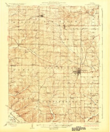
13 topographic sheets cover this place, the earliest surveyed in 1926 and the latest in 1990. It stands in Martinsburg Township. It lies in ZIP code area 62366. The Survey maps it on the Pittsfield quadrangle.
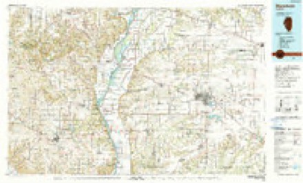
Topographic sheets covering this place
8 surveys from 13 printed sheetsMatched by testing this settlement's coordinate against the published boundary of every sheet in the United States Geological Survey's historical collection. Each opens the scanned sheet at the Survey.
- 1926 USGS Pittsfield quadrangle1:62500, 3 printings
- 1948 USGS Quincy quadrangle1:250000, 2 printings
- 1956 USGS Quincy quadrangle1:250000, 3 printings
- 1975 USGS Pittsfield SE quadrangle1:24000
- 1981 USGS Pittsfield quadrangle1:24000
- 1981 USGS Pittsfield SE quadrangle1:24000
- 1985 USGS Meredosia quadrangle1:100000
- 1990 USGS Meredosia quadrangle1:100000



In the county-history sources
483 words on this townshipWith The Colors in Pike County, Illinois, published 1920 names this settlement in its chapter on Martinsburg Township. These are the passages that mention it, exactly as the scans read.
The Martinsburg Branch of the Pike County Red Cross Chapter was organized January 9, 1918, with the following officers: Chairman, J. S. Roberts; vice-chairman, Frank Lard; secretary, C. H. Cooper; treasurer, Mrs. A. D. Barton, the latter succeeded by Mrs. Cleon Kinnamon; member of county executive board, Mrs. C. H. Cooper; member executive committee, Mrs. John Aiten,; inspection committee, Mrs. Isaac Aiten, Mrs. J. S. Roberts, Mrs. Arthur Stone; purchasing committee, Mrs. E. D. Barton, Mrs. Arthur Stone, Mrs. J. S. Roberts, Mrs. Isaac Aton; membership committee, Mrs. Cleon Kinnamon, Mrs. James Lane, Jr., Mrs. Thos. Briscoe, Mrs. Henry Butler, Mrs. Guy Pyle, Ruth Roberts, Gerdie Ward.
Passage source: With The Colors in Pike County, Illinois, published 1920.
The Martinsburg Township Unit of the Women's Committee, Council of National Defense, was organized September 6, 1918, with Mrs. Annie Cooper chairman, Mrs. Etta Roberts vice-chairman, Mrs. Amy Lyman secretary, and Miss Alta Waggoner treasurer. Township department chairmen were as follows: Americanization, Mrs. Pearl Baker; Allied Relief, Mrs. Lora Kinnamon; Conservation, Mrs. Etta Roberts; Child Welfare, Mrs. W. H. Cannon; Courses of Instruction, Mrs. Amy Lyman; Finance, Mrs. Mina Ator; Food Production, Mrs. Percy Lord; Liberty Loan and WarSavings, Mrs. Ollie Ator; Publicity, Mrs. Mattie Roberts; Registration, Mrs. Vida Stone; Recreation for Girls, Miss Gerda Ward. School district chairmen were: Central, Mrs. Agnes McGrevey; Black Oak, Mrs. Ella Briscoe; Liberty, Mrs. Bertha Butler; Fruit Ridge, Miss Eva Dexter; Highland, Mrs. Ola Pyle; Martinsburg, Mrs. J. K. Ator; Rose Hill, Mrs. James Roberts.
Passage source: With The Colors in Pike County, Illinois, published 1920.
Machine-read from a century-old scan, so expect the errors a machine makes: misspelled names, dropped words, stray characters.
Fires near this place
6 since 2013Regional context, not property-specific evidence. The federal wildfire occurrence database lists 6 fires within 5 miles of Martinsburg between 2013 and 2014, burning about 195 acres in total. None started naturally. None was recorded as arson. Distance is straight-line from the map coordinates, so a fire counted here may appear on a neighbouring settlement's page as well.
| Reported cause | Fires |
|---|---|
| Debris and open burning | 6 |
The most recent of them, most recent first, with the day each was reported and the service that recorded it.
| Date | Cause | Size | Reported by | Name on the report |
|---|---|---|---|---|
| 22 March 2014 | Debris and open burning | 5.0 acres | Illinois Division of Forestry Resources | 140048 |
| 15 March 2014 | Debris and open burning | 5.0 acres | Illinois Division of Forestry Resources | 140044 |
| 14 March 2014 | Debris and open burning | 8.0 acres | Illinois Division of Forestry Resources | 140045 |
| 13 March 2013 | Debris and open burning | 12 acres | Illinois Division of Forestry Resources | 130018 |
| 11 March 2014 | Debris and open burning | 25 acres | Illinois Division of Forestry Resources | 140040 |
| 29 January 2014 | Debris and open burning | 140 acres | Illinois Division of Forestry Resources | 140012 |
Settlements close enough to share some of these fires:
Mines and quarries near this place
5 within 5 milesRegional context, not property-specific evidence. The federal mineral resources record lists 5 workings within 5 miles of Martinsburg: 5 past producers. None of them still produces. What was taken out: Sand and Gravel, Construction, Stone, Crushed/Broken. Distance is straight-line from the map coordinates, so a quarry counted here may appear on a neighbouring settlement's page as well.
| Where | Site | Commodity | Status | Recorded |
|---|---|---|---|---|
| Buckeye Quarry | Stone, Crushed/Broken | Past Producer | ||
| Barry Plant No. 6, Dredge | Sand and Gravel, Construction | Past Producer | ||
| C.W. Curtis Sand & Gravel Co. Pit | Sand and Gravel, Construction | Past Producer | ||
| Honey Creek Pit | Sand and Gravel, Construction | Past Producer | ||
| Six Mile Creek Pit | Sand and Gravel, Construction | Past Producer |
Storms near this place
5 since 1998Regional context, not property-specific evidence. The National Weather Service names Martinsburg in 5 storm reports between 1998 and 2014: 3 thunderstorm wind, 1 hail, 1 tornado. The reports record 1 injury. Each account below is quoted exactly as the forecast office filed it, from the NOAA Storm Events Database, and each date opens the federal record of that event.
| When | Event | Place named | Harm | What the report says |
|---|---|---|---|---|
| February 2014 | Tornado (EF2) | Martinsburg | 1 hurt | The tornado developed over the north side of Martinsburg, Illinois. One home sustained minor roof and fascia damage and one window was damaged along the south side of the home. A few large trees and several large branches were downed by the tornado. The tornado then traveled east-northeast and sheared a path of large pine trees 30 to 40 feet tall half a mile north of Martinsburg along and west of County Road 11. Many of the pine trees were snapped from near the base to half way up the trunk. The width of this damage area was 80 yards. The next damage was found approximately 300 yards south of the intersection of County Road 7 and 205th Avenue. A one story residence home sustained minor fascia damage and a few pine trees were snapped at the bases. The tornado then totally destroyed a medium size machine shed on the south side of Watsons Cemetery east of the intersection. Several tomb stones were damaged. Approximately 300 yards east of the cemetery another farmstead sustained damage. Two empty medium size grain bins were destroyed while another machine shed was destroyed. Damage was found again at another farmstead located 1 mile west of Detroit, Illinois. The east side of a two story farm house was moved off its foundation by 5 inches while part of the east side of the roof was tossed to the east. The upper half of a large barn was removed and tossed to the east. One old machine shed was completely destroyed while two canvas hoop sheds were completely destroyed. Debris from the machine sheds were tossed a quarter of a mile to the east. The tornado crossed Illinois Route 106 about a mile west of Detroit and damaged several large trees. The tornado then directly hit a hog building which was supported by steel I-beams. The southern part of the structure was pushed to the north and northeast. Debris from the roof of this structure was tossed over half a mile to the northeast. The damage width over this area was 80 yards wide. Damage to this structure was rated EF-2. The tornado continued to the northeast destroying a shed before lifting and dissipating about a mile north northeast of Detroit. Several people were in the area of the shed working on repairing fencing. One man sustained a minor shoulder injury and was taken to the hospital. The maximum intensity was EF2 with a maximum wind speed of 120 mph. The total path length was 12.09 miles with a maximum width 80 yards. |
| December 2010 | Thunderstorm Wind | Martinsburg | - | Thunderstorm winds blew down a large tree just north of Martinsburg. |
| May 2011 | Hail | Martinsburg | - | no account filed |
| June 2000 | Thunderstorm Wind | Martinsburg | - | no account filed |
| May 1998 | Thunderstorm Wind | Martinsburg | - | no account filed |
Nearest settlements
The eight closest, with where each one stands in the county. Distances are straight-line, computed from the Geographic Names Information System coordinates.
| Map | Place | Distance | Sheets |
|---|---|---|---|
| Independence | 2.9 miles | 13 | |
| Summer Hill | 4.6 miles | 11 | |
| Pleasant Hill | 5.2 miles | 15 | |
| New Hartford | 5.5 miles | 11 | |
| Nebo | 5.8 miles | 15 | |
| Pittsfield | 6.6 miles | 13 | |
| Atlas | 6.7 miles | 11 | |
| Time | 7.0 miles | 12 |
Provenance
This settlement is recorded in the Geographic Names Information System as feature 422946. The sheet list is computed by point-in-boundary test against the United States Geological Survey's historical topographic inventory. Both are works of the United States government and carry no copyright under 17 U.S.C. 105.
Wildfire. Short, Karen C. 2022. Spatial wildfire occurrence data for the United States, 1992-2020 [FPA_FOD_20221014]. 6th Edition. Fort Collins, CO: Forest Service Research Data Archive. https://doi.org/10.2737/RDS-2013-0009.6 Collected with United States Government funding and usable without additional permissions or fees.
Mines and quarries. USGS Mineral Resources Data System (MRDS) https://mrdata.usgs.gov/mrds/ A work of the United States government, no copyright under 17 U.S.C. 105.
Storms. NOAA National Centers for Environmental Information, Storm Events Database https://www.ncei.noaa.gov/stormevents/ A work of the United States government, no copyright under 17 U.S.C. 105. Narratives are quoted verbatim from the National Weather Service report and are not edited or summarised.