 Block
Moweaqua, Illinois
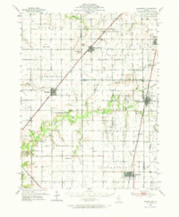
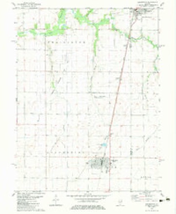
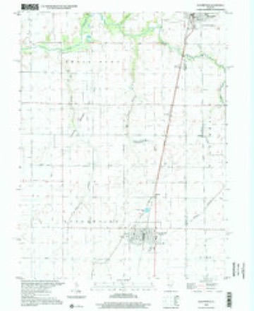
11 topographic sheets cover this place, the earliest surveyed in 1952 and the latest in 1998. It stands in Moweaqua Township. It lies in ZIP code area 62550. The Survey maps it on the Assumption quadrangle.
Topographic sheets covering this place
6 surveys from 11 printed sheetsMatched by testing this settlement's coordinate against the published boundary of every sheet in the United States Geological Survey's historical collection. Each opens the scanned sheet at the Survey.
- 1952 USGS Assumption quadrangle1:62500, 2 printings
- 1958 USGS Decatur quadrangle1:250000, 3 printings
- 1961 USGS Decatur quadrangle1:250000, 2 printings
- 1982 USGS Assumption quadrangle1:24000
- 1985 USGS Springfield quadrangle1:100000, 2 printings
- 1998 USGS Assumption quadrangle1:24000



In the county-history sources
6,248 words on this townshipShelby County in the World War, published 1919 names this settlement in its chapter on Moweaqua Township. These are the passages that mention it, exactly as the scans read.
The Christmas Seals campaign was waged each year in the county seat and the county at large. In 1917 the sales were very gratifying. Incidents illustrating the alacrity with which the Seals were purchased include the following: Miss Catherine Anderson, teacher of the Empire school in the western part of the county, originally was furnished 500 Seals. She soon ordered 1,000 more. Miss Margaret Welch of the schools in Moweaqua, where again and again it was demonstrated the people were 100 per cent patriotic, telephoned to headquarters for 2,700 Seals additional to her allotment. Miss Hester Clem of Ash Grove asked for a 500 per cent increase in her allotment. Mrs. Matthew Maurer of Rural ordered double the number she first received, Windsor called for an additional 2.000, and Findlay 3,000.
Passage source: Shelby County in the World War, published 1919.
The Moweaqua Branch, organized May 31, 1917, and with a Woman's Auxiliary formed at the same time, has the county record, outside of Shelbyville, for the amount of funds raised for the work of the Red Cross. Moweaqua's total cash donations amounted to $7,978.06, of which $6,674.61 was derived from a Red Cross sale on May 4, 1918. The membership of the Moweaqua Branch the first year of its organization was 438, while in the second year it was 266. Fifty-three Christmas boxes were sent overseas, many sweaters, helmets, socks and other articles were furnished the soldiers direct, while 1,000 garments were made. The Branch has the distinction of sending two nurses into the field, one of them across seas and the other into the home service. These are Miss Minnie Snyder and Miss Ethel Yantis, whose records are given elsewhere in this volume. The officers of the regular Branch were: Chairman, Dr. J. L. Sparling; secretary, Miss Aileen Day; treasurer, K. R. Snyder. The officers of the Woman's Auxiliary were: Chairman, Mrs B. F. Stults; secretary, Miss Aileen Day; treasurer, Miss Mattie Snell.
Passage source: Shelby County in the World War, published 1919.
Machine-read from a century-old scan, so expect the errors a machine makes: misspelled names, dropped words, stray characters.
Storms near this place
27 since 1994Regional context, not property-specific evidence. The National Weather Service names Moweaqua in 27 storm reports between 1994 and 2026: 10 thunderstorm wind, 8 hail, 6 flash flood, 2 tornado. No death or injury is recorded in these reports. Each account below is quoted exactly as the forecast office filed it, from the NOAA Storm Events Database, and each date opens the federal record of that event.
| When | Event | Place named | Harm | What the report says |
|---|---|---|---|---|
| June 1994 | Thunderstorm Wind | Moweaqua | $5,000,000 | Thunderstorm winds blew down or destroyed over 1,000 trees in Moweaqua. Two homes sustained serious damage and numerous homes had minor damage. Numerous power, telephone, and cable lines were blown down. Property damage was estimated around $750,000 and crop damage around $6 million. |
| December 2015 | Flood | Moweaqua | $1,000,000 | An extended period of heavy rain during the evening of December 26th in Shelby County combined with an already saturated ground to produce flash flooding. Rainfall amounts ranged from 3.65 to 5.20 inches in less than six hours, with the heaviest rain in the western half of the county. Most rural roads and state highways were flooded and impassable. City streets in Shelbyville were also flooded. The flooding continued through all of December 27th. Additional rainfall of 1.75 to 3.75 from December 28th into the 29th aggravated the flooding situation significantly. The towns of Windsor, Tower Hill, Oconee and Shelbyville had the most flood damage to roads and basements. Every road in the county was flooded, until the water finally subsided by the afternoon of December 31st, more than four days after it started. |
| July 2008 | Thunderstorm Wind | Moweaqua | $25,000 | A barn was destroyed near Moweaqua. |
| June 2009 | Thunderstorm Wind | Moweaqua | $15,000 | Multiple tree limbs were blown down in Moweaqua. |
| April 1998 | Hail | Moweaqua | $5,000 | Golfball sized hail fell in an area between Moweaqua and Findlay. It shredded a patio roof, shattered a windshield of a sheriff deputy's car, and dented several vehicles. Also, the hail broke out several windows on a barn 4 miles north of Findlay. No injuries were reported and damage was estimated around $5,000. |
| June 1998 | Thunderstorm Wind | Moweaqua | $300 | Trees, tree limbs, and power lines were blown down in an area extending from Moweaqua to Windsor. In Windsor, one tree fell onto some playground equipment causing approximately $300 in damage. No injuries were reported. |
| May 2024 | Thunderstorm Wind | Moweaqua | - | Large seed boxes were toppled and several tree branches were blown down on a farm south of Moweaqua. |
| August 2021 | Flash Flood | Moweaqua | - | A quarter-mile stretch of a county road was under water southeast of Moweaqua. |
| June 2019 | Flash Flood | Moweaqua | - | Heavy rainfall of 2.50 to 4.00 inches on already saturated ground resulted in flash flooding across much of Shelby County during the morning of June 22nd. Many rural roads were flooded, as were parts of Illinois Routes 128 and 16. The flooded subsided just before Noon. |
| August 2019 | Tornado (EF0) | Moweaqua | - | This tornado crossed from Christian County into far western Shelby County about 6.4 miles south of Moweaqua at 9:43 PM CDT. Significant crop damage occurred near the county line before the tornado dissipated just before reaching County Road 700 East at 9:44 PM CDT. |
| December 2015 | Flash Flood | Moweaqua | - | An extended period of heavy rain during the evening of December 26th in Shelby County combined with an already saturated ground to produce flash flooding. Rainfall amounts ranged from 3.65 to 5.20 inches in less than six hours, with the heaviest rain in the western half of the county. Most rural roads and state highways were flooded and impassable. City streets in Shelbyville were also flooded. |
| June 2010 | Flash Flood | Moweaqua | - | Rainfall amounts around 2.00 overnight fell on already saturated ground. This resulted in widespread flash flooding across northern Shelby County. Rural roads, especially those in the vicinity of Lake Shelbyville, were impassable. |
| September 2010 | Flash Flood | Moweaqua | - | Heavy rainfall rates of 1.00 to 1.50 per hour for three hours in the late evening resulted in flash flooding across the northern half of Shelby County. State highway 16 and 128 both had nearly a foot of flowing water, and most other rural roads were impassable due to the heavy rain. |
| June 2009 | Thunderstorm Wind | Moweaqua | - | Numerous tree limbs were blown down in Moweaqua. |
| February 2006 | Thunderstorm Wind | Moweaqua | - | Thunderstorm winds blew down a few power poles. Three quarter inch hail was also reported. |
| May 2004 | Flash Flood | Moweaqua | - | Several streets in Moweaqua were flooded due to heavy rainfall. |
| May 2004 | Thunderstorm Wind | Moweaqua | - | Thunderstorm winds blew a 16' by 20' door off a barn, knocked a chimney over, and blew down numerous large tree limbs. |
| May 2003 | Thunderstorm Wind | Moweaqua | - | Several trees were blown down. |
| August 2000 | Thunderstorm Wind | Moweaqua | - | Several trees were blown down. |
| April 1998 | Tornado (F0) | Moweaqua | - | A tornado briefly touched down in a field 4 miles east of Moweaqua. No injuries or damage were reported. |
| March 2026 | Hail | Moweaqua | - | no account filed |
| May 2009 | Hail | Moweaqua | - | no account filed |
| June 2006 | Hail | Moweaqua | - | no account filed |
| May 2004 | Hail | Moweaqua | - | no account filed |
| May 2003 | Hail | Moweaqua | - | no account filed |
| April 2000 | Hail | Moweaqua | - | no account filed |
| February 1996 | Hail | Moweaqua | - | no account filed |
Nearest settlements
The eight closest, with where each one stands in the county. Distances are straight-line, computed from the Geographic Names Information System coordinates.
| Map | Place | Distance | Sheets |
|---|---|---|---|
| Pleak | 4.7 miles | 11 | |
| Obed | 7.4 miles | 11 | |
| Prairie Home | 9.2 miles | 11 | |
| Yantisville | 9.4 miles | 11 | |
| Henton | 12.7 miles | 13 | |
| Dollville | 13.0 miles | 13 | |
| Westervelt | 13.1 miles | 14 | |
| Todds Point | 13.8 miles | 11 |
Provenance
This settlement is recorded in the Geographic Names Information System as feature 414154. The sheet list is computed by point-in-boundary test against the United States Geological Survey's historical topographic inventory. Both are works of the United States government and carry no copyright under 17 U.S.C. 105.
Storms. NOAA National Centers for Environmental Information, Storm Events Database https://www.ncei.noaa.gov/stormevents/ A work of the United States government, no copyright under 17 U.S.C. 105. Narratives are quoted verbatim from the National Weather Service report and are not edited or summarised.