 Block
Peru, Illinois
19 topographic sheets cover this place, the earliest surveyed in 1893 and the latest in 1985. It stands in Peru Township. It lies in ZIP code area 61354. It stands on Cedar Creek. The Survey maps it on the Spring Valley quadrangle.
Research this city
On record in Peru
Buildings and businesses the archive holds for this place. Each opens its own page, with the source record it came from.
On the National Register 1 record
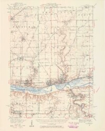
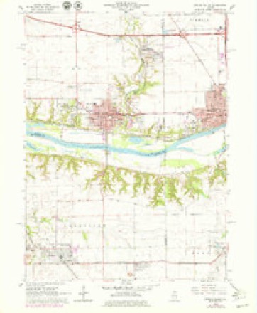
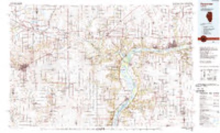
Topographic sheets covering this place
9 surveys from 19 printed sheetsMatched by testing this settlement's coordinate against the published boundary of every sheet in the United States Geological Survey's historical collection. Each opens the scanned sheet at the Survey.
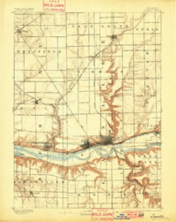
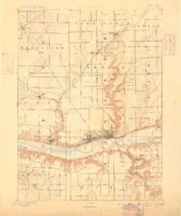
- 1893 USGS La Salle quadrangle1:62500, 2 printings
- 1893 USGS Lasalle quadrangle1:62500, 2 printings
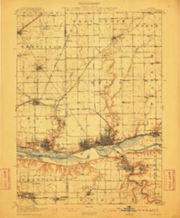
- 1911 USGS La Salle quadrangle1:62500
- 1913 USGS La Salle quadrangle1:62500, 4 printings
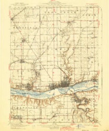
- 1947 USGS La Salle quadrangle1:62500, 2 printings
- 1958 USGS Aurora quadrangle1:250000, 3 printings
- 1961 USGS Aurora quadrangle1:250000
- 1966 USGS Spring Valley quadrangle1:24000, 2 printings
- 1985 USGS Kewanee quadrangle1:100000, 2 printings


In the county-history sources
2,272 words on this townshipHistory of LaSalle County, Illinois : Its Topography, Geology, Botany, Natural History, History of the Mound Builders, Indian Tribes, French Explorations, and a Sketch of the Pioneer Settlers of Each Town to 1840, with an Appendix, Giving the Present Status of the County, Its Population, Resources, Manufactures and Institutions, published 1877 names this settlement in its chapter on Peru Township. These are the passages that mention it, exactly as the scans read.
Pern embraces the west half of Township 33, Range 1, and lies on both sides of the [linois river, while the east half of the township constitutes its sister town of La Salle. The city of Peru is on the north side of the river at the foot and on the bluff, Its commercial advantages are scarcely inferior to those of its rival - La Salle. The Chicago & Rock Island Railroad passes through it from east to west, and the river trade passes its levee and warehouses as it goes to und from the busin ab La Salle, The long and bitter contest to secure the termination of the Canal was decided in favor of La Salle, not because it offered euperior advantages, but because it was located on canal land belonging to the State, The two cities are practically one, and will eventually be included in one municipal government. The location is commanding and important, not only in reference to the County, but to the State and Nation. The rich and heavy deposit of coal, and facilities for transportation, will make it one of the largest manufacturing cities in the West. Its
Lyman D. Brewster came from Nashville, Tenn. Th 1892, he traveled on horseback from Nashville, throngh Ottawa and Chicago, to Salisbury, Ct.; he returned and settled at Peru in 1834, and died at where Peru now is, in 1884; sold his claim to Kinney & Spaulding, and went to Hennepin, where he married the daughter of Dr. Pulsifer; came back to Pern in 1843, and kept a store ti 1867 or *69, then moved to Vineland, New Jersey, where he now resides.
Ulysses Spaulding came from Tennessee in 1834; engaged in selling goods with Kinney; died in 1836 ; was Justice of the Peace, and kept a grocery store, Left two sons and two daughters - one married Mr. Coffling, of Peru. Widow died in 1860.
Machine-read from a century-old scan, so expect the errors a machine makes: misspelled names, dropped words, stray characters.
Read the whole chapter on Peru Township - it names this place 15 more 15 times.
Fires near this place
22 since 2010Regional context, not property-specific evidence. The federal wildfire occurrence database lists 22 fires within 5 miles of Peru between 2010 and 2019, burning about 236 acres in total. None started naturally. None was recorded as arson. Distance is straight-line from the map coordinates, so a fire counted here may appear on a neighbouring settlement's page as well.
| Reported cause | Fires |
|---|---|
| Missing data/not specified/undetermined | 14 |
| Debris and open burning | 6 |
| Smoking | 2 |
The most recent of them, most recent first, with the day each was reported and the service that recorded it.
| Date | Cause | Size | Reported by | Name on the report |
|---|---|---|---|---|
| 3 August 2019 | Smoking | under an acre | Illinois Division of Forestry Resources | 19-00092 |
| 28 August 2010 | Missing data/not specified/undetermined | under an acre | Illinois Division of Forestry Resources | 1063 |
| 6 July 2019 | Missing data/not specified/undetermined | under an acre | Illinois Division of Forestry Resources | 19-00080 |
| 28 July 2019 | Missing data/not specified/undetermined | 1.0 acres | Illinois Division of Forestry Resources | 19-00089 |
| 10 July 2014 | Debris and open burning | 1.0 acres | Illinois Division of Forestry Resources | 14-0000049 |
| 17 June 2015 | Missing data/not specified/undetermined | 3.0 acres | Illinois Division of Forestry Resources | 15-0000065 |
| 3 May 2015 | Missing data/not specified/undetermined | 2.0 acres | Illinois Division of Forestry Resources | 15-0000051 |
| 27 May 2010 | Missing data/not specified/undetermined | under an acre | Illinois Division of Forestry Resources | 1046 |
Settlements close enough to share some of these fires:
Mines and quarries near this place
10 within 5 milesRegional context, not property-specific evidence. The federal mineral resources record lists 10 workings within 5 miles of Peru: 6 past producers, 4 producers. 4 still produce. What was taken out: Stone, Crushed/Broken, Sand and Gravel, Construction, Stone. Distance is straight-line from the map coordinates, so a quarry counted here may appear on a neighbouring settlement's page as well.
| Where | Site | Commodity | Status | Recorded |
|---|---|---|---|---|
| Lasalle City Pit | Stone | Past Producer | ||
| Alpha Cement Pitmertel Gravel Co. | Sand and Gravel, Construction | Producer | ||
| Bonucci Gravel Pit | Sand and Gravel, Construction | Producer | ||
| Bonucci Gravel Pit | Sand and Gravel, Construction | Past Producer | ||
| Sitterly Pit | Sand and Gravel, Construction | Past Producer | ||
| Alpha Portland Quarry | Stone, Crushed/Broken | Past Producer | ||
| Lasalle Quarry & Mill | Stone, Crushed/Broken | Producer | ||
| Lehigh Portland Quarry | Stone, Crushed/Broken | Past Producer | ||
| Lone Star-Oglesby Quarry & Mill | Stone, Crushed/Broken | Producer | ||
| Marquette Quarry | Stone, Crushed/Broken | Past Producer |
Storms near this place
59 since 1995Regional context, not property-specific evidence. The National Weather Service names Peru in 59 storm reports between 1995 and 2025: 35 thunderstorm wind, 13 hail, 4 flash flood, 3 lightning. The reports record 8 deaths and 7 injuries. Each account below is quoted exactly as the forecast office filed it, from the NOAA Storm Events Database, and each date opens the federal record of that event.
| When | Event | Place named | Harm | What the report says |
|---|---|---|---|---|
| April 2004 | Tornado (F3) | Peru | 8 killed, 7 hurt | The tornado entered LaSalle County from Putnam County, approximately 3 miles northeast of the town of Standard, producing F0 intensity damage in a wooded area southwest of Peru. As the tornado continued northeast, F2 intensity damage was done to several homes in a subdivision near the intersection of East 250th and 2569th Roads. Several roofs were blown off homes along with damage to external walls. Significant tree damage was done as well. Path width was estimated at 50 yards at this location. The tornado then continued northeast, crossing the Illinois River twice as it moved toward the town of Utica, downing a steel high tension tower on the north bank of the river, immediately west of Illinois 251. The tornado moved into the southwest side of Utica where it was F0 intensity. Homes along Washington Street only had tree and minor roof damage. A church steeple was damaged on Division between Johnson and Washington. Roofs and trees were more severely damaged on the south side of Johnson Street. The tornado rapidly increased to F3 intensity on the north side of Johnson Street where one home had its roof taken off and north walls blown out. A machinery building was completely destroyed on the south side of the canal and a semi-tractor trailer was blown into the canal. A large grain bin was blown across the canal and flattened. The tornado then moved north of the canal into the heart of town where several homes were severely damaged, garages were destroyed and brick buildings collapsed. Eight people died and seven were rescued from the basement of a turn of the century sandstone building at Clark and Church Streets. The tornado was approximately 250 yards wide at this point. On the east edge of the vortex along Mill Street, in downtown, buildings suffered damage to facades, roofs and windows. East of Mill Street there was damage to trees and minor roof damage. In the northeast section of town a mobile home was overturned on Grove, just east of Mill Street. The vortex crossed the railroad tracks and apparently dissipated on a steep bluff on the northeast side of town. At the top of the hill there were some trees and limbs down and some debris deposited. See Storm Data for Northwest and Central Illinois for results of Tornado Damage Survey for Putnam and Bureau Counties, IL |
| October 2006 | Thunderstorm Wind | Peru | $50,000 | A roof was blown off a hotel in downtown Peru. |
| June 2013 | Thunderstorm Wind | Peru | $25,000 | A semi truck was flipped over by winds on Interstate 80 near mile marker 75. |
| August 2007 | Lightning | Peru | $20,000 | Lightning struck a house in Peru, which started a fire in the attic causing damage to the house. |
| June 2007 | Thunderstorm Wind | Peru | $15,000 | Several trees snapped in half or blown over. Siding and shingles were ripped off of a house and heavy yard objects were tossed around. A section of a plastic fence was broken and tossed. Damage confined to a small area near the intersection of Shooting Park Road and Peoria Street. |
| August 2007 | Lightning | Peru | $5,000 | Lightning struck in a parking lot, near a hospital causing a power surge which activated pumps in a laundry room, causing a bleach spill. Several patients had to be relocated away from the fumes. |
| August 1995 | Thunderstorm Wind | Peru | $5,000 | Severe thunderstorms developed across Lee, La Salle and Grundy Counties in the mid to late afternoon. Funnel clouds were sighted near Wedron and a tornado was reported north of Marseilles but there was no report of damage from the tornado. The storm also dropped large hail at Wedron and Seneca. Trees and limbs were blown down in and around Seneca and in Marseilles. Another storm produced large hail in western La Salle County in the La Salle-Peru area. Another storm developed at the Lee-La Salle County line. Corn was flattened north of Mendota. The storm built southward and later damaged an air conditioner and the roof of a JC Penney store at a mall in Peru. |
| August 2011 | Flash Flood | Peru | $2,000 | Very heavy rain fell across parts of La Salle county during the afternoon of August 8th. A rainfall amount of 2.03 inches was measured in just 45 minutes along the border between Peru and La Salle. Many streets were flooded including Marquette Road in Peru. Water was shooting about 7 feet in the air from a manhole cover near First and Bucklin Streets. Portions of asphalt pavement were curled up after flowing water lifted portions of Tonti Street in La Salle. |
| July 2025 | Thunderstorm Wind | Peru | - | Wind gusts were estimated between 60 and 70 mph. |
| August 2025 | Flash Flood | Peru | - | Street flooding was reported at 26th St and Marquette Rd. |
| July 2024 | Thunderstorm Wind | Peru | - | Trees and power lines were blown down throughout Peru. |
| March 2023 | Thunderstorm Wind | Peru | - | Power poles were downed near the LaSalle-Bureau county line in Peru. Wind magnitude and time were estimated based on radar. |
| July 2022 | Thunderstorm Wind | Peru | - | Tree limbs were blown down. |
| July 2022 | Heavy Rain | Peru | - | A private weather station measured 3.75 inches of rain in 84 minutes. |
| August 2020 | Thunderstorm Wind | Peru | - | Trees, tree limbs and power lines were blown down in Peru and La Salle. Some roads were blocked by fallen trees. |
| June 2020 | Thunderstorm Wind | Peru | - | A wind gust to 72 mph was measured at WLPO. |
| June 2020 | Thunderstorm Wind | Peru | - | A large tree was blown down and corn stalks were bent over. |
| July 2017 | Hail | Peru | - | Ping Pong Ball sized hail was reported near Shooting Park Road. |
| August 2017 | Thunderstorm Wind | Peru | - | Wind gusts were estimated at 60 mph. |
| June 2015 | Thunderstorm Wind | Peru | - | Tree limbs seven inches in diameter were snapped. |
| May 2011 | Flash Flood | Peru | - | Several inches of flowing water was reported on many streets in Peru including Green, Calhoun, Second and Water Streets. U.S. Route 6 was closed for a short time due to flooding. A manhole cover was lifted up and out of its fitting onto First Street in LaSalle. Storm total rainfall of 3.52 inches was measured in LaSalle. |
| April 2011 | Hail | Peru | - | Golfball sized hail was reported on Interstate 80 near the La Salle/Bureau County line. |
| April 2011 | Hail | Peru | - | Hail to the size of quarters was reported two miles west of Peru. |
| September 2011 | Thunderstorm Wind | Peru | - | Wind gusts were estimated to 60 mph. |
| July 2010 | Thunderstorm Wind | Peru | - | A wind gust to 70 mph was estimated along Route 251 about one half mile south of Interstate 80. |
| April 2009 | Hail | Peru | - | Penny to nickel size hail was reported at the intersection of 4th Street and Cross Street in Peru. |
| August 2009 | Heavy Rain | Peru | - | Rainfall of 3.02 inches was reported in the past 24 hours. |
| July 2008 | Thunderstorm Wind | Peru | - | A wind gust was measured to 63 mph at Illinois Valley Regional Airport. |
| July 2008 | Thunderstorm Wind | Peru | - | Significant tree damage was reported in Peru. |
| May 2008 | Thunderstorm Wind | Peru | - | Large tree limbs were blown down. |
| June 2008 | Hail | Peru | - | Nickel size hail lasted for six minutes. |
| May 2008 | Thunderstorm Wind | Peru | - | Large construction message boards were blown over on Interstate 80, near the LaSalle County line. |
| July 2008 | Thunderstorm Wind | Peru | - | A gust to 69 mph was measured at the Illinois Valley Regional Airport. |
| July 2008 | Thunderstorm Wind | Peru | - | Damage was reported to several trees and to outdoor lawn furniture. |
| August 2007 | Flash Flood | Peru | - | Progress Blvd at Route 251 flooded. Several streets closed by mudslides along the Illinois River, 2.65 inches of rain measured in Peru. |
| August 2007 | Thunderstorm Wind | Peru | - | Several large trees down blocking Shooting Park Road. |
| August 2007 | Thunderstorm Wind | Peru | - | A gust to 58 mph was measured at the Illinois Valley Regional Airport, west of Peru. |
| September 2005 | Lightning | Peru | - | Lightning struck a the steeple of a church in Peru. Shards of wood and shingles were scattered around the church from the strike. Several pieces tore through the roof of the church. |
| April 2004 | Hail | Peru | - | Reported by NWS cooperative observer. |
| July 2004 | Thunderstorm Wind | Peru | - | Wind gust estimated by co-op observer, knocking down trees. |
| May 2003 | Tornado (F0) | Peru | - | A weak tornado touched down about two miles north of Peru and lasted one minute. Some debris was reported along Route 251. |
| July 2003 | Thunderstorm Wind | Peru | - | The Peru AWOS measured a gust to 59 mph. |
| March 1998 | Thunderstorm Wind | Peru | - | Winds to 50 mph were reported at Peru by the Peru police. Strong winds downed power lines and trees. |
| May 2017 | Thunderstorm Wind | Peru | - | no account filed |
| March 2016 | Hail | Peru | - | no account filed |
| July 2016 | Thunderstorm Wind | Peru | - | no account filed |
| June 2013 | Thunderstorm Wind | Peru | - | no account filed |
| November 2013 | Thunderstorm Wind | Peru | - | no account filed |
| June 2011 | Thunderstorm Wind | Peru | - | no account filed |
| September 2011 | Thunderstorm Wind | Peru | - | no account filed |
| November 2010 | Hail | Peru | - | no account filed |
| June 2010 | Thunderstorm Wind | Peru | - | no account filed |
| June 2008 | Hail | Peru | - | no account filed |
| June 2008 | Hail | Peru | - | no account filed |
| July 2008 | Hail | Peru | - | no account filed |
| April 2004 | Hail | Peru | - | no account filed |
| May 2000 | Thunderstorm Wind | Peru | - | no account filed |
| June 1999 | Thunderstorm Wind | Peru | - | no account filed |
| April 1996 | Hail | Peru | - | no account filed |
Nearest settlements
The eight closest, with where each one stands in the county. Distances are straight-line, computed from the Geographic Names Information System coordinates.
| Map | Place | Distance | Sheets |
|---|---|---|---|
| La Salle | 2.0 miles | 21 | |
| Piety Hill | 3.0 miles | 21 | |
| Jonesville | 3.2 miles | 21 | |
| Oglesby | 4.3 miles | 21 | |
| Tomahawk Bluff | 4.4 miles | 20 | |
| Little Rock (historical) | 4.4 miles | 21 | |
| Cedar Point | 4.4 miles | 19 | |
| Deer Park | 5.4 miles | 21 |
Provenance
This settlement is recorded in the Geographic Names Information System as feature 415574. The sheet list is computed by point-in-boundary test against the United States Geological Survey's historical topographic inventory. Both are works of the United States government and carry no copyright under 17 U.S.C. 105.
Wildfire. Short, Karen C. 2022. Spatial wildfire occurrence data for the United States, 1992-2020 [FPA_FOD_20221014]. 6th Edition. Fort Collins, CO: Forest Service Research Data Archive. https://doi.org/10.2737/RDS-2013-0009.6 Collected with United States Government funding and usable without additional permissions or fees.
Mines and quarries. USGS Mineral Resources Data System (MRDS) https://mrdata.usgs.gov/mrds/ A work of the United States government, no copyright under 17 U.S.C. 105.
Storms. NOAA National Centers for Environmental Information, Storm Events Database https://www.ncei.noaa.gov/stormevents/ A work of the United States government, no copyright under 17 U.S.C. 105. Narratives are quoted verbatim from the National Weather Service report and are not edited or summarised.