 Block
Rochelle, Illinois
11 topographic sheets cover this place, the earliest surveyed in 1952 and the latest in 1993. It stands in Flagg Township. It lies in ZIP code area 61068. It stands on Creston Ditch. The Survey maps it on the Rochelle quadrangle. 9,446 people lived here at the 2020 count. It stands 823 feet above sea level.
On record in Rochelle
Buildings and businesses the archive holds for this place. Each opens its own page, with the source record it came from.
On the National Register 4 records
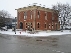 City and Town Halllisted 1992
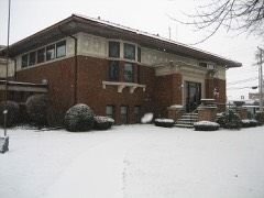 Flagg Township Public Librarylisted 1973
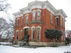 William H. Holcomb Houselisted 1973
- Rochelle Downtown Historic Districtlisted 2018
Population over time
2 figuresRochelle fell from 9,574 to 9,446 between 2010 and 2020. These are the recorded population figures Wikidata holds for this place, reached through the Geographic Names Information System number this page is keyed on rather than by name, so they belong to this place and not to another of the same name. Most are census counts, but not all are: an early figure may be a founding or settlement estimate, and an estimate published within five years of a census is left out. The change column is computed, and is left blank where more than 20 years separate a figure from the one before it, because a gap that long is not a change between two counts.
| Year | People | Change |
|---|---|---|
| 2010 | 9,574 | |
| 2020 | 9,446 | -128 (-1%) |
Topographic sheets covering this place
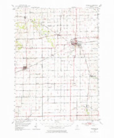
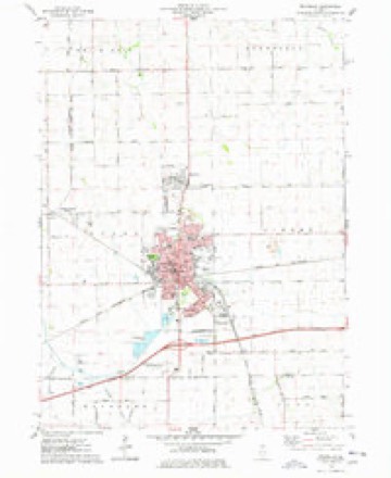
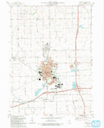
6 surveys from 11 printed sheetsMatched by testing this settlement's coordinate against the published boundary of every sheet in the United States Geological Survey's historical collection. Each opens the scanned sheet at the Survey.
- 1952 USGS Rochelle quadrangle1:62500, 3 printings
- 1958 USGS Aurora quadrangle1:250000, 3 printings
- 1961 USGS Aurora quadrangle1:250000
- 1975 USGS Rochelle quadrangle1:24000
- 1985 USGS Dixon quadrangle1:100000, 2 printings
- 1993 USGS Rochelle quadrangle1:24000



In the county-history sources
16,079 words on this townshipThe History of Ogle County, Illinois, Containing a History of the County, Its Cities, Towns, Etc., a Biographical Directory of Its Citizens, War Record of Its Volunteers in the Late Rebellion, General and Local Statistics ... History of the Northwest, History of Illinois ... Etc, published 1878 names this settlement in its chapter on Flagg Township. These are the passages that mention it, exactly as the scans read.
AUSTIir JOHIf W. Farmer; Sec. 6; P. O. Rochelle; born July 11, 1840, in Knox Co., O. ; came with his parents to Ogle Co. in 1849; owns 125 acres land, valued at $60 per acre; married Rachel Horton Nov. 29, 1866 ; she was born Sept. 9, 1844, in Bradford Co., Pa. ; have three children: Eddie, born April 19, 1868; Alta May, June 11, 1873, and Baby (not named) born July 8, 1877 ; Mrs. A. is a member of the Baptist Church; her father, Ithiel Horton, and mother live in Lee Co. with their three sons and one daughter; ihey were both born in Bedford Co., Pa.
Passage source: The History of Ogle County, Illinois, Containing a History of the County, Its Cities, Towns, Etc., a Biographical Directory of Its Citizens, War Record of Its Volunteers in the Late Rebellion, General and Local Statistics ... History of the Northwest, History of Illinois ... Etc, published 1878.
BEWXETT C. C. Express Agent; resides corner Grant and Chapin Streets; born Sept. 28, 1835, at Lockport, N. Y.; moved to Buffalo, N. Y., in 1837, and in 1852 came to Chicago ; was clerk for A. H. & C. Burley, books, etc. ; in 1856 came to Rochelle and commenced in the drug and book business; has had charge of various branches of business, and in 1871 commenced express business; married Louisa Fulton Oct. 18, 1857 ; she was born in Painesville, Ohio, Aug. 18, 1835 ; they have seven children: William A., Frank B., Clarence W., C. C, Jr., H. B., William Alfred and Ida A. ; has been Deputy Postmaster for about six years.
Passage source: The History of Ogle County, Illinois, Containing a History of the County, Its Cities, Towns, Etc., a Biographical Directory of Its Citizens, War Record of Its Volunteers in the Late Rebellion, General and Local Statistics ... History of the Northwest, History of Illinois ... Etc, published 1878.
BIRD J AS. F. Butter and Produce; residence Washington Street; born April 2, 1836, at Groton, Huron Co., Ohio; came to Freeport in 1856 ; came to Lynnville, Ogle Co , in 1857, and in 1863 came to Dement, thence to Rochelle in 1873; married Jennette A. Payne Oct. 29, 1863 ; she was born Jan. 18, 1844, in Brookfield, Fairfield Co., Conn. ; they have one child, Nellie A., born Feb. 24, 1868.
Passage source: The History of Ogle County, Illinois, Containing a History of the County, Its Cities, Towns, Etc., a Biographical Directory of Its Citizens, War Record of Its Volunteers in the Late Rebellion, General and Local Statistics ... History of the Northwest, History of Illinois ... Etc, published 1878.
Machine-read from a century-old scan, so expect the errors a machine makes: misspelled names, dropped words, stray characters.
Read the whole chapter on Flagg Township - it names this place 91 more 91 times.
Mines and quarries near this place
2 within 5 milesRegional context, not property-specific evidence. The federal mineral resources record lists 2 workings within 5 miles of Rochelle: 1 producer, 1 plant. All of them still produce. What was taken out: Stone, Crushed/Broken. Distance is straight-line from the map coordinates, so a quarry counted here may appear on a neighbouring settlement's page as well.
| Where | Site | Commodity | Status | Recorded |
|---|---|---|---|---|
| Atwood Quarry | Stone, Crushed/Broken | Producer | ||
| Rochelle Quarry & Mill | Stone, Crushed/Broken | Plant |
Storms near this place
45 since 1996Regional context, not property-specific evidence. The National Weather Service names Rochelle in 45 storm reports between 1996 and 2024: 25 thunderstorm wind, 7 hail, 7 flood, 3 lightning. The reports record 2 injuries. Each account below is quoted exactly as the forecast office filed it, from the NOAA Storm Events Database, and each date opens the federal record of that event.
| When | Event | Place named | Harm | What the report says |
|---|---|---|---|---|
| April 2010 | Thunderstorm Wind | Rochelle | 1 hurt, $50,000 | Two semi trucks were blown over along Interstate 39 and one on Interstate 88. One driver was taken to the hospital. |
| June 1998 | Lightning | Rochelle | 1 hurt | A 27 year old man was injured when lightning struck a nearby tree. |
| April 2013 | Thunderstorm Wind | Rochelle | $150,000 | Over a dozen semi trucks either jackknifed or flipped onto their side at the Interstate 39 and 88 interchange in southeast Ogle County. A squall line moved across the interstate causing the strong winds. Nearby, at Rochelle Airport winds were measured to 51 mph, while farther east winds were measured to 56 mph at Northern Illinois University in De Kalb. |
| October 2010 | Thunderstorm Wind | Rochelle | $50,000 | Thunderstorm winds caused damage to a hog confinement building. The roof was lifted off and the underlying wood structure was ripped out and deposited in a field. Winds were estimated at 75 to 80 mph. |
| June 2010 | Thunderstorm Wind | Rochelle | $50,000 | Roof damage was reported at a car dealership and at a country club. |
| June 2008 | Thunderstorm Wind | Rochelle | $50,000 | About a dozen big trees were blown down along with 20 to 30 smaller trees. Numerous tree limbs and power lines were also blown down. Part of the roof of a dealership was blown off. A semi-trailer was blown over on Interstate 39. |
| April 2010 | Lightning | Rochelle | $30,000 | The Rochelle police department's antenna was struck by lightning. The lightning travelled down the antenna and damaged a police car and then damaged all three of their dispatch stations. |
| June 2018 | Lightning | Rochelle | $5,000 | Lightning struck a garage and started a fire. |
| August 2008 | Thunderstorm Wind | Rochelle | $2,000 | A large tree was blown down on Route 38 just east of Route 251. Tree limbs and power lines were blown down across parts of Rochelle. A motorcyclist collided with a tree limb that fell across a road, but no serious injuries were reported. |
| August 2007 | Thunderstorm Wind | Rochelle | $2,000 | A tree limb was blown down onto power lines causing a fire. |
| June 2009 | Thunderstorm Wind | Rochelle | $1,000 | A couple of trees and power lines were blown down. |
| June 2024 | Thunderstorm Wind | Rochelle | - | A 5 inch diameter tree branch was down onto a home causing damage to the porch. |
| July 2024 | Thunderstorm Wind | Rochelle | - | A tree was blown down on Parkview Drive. |
| July 2022 | Thunderstorm Wind | Rochelle | - | Several trees and tree limbs 4 to 6 inches in diameter were blown down. |
| August 2022 | Thunderstorm Wind | Rochelle | - | Large tree limbs estimated to be 8 to 12 inches in diameter were blown down on 9th Avenue and on 9th Street. Numerous large tree limbs were blown down near 10th Avenue and Lincoln Highway. |
| August 2021 | Thunderstorm Wind | Rochelle | - | A private weather station measured a gust to 58 mph in northwest Rochelle. |
| August 2021 | Thunderstorm Wind | Rochelle | - | Tree limbs at least 6 inches in diameter were blown down in southern Rochelle. |
| February 2018 | Flood | Rochelle | - | Several roads in Rochelle were closed due to flooding. |
| September 2018 | Thunderstorm Wind | Rochelle | - | Widespread tree damage was reported in Rochelle. One tree limb fell onto a house causing roof damage. |
| August 2018 | Flood | Rochelle | - | Standing water was estimated a few inches deep in multiple locations in Rochelle. |
| June 2018 | Flash Flood | Rochelle | - | The Kyte River was out of its banks near Route 38. Two storm total rainfall amounts in Rochelle included 4.60 inches and 4.40 inches. |
| June 2018 | Flood | Rochelle | - | Standing water was reported on South 9th Street. |
| July 2017 | Thunderstorm Wind | Rochelle | - | Several tree limbs 4 to 5 feet long and 5 to 6 inches in diameter were blown down. |
| July 2017 | Flood | Rochelle | - | The intersection of Route 251 and 10th Avenue was flooded along with portions of 7th Street. |
| June 2015 | Flood | Rochelle | - | Standing water one to two feet deep was reported near the intersection of Route 38 and Turkington Terrace. |
| November 2013 | Thunderstorm Wind | Rochelle | - | Two semi-trucks were overturned near the I-39 and I-88 interchange. |
| April 2011 | Hail | Rochelle | - | Quarter size hail was reported in Rochelle. |
| June 2010 | Thunderstorm Wind | Rochelle | - | A wind gust to 66 mph was estimated near Interstate 88 and Interstate 39. |
| June 2008 | Thunderstorm Wind | Rochelle | - | Winds gusted to 58 mph in Rochelle. A tree was blown down near Cooper Park. |
| July 2007 | Flood | Rochelle | - | Water bumper deep on Capron Road. Rochelle measured 2.75 inches of rain. |
| August 2007 | Thunderstorm Wind | Rochelle | - | A large tree was blown down. |
| August 2007 | Flash Flood | Rochelle | - | Creek overflowing with two to three inches of water flowing across Interstate 88 near mile marker 89. |
| August 2007 | Flood | Rochelle | - | Up to one foot of water on streets in low spots. |
| August 2006 | Thunderstorm Wind | Rochelle | - | A car was blown off a road on Route 251, north of Rochelle. |
| May 2004 | Thunderstorm Wind | Rochelle | - | Trees were blown down. |
| July 2004 | Thunderstorm Wind | Rochelle | - | Large limbs torn off of trees. |
| June 2004 | Flash Flood | Rochelle | - | Milford Road was flooded south of Twombley Road. |
| April 1999 | Thunderstorm Wind | Rochelle | - | Thundersotm winds blew down trees and large limbs and a power pole on the west side of Rochelle. A semi-tractor trailer was overturned on Interstate 88. |
| June 2018 | Hail | Rochelle | - | no account filed |
| May 2014 | Hail | Rochelle | - | no account filed |
| April 2012 | Hail | Rochelle | - | no account filed |
| March 2000 | Hail | Rochelle | - | no account filed |
| September 2000 | Hail | Rochelle | - | no account filed |
| September 2000 | Hail | Rochelle | - | no account filed |
| June 1996 | Thunderstorm Wind | Rochelle | - | no account filed |
Nearest settlements
The eight closest, with where each one stands in the county. Distances are straight-line, computed from the Geographic Names Information System coordinates.
| Map | Place | Distance | Sheets |
|---|---|---|---|
| Askvig Addition | 1.4 miles | 11 | |
| Hillcrest | 1.9 miles | 11 | |
| Southgate | 2.2 miles | 11 | |
| Highland Estates | 2.5 miles | 11 | |
| Briarwood | 2.8 miles | 11 | |
| Ramsey Acres | 2.9 miles | 11 | |
| Flagg Center | 3.1 miles | 11 | |
| Childers Acres | 3.2 miles | 10 |
Elsewhere
Matched on this settlement's Geographic Names Information System number rather than its name, so it cannot be a different place of the same name in another state.
| Wikipedia article on Rochelle | An encyclopaedic summary. Its text is share-alike, so it is linked here rather than copied. |
| Wikidata item Q575294 | The structured record the population and elevation above come from. Public domain (CC0). |
Provenance
This settlement is recorded in the Geographic Names Information System as feature 416783. The sheet list is computed by point-in-boundary test against the United States Geological Survey's historical topographic inventory. Both are works of the United States government and carry no copyright under 17 U.S.C. 105.
Mines and quarries. USGS Mineral Resources Data System (MRDS) https://mrdata.usgs.gov/mrds/ A work of the United States government, no copyright under 17 U.S.C. 105.
Storms. NOAA National Centers for Environmental Information, Storm Events Database https://www.ncei.noaa.gov/stormevents/ A work of the United States government, no copyright under 17 U.S.C. 105. Narratives are quoted verbatim from the National Weather Service report and are not edited or summarised.