 Block
Savanna, Illinois
24 topographic sheets cover this place, the earliest surveyed in 1892 and the latest in 1984. It stands in Savanna Township. It lies in ZIP code area 61074. It stands on Plum River. The Survey maps it on the Savanna quadrangle. 2,783 people lived here at the 2020 count. It stands 600 feet above sea level.
Research this city
Population over time
2 figuresSavanna fell from 3,062 to 2,783 between 2010 and 2020. These are the recorded population figures Wikidata holds for this place, reached through the Geographic Names Information System number this page is keyed on rather than by name, so they belong to this place and not to another of the same name. Most are census counts, but not all are: an early figure may be a founding or settlement estimate, and an estimate published within five years of a census is left out. The change column is computed, and is left blank where more than 20 years separate a figure from the one before it, because a gap that long is not a change between two counts.
| Year | People | Change |
|---|---|---|
| 2010 | 3,062 | |
| 2020 | 2,783 | -279 (-9%) |
Topographic sheets covering this place
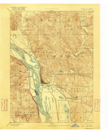
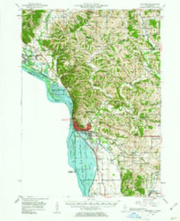
8 surveys from 24 printed sheetsMatched by testing this settlement's coordinate against the published boundary of every sheet in the United States Geological Survey's historical collection. Each opens the scanned sheet at the Survey.
- 1892 USGS Savanna quadrangle1:62500, 8 printings
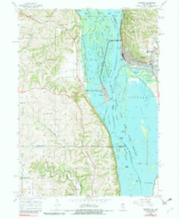
- 1952 USGS Savanna quadrangle1:62500, 3 printings
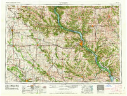
- 1959 USGS Dubuque quadrangle1:250000
- 1961 USGS Dubuque quadrangle1:250000
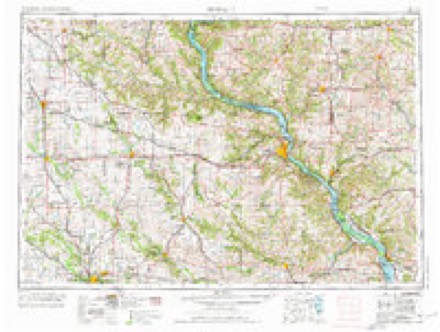
- 1962 USGS Dubuque quadrangle1:250000, 2 printings
- 1967 USGS Savanna quadrangle1:24000, 4 printings
- 1976 USGS Dubuque quadrangle1:250000
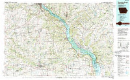
- 1984 USGS Dubuque South quadrangle1:100000, 4 printings
In the county-history sources
5,059 words on this townshipThe History of Carroll County, Illinois, Containing a History of the County-its Cities, Towns, Etc., a Biographical Directory ... War Record ... Statistics, Portraits of Early Settlers and Prominent Men ... History of the Northwest ... Illinois ... Miscellaneous Matters, Etc, published 1878 names this settlement in its chapter on Savanna Township. These are the passages that mention it, exactly as the scans read.
The first settlement by white people within the territory of Carroll County, was made on the land now occupied by the village of Savanna, in the Fall of 1828. That settlement was made by George and Vance L. Davidson, Aaron Pierce and William Blundell and their families, a full history of which will be found in the first pages of this book. Commencing there, settlements extended out in every direction. For many years Savanna was as noted as Galena. Before the days of railroads, it was an important shipping point, and hundreds of the pioneer settlers in this and adjoining counties found their way from their old homes by steamboats to Savanna. After their claims and future homes were selected, it was the point from which they received their supplies, and when they began to raise a surplus of farm products, a market was found byway of Savanna and the Mississippi River. In those days, the farmers from Rockford, Freeport and other points in that direction, came here to dispose of their commodities and buy their lumber, a^d such other necessities as their wants demanded. It is one of the oldest tow ^^^s on the Upper Mississip|)i and as such has a history within itself. Much of th at history has already been written, but there are many things yet to speak about.
Passage source: The History of Carroll County, Illinois, Containing a History of the County-its Cities, Towns, Etc., a Biographical Directory ... War Record ... Statistics, Portraits of Early Settlers and Prominent Men ... History of the Northwest ... Illinois ... Miscellaneous Matters, Etc, published 1878.
Until 1836, no steps were taken towards building a town at this point. In that year, however, Luther H. Bowen, having one year before bought the claim interests of George Davidson and Aaron Pierce, laid off the to<vn of Savanna, and soon after opened a general store. Other trading places soon followed, and in 1839, when Carroll County was organized, Savanna became the countyseat, a distinction it maintained until the re-location of the county seat by a vote of the people, in August, 1843, and the removal of the county offices to Mount Carroll, in September, 1844.
Passage source: The History of Carroll County, Illinois, Containing a History of the County-its Cities, Towns, Etc., a Biographical Directory ... War Record ... Statistics, Portraits of Early Settlers and Prominent Men ... History of the Northwest ... Illinois ... Miscellaneous Matters, Etc, published 1878.
The Methodist peoole had religious services as early as 1836. These services were rendered by circuit riders - a circuit then extendmg over the territory now embraced in perhaps a half a dozen counties. Meeting-houses there were none, but the doors of the settlers' cabins were thrown open, and every body went to church. The most active members of that denominalion wrrc George Davidson and wife, and William Blundell and wife. In iS3S. the Ashby family, ardent and devoted Methodists, came in. and soon after their arriv.il. a class was formed and preaching became more frcpient. In the I-all ol i\;9. a camp meeting was held in the grove about one mile east of town, on land now owned by William L. B. Jcnks. The presiding elder was Rev Mr. w cc« Such were the beginnings of Methodism at Savanna, but the building ol
Passage source: The History of Carroll County, Illinois, Containing a History of the County-its Cities, Towns, Etc., a Biographical Directory ... War Record ... Statistics, Portraits of Early Settlers and Prominent Men ... History of the Northwest ... Illinois ... Miscellaneous Matters, Etc, published 1878.
Machine-read from a century-old scan, so expect the errors a machine makes: misspelled names, dropped words, stray characters.
Read the whole chapter on Savanna Township - it names this place 38 more 38 times.
Fires near this place
16 since 1992Regional context, not property-specific evidence. The federal wildfire occurrence database lists 16 fires within 5 miles of Savanna between 1992 and 2019, burning about 41 acres in total. None started naturally. 2 were recorded as arson. Distance is straight-line from the map coordinates, so a fire counted here may appear on a neighbouring settlement's page as well.
| Reported cause | Fires |
|---|---|
| Missing data/not specified/undetermined | 7 |
| Debris and open burning | 6 |
| Arson/incendiarism | 2 |
| Recreation and ceremony | 1 |
The most recent of them, most recent first, with the day each was reported and the service that recorded it.
| Date | Cause | Size | Reported by | Name on the report |
|---|---|---|---|---|
| 12 June 1992 | Debris and open burning | under an acre | Savanna District, Upper Mississippi National Wildlife Refuge | ISLAND 199 |
| 1 May 2013 | Missing data/not specified/undetermined | 4.1 acres | Savanna District, Upper Mississippi National Wildlife Refuge | SETBACK LEVEE |
| 6 April 2004 | Arson/incendiarism | 7.0 acres | Savanna District, Upper Mississippi National Wildlife Refuge | GOOSEPOINT |
| 5 April 2004 | Missing data/not specified/undetermined | 1.0 acres | Savanna District, Upper Mississippi National Wildlife Refuge | ESMAY SLOUGH |
| 28 April 2018 | Debris and open burning | 1.0 acres | Illinois Division of Forestry Resources | 35 |
| 23 April 2018 | Debris and open burning | 1.0 acres | Illinois Division of Forestry Resources | 31 |
| 23 April 2009 | Debris and open burning | 2.0 acres | Savanna District, Upper Mississippi National Wildlife Refuge | DUCK BLIND 80 |
| 15 April 2009 | Missing data/not specified/undetermined | 2.0 acres | Illinois Division of Forestry Resources | 37 |
Settlements close enough to share some of these fires:
Mines and quarries near this place
10 of 14 shownRegional context, not property-specific evidence. The federal mineral resources record lists 14 workings within 5 miles of Savanna: 8 past producers, 4 producers, 2 occurrences. 4 still produce. What was taken out: Stone, Crushed/Broken, Sand and Gravel, Construction, Limestone, General. Distance is straight-line from the map coordinates, so a quarry counted here may appear on a neighbouring settlement's page as well.
| Where | Site | Commodity | Status | Recorded |
|---|---|---|---|---|
| Lloyde Haas Quarry | Limestone, General | Producer | ||
| Schultz Quarry | Limestone, General | Producer | ||
| Old Nichols Pit | Sand and Gravel, Construction | Past Producer | ||
| Trenkamp Pit | Sand and Gravel, Construction | Past Producer | ||
| Turner Sand Pit | Sand and Gravel, Construction | Producer | ||
| Unknown | Sand and Gravel, Construction | Past Producer | ||
| Hoffman Quarry | Stone, Crushed/Broken | Producer | ||
| Limestone Prospect | Stone, Crushed/Broken | Occurrence | ||
| Limestone Prospect | Stone, Crushed/Broken | Occurrence | ||
| Marshall Quarry | Stone, Crushed/Broken | Past Producer |
Storms near this place
46 since 1996Regional context, not property-specific evidence. The National Weather Service names Savanna in 46 storm reports between 1996 and 2026: 26 thunderstorm wind, 7 hail, 7 flash flood, 2 flood. The reports record 1 injury. Each account below is quoted exactly as the forecast office filed it, from the NOAA Storm Events Database, and each date opens the federal record of that event.
| When | Event | Place named | Harm | What the report says |
|---|---|---|---|---|
| June 2013 | Tornado (EF2) | Savanna | 1 hurt | A NWS Survey team determined that EF2 tornado with maximum winds of 135 mph. The track began 6 miles north of Savanna and ended 4 miles west of Mount Carroll Illinois. The tornado was well defined with significant tree damage. Several farm outbuildings were damaged and one house was pushed off its foundation where the one injury occurred. |
| July 2011 | Flash Flood | Savanna | $250,000 | A large breach in the Portland Avenue Levee on the Plum River caused some flash flooding in parts of Savanna, IL during the evening of July 28 and early morning hours of July 29. |
| August 2008 | Thunderstorm Wind | Savanna | $100,000 | Wind gusts estimated to be 75 mph blew down numerous trees and power lines across Carroll County around 600 pm August 4. Eight trees were blown down at the county fairgrounds, some of which fell on some cars. Several power outages were observed across the county. |
| August 2007 | Thunderstorm Wind | Savanna | $10,000 | Winds estimated to be 70 mph blew down some trees and branches in Savanna, IL. Some landed on power lines and across Scenic Bluff Rd. One tree fell on a car. Delayed report. |
| May 2004 | Thunderstorm Wind | Savanna | $10,000 | Several very large trees down with a carport damaged in the Carroll Heights subdivision up on the bluffs East of the City. |
| June 1999 | Lightning | Savanna | $10,000 | Lightning struck a bell tower at St. Paul's Episcopal Church causing significant smoke and fire damage. |
| July 2017 | Flash Flood | Savanna | $5,000 | Local enforcement reported a mudslide over a portion of Route 84 north of Savanna. The area was deemed unsafe for travel. |
| July 2003 | Thunderstorm Wind | Savanna | $5,000 | Tree limbs down on Illinois 84 |
| June 2006 | Flash Flood | Savanna | $2,000 | U.S. 52 just south of the business district with a few feet of water across it. |
| July 2017 | Flash Flood | Savanna | $1,000 | Local law enforcement reported a gravel road was washed out. |
| July 2006 | Thunderstorm Wind | Savanna | $1,000 | 5 inch diameter limbs down. A spotter several miles away measured a gust of 43 knots (49 mph). |
| June 1998 | Thunderstorm Wind | Savanna | $500 | High winds toppled trees causing minor property damage. |
| April 2026 | Thunderstorm Wind | Savanna | - | Multiple trees downed in town. Relayed through broadcast media. Time estimated using radar data. |
| April 2026 | Thunderstorm Wind | Savanna | - | Large tree blown down. Time estimated from radar data. |
| April 2026 | Tornado (EF1) | Savanna | - | A brief tornado developed northeast of Savanna with maximum winds near 90 mph. The tornado caused tree damage in a convergent path and also tossed and damaged a small shed. |
| July 2025 | Thunderstorm Wind | Savanna | - | A public report of a 70 foot repeater tower knocked down due to high winds. |
| May 2024 | Thunderstorm Wind | Savanna | - | Trees reported blown down. Time estimated from radar data. |
| June 2023 | Thunderstorm Wind | Savanna | - | Trees reported blown down. |
| June 2021 | Thunderstorm Wind | Savanna | - | A tree limb was reported down, along with a powerline. |
| August 2020 | Thunderstorm Wind | Savanna | - | Widespread straight-line winds that produced extensive damage were reported throughout Carroll County, associated with a derecho. These winds lasted around an hour in total in any one location, even though the initial line of storms moved out fast. Damaging straight-line winds continued and were associated with the rear inflow jet. Maximum wind speeds were reported up to 80 mph These estimates were determined based off damage surveys and photos submitted through social media. These strong winds damaged many trees, crops, and a few structures in their path. |
| June 2019 | Thunderstorm Wind | Savanna | - | Emergency Manager reported trees and power lines down. |
| August 2015 | Flash Flood | Savanna | - | Law enforcement reported a road was washed out due to flash flooding southeast of Savanna. The time of the event was estimated from radar. |
| September 2015 | Flash Flood | Savanna | - | Several inches of rain resulted in many road closures due to water, mud and debris over the roadways. |
| May 2014 | Hail | Savanna | - | Quarter sized hail fell in Savanna, IL at 831 pm CDT May 20. |
| August 2012 | Thunderstorm Wind | Savanna | - | Emergency Manager reported power lines down across Carroll County. |
| May 2009 | Flash Flood | Savanna | - | Heavy rains resulted in flooding of a low lying railroad underpass near Savanna, IL during the evening of May 13. |
| March 2007 | Thunderstorm Wind | Savanna | - | Law enforcement reported trees down across a road 1N Savanna. |
| July 2007 | Thunderstorm Wind | Savanna | - | Winds estimated to be 65 mph blew down several trees onto Chicago Ave. |
| June 2006 | Heavy Rain | Savanna | - | ponding of water on streets with depths of 1 to 4 inches; estimated 3 inches of rain |
| July 2002 | Thunderstorm Wind | Savanna | - | Several trees blown down. |
| September 2001 | Thunderstorm Wind | Savanna | - | Thunderstorm wind gusts to 60 mph downed trees and limbs. Reported by law enforcement. |
| June 1999 | Thunderstorm Wind | Savanna | - | Several 15 inch diameter trees uprooted. |
| June 1999 | Thunderstorm Wind | Savanna | - | Thunderstorm winds gusting over 60 mph blew down several large trees. |
| March 1998 | Thunderstorm Wind | Savanna | - | Trees and power lines were down across Route 40 East of Savanna. |
| March 1998 | Thunderstorm Wind | Savanna | - | Large blown down tree was blocking Wacker Road. |
| August 1997 | Thunderstorm Wind | Savanna | - | A line of strong to severe thunderstorms pushed through the area. Winds at Savanna were measured with a peak wind gust to 65 mph. |
| July 2025 | Hail | Savanna | - | no account filed |
| July 2009 | Hail | Savanna | - | no account filed |
| April 2008 | Flood | Savanna | - | no account filed |
| April 2002 | Hail | Savanna | - | no account filed |
| September 2002 | Thunderstorm Wind | Savanna | - | no account filed |
| June 2000 | Flood | Savanna | - | no account filed |
| June 1999 | Hail | Savanna | - | no account filed |
| August 1998 | Thunderstorm Wind | Savanna | - | no account filed |
| April 1997 | Hail | Savanna | - | no account filed |
| April 1996 | Hail | Savanna | - | no account filed |
Nearest settlements
The eight closest, with where each one stands in the county. Distances are straight-line, computed from the Geographic Names Information System coordinates.
| Map | Place | Distance | Sheets |
|---|---|---|---|
| Ayers | 3.5 miles | 21 | |
| Marcus | 4.9 miles | 23 | |
| Hickory Grove | 5.3 miles | 21 | |
| Center Hill | 5.9 miles | 21 | |
| Wacker | 6.4 miles | 21 | |
| Arnold | 6.4 miles | 23 | |
| Burke | 7.0 miles | 21 | |
| Blackhawk | 7.3 miles | 23 |
Elsewhere
Matched on this settlement's Geographic Names Information System number rather than its name, so it cannot be a different place of the same name in another state.
| Wikipedia article on Savanna | An encyclopaedic summary. Its text is share-alike, so it is linked here rather than copied. |
| Wikidata item Q539292 | The structured record the population and elevation above come from. Public domain (CC0). |
Provenance
This settlement is recorded in the Geographic Names Information System as feature 418038. The sheet list is computed by point-in-boundary test against the United States Geological Survey's historical topographic inventory. Both are works of the United States government and carry no copyright under 17 U.S.C. 105.
Wildfire. Short, Karen C. 2022. Spatial wildfire occurrence data for the United States, 1992-2020 [FPA_FOD_20221014]. 6th Edition. Fort Collins, CO: Forest Service Research Data Archive. https://doi.org/10.2737/RDS-2013-0009.6 Collected with United States Government funding and usable without additional permissions or fees.
Mines and quarries. USGS Mineral Resources Data System (MRDS) https://mrdata.usgs.gov/mrds/ A work of the United States government, no copyright under 17 U.S.C. 105.
Storms. NOAA National Centers for Environmental Information, Storm Events Database https://www.ncei.noaa.gov/stormevents/ A work of the United States government, no copyright under 17 U.S.C. 105. Narratives are quoted verbatim from the National Weather Service report and are not edited or summarised.