 Block
Shiloh, Illinois
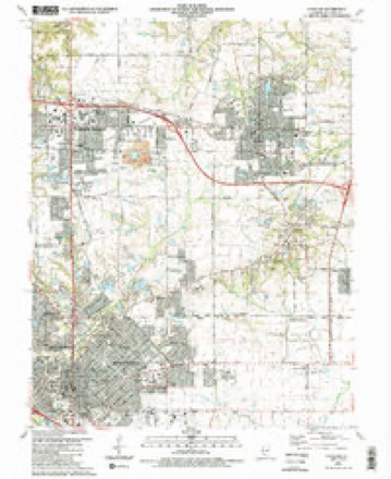
17 topographic sheets cover this place, the earliest surveyed in 1907 and the latest in 1991. It stands in Shiloh Valley Township. It lies in ZIP code area 62269. The Survey maps it on the O'Fallon quadrangle. 14,098 people lived here at the 2020 count.
Population over time
2 figuresShiloh grew from 12,651 to 14,098 between 2010 and 2020. These are the recorded population figures Wikidata holds for this place, reached through the Geographic Names Information System number this page is keyed on rather than by name, so they belong to this place and not to another of the same name. Most are census counts, but not all are: an early figure may be a founding or settlement estimate, and an estimate published within five years of a census is left out. The change column is computed, and is left blank where more than 20 years separate a figure from the one before it, because a gap that long is not a change between two counts.
| Year | People | Change |
|---|---|---|
| 2010 | 12,651 | |
| 2020 | 14,098 | +1,447 (+11%) |
Topographic sheets covering this place
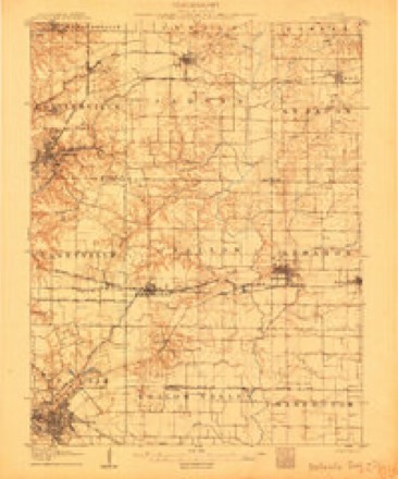
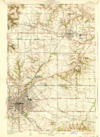
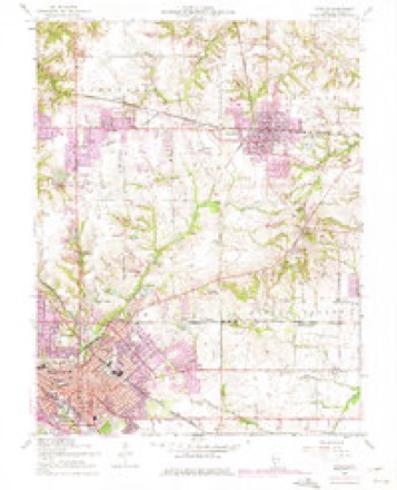
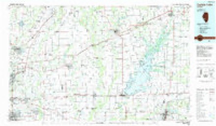
7 surveys from 17 printed sheetsMatched by testing this settlement's coordinate against the published boundary of every sheet in the United States Geological Survey's historical collection. Each opens the scanned sheet at the Survey.
- 1907 USGS Belleville quadrangle1:62500, 3 printings
- 1937 USGS O'Fallon quadrangle1:24000, 2 printings
- 1954 USGS O'Fallon quadrangle1:24000, 4 printings
- 1958 USGS Belleville quadrangle1:250000, 3 printings
- 1962 USGS Belleville quadrangle1:250000
- 1985 USGS Carlyle Lake quadrangle1:100000, 2 printings
- 1991 USGS O'Fallon quadrangle1:24000, 2 printings


In the county-history sources
4,315 words on this townshipHistory of St. Clair County, Illinois. With Illustrations ... and Biographical Sketches of Some of Its Prominent Men and Pioneers, published 1881 names this settlement in its chapter on Shiloh Valley Township. These are the passages that mention it, exactly as the scans read.
In Rsynolds' Pionser History of Illinois, we find that in the summsr of 1807, Bishop McKendree, whose name has been perpetuated in the Methodist College at Lebanon, was one of the earliest Methodist ministers to preach in this vicinity. He had erected at Shiloh a log meeting-house, which was one of the earliest churches of this denomination in Illinois. He also organized and held a camp-meeting at this point the same year. There have been four churches erected by this denomination on the same spot. The present one is constructed of brick, and is a neat and costly edifice.
Passage source: History of St. Clair County, Illinois. With Illustrations ... and Biographical Sketches of Some of Its Prominent Men and Pioneers, published 1881.
Oa comiag hare he first resided on Turkey Hill and there two of his children are now buried. In the year .1828 he purchased for four hundred dollars the south half of the south-east quarter of section fourteen of township one north, range seven west. He had not then sufficient means to make the whole payment on the land. This place was subsequently his residence till his death. At the time he moved on this land only a small part was under cultivation. Mr. Griffen worked industriously at improving the farm. He was a man of great energy and activity. He had good business qualifications, and at the time of his death was one of the largest land owners of the Shiloh valley. -His first marriage took place in February, 1826, to Mrs. Mary Shepherd, whose maiden name was Foulks. Her death occurred on the 5th of February, 1841, at the age of thirty-nine. She was born in Pennsylvania on the 5th of February, 1802. His second marriage was on the 13th of October, 1841, to Sally Ann Collins, who was born near Greenville, New York, on the 1st of December, 1805. This marriage occurred at Amsterdam, New York, while Mr. Grifien was in that state on a visit to his brother.
Passage source: History of St. Clair County, Illinois. With Illustrations ... and Biographical Sketches of Some of Its Prominent Men and Pioneers, published 1881.
He had in all twelve children, whose names are as follows : - Jacob Fardon Grifien, born on the 6th of February, 1827, died on the 15th of November of the same year ; Smith Grifien, who was born in 1828 and died in 1831 ; Harriet Jane Grifien, born August 10, 1831, and died the succeeding 15th of November; Joseph Grifien, who was born in 1832, and is now living in the Shiloh valley; Caroline Grifien, born in 1834 and died in 1835; Sarah Ann Grifien, born March, 1836, now residing in Macon county, the wife of James H.Alexander; Mariah Grifien, now Mrs. Wm. D. Howard of Lebanon ; Rachel Grifien, who was born in 1840 and died the same year ; Boon Grifien, who was born July 27th, 1842 and died May 4, 1862 ; Alletta Grifien, who 'was born in 1843 and died in 1844 ; Charles Griffen, born February 20, 1845, and Jane, who was born in January, 1849, and died in September of the Boon Griffen was a student at McKendree college at the time of the breaking out of the war of the rebellion. He enlisted at St. Louis in a Missouri regiment, not then nineteen years old, and was in the three months service under General Fremont. After the expiration of his term of service he returned to his studies, but died of consumption in 1862, while a member of the college graduating class. He would have graduated had he lived till June.
Passage source: History of St. Clair County, Illinois. With Illustrations ... and Biographical Sketches of Some of Its Prominent Men and Pioneers, published 1881.
Machine-read from a century-old scan, so expect the errors a machine makes: misspelled names, dropped words, stray characters.
Read the whole chapter on Shiloh Valley Township - it names this place 6 more 6 times.
Storms near this place
19 since 2002Regional context, not property-specific evidence. The National Weather Service names Shiloh in 19 storm reports between 2002 and 2025: 9 thunderstorm wind, 8 hail, 2 tornado. No death or injury is recorded in these reports. Each account below is quoted exactly as the forecast office filed it, from the NOAA Storm Events Database, and each date opens the federal record of that event.
| When | Event | Place named | Harm | What the report says |
|---|---|---|---|---|
| April 2023 | Thunderstorm Wind | Shiloh | $20,000 | Thunderstorm winds blew down a row of power lines along Illinois Route 158 on the west side of Scott Air Force Base. |
| May 2023 | Thunderstorm Wind | Shiloh | - | Thunderstorm winds blew down several power lines and damaged a bank sign due to wind-driven large hail. |
| July 2023 | Thunderstorm Wind | Shiloh | - | Thunderstorm winds snapped off a large tree limb. |
| April 2023 | Thunderstorm Wind | Shiloh | - | Thunderstorm winds caused a swath of damage across an area from just east of N. Green Mount Road and north of Lebanon Avenue. Several trees and fences were blown down, numerous tree limbs blown down, a large wooden residential playground was damaged and several homes had some shingles missing. |
| April 2012 | Thunderstorm Wind | Shiloh | - | Thunderstorm winds blew down numerous large tree limbs. |
| June 2009 | Tornado (EF2) | Shiloh | - | The tornado touched down just northeast of the intersection of North Green Mount Road and Lebanon Avenue in the Eagles Landing Subdivision, where up to 6 homes sustained minor to moderate damage. From this point the tornado produced a nearly continuous damage path that extended to about 1 mile southeast of the intersection of Highway 4 and Jefferson Road. It finally lifted as it approached the Kaskaskia River. The total path length of the tornado is estimated to be 12.8 miles, with an average width of damage of about one-tenth of a mile. However, straight line winds did cause lesser damage over a wider swath of up to 3 miles. The greatest damage was to a home located just west of the intersection of Highway 4 and Jefferson Road. Damage there was rated EF2 on the Enhanced Fujita Scale. Elsewhere along the path of the tornado, the damage was generally in the EF0-EF1 range. |
| July 2006 | Thunderstorm Wind | Shiloh | - | Numerous trees were topped. |
| May 2004 | Thunderstorm Wind | Shiloh | - | The County Sheriff reported trees down in Shiloh. |
| April 2002 | Tornado (F1) | Shiloh | - | Around 1035 pm CDT, a tornado formed just southwest of Shiloh and started to cause damage. The worst damage occurred along Rio Verde Drive where 23 homes sustained some degree of damage. Two large buildings at the Yorktown Golf Club were also damaged. The tornado continued northeast crossing the intersections of Wendy Way and Goalby and Wendy Way and Anderson Lane. A number of homes sustained roof damage in this area with a number of trees uprooted or snapped off. The tornado caused minor roof damage to Whiteside Elementary School. A total of 34 homes along the path sustained some type of damage. |
| March 2025 | Hail | Shiloh | - | no account filed |
| March 2025 | Hail | Shiloh | - | no account filed |
| May 2023 | Hail | Shiloh | - | no account filed |
| April 2016 | Hail | Shiloh | - | no account filed |
| June 2009 | Hail | Shiloh | - | no account filed |
| June 2008 | Hail | Shiloh | - | no account filed |
| May 2008 | Hail | Shiloh | - | no account filed |
| May 2006 | Hail | Shiloh | - | no account filed |
| July 2004 | Thunderstorm Wind | Shiloh | - | no account filed |
| June 2003 | Thunderstorm Wind | Shiloh | - | no account filed |
Nearest settlements
The eight closest, with where each one stands in the county. Distances are straight-line, computed from the Geographic Names Information System coordinates.
| Map | Place | Distance | Sheets |
|---|---|---|---|
| Shiloh Station | 1.9 miles | 17 | |
| O'Fallon | 2.3 miles | 17 | |
| Petersburg | 2.5 miles | 17 | |
| Glenview | 2.8 miles | 17 | |
| Miller | 2.8 miles | 17 | |
| Carbon | 3.2 miles | 17 | |
| Crossroads | 4.2 miles | 17 | |
| Capitol Oaks | 4.3 miles | 17 |
Elsewhere
Matched on this settlement's Geographic Names Information System number rather than its name, so it cannot be a different place of the same name in another state.
| Wikipedia article on Shiloh | An encyclopaedic summary. Its text is share-alike, so it is linked here rather than copied. |
| Wikidata item Q1641918 | The structured record the population and elevation above come from. Public domain (CC0). |
Provenance
This settlement is recorded in the Geographic Names Information System as feature 426528. The sheet list is computed by point-in-boundary test against the United States Geological Survey's historical topographic inventory. Both are works of the United States government and carry no copyright under 17 U.S.C. 105.
Storms. NOAA National Centers for Environmental Information, Storm Events Database https://www.ncei.noaa.gov/stormevents/ A work of the United States government, no copyright under 17 U.S.C. 105. Narratives are quoted verbatim from the National Weather Service report and are not edited or summarised.