 Block
Staunton, Illinois
11 topographic sheets cover this place, the earliest surveyed in 1912 and the latest in 1982. It stands in Staunton Township. It lies in ZIP code area 62088. The Survey maps it on the Gillespie South quadrangle. 5,054 people lived here at the 2020 count. It stands 620 feet above sea level.
Population over time
2 figuresStaunton fell from 5,139 to 5,054 between 2010 and 2020. These are the recorded population figures Wikidata holds for this place, reached through the Geographic Names Information System number this page is keyed on rather than by name, so they belong to this place and not to another of the same name. Most are census counts, but not all are: an early figure may be a founding or settlement estimate, and an estimate published within five years of a census is left out. The change column is computed, and is left blank where more than 20 years separate a figure from the one before it, because a gap that long is not a change between two counts.
| Year | People | Change |
|---|---|---|
| 2010 | 5,139 | |
| 2020 | 5,054 | -85 (-2%) |
Topographic sheets covering this place
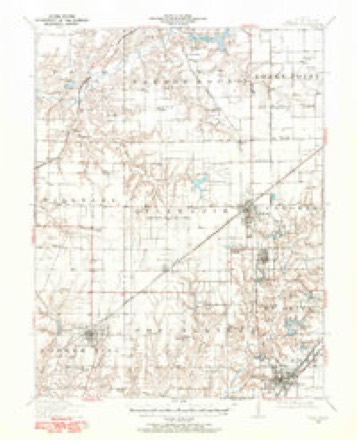
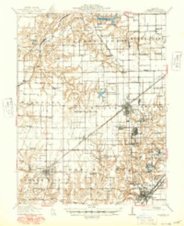
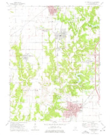
6 surveys from 11 printed sheetsMatched by testing this settlement's coordinate against the published boundary of every sheet in the United States Geological Survey's historical collection. Each opens the scanned sheet at the Survey.
- 1912 USGS Gillespie quadrangle1:62500
- 1915 USGS Gillespie quadrangle1:62500, 3 printings
- 1958 USGS Decatur quadrangle1:250000, 3 printings
- 1961 USGS Decatur quadrangle1:250000, 2 printings
- 1974 USGS Gillespie South quadrangle1:24000
- 1982 USGS Litchfield quadrangle1:100000



In the county-history sources
3,215 words on this townshipHistory of Macoupin County, Illinois : Biographical and Pictorial, published 1911 names this settlement in its chapter on Staunton Township. These are the passages that mention it, exactly as the scans read.
Staunton Times was established in August, 1878, by Showman and Lamb, who sold after two months to W. F. Bently. It was published and edited by F. L. Blome from 1885 to 1898; T. H. Edwards, 1898 to 1904; T. H. and J. J. Edwards, 1904 to 1908; M. W. Meyers, 1909. Bound files dated from 1885 to 1908 in possession of T. H. Edwards. The Times was the first paper conducted in Staunton after the lapse of time between 1861 until 1878. In 1858 the Staunton Banner was established by Parsons Percy, a practical printer, who brought the office outfit from Monroe county. The existence of the Banner was a precarious one and in 1861 the plant was purchased and moved to Gillespie.
Passage source: History of Macoupin County, Illinois : Biographical and Pictorial, published 1911.
In 1905 John Camp came into possession of the Star and in November, 1910, bought the Times. He then hyphenated the name of the paper and it is now 'known as the Star-Times. It is an excellent sheet, well patronized, and the only paper published at Staunton.
Passage source: History of Macoupin County, Illinois : Biographical and Pictorial, published 1911.
Staunton township is situated in the extreme southeast corner of Macoupin county, and is bounded on the north by Cahokia township, on the west by Dorchester township, on the south by Madison county and on the east by Montgomery county. The township is mostly rolling prairie, well adapted for all kinds of agriculture. Several creeks run through the township, the principal one of which is Cahokia, which enters in the north part of section 5 and flowing in a southwesterly direction, passes out on the west of section 19. The streams are bordered by belts of timber, which include various kinds of oak, ash, sugar maple, walnut and hickory.
Passage source: History of Macoupin County, Illinois : Biographical and Pictorial, published 1911.
Machine-read from a century-old scan, so expect the errors a machine makes: misspelled names, dropped words, stray characters.
Read the whole chapter on Staunton Township - it names this place 10 more 10 times.
Fires near this place
12 since 2009Regional context, not property-specific evidence. The federal wildfire occurrence database lists 12 fires within 5 miles of Staunton between 2009 and 2016, burning about 17 acres in total. None started naturally. None was recorded as arson. Distance is straight-line from the map coordinates, so a fire counted here may appear on a neighbouring settlement's page as well.
| Reported cause | Fires |
|---|---|
| Missing data/not specified/undetermined | 9 |
| Debris and open burning | 2 |
| Equipment and vehicle use | 1 |
The most recent of them, most recent first, with the day each was reported and the service that recorded it.
| Date | Cause | Size | Reported by | Name on the report |
|---|---|---|---|---|
| 4 September 2014 | Equipment and vehicle use | under an acre | Illinois Division of Forestry Resources | OLIVE1 |
| 9 August 2012 | Debris and open burning | under an acre | Illinois Division of Forestry Resources | BACKYARD |
| 8 July 2012 | Missing data/not specified/undetermined | 2.0 acres | Illinois Division of Forestry Resources | MADISON |
| 22 July 2012 | Debris and open burning | under an acre | Illinois Division of Forestry Resources | GOODMAN |
| 11 July 2012 | Missing data/not specified/undetermined | under an acre | Illinois Division of Forestry Resources | LIVINGSTON |
| 22 March 2011 | Missing data/not specified/undetermined | under an acre | Illinois Division of Forestry Resources | HENRY |
| 18 March 2009 | Missing data/not specified/undetermined | under an acre | Illinois Division of Forestry Resources | ILL |
| 17 February 2009 | Missing data/not specified/undetermined | under an acre | Illinois Division of Forestry Resources | RAMSEY RD |
Settlements close enough to share some of these fires:
Mines and quarries near this place
3 within 5 milesRegional context, not property-specific evidence. The federal mineral resources record lists 3 workings within 5 miles of Staunton: 2 occurrences, 1 prospect. None of them still produces. What was taken out: Stone, Crushed/Broken, Clay. Distance is straight-line from the map coordinates, so a quarry counted here may appear on a neighbouring settlement's page as well.
| Where | Site | Commodity | Status | Recorded |
|---|---|---|---|---|
| Honey Creek Clay Shale Exposure | Clay | Prospect | ||
| Limestone Prospect | Stone, Crushed/Broken | Occurrence | ||
| Limestone Prospect | Stone, Crushed/Broken | Occurrence |
Storms near this place
34 since 1994Regional context, not property-specific evidence. The National Weather Service names Staunton in 34 storm reports between 1994 and 2026: 16 thunderstorm wind, 10 hail, 4 tornado, 2 lightning. The reports record 1 injury. Each account below is quoted exactly as the forecast office filed it, from the NOAA Storm Events Database, and each date opens the federal record of that event.
| When | Event | Place named | Harm | What the report says |
|---|---|---|---|---|
| May 2011 | Thunderstorm Wind | Staunton | 1 hurt | Thunderstorm winds blew over a semi on the north bound lanes of I-55 just south of the Staunton exit. The driver lost control when the truck was hit by the winds and ended up in a ditch about 50 feet from the road. The driver sustained minor injuries. |
| May 2008 | Thunderstorm Wind | Staunton | $50,000 | Wind gusts estimated at 60 to 65 mph downed large tree limbs, a few power lines and blew roof shingles off homes. The garage at a new home under construction was blown apart. A few cars suffered minor damage from falling tree limbs. |
| March 2026 | Thunderstorm Wind | Staunton | - | National Weather Service survey concluded that snapped wooden power poles along Reservoir Road were the result of approximately 100 mph wind gusts. |
| March 2026 | Tornado (EF1) | Staunton | - | The tornado continued into Macoupin County from Madison County where it uprooted trees along Double Arch Road before dissipating. |
| May 2025 | Thunderstorm Wind | Staunton | - | Thunderstorm winds downed one large tree. |
| July 2023 | Thunderstorm Wind | Staunton | - | Thunderstorm winds blew down several large tree limbs around town. |
| August 2023 | Hail | Staunton | - | Numerous severe hail reports came from Staunton at around 7PM CST with sizes ranging from 1.00 to 1.50. |
| December 2018 | Tornado (EF1) | Staunton | - | A tornado touched down over the Country Classic Cars business northeast of Staunton, IL. Many videos surfaced showing a funnel develop and pass over Interstate 55. No damage could be seen west of the interstate, creating the initial damage to a carport at the business, and then cutting an approximately 50 yard path through the middle portion of the second storage shed on the property. The tornado proceeded east, depositing several pieces of sheet metal and wood onto Old Route 66 and fields to the east. Despite visible power flashed in videos, power lines looked untouched. Arching likely occurred when metal sheeting was thrown across the lines. A debris path could be seen strewn for several hundred feet to the northeast. A house, couple of farm buildings and trees were damaged on the south side of Tall Timber Road. Another structure to the north side of Tall Timber Road, at the end of Adden Road, was also damaged. Several pieces of debris could be seen in the field to the northeast of Adden Road and to the west of Two Mile Road. However, no damage was assessed past the field, where it is likely the tornado dissipated. Additional videos from Mt. Olive show a long rope funnel ascended above the town with no damage to the community. Overall the tornado was rated EF1 with a path length of 1.39 miles and a max path width of 50 yards. No injuries or deaths were reported with this tornado. |
| July 2018 | Thunderstorm Wind | Staunton | - | Thunderstorm winds blew down several large tree limbs down around town. One large tree limb fell onto a house causing minor damage. |
| March 2017 | Thunderstorm Wind | Staunton | - | Thunderstorm winds blew the awning off of a business in town. |
| June 2017 | Thunderstorm Wind | Staunton | - | Thunderstorm winds blew down several large trees around town as well as power lines. |
| December 2015 | Flash Flood | Staunton | - | Between 3 and 4 inches of rain fell causing flash flooding. Numerous roads were flooded especially across the southern half of the county. Some of the flooded roads were Bayless Road/Three Mile Road near Gillespie, Sunset Street on west side of Mt. Olive, Spanish Needle Road near Gillespie Lake, Brushy Mound Road just south of Carlinville, and Moore Cemetery Road east of bridge that goes over Richardson Branch Creek. |
| May 2013 | Thunderstorm Wind | Staunton | - | Thunderstorm winds blew off the decorative steel portion of a grocery store roof in Staunton. The main roof remained intact with just minor leaks into the store below. Also, several trees and power lines were blown down around town. |
| September 2012 | Thunderstorm Wind | Staunton | - | Thunderstorm winds blew down several trees in Staunton. |
| September 2011 | Thunderstorm Wind | Staunton | - | Thunderstorm winds blew down several tree limbs and power lines. Also, part of the roof of a barn was blown off. |
| June 2007 | Flash Flood | Staunton | - | Local law enforcement reported a couple of county roads became impassable due to heavy rain. |
| April 2006 | Tornado (F0) | Staunton | - | The Madison County tornado that started near Dorsey crossed the Macoupin County line about 6 miles west southwest of Staunton. The tornado damaged trees, downed a few power lines, and blew off roof shingles near Staunton and Mt. Olive. |
| June 2006 | Thunderstorm Wind | Staunton | - | Thunderstorm winds damaged 50 to 100 trees in town. Four to six homes sustained some kind of structural damage due to the fallen trees and tree limbs. Several power lines were blown down as well, leaving 60 to 80 houses without power for a time. No injuries were reported. |
| September 2005 | Lightning | Staunton | - | Lightning struck a substation Monday evening causing substantial damage. Power was out for much of town through Tuesday until repairs could be finished. |
| May 2003 | Tornado (F0) | Staunton | - | A local farmer reported that a brief tornado occurred in a field between Staunton and Bunker Hill. |
| June 2000 | Thunderstorm Wind | Staunton | - | The County Sheriff reported power lines down. |
| June 1994 | Thunderstorm Wind | Staunton | - | Thunderstorm winds blew down a large tree, as well as some tree limbs, in Staunton. |
| April 2026 | Hail | Staunton | - | no account filed |
| April 2026 | Hail | Staunton | - | no account filed |
| May 2018 | Hail | Staunton | - | no account filed |
| May 2010 | Hail | Staunton | - | no account filed |
| June 2009 | Hail | Staunton | - | no account filed |
| April 2008 | Hail | Staunton | - | no account filed |
| May 2005 | Hail | Staunton | - | no account filed |
| May 2004 | Thunderstorm Wind | Staunton | - | no account filed |
| May 2004 | Lightning | Staunton | - | no account filed |
| June 1998 | Hail | Staunton | - | no account filed |
| May 1998 | Thunderstorm Wind | Staunton | - | no account filed |
| March 1997 | Hail | Staunton | - | no account filed |
Nearest settlements
The eight closest, with where each one stands in the county. Distances are straight-line, computed from the Geographic Names Information System coordinates.
| Map | Place | Distance | Sheets |
|---|---|---|---|
| White City | 3.9 miles | 11 | |
| Sawyerville | 4.6 miles | 11 | |
| Wilsonville | 5.3 miles | 11 | |
| Mount Olive | 5.3 miles | 12 | |
| Benld | 5.6 miles | 11 | |
| Carlsburg | 6.1 miles | 12 | |
| Mount Clare | 6.2 miles | 11 | |
| Lake Ka-Ho | 6.5 miles | 12 |
Elsewhere
Matched on this settlement's Geographic Names Information System number rather than its name, so it cannot be a different place of the same name in another state.
| Wikipedia article on Staunton | An encyclopaedic summary. Its text is share-alike, so it is linked here rather than copied. |
| Wikidata item Q575509 | The structured record the population and elevation above come from. Public domain (CC0). |
Provenance
This settlement is recorded in the Geographic Names Information System as feature 419076. The sheet list is computed by point-in-boundary test against the United States Geological Survey's historical topographic inventory. Both are works of the United States government and carry no copyright under 17 U.S.C. 105.
Wildfire. Short, Karen C. 2022. Spatial wildfire occurrence data for the United States, 1992-2020 [FPA_FOD_20221014]. 6th Edition. Fort Collins, CO: Forest Service Research Data Archive. https://doi.org/10.2737/RDS-2013-0009.6 Collected with United States Government funding and usable without additional permissions or fees.
Mines and quarries. USGS Mineral Resources Data System (MRDS) https://mrdata.usgs.gov/mrds/ A work of the United States government, no copyright under 17 U.S.C. 105.
Storms. NOAA National Centers for Environmental Information, Storm Events Database https://www.ncei.noaa.gov/stormevents/ A work of the United States government, no copyright under 17 U.S.C. 105. Narratives are quoted verbatim from the National Weather Service report and are not edited or summarised.