BlockBefore
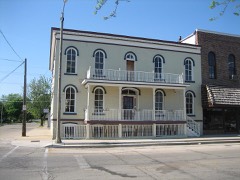
Photograph of Lewis Steward House
Photograph by Lester1950, CC BY-SA 3.0. Via Wikimedia Commons.

Lewis Steward House

Listed on the National Register of Historic Places in 2003.

From the record

“The Lewis Steward House is a historic residence in Plano, Illinois. It was the home of Lewis Steward, a prominent early settler to Kendall County who co-founded Marsh, Steward & Company, ran for the governorship of Illinois, and was elected to the United States House of Representatives.”

Wikipedia article Lewis Steward House, CC BY-SA 4.0.

One of 10 National Register listings published here for Kendall County · listed in 2003 · category: Building.

Sources: the Wikipedia article · the case file at the National Archives · the National Register database, National Park Service

The listing

  • Listed as. Steward, Lewis, House - the National Register files a house under its owner's surname.
  • Address. 611 E. Main St., Plano, 60545
  • When was it listed? November 2003
  • Category. building
  • Township. Little Rock township
  • National Register reference number. 03001200 - the number the National Park Service assigned this property when it was listed, and the key its nomination file is catalogued under at the National Archives.

The ground it stands on

179 words

This property stands in Little Rock Township. History of Kendall County, Illinois, from the Earliest Discoveries to the Present Time, published 1877 gives that township a chapter of its own.

The chapter covers the township.

Machine-read from a century-old scan, so expect the errors a machine makes: misspelled names, dropped words, stray characters.

Read the whole chapter on Little Rock Township - 179 words on its settlement, mills, schools and churches.

Mines and quarries near this property

2 within 5 miles

Regional context, not property-specific evidence. The federal mineral resources record lists 2 workings within 5 miles of Lewis Steward House: 2 past producers. None of them still produces. What was taken out: Sand and Gravel, Construction, Stone. Distance is straight-line from the map coordinates, so a quarry counted here may appear on a neighbouring settlement's page as well.

Where SiteCommodity StatusRecorded
Kendall Co. Hwy. Dept. PitStonePast Producer
Plano PitSand and Gravel, ConstructionPast Producer

Every working recorded in Kendall County

Storms near this property

39 since 2000

Regional context, not property-specific evidence. The National Weather Service names Plano, the town this property stands in, in 39 storm reports between 2000 and 2026: 27 thunderstorm wind, 9 hail, 2 flash flood, 1 funnel cloud. The reports record 1 injury. Each account below is quoted exactly as the forecast office filed it, from the NOAA Storm Events Database, and each date opens the federal record of that event.

WhenEvent Place namedHarm What the report says
May 2004Thunderstorm WindPlano1 hurtA tree was down on a car with a person trapped inside.
June 2010Thunderstorm WindPlano$10,000Two large trees were blown down on Keller Road. Trees were blown down on River Road. Part of a roof was blown off a house on River Road. One tree fell on a car. Other trees were blown over onto power lines.
June 2007Thunderstorm WindPlano$5,000A large string of powerlines was blown down on Burr Oak Road off of Griswald Springs Road.
August 2008Thunderstorm WindPlano$4,000A large section of a tree was blown down at Dearborn and Harve Streets, which knocked down a utility pole. Tree limbs and power lines were blown down across other areas of Plano.
June 2011Thunderstorm WindPlano$500A utility pole was snapped near Fox River Drive.
March 2026HailPlano-A few 1 inch hail reports came out of the Plano and Millbrook areas. Time estimated using radar.
June 2025Thunderstorm WindPlano-Significant tree damage was reported around the Edith Farnsworth House south of Plano.
July 2025Thunderstorm WindPlano-A photo showed a portion of a 4 to 5 inch diameter tree snapped along with a large tree limb blown down.
July 2023Thunderstorm WindPlano-A 64 mph gust was measured by a personal weather station.
July 2023Thunderstorm WindPlano-Part of a fence was blown over in Plano in addition to several downed tree limbs. Time and wind speed were estimated using radar.
July 2023Thunderstorm WindPlano-Kendall County Sheriff reported a tree approximately 22 inches in diameter had snapped at the trunk. This occurred near the intersection of Harve and Charles Streets in Plano. Time was estimated using radar.
August 2021Thunderstorm WindPlano-Several trees were snapped or blown down between Sandwich and Plano, including one tree blown down on Little Rock Road.
August 2021Thunderstorm WindPlano-A private weather station measured wind gusts above 60 mph for 15 minutes with a peak gust to 68 mph.
August 2020Thunderstorm WindPlano-Tree limbs and power lines were blown down in Plano.
June 2019Thunderstorm WindPlano-Multiple large tree limbs were blown down.
July 2016Funnel CloudPlano-Funnel cloud lasted a few minutes and extended about half way to the ground.
May 2016Thunderstorm WindPlano-Four 6-8 inch trees uprooted at Hoffman St. near Kristen St.
June 2013Thunderstorm WindPlano-Winds were estimated to 70 mph. Numerous trees were bent over between Plano and Yorkville.
June 2012Thunderstorm WindPlano-Two 70-foot sections of wooden fencing were blown down.
June 2010Thunderstorm WindPlano-Tree limbs up to six inches in diameter were blown down. Part of a twelve inch diameter tree was blown down on a house.
June 2008Thunderstorm WindPlano-Trees were blown down in Plano.
July 2007Thunderstorm WindPlano-Small tree limbs were blown down.
August 2006Thunderstorm WindPlano-A five inch diameter tree limb was blown down blocking a road.
October 2006Thunderstorm WindPlano-Four to five inch diameter tree limbs blown down on Milhurth Road.
October 2006Thunderstorm WindPlano-Numerous tree limbs blown down on Route 34 between Plano and Yorkville Roads.
June 2004Flash FloodPlano-Water was flowing across U.S. Highway 34 in Plano and numerous roads were covered by high water in Oswego. Collins Road between Grove and Plainfield Roads was closed due to high water.
June 2024HailPlano-no account filed
April 2023HailPlano-no account filed
May 2019HailPlano-no account filed
June 2013HailPlano-no account filed
April 2006HailPlano-no account filed
June 2005HailPlano-no account filed
May 2004Thunderstorm WindPlano-no account filed
July 2003Thunderstorm WindPlano-no account filed
July 2003HailPlano-no account filed
July 2003Thunderstorm WindPlano-no account filed
July 2003Flash FloodPlano-no account filed
July 2003Thunderstorm WindPlano-no account filed
September 2000HailPlano-no account filed

Every storm recorded in Kendall County

Map coverage status

No historic map-sheet match is published for this property yet. That does not mean no map exists. This record needs a coordinate-quality review before it can be joined to a sheet boundary. Browse the county's mapped places while that work is pending.

Listed places nearby

6 within 8 miles

Other National Register properties close enough to walk or drive between, ordered by distance from this one. Both positions come from the same geocoding pass that matched these properties to their map sheets.

Photograph PropertyDistance Listed
Albert H. Sears Houseunder 500 feet1987
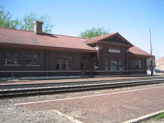
Chicago, Burlington & Quincy Railroad Depot0.5 miles1993
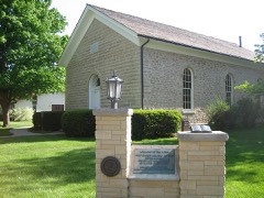
Reorganized Church of Jesus Christ of Latter Day Saints0.5 miles1990
Plano Hotel0.5 miles1993
Farnsworth House2.1 miles2004
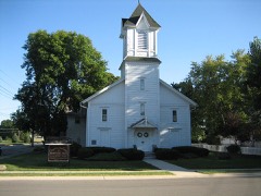
Bristol Congregational Church4.2 miles2016

Sources for this property

National Archives recordThe nomination case file for reference 03001200 in Record Group 79.
Wikipedia articleCommunity-written account of this property, licensed CC BY-SA.
Kendall CountyAll 10 listed properties in this county.

Provenance

  • Listing record. National Park Service National Register of Historic Places, listed-properties dataset, current to 2026-05-22.
  • Map join. Address geocoded through the United States Census geocoder, then tested against the published boundary of every sheet in the USGS Historical Topographic Map Collection.
  • How this page is made. Listing fields come from federal records; map-sheet coverage is a labelled coordinate-to-boundary calculation, not a source-field claim.
  • Mines and quarries. USGS Mineral Resources Data System (MRDS) https://mrdata.usgs.gov/mrds/ A work of the United States government, no copyright under 17 U.S.C. 105.
  • Storms. NOAA National Centers for Environmental Information, Storm Events Database https://www.ncei.noaa.gov/stormevents/ A work of the United States government, no copyright under 17 U.S.C. 105. Narratives are quoted verbatim from the National Weather Service report and are not edited or summarised.