 Block
From the record
One of 29 National Register listings published here for LaSalle County · listed in 2007 · category: Building.
Sources: the case file at the National Archives · the National Register database, National Park Service
Listed on the National Register of Historic Places in 2007.
One of 29 National Register listings published here for LaSalle County · listed in 2007 · category: Building.
Sources: the case file at the National Archives · the National Register database, National Park Service
The chapter on LaSalle Township in History of LaSalle County, Illinois : Its Topography, Geology, Botany, Natural History, History of the Mound Builders, Indian Tribes, French Explorations, and a Sketch of the Pioneer Settlers of Each Town to 1840, with an Appendix, Giving the Present Status of the County, Its Population, Resources, Manufactures and Institutions, published 1877 names LaSalle. This is what it says, exactly as the scans read.
The next summer he left on account of the war, and remained two years at Magnolia, Tn 1835, sold his claim and bought 400 acres north of and now adjoining the town of LaSalle. In common with most of the settlers in 1896, he supposed his fortune made, being told that his 400 acres were worth $40,000, and that he need work no more, bat not realizing that sam he went one year on the Ottawa mission as a Methodist exhorter, and in 1837 was married to Nancy Winters, of Mt. Palatine, and went to farmi nding his 400 neres worth what its production of farm erops would Indicate. He is still living on a part of the $40,000 farm, at a ripe old age, probably as comfortable as he would have been had he realized his anticipated fortune His experience and disappointment in that respect,
Machine-read from a century-old scan, so expect the errors a machine makes: misspelled names, dropped words, stray characters.
Read the whole chapter on LaSalle Township - 2,263 words on its settlement, mills, schools and churches.
Regional context, not property-specific evidence. The federal wildfire occurrence database lists 32 fires within 5 miles of Hotel Kaskaskia Buildings (Boundary Increase) between 2008 and 2019, burning about 104 acres in total. 2 started naturally. None was recorded as arson. Distance is straight-line from the map coordinates, so a fire counted here may appear on a neighbouring settlement's page as well.
| Reported cause | Fires |
|---|---|
| Missing data/not specified/undetermined | 18 |
| Debris and open burning | 7 |
| Smoking | 4 |
| Natural | 2 |
| Power generation/transmission/distribution | 1 |
The most recent of them, most recent first, with the day each was reported and the service that recorded it.
| Date | Cause | Size | Reported by | Name on the report |
|---|---|---|---|---|
| 3 August 2019 | Smoking | under an acre | Illinois Division of Forestry Resources | 19-00092 |
| 28 August 2010 | Missing data/not specified/undetermined | under an acre | Illinois Division of Forestry Resources | 1063 |
| 25 August 2010 | Missing data/not specified/undetermined | under an acre | Illinois Division of Forestry Resources | 10118 |
| 2 August 2010 | Missing data/not specified/undetermined | under an acre | Illinois Division of Forestry Resources | 1060 |
| 6 July 2019 | Missing data/not specified/undetermined | under an acre | Illinois Division of Forestry Resources | 19-00080 |
| 28 July 2019 | Missing data/not specified/undetermined | 1.0 acres | Illinois Division of Forestry Resources | 19-00089 |
| 29 May 2014 | Debris and open burning | 2.0 acres | Illinois Division of Forestry Resources | 14-0000082 |
| 27 May 2010 | Missing data/not specified/undetermined | under an acre | Illinois Division of Forestry Resources | 1046 |
Regional context, not property-specific evidence. The federal mineral resources record lists 15 workings within 5 miles of Hotel Kaskaskia Buildings (Boundary Increase): 9 past producers, 6 producers. 6 still produce. What was taken out: Stone, Crushed/Broken, Sand and Gravel, Construction, Clay, Stone. Distance is straight-line from the map coordinates, so a quarry counted here may appear on a neighbouring settlement's page as well.
| Where | Site | Commodity | Status | Recorded |
|---|---|---|---|---|
| Boehm No. 2 Pit | Clay | Producer | ||
| Lasalle City Pit | Stone | Past Producer | ||
| Alpha Cement Pitmertel Gravel Co. | Sand and Gravel, Construction | Producer | ||
| Bailey Falls Pit | Sand and Gravel, Construction | Past Producer | ||
| Bonucci Gravel Pit | Sand and Gravel, Construction | Past Producer | ||
| Lock Pit | Sand and Gravel, Construction | Past Producer | ||
| Sitterly Pit | Sand and Gravel, Construction | Past Producer | ||
| Wetherby Pit | Sand and Gravel, Construction | Past Producer | ||
| Alpha Portland Quarry | Stone, Crushed/Broken | Past Producer | ||
| Lasalle Quarry & Mill | Stone, Crushed/Broken | Producer |
No historic map-sheet match is published for this property yet. That does not mean no map exists. This record needs a coordinate-quality review before it can be joined to a sheet boundary. Browse the county's mapped places while that work is pending.
Other National Register properties close enough to walk or drive between, ordered by distance from this one. Both positions come from the same geocoding pass that matched these properties to their map sheets.
| Photograph | Property | Distance | Listed |
|---|---|---|---|
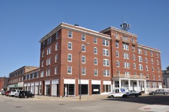 | Hotel Kaskaskia | under 500 feet | 1988 |
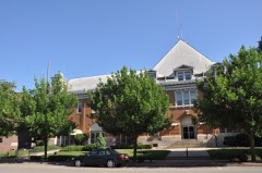 | LaSalle City Building | under 500 feet | 1985 |
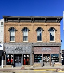 | LaSalle Downtown Commercial District | under 500 feet | 2017 |
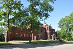 | Julius W. Hegeler I House | 0.6 miles | 2009 |
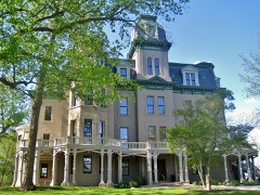 | Hegeler-Carus Mansion | 0.6 miles | 1995 |
| Westclox Manufacturing Plant Historic District | 0.7 miles | 2007 |
| National Archives record | The nomination case file for reference 06001023 in Record Group 79. |
| LaSalle County | All 29 listed properties in this county. |