 Block
From the record
One of 29 National Register listings published here for Ogle County · listed in 2022 · category: District.
Sources: the National Register database, National Park Service
Listed on the National Register of Historic Places in 2022.
One of 29 National Register listings published here for Ogle County · listed in 2022 · category: District.
Sources: the National Register database, National Park Service
The chapter on Mount Morris Township in The History of Ogle County, Illinois, Containing a History of the County, Its Cities, Towns, Etc., a Biographical Directory of Its Citizens, War Record of Its Volunteers in the Late Rebellion, General and Local Statistics ... History of the Northwest, History of Illinois ... Etc, published 1878 names Mount Morris. This is what it says, exactly as the scans read.
SCHOOLS. The First School. - The Maryland colonists who first settled at Mount Morris were determined that their children should not want for educational privileges, and a school house was as necessary as a "cabin." When Samuel M.
Passage source: The History of Ogle County, Illinois, Containing a History of the County, Its Cities, Towns, Etc., a Biographical Directory of Its Citizens, War Record of Its Volunteers in the Late Rebellion, General and Local Statistics ... History of the Northwest, History of Illinois ... Etc, published 1878.
The school numbered twenty-six pupils, and a record of their names, so far as they are now remembered by Mr. Allen, will be interesting to their descendants in the present and in the future. Among this little group were Margaret C. Hitt (now Mrs. D. J. Pinckney), John W. Hitt (now an influential citizen of Mount Morris, and for several years past Supervisor of the town), George Hitt (since dead), Andrew M. Hitt, Joseph Hitt, John Hitt (now Deputy Collector of Customs, Chicago), Robert S. Hitt (of Chicago), Robert R. Hitt (now Secretary of Legation at Paris), Martin R. M. Wallace (Judge Wallace of Chicago), Elizabeth Reynolds, Caroline M. Reynolds, Ann E. Swingley (Mrs. Phelps), Urilla Swingley, John H. Swingley, Upton Swingley, Nathaniel A. Ankeny, Augustus H. Ankeny (afterward a leading citizen of Clinton, Iowa), Ann M. Ankeny (Mrs. Wm. Watts), Clinton Helm (an eminent physician at Rockford), James C. T. Phelps (now of Rochelle on the farm his father made), James Reynolds, Peter Householder, the Worden boys, and Richard McClain's children. Rock River Seminary was located here in the Spring of 1839, under the auspices of the Methodist Church, and the first term commenced in November, 1840. A more extended sketch of this important institution will be found on page 468. Mr. Allen taught school in the school house above mentioned during that Spring and Summer.
Passage source: The History of Ogle County, Illinois, Containing a History of the County, Its Cities, Towns, Etc., a Biographical Directory of Its Citizens, War Record of Its Volunteers in the Late Rebellion, General and Local Statistics ... History of the Northwest, History of Illinois ... Etc, published 1878.
Machine-read from a century-old scan, so expect the errors a machine makes: misspelled names, dropped words, stray characters.
Read the whole chapter on Mount Morris Township - 12,108 words on its settlement, mills, schools and churches.
Regional context, not property-specific evidence. The federal wildfire occurrence database lists 8 fires within 5 miles of Mount Morris Downtown Historic District between 2008 and 2014, burning about 49 acres in total. None started naturally. None was recorded as arson. Distance is straight-line from the map coordinates, so a fire counted here may appear on a neighbouring settlement's page as well.
| Reported cause | Fires |
|---|---|
| Missing data/not specified/undetermined | 7 |
| Fireworks | 1 |
The most recent of them, most recent first, with the day each was reported and the service that recorded it.
| Date | Cause | Size | Reported by | Name on the report |
|---|---|---|---|---|
| 6 May 2010 | Missing data/not specified/undetermined | 1.0 acres | Illinois Division of Forestry Resources | ROADWAY |
| 6 April 2008 | Missing data/not specified/undetermined | 1.0 acres | Illinois Division of Forestry Resources | CARILLO |
| 30 April 2011 | Missing data/not specified/undetermined | 5.0 acres | Illinois Division of Forestry Resources | MOON |
| 19 April 2014 | Fireworks | under an acre | Illinois Division of Forestry Resources | HOUGH1 |
| 16 April 2009 | Missing data/not specified/undetermined | 2.0 acres | Illinois Division of Forestry Resources | DEKONING |
| 11 April 2009 | Missing data/not specified/undetermined | 36 acres | Illinois Division of Forestry Resources | PIEPER |
| 13 March 2012 | Missing data/not specified/undetermined | 3.0 acres | Illinois Division of Forestry Resources | HORST |
| 10 October 2008 | Missing data/not specified/undetermined | under an acre | Illinois Division of Forestry Resources | DAVIS |
Regional context, not property-specific evidence. The federal mineral resources record lists 14 workings within 5 miles of Mount Morris Downtown Historic District: 12 past producers, 1 producer, 1 plant. 2 still produce. What was taken out: Stone, Crushed/Broken, Sand and Gravel, Industrial/Frac Sand. Distance is straight-line from the map coordinates, so a quarry counted here may appear on a neighbouring settlement's page as well.
| Where | Site | Commodity | Status | Recorded |
|---|---|---|---|---|
| Oregon Quarry & Plant | Sand and Gravel, Industrial/Frac Sand | Producer | ||
| A. Right Quarry | Stone, Crushed/Broken | Past Producer | ||
| Ed Schnulle Quarry | Stone, Crushed/Broken | Past Producer | ||
| J. Horst Quarry | Stone, Crushed/Broken | Past Producer | ||
| Mt. Morris Limestone Quarry | Stone, Crushed/Broken | Past Producer | ||
| Oregon Construction Co. Quarry | Stone, Crushed/Broken | Past Producer | ||
| Pieper Quarry | Stone, Crushed/Broken | Past Producer | ||
| R. Little Quarry | Stone, Crushed/Broken | Past Producer | ||
| Saint Clair Quarry and Mill | Stone, Crushed/Broken | Plant | ||
| Sheely No. 2 Quarry | Stone, Crushed/Broken | Past Producer |
No historic map-sheet match is published for this property yet. That does not mean no map exists. This record needs a coordinate-quality review before it can be joined to a sheet boundary. Browse the county's mapped places while that work is pending.
Other National Register properties close enough to walk or drive between, ordered by distance from this one. Both positions come from the same geocoding pass that matched these properties to their map sheets.
| Photograph | Property | Distance | Listed |
|---|---|---|---|
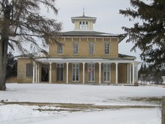 | Samuel M. Hitt House | 2.7 miles | 1985 |
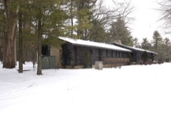 | White Pines State Park Lodge and Cabins | 4.0 miles | 1985 |
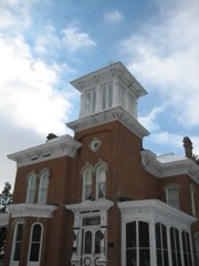 | Pinehill | 5.2 miles | 1978 |
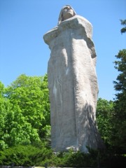 | Indian Statue | 5.3 miles | 2009 |
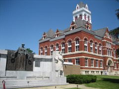 | Ogle County Courthouse | 5.6 miles | 1981 |
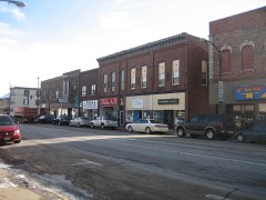 | Oregon Commercial Historic District | 5.7 miles | 2006 |
| National Archives record | The nomination case file for reference 100007993 in Record Group 79. |
| Ogle County | All 29 listed properties in this county. |