 Block
From the record
One of 10 National Register listings published here for Kendall County · listed in 2022 · category: District.
Sources: the National Register database, National Park Service
Listed on the National Register of Historic Places in 2022.
One of 10 National Register listings published here for Kendall County · listed in 2022 · category: District.
Sources: the National Register database, National Park Service
This property stands in Oswego Township. History of Kendall County, Illinois, from the Earliest Discoveries to the Present Time, published 1877 gives that township a chapter of its own.
The chapter covers the township.
Machine-read from a century-old scan, so expect the errors a machine makes: misspelled names, dropped words, stray characters.
Read the whole chapter on Oswego Township - 83 words on its settlement, mills, schools and churches.
Regional context, not property-specific evidence. The federal wildfire occurrence database lists 1 fire within 5 miles of Downtown Oswego Historic District in 2020, burning about 1 acre in total. None started naturally. 1 was recorded as arson. Distance is straight-line from the map coordinates, so a fire counted here may appear on a neighbouring settlement's page as well.
| Reported cause | Fires |
|---|---|
| Arson/incendiarism | 1 |
The most recent of them, most recent first, with the day each was reported and the service that recorded it.
| Date | Cause | Size | Reported by | Name on the report |
|---|---|---|---|---|
| 8 April 2020 | Arson/incendiarism | 1.0 acres | Illinois Division of Forestry Resources | 20-0000121 |
Regional context, not property-specific evidence. The federal mineral resources record lists 5 workings within 5 miles of Downtown Oswego Historic District: 3 past producers, 2 producers. 2 still produce. What was taken out: Sand and Gravel, Construction, Stone, Crushed/Broken. Distance is straight-line from the map coordinates, so a quarry counted here may appear on a neighbouring settlement's page as well.
| Where | Site | Commodity | Status | Recorded |
|---|---|---|---|---|
| Unamed Limestone Quarry | Stone, Crushed/Broken | Past Producer | ||
| Feltes Pit No. 6 | Sand and Gravel, Construction | Producer | ||
| Fox Ridge Stone | Sand and Gravel, Construction | Producer | ||
| Fox Valley Gravel Pit | Sand and Gravel, Construction | Past Producer | ||
| Hafrenrichter Gravel Pit | Sand and Gravel, Construction | Past Producer |
Regional context, not property-specific evidence. The National Weather Service names Oswego, the town this property stands in, in 68 storm reports between 1996 and 2025: 34 thunderstorm wind, 18 hail, 9 flood, 5 flash flood. No death or injury is recorded in these reports. Each account below is quoted exactly as the forecast office filed it, from the NOAA Storm Events Database, and each date opens the federal record of that event.
| When | Event | Place named | Harm | What the report says |
|---|---|---|---|---|
| August 2025 | Flash Flood | Oswego | $300,000 | At Oswego High School, prolonged intense rainfall overwhelmed the capacity of a storm drainage system. Up to two feet of water flooded a courtyard near the school. Water flowed from the courtyard into the school via a set of double doors and reached depths of 8 to 10 inches near the entrance to the building. Water proceeded to flow into hallways, athletic facilities, and the gymnasium. The damage required the gym floor to be replaced. Damages amounted to over $300,000, with the gym floor alone costing around $250,000. |
| June 2010 | Thunderstorm Wind | Oswego | $5,000 | A row of utility poles was blown down along Ridge Road. |
| June 2010 | Thunderstorm Wind | Oswego | $3,000 | A large tree was blown down in front of a house on Fox Mead Court. The tree damaged gutters and siding on the house. |
| March 2017 | Thunderstorm Wind | Oswego | $1,000 | A couple of power poles were blown down. |
| July 2025 | Thunderstorm Wind | Oswego | - | Large tree limbs were blown down in Oswego. |
| July 2025 | Thunderstorm Wind | Oswego | - | Trees were blown down blocking portions of a roadway. |
| July 2025 | Thunderstorm Wind | Oswego | - | A photo showed a large tree limb 15 inches in diameter that was blown down. |
| August 2025 | Heavy Rain | Oswego | - | A private weather station in Oswego recorded 6.02 of 24-hour rainfall, 5.42 of which fell between 2 and 6 AM CST. |
| August 2025 | Flash Flood | Oswego | - | Three to four feet of standing water were reported in Oswego's Fox Chase subdivision. |
| June 2024 | Thunderstorm Wind | Oswego | - | A photo received showed a small tree snapped at the trunk. |
| July 2024 | Flood | Oswego | - | Washington Street was impassable at Route 34 and Route 31 due to flooding. |
| April 2023 | Hail | Oswego | - | A photo showed hail two inches in diameter. |
| July 2023 | Tornado (EF0) | Oswego | - | An EF-0 tornado impacted northeastern Oswego and southeastern Aurora. Damage along the tornado's path was characterized primarily by downed trees and tree limbs, as well as a few instances of exterior damage to homes. |
| September 2022 | Flood | Oswego | - | Street flooding was reported in Oswego. |
| September 2022 | Thunderstorm Wind | Oswego | - | A photo shared on social media showed a healthy 9 inch diameter tree limb snapped near Cheshire Court and Canton Drive. |
| June 2021 | Flash Flood | Oswego | - | The intersection of Route 126 and Ridge Road was flooded and impassable. |
| August 2021 | Thunderstorm Wind | Oswego | - | A large tree limb was blown down and a fence was blown over. Half of another tree was snapped at its fork. |
| May 2020 | Flash Flood | Oswego | - | Multiple reports of flooded roads were received near 127th Street and Collins Road. |
| July 2020 | Thunderstorm Wind | Oswego | - | A 3 to 6 inch diameter tree limb was blown down. |
| August 2020 | Hail | Oswego | - | Nickel to quarter size hail was reported in Oswego. |
| August 2020 | Thunderstorm Wind | Oswego | - | Damage to siding of a house was reported along with small tree limbs blown down nearby. |
| June 2020 | Thunderstorm Wind | Oswego | - | Wind gusts were estimated between 60 mph and 70 mph. |
| May 2019 | Thunderstorm Wind | Oswego | - | A large tree was uprooted along Main Street. |
| May 2019 | Flood | Oswego | - | Six to ten inches of standing water was reported on some neighborhood streets. |
| May 2019 | Thunderstorm Wind | Oswego | - | Wind gusts were estimated to 60 mph. A garage door was damaged by the winds. |
| May 2019 | Hail | Oswego | - | Hail up to two inches in diameter was reported in Oswego. Several homes suffered significant roof, siding and gutter damage. |
| May 2018 | Flood | Oswego | - | Residential flooding was reported in the Southbury subdivision. The intersection of Southbury Blvd and Colchester Drive was flooded with water over the curb and up to the sidewalk. |
| July 2016 | Thunderstorm Wind | Oswego | - | Mature trees were bending. Tree fell on Ashbrook Lane in Plainfield covering most of street. 56 knot winds were reported by broadcast media. |
| June 2013 | Thunderstorm Wind | Oswego | - | A large tree was snapped. |
| June 2013 | Thunderstorm Wind | Oswego | - | A large tree was uprooted on Fox Bend Golf Course off of Ogden Avenue. |
| June 2013 | Hail | Oswego | - | Multiple reports of penny to quarter sized hail were received from Oswego, including a quarter size hail report near the intersection of routes 30 and 34. |
| June 2012 | Thunderstorm Wind | Oswego | - | Trees and tree limbs were blown down. |
| June 2011 | Hail | Oswego | - | Quarter size hail was reported near Collins and Grove Roads. |
| June 2011 | Flood | Oswego | - | Heavy rain caused 10 to 12 inches of standing water at the intersection of Dolores Street and Charles Court. |
| June 2010 | Thunderstorm Wind | Oswego | - | Oswego public works estimated 1,000 trees suffered some kind of damage or were completely blown down. |
| June 2010 | Thunderstorm Wind | Oswego | - | A wind gust was measured to 78 mph on Orchard Road, approximately four miles south of Route 30. |
| June 2010 | Thunderstorm Wind | Oswego | - | A semi truck was blown over on Route 34. |
| December 2008 | Flash Flood | Oswego | - | Collins Road between Plainfield Road and Grove Road was flooded and impassable. Stormtotal rainfall amounts included 1.99 inches about one mile west of Yorkville and 1.93 inches near Plano. |
| March 2007 | Flood | Oswego | - | Six inches of standing water on Reservation Road east of Minkler Road. |
| March 2007 | Flood | Oswego | - | Four to five inches of water on Minkler and Reservation Roads. |
| March 2007 | Flood | Oswego | - | Standing water covering both lanes of 127th Street at the Will/Kendall County line. |
| July 2007 | Flood | Oswego | - | Four inches of flowing water at Simmom and Douglas Roads. Simmon flooded for one half mile. Eight inches of standing water at Dolores and Route 31. |
| April 2006 | Hail | Oswego | - | Penny to quarter size hail was reported across eastern Kendall County. |
| April 2006 | Hail | Oswego | - | Penny size hail was reported at US 34 and US 30. |
| May 2005 | Hail | Oswego | - | Penny size hail reported near Route 34. |
| May 2004 | Thunderstorm Wind | Oswego | - | Large tree limbs were down along Wolfs Crossing Road. |
| August 2003 | Hail | Oswego | - | Reported at the intersection of US 30 and US 34. |
| July 1999 | Thunderstorm Wind | Oswego | - | Trees blown down from thunderstorm winds. |
| May 2019 | Hail | Oswego | - | no account filed |
| May 2015 | Thunderstorm Wind | Oswego | - | no account filed |
| June 2014 | Thunderstorm Wind | Oswego | - | no account filed |
| June 2013 | Hail | Oswego | - | no account filed |
| June 2013 | Hail | Oswego | - | no account filed |
| June 2013 | Hail | Oswego | - | no account filed |
| April 2013 | Hail | Oswego | - | no account filed |
| July 2011 | Thunderstorm Wind | Oswego | - | no account filed |
| May 2011 | Thunderstorm Wind | Oswego | - | no account filed |
| June 2010 | Thunderstorm Wind | Oswego | - | no account filed |
| June 2010 | Thunderstorm Wind | Oswego | - | no account filed |
| June 2009 | Thunderstorm Wind | Oswego | - | no account filed |
No historic map-sheet match is published for this property yet. That does not mean no map exists. This record needs a coordinate-quality review before it can be joined to a sheet boundary. Browse the county's mapped places while that work is pending.
Other National Register properties close enough to walk or drive between, ordered by distance from this one. Both positions come from the same geocoding pass that matched these properties to their map sheets.
| Photograph | Property | Distance | Listed |
|---|---|---|---|
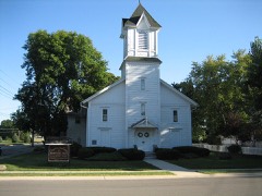 | Bristol Congregational Church | 5.2 miles | 2016 |
 | Yorkville School | 5.5 miles | 1995 |
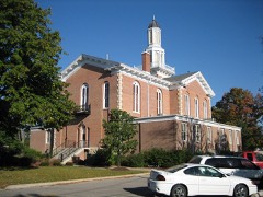 | Kendall County Courthouse | 5.8 miles | 1998 |
| National Archives record | The nomination case file for reference 100007995 in Record Group 79. |
| Kendall County | All 10 listed properties in this county. |