 Block
From the record
One of 621 National Register listings published here for Cook County · listed in 2023 · category: Site.
Sources: the National Register database, National Park Service
Listed on the National Register of Historic Places in 2023.
One of 621 National Register listings published here for Cook County · listed in 2023 · category: Site.
Sources: the National Register database, National Park Service
Regional context, not property-specific evidence. The federal mineral resources record lists 8 workings within 5 miles of Dr. Joseph Carter Corbin Gravesite: 8 past producers. None of them still produces. What was taken out: Stone, Crushed/Broken. Distance is straight-line from the map coordinates, so a quarry counted here may appear on a neighbouring settlement's page as well.
| Where | Site | Commodity | Status | Recorded |
|---|---|---|---|---|
| A C O'Laughlin Stone Co Quarry | Stone, Crushed/Broken | Past Producer | ||
| Bellwood Quarry | Stone, Crushed/Broken | Past Producer | ||
| Melrose Park City Eng. - Own Crews | Stone, Crushed/Broken | Past Producer | ||
| Northlake City Eng. - Own Crews | Stone, Crushed/Broken | Past Producer | ||
| River Forest City Eng - Own Crews | Stone, Crushed/Broken | Past Producer | ||
| Riverside Lime and Stone Co Quarry | Stone, Crushed/Broken | Past Producer | ||
| Summit Quarry Consumers Company | Stone, Crushed/Broken | Past Producer | ||
| West Chester City Eng. - Own Crews | Stone, Crushed/Broken | Past Producer |
Regional context, not property-specific evidence. The National Weather Service names Forest Park, the town this property stands in, in 6 storm reports between 2007 and 2026: 5 thunderstorm wind, 1 hail. No death or injury is recorded in these reports. Each account below is quoted exactly as the forecast office filed it, from the NOAA Storm Events Database, and each date opens the federal record of that event.
| When | Event | Place named | Harm | What the report says |
|---|---|---|---|---|
| June 2010 | Thunderstorm Wind | Forest Park | $40,000 | A large ash tree was blown down onto a house on Marengo Avenue. The tree caused significant damage to the roof, a bedroom and the porch. |
| August 2007 | Thunderstorm Wind | Forest Park | $25,000 | Numerous tree limbs blown down. Three cars were damaged by falling tree limbs on DesPlaines Avenue. |
| June 2010 | Thunderstorm Wind | Forest Park | $2,000 | Numerous trees, tree limbs and power lines were blown down on the west side of the City of Chicago. |
| March 2026 | Hail | Forest Park | - | A handful of 1 to 1.5 inch hail reports were received from near Berwyn and Cicero. |
| July 2024 | Thunderstorm Wind | Forest Park | - | Numerous trees, tree limbs and power lines were blown down between Interstate 290 and Madison Street. Tree and shingle damage was reported throughout the 700 block of Clarence Avenue. Concentrated damage occurred along Jackson Boulevard. Other tree limbs were blown down nearby. |
| August 2024 | Thunderstorm Wind | Forest Park | - | A photo shared via social media showed large tree limb approximately 18 inches in diameter was completely snapped off. |
No historic map-sheet match is published for this property yet. That does not mean no map exists. This record needs a coordinate-quality review before it can be joined to a sheet boundary. Browse the county's mapped places while that work is pending.
Other National Register properties close enough to walk or drive between, ordered by distance from this one. Both positions come from the same geocoding pass that matched these properties to their map sheets.
| Photograph | Property | Distance | Listed |
|---|---|---|---|
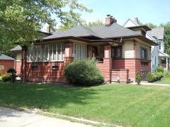 | Mads C. Larson House | 1.1 miles | 1992 |
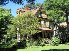 | William H. Hatch House | 1.1 miles | 2007 |
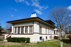 | Mrs. Henry F. Akin House | 1.1 miles | 1992 |
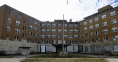 | Baptist Retirement Home | 1.1 miles | 2017 |
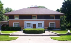 | William H. Winslow House And Stable | 1.2 miles | 1970 |
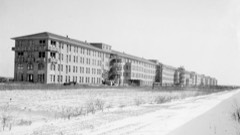 | Edward Jr. Hines Veterans Administration Hospital Historic District | 1.2 miles | 2013 |
| National Archives record | The nomination case file for reference 100008842 in Record Group 79. |
| Cook County | All 621 listed properties in this county. |