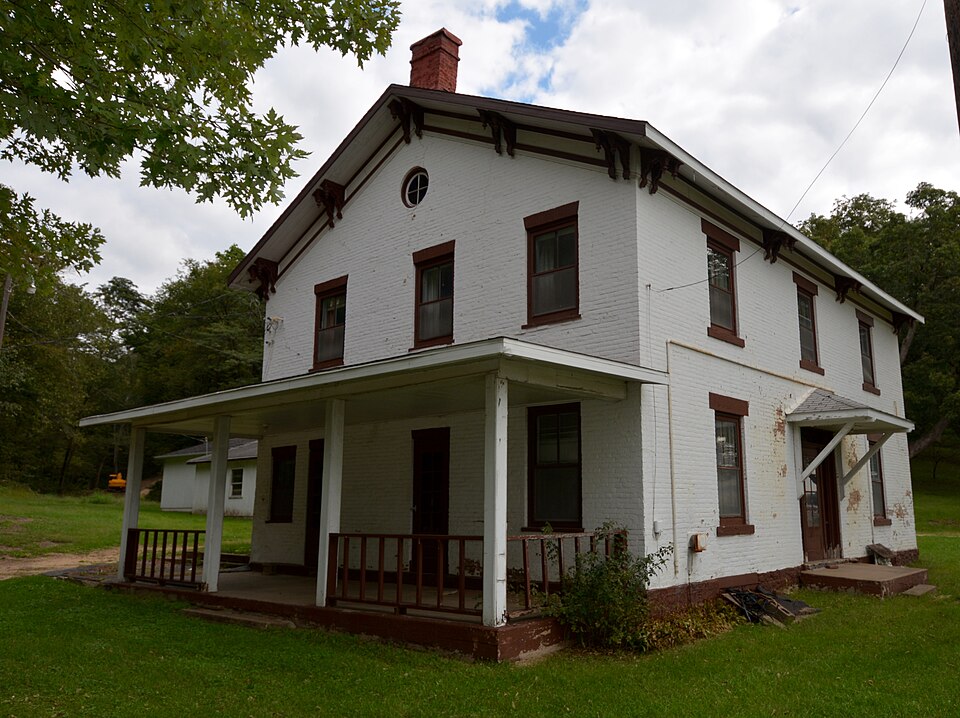
National Register reference number.10001202- the number the National Park Service assigned this property when it was listed, and the key its nomination file is catalogued under at the National Archives.
Regional context, not property-specific
evidence. The
federal wildfire occurrence database
lists 7 fires within 5 miles of Henry N. Frentess Farmstead
between 2010 and 2019, burning about 35 acres in total. None started naturally. None was recorded as arson.
Distance is straight-line from the map coordinates, so a fire counted
here may appear on a neighbouring settlement's page as well.
Reported cause
Fires
Missing data/not specified/undetermined
3
Smoking
2
Debris and open burning
1
Recreation and ceremony
1
The most recent of
them, most recent first, with the day each was reported and the service
that recorded it.
Regional context, not property-specific
evidence. The federal mineral resources record lists
17 workings within 5 miles of Henry N. Frentess Farmstead: 10 past producers, 3 unknowns, 3 producers, 1 occurrence.
3 still produce. What was taken out: Stone, Crushed/Broken, Zinc, Lead, Phosphorus-Phosphates. Distance is straight-line from the
map coordinates, so a quarry counted here may appear on a neighbouring
settlement's page as well.
Regional context, not property-specific
evidence. The National Weather Service names
East Dubuque, the town this property stands in, in 34 storm reports between 1994 and 2024: 9 flash flood, 8 thunderstorm wind, 8 flood, 7 hail.
The reports record 3 deaths. Each account below is quoted exactly as the forecast office
filed it, from the NOAA Storm Events Database, and each date
opens the federal record of that event.
Torrential rains of 7 to 15 inches caused some flash flooding across Jo Davies County during the evening of July 27 and morning of July 28. Numerous streets were reported flooded in East Dubuque causing sink holes to form as well as buckling of the road rending them impassible. A 70 year old woman died in the flood waters after being thrown from a vehicle overcome by flood waters while traveling along Long Hollow Road near Elizabeth, IL. A 75 year old man died in his car which was swept away in flood waters near Galena, IL. A Galena, IL man died of electrocution going down into his flooded basement.
Widespread flash flooding occurred throughout the county from 3 to over 9 inches of rain. Almost 1000 structures were flooded. Two water treatment sewage plants sustained damage with thousands of acres of crops lost. Preliminary damage estimates are between 7 and 8 million dollars.
Heavy rains of 3 to 9 inches fell across Jo Daviess County during the late evening of July 22 and through the morning of July 23 resulting in flash flooding of much of the county. At 315 am CDT, water was over Highway 20 near Galena and Highway 35 near East Dubuque. Apple River overflowed its banks due to the flash flooding. In Elizabeth, water was flowing out of manhole covers. In addition, Lone Street and Apple River Road were closed due to the flood waters. At 940 am CDT, water rescues were in progress in Elizabeth. Several roads were closed due to flooding.
Heavy rains during the late night of July 23 and early morning of July 24 resulted in flash flooding of much of Jo Daviess County during the morning of July 24. Major flooding was observed along the Apple River near Elizabeth, where the river level was just below the bridge deck of Highway 20. Water rescues of stranded motorists were performed near Galena, Stockton, and Scales Mound between 4 am CDT and 630 am CDT. A bridge was washed out near Little Rush Creek and Bethel Road about 3 miles east southeast of Elizabeth, IL. A grocery store in Stockton was flooded with 3 inches of water.||Galena closed their flood gates around 5 am CDT on Saturday the 24th, and the Galena River crested about 3 feet high in front of the gates.
Wind gusts estimated to be 70 mph blew a garage down at 7427 Main Street about 4 miles east of East Dubuque, IL around 655 pm July 24. A boat and truck stored inside the garage were also destroyed.
Lightning caused power outages during the early morning hours of August 7th across parts of Jo Daviess County. A transformer was damaged and needed to be replaced.
The Mississippi River gage at Dubuque Lock and Dam rose above its major flood stage of 20.5 feet around 6 PM CST on July 4 and crested at 20.85 feet on July 6. The river fell back below major flood stage around 1 AM CST on July 9.
Rapid snow melt across Minnesota and Wisconsin caused the Mississippi River at Dubuque Lock and Dam 11 to rise above its major flood stage of 20.5 feet during the evening hours of April 22nd. The river crested at 25.59 feet on April 27th. The river began to gradually fall but remain above major flood stage.
The Mississippi River at Dubuque Lock Dam 11 began the month above the major flood stage of 20.5 feet. The river was at 21.28 feet at midnight and continued to fall below is major flood stage around 6 PM on May 2nd. The Mississippi River at Dubuque (DBQI4) began the month also at major flood stage over 21.5 feet. The river was 22.8 feet at Midnight, and continued to fall below major flood stage by late evening May 4th.
The Mississippi River at Dubuque rose above its major flood stage of 20.5 feet at Dubuque Lock and Dam 11 on April 3rd and fell back below the flood stage late in the day on April 9th. There is a preliminary crest of 21.21 feet midday on the 5th through midday on the 6th. This is preliminarily the 3rd highest crest at that location.
River levels continued to run high during the month of April. Heavy rain across the area caused the Mississippi River to rise above its major flood stage of 20.5 feet early in the morning on the 25th, and it remained above its major flood stage into the month of May. During this second crest, the river crested at 21.77 feet on April 27th. Preliminarily, this is the 4th highest crest on record at Dubuque Lock and Dam 11.
As rainfall totals for the storm approached 2 inches, localized flash flooding began in Jo Daviess County, particularly from East Dubuque towards Galena.
Water 2 to 3 feet deep flowed down Wisconsin Avenue, which ironically had been under construction for a storm-drainage system. The flash flooding left 10-15-foot crevices in the road. Basements of many businesses were filled with water, and about 100 homes were evacuated during the early morning hours. The flash flooding washed away more than a dozen cars in East Dubuque. One truck was pushed into a train bridge, forcing the fast-water rescue of its driver and a passenger.
No historic map-sheet match is published
for this property yet. That does not mean no map exists. This record needs
a coordinate-quality review before it can be joined to a sheet boundary.
Browse the county's mapped places while that work is
pending.
Listed places nearby
2 within 8 miles
Other National Register properties close
enough to walk or drive between, ordered by distance from this one. Both
positions come from the same geocoding pass that matched these properties
to their map sheets.
Listing record. National Park Service National Register of Historic Places, listed-properties dataset, current to 2026-05-22.
Map join. Address geocoded through the United States Census geocoder, then tested against the published boundary of every sheet in the USGS Historical Topographic Map Collection.
How this page is made. Listing fields come from federal records; map-sheet coverage is a labelled coordinate-to-boundary calculation, not a source-field claim.
Wildfire. Short, Karen C. 2022. Spatial wildfire occurrence data for the United States, 1992-2020 [FPA_FOD_20221014]. 6th Edition. Fort Collins, CO: Forest Service Research Data Archive. https://doi.org/10.2737/RDS-2013-0009.6 Collected with United States Government funding and usable without additional permissions or fees.
Mines and quarries. USGS Mineral Resources Data System (MRDS) https://mrdata.usgs.gov/mrds/ A work of the United States government, no copyright under 17 U.S.C. 105.
Storms. NOAA National Centers for Environmental Information, Storm Events Database https://www.ncei.noaa.gov/stormevents/ A work of the United States government, no copyright under 17 U.S.C. 105. Narratives are quoted verbatim from the National Weather Service report and are not edited or summarised.
 Block