 Block
From the record
One of 29 National Register listings published here for Ogle County · listed in 2026 · category: Building.
Sources: the National Register database, National Park Service
Listed on the National Register of Historic Places in 2026.
One of 29 National Register listings published here for Ogle County · listed in 2026 · category: Building.
Sources: the National Register database, National Park Service
The chapter on Grand Detour Township in The History of Ogle County, Illinois, Containing a History of the County, Its Cities, Towns, Etc., a Biographical Directory of Its Citizens, War Record of Its Volunteers in the Late Rebellion, General and Local Statistics ... History of the Northwest, History of Illinois ... Etc, published 1878 names Grand Detour. This is what it says, exactly as the scans read.
Al^DRUS WIIiLilAM C. Farmer ; Grand Detour ; was born Nov. 28, 1850, at Grand Detour; Mr. A.'s father was born in Cornwall, Vt., in 1803 ; married Miss Sarah Bosworth June 3, 1838 ; she was born June 27, 1819, in Windsor Co., Vt., died Oct. 29, 1858 ; came to this county in 1838 ; he was in the Legislature and Super-
Passage source: The History of Ogle County, Illinois, Containing a History of the County, Its Cities, Towns, Etc., a Biographical Directory of Its Citizens, War Record of Its Volunteers in the Late Rebellion, General and Local Statistics ... History of the Northwest, History of Illinois ... Etc, published 1878.
Cj^ATES emery T. Farmer; Sec. 1 ; P. 0. Grand Detour ; was born in Windom County, Vt., and came to this county, Oct., 1838 ; married Miss Caroline M. Talmer, Sept. 1, 1839, born in St. Lawrence Co., N. Y., Oct. 8, 1812 ; have raised two children by adoption - Mary E., born Nov. 5, 1841, died July 13, 1860 ; Byron Taylor, born in 1845; living in Iowa ; enlisted in the late war from 1861 until the close ; Mr. Gates and wife were members of the F. W. Baptist Church, until it disbanded ; was Church Clerk about ten years ; at present are members of Methodist Church ; Mr. Gates came from Vermont in his own team, with twelve passengers ; they
Passage source: The History of Ogle County, Illinois, Containing a History of the County, Its Cities, Towns, Etc., a Biographical Directory of Its Citizens, War Record of Its Volunteers in the Late Rebellion, General and Local Statistics ... History of the Northwest, History of Illinois ... Etc, published 1878.
Machine-read from a century-old scan, so expect the errors a machine makes: misspelled names, dropped words, stray characters.
Read the whole chapter on Grand Detour Township - 25,103 words on its settlement, mills, schools and churches.
Regional context, not property-specific evidence. The federal wildfire occurrence database lists 2 fires within 5 miles of St. Peter's Episcopal Church between 2011 and 2020, burning about 3 acres in total. None started naturally. None was recorded as arson. Distance is straight-line from the map coordinates, so a fire counted here may appear on a neighbouring settlement's page as well.
| Reported cause | Fires |
|---|---|
| Missing data/not specified/undetermined | 2 |
The most recent of them, most recent first, with the day each was reported and the service that recorded it.
| Date | Cause | Size | Reported by | Name on the report |
|---|---|---|---|---|
| 22 April 2020 | Missing data/not specified/undetermined | 2.0 acres | Illinois Division of Forestry Resources | 20-0327 |
| 30 March 2011 | Missing data/not specified/undetermined | 1.0 acres | Illinois Division of Forestry Resources | YOCUM |
Regional context, not property-specific evidence. The federal mineral resources record lists 18 workings within 5 miles of St. Peter's Episcopal Church: 14 past producers, 3 occurrences, 1 producer. 1 still produces. What was taken out: Stone, Crushed/Broken, Sand and Gravel, Construction, Limestone, General. Distance is straight-line from the map coordinates, so a quarry counted here may appear on a neighbouring settlement's page as well.
| Where | Site | Commodity | Status | Recorded |
|---|---|---|---|---|
| Dixon Quarry & Cement Plant | Limestone, General | Producer | ||
| Medusa Quarry | Sand and Gravel, Construction | Past Producer | ||
| Hallquist Quarry | Stone, Crushed/Broken | Past Producer | ||
| Limestone Prospect | Stone, Crushed/Broken | Occurrence | ||
| Limestone Prospect | Stone, Crushed/Broken | Occurrence | ||
| Limestone Prospect | Stone, Crushed/Broken | Occurrence | ||
| Sandusky Quarry | Stone, Crushed/Broken | Past Producer | ||
| Sanner Quarry | Stone, Crushed/Broken | Past Producer | ||
| Steder Quarry | Stone, Crushed/Broken | Past Producer | ||
| Unnamed Limestone Quarry | Stone, Crushed/Broken | Past Producer |
Regional context, not property-specific evidence. The National Weather Service names Grand Detour, the town this property stands in, in 3 storm reports between 2010 and 2026: 1 thunderstorm wind, 1 hail, 1 tornado. No death or injury is recorded in these reports. Each account below is quoted exactly as the forecast office filed it, from the NOAA Storm Events Database, and each date opens the federal record of that event.
| When | Event | Place named | Harm | What the report says |
|---|---|---|---|---|
| April 2026 | Tornado (EF1) | Grand Detour | - | An NWS damage survey confirmed that a brief EF-1 tornado with estimated peak winds of 105 mph impacted a few properties along Ridge Road in southern Ogle County. One house had two-thirds of its roof removed by the tornado and several trees were damaged by the tornado as well. |
| March 2024 | Hail | Grand Detour | - | A photo shared on social media showed quarter size hail near Grand Detour. |
| June 2010 | Thunderstorm Wind | Grand Detour | - | Numerous trees were blown down. |
No historic map-sheet match is published for this property yet. That does not mean no map exists. This record needs a coordinate-quality review before it can be joined to a sheet boundary. Browse the county's mapped places while that work is pending.
Other National Register properties close enough to walk or drive between, ordered by distance from this one. Both positions come from the same geocoding pass that matched these properties to their map sheets.
| Photograph | Property | Distance | Listed |
|---|---|---|---|
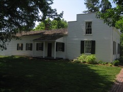 | John Deere House and Shop | 0.1 miles | 1966 |
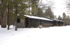 | White Pines State Park Lodge and Cabins | 7.2 miles | 1985 |
| National Archives record | The nomination case file for reference 100012470 in Record Group 79. |
| Ogle County | All 29 listed properties in this county. |