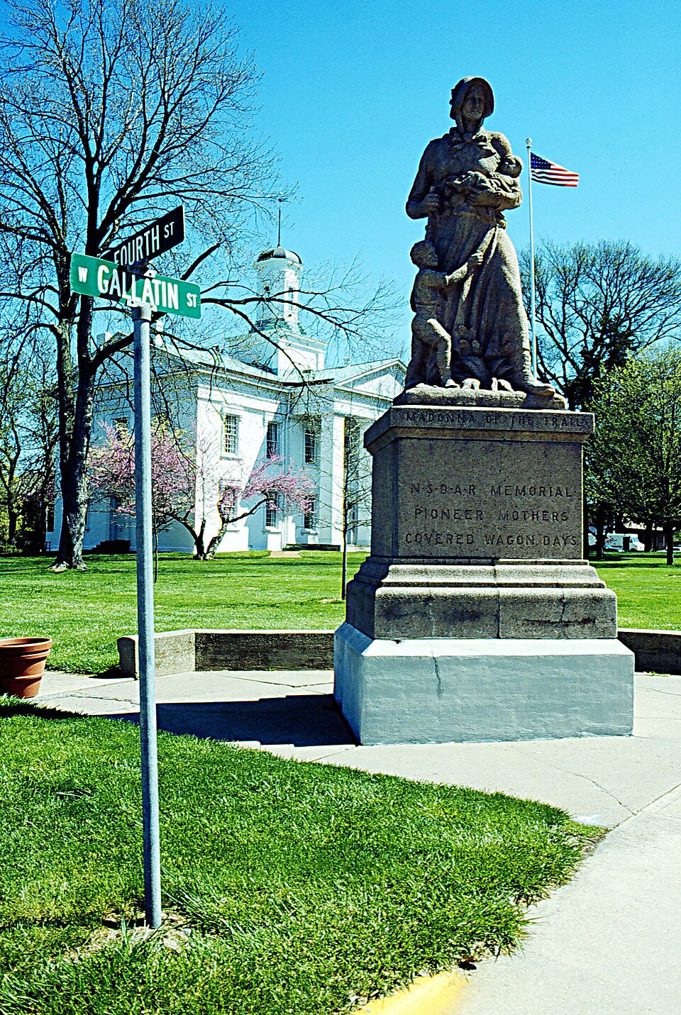
Built in 1836 (Greek Revival architecture). Listed on the National Register of Historic Places in 1974.
From the record
“The Vandalia State House, built in 1836, is the fourth capitol building of the U.S. state of Illinois. It is also the oldest capitol building in Illinois to survive, as the first, second, and third capitol buildings have all disappeared.”
Wikipedia article Vandalia State House State Historic Site, CC BY-SA 4.0.
One of 4 National Register listings published here for Fayette County · listed in 1974 · category: Building · built in 1836, Greek Revival architecture.
National Register reference number.74000760- the number the National Park Service assigned this property when it was listed, and the key its nomination file is catalogued under at the National Archives.
The ground it stands on
1,792 words
The chapter on Vandalia Township in History of Fayette County, Illinois, published 1878 names Vandalia. This is what it says, exactly as the scans read.
This town was surveyed aul laid out in July, 1819, by Wm. C. Greenup, Beal Greenup, and John McCullom, and was for about twenty years the seat of Government for the state. In the year 1820 the state capital re¬ moved here from Kaskaskia, and the village at once became a place of im¬ portance, and boasted a population of 2,000 people. In 1839 the capital was removed to Springfield, and Vandalia rapidly declined until its popula¬ tion numbered less than 500, at which figure it remained for many years. - However, on the building of the Ill. Central R. R. it began to grow in com¬ mercial and manufacturing importance, and bids fair to become an important and thriving city.
The following is a statement of the course of study, number of teachers and pupils, the different departments, the names of teachers and number of pupils in each department of the Vandalia Public Schools for the term ending December 21, 1877. Principal - J. D. Collins.*
Regional context, not property-specific
evidence. The federal mineral resources record lists
7 workings within 5 miles of Vandalia Statehouse: 5 past producers, 2 producers.
2 still produce. What was taken out: Sand and Gravel, Construction, Stone. Distance is straight-line from the
map coordinates, so a quarry counted here may appear on a neighbouring
settlement's page as well.
Regional context, not property-specific
evidence. The National Weather Service names
Vandalia, the town this property stands in, in 47 storm reports between 1994 and 2025: 31 thunderstorm wind, 11 hail, 3 tornado, 1 funnel cloud.
No death or injury is recorded in these reports. Each account below is quoted exactly as the forecast office
filed it, from the NOAA Storm Events Database, and each date
opens the federal record of that event.
A small tornado formed in Fayette County south of Vandalia. One mobile home was destroyed, a boat dock at a pond destroyed and several trees downed. Power lines were also downed.
There were numerous hail reports between Vandalia and Brownstown at around 6PM CST. Hail in Vandalia was sub-severe, but the storm intensified and produced 1.00 to 1.25 in diameter hail in Brownstown.
Thunderstorm winds caused a wide swath of damage from Vandalia to near Stanbery Lake. Numerous large trees, tree limbs and power lines were blown down. In Vandalia, several homes sustained moderate to major damage from the fallen trees. Near Stanbery Lake, a home was destroyed by two large trees. One home owner was briefly trapped in the home, but was rescued unharmed from the home.
Thunderstorm winds blew down numerous trees, tree limbs and power lines in Vandalia, Brownstown, and St. Elmo. A few of the fallen trees blocked U.S. Highway 51 in Vandalia.
Thunderstorm winds blew down several large tree limbs and power lines around town. Also, the winds blew over a semi on Interstate 70. No injuries were reported.
National Weather Service personnel did a survey of the damage in the Vandalia area and determined that it was straight line wind damage. Numerous large tree limbs, trees and power lines were blown down. Overall the damage was produced by 50 to 60 mph winds. However, there were two areas of damage that suggested slightly higher wind speeds. One area was a corn field about a mile west of the U.S. Highway 40-Interstate 70 interchange that was completely flattened. The other area of slightly higher winds was over southern sections of Vandalia. Tree damage here was a bit more extensive and two large trees were totally uprooted by the winds. There was also some minor damage to two metal roofs in the area.
A small tornado hit northwest of Vandalia. A couple of machine sheds were damaged and one two-story home suffered roof damage. Several trees were downed along the path as well.
No historic map-sheet match is published
for this property yet. That does not mean no map exists. This record needs
a coordinate-quality review before it can be joined to a sheet boundary.
Browse the county's mapped places while that work is
pending.
Listed places nearby
2 within 8 miles
Other National Register properties close
enough to walk or drive between, ordered by distance from this one. Both
positions come from the same geocoding pass that matched these properties
to their map sheets.
Listing record. National Park Service National Register of Historic Places, listed-properties dataset, current to 2026-05-22.
Map join. Address geocoded through the United States Census geocoder, then tested against the published boundary of every sheet in the USGS Historical Topographic Map Collection.
How this page is made. Listing fields come from federal records; map-sheet coverage is a labelled coordinate-to-boundary calculation, not a source-field claim.
Mines and quarries. USGS Mineral Resources Data System (MRDS) https://mrdata.usgs.gov/mrds/ A work of the United States government, no copyright under 17 U.S.C. 105.
Storms. NOAA National Centers for Environmental Information, Storm Events Database https://www.ncei.noaa.gov/stormevents/ A work of the United States government, no copyright under 17 U.S.C. 105. Narratives are quoted verbatim from the National Weather Service report and are not edited or summarised.
 Block