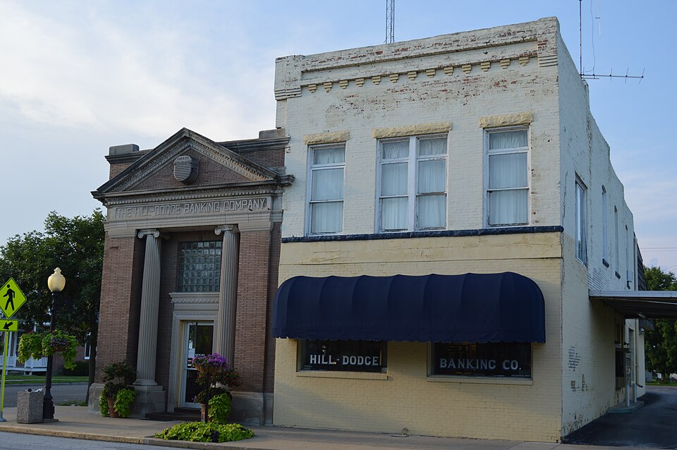
National Register reference number.77000486- the number the National Park Service assigned this property when it was listed, and the key its nomination file is catalogued under at the National Archives.
Cyrus B. Adams, proprietor of the Adams House of Warsaw, is a native of Rochester, New York; was born May 25. 1S22, and is a son of J. D. Adams, who was a native of Vermont. He was reared and educated in JSTew York; came to Warsaw in 1858, and brought tlie first locomotive on the T., P. &. W. R. R. to Warsaw. He was master meciianic and assistant superintendent of the raih'oad until 1862, when he entered the navy; was 1st Asst. Engineer of the Mississippi squadron, being 3 years in the service, which closed in 1865. Soon afterward he opened the Adams House, and is still proprietor, and keeps a first-class hotel. He was married Dec. 12, 1843, to Catharine Lanard, of Canada. On his father's side he is of Scotch ancestry. His father was in the war of 1812, and participated in the battle of Lake Champlain. He was Ensign in the navy. His grandfather was a soldier in the Revolutionary war, participating in the first battle of the Revolution. On his mother's side he is of French ancestry. Her uncle was a soldier in the Revolutionary war; also was in the frigate Boston; was ranked as Captain in the army. The Master was taken prisoner and confined in Dartmere prison in London, about 8 months.
C. Alhers is a native of Hanover, German^', and was born in 1817. He emigrated to America in 1836, and to Warsaw in 1847. He here became a prominent merchant, and in 1856 erected a large flouring mill at a cost of $30,000. This mill is known far and near as the " Grace Mills," and stands on the foundation of the Water street mill that was erected in 1854, and was burned in 1855, during the great conflagration that occurred in Warsaw at that time. C. Albers & Co. manufacture the best of flour, and have entirely a merchant trade. They use Thropp's patent middlings purifier, and Becker's brusher. There are 6 stands of burrs, which are driven by an 80 horse-power engine. The present capacity of the mill is 250 barrels in 24 hours.
Regional context, not property-specific
evidence. The
federal wildfire occurrence database
lists 4 fires within 5 miles of Warsaw Historic District
between 1996 and 2014, burning about 77 acres in total. None started naturally. None was recorded as arson.
Distance is straight-line from the map coordinates, so a fire counted
here may appear on a neighbouring settlement's page as well.
Reported cause
Fires
Debris and open burning
3
Missing data/not specified/undetermined
1
The most recent of
them, most recent first, with the day each was reported and the service
that recorded it.
Regional context, not property-specific
evidence. The federal mineral resources record lists
3 workings within 5 miles of Warsaw Historic District: 2 past producers, 1 producer.
1 still produces. What was taken out: Stone, Crushed/Broken, Sand and Gravel, Construction. Distance is straight-line from the
map coordinates, so a quarry counted here may appear on a neighbouring
settlement's page as well.
Regional context, not property-specific
evidence. The National Weather Service names
Warsaw, the town this property stands in, in 30 storm reports between 1996 and 2020: 12 thunderstorm wind, 7 hail, 5 tornado, 3 flash flood.
No death or injury is recorded in these reports. Each account below is quoted exactly as the forecast office
filed it, from the NOAA Storm Events Database, and each date
opens the federal record of that event.
Heavy rains resulted in some flash flooding in parts of Hancock County IL during the morning of June 14. New Warsaw Rd in Warsaw, IL to Route 400 E was closed due to the flood waters. Several mud slides occurred in the area.
A tornado touched down briefly around 8:45 pm at the farm residence located at 875 N County Road 300E just southwest of Warsaw, IL. The roof of a cattle barn, a corn storage silo, irrigation equipment, some trees, and the roof, siding and a window of the residence were all damaged.
The Mississippi River at Gregory Landing and Keokuk began June above their major flood stages of 25.0 and 19.0 feet respectively. The river at Gregory Landing fell below major flood stage around 5 AM on June 1st and around 5 AM on June 13th at Keokuk. The river crested at 26.97 feet on June 2 at Gregory Landing which is preliminarily the 3rd highest crest on record. The Mississippi River at Keokuk crested on May 30th and was falling through the month of June but its highest level during the month was 25.3 feet early on June 1st.
Heavy rains resulted in some flash flooding during the evening of June 1 across parts of Hancock County Illinois. A bridge on Conable Road about 5 miles north of Hamilton, IL was under flood waters. In addition, the Bentley Blacktop was flooded and impassible just east of Bentley, IL.
No historic map-sheet match is published
for this property yet. That does not mean no map exists. This record needs
a coordinate-quality review before it can be joined to a sheet boundary.
Browse the county's mapped places while that work is
pending.
Listed places nearby
1 within 8 miles
Other National Register properties close
enough to walk or drive between, ordered by distance from this one. Both
positions come from the same geocoding pass that matched these properties
to their map sheets.
Listing record. National Park Service National Register of Historic Places, listed-properties dataset, current to 2026-05-22.
Map join. Address geocoded through the United States Census geocoder, then tested against the published boundary of every sheet in the USGS Historical Topographic Map Collection.
How this page is made. Listing fields come from federal records; map-sheet coverage is a labelled coordinate-to-boundary calculation, not a source-field claim.
Wildfire. Short, Karen C. 2022. Spatial wildfire occurrence data for the United States, 1992-2020 [FPA_FOD_20221014]. 6th Edition. Fort Collins, CO: Forest Service Research Data Archive. https://doi.org/10.2737/RDS-2013-0009.6 Collected with United States Government funding and usable without additional permissions or fees.
Mines and quarries. USGS Mineral Resources Data System (MRDS) https://mrdata.usgs.gov/mrds/ A work of the United States government, no copyright under 17 U.S.C. 105.
Storms. NOAA National Centers for Environmental Information, Storm Events Database https://www.ncei.noaa.gov/stormevents/ A work of the United States government, no copyright under 17 U.S.C. 105. Narratives are quoted verbatim from the National Weather Service report and are not edited or summarised.
 Block