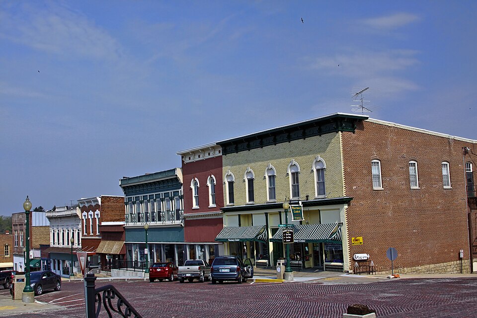
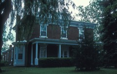
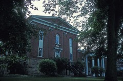
Listed on the National Register of Historic Places in 1980.
From the record
“The Mount Carroll Historic District is a designated historic district in the Carroll County, Illinois town of Mount Carroll, which is the county seat. The district is listed on the National Register of Historic Places (NRHP), and is one of a total of six sites in the county included on the Register.”
Wikipedia article Mount Carroll Historic District, CC BY-SA 4.0.
One of 6 National Register listings published here for Carroll County · listed in 1980 · category: District.
National Register reference number.80001340- the number the National Park Service assigned this property when it was listed, and the key its nomination file is catalogued under at the National Archives.
What happened here
An account from the chapter on Mount Carroll township. The inset identifies its exact
source book and publication year.
ALI^ISOX JOkSKPH F. County Treasurer; born near Toronto, Canaila, October 19, 1«88; came to the States in infancy; came to Carroll Co. in iy40, and has lived here 37 years; one of the early settlers; was in the army during the Rebellion - in ir)tii Rogt. I. V. I., Co. H; was wounded at llatehee Kiver, Tenn., and at Champion Hills, Miss.; was in battle Pittsburg Landing, siege Vicksl)urg, Coriuth and Atlanta; was elected Circuiit Clerk, 18«8; was elected Treasurer of Carroll Co., 1«7;{, and re-electi'd, 1S7."> ami 1877; married Miss Ilallie A.
This certificate was returned to the County Commissioners' Court and ordered to be spread upon the record, and is to be seen on the Oth page ot within the territory of the county there were only three precmcts or voting places - Savanna, Plum River and Elkhorn Grove. Only two places for the county seat were voted for - Savanna, and Section 9 jn townshii) 24: north, range 5 east, about three miles to_ the southeast ot Mount Carroll. The vote in the three precincts was as follows:
A third addition of 40 by 100 feet at the northeast corner of the buildings already erected, was commenced in 1S65 and completed in 1867. It has four stories and a fifteen-room attic - adding, all told, seventy-one rooms, and increasing the other conveniences in like proportion, and costing about $30,000. As in the construction of the other additions, so in this one. Miss Wood superintended the building from its commencement to its completion. She contracted for the lumber with Minnesota Mills, and had it delivered in strings of rafts at Savanna. There she contracted with planing mills to receive it, reduce it to proper dimensions for particular purposes, to dress it and deliver it on the cars, having also contracted with the railroad authorities to deliver'it from Savanna at the Mount Carroll depot. In this way she maintains that she saved fully, if not more than half in the cost of the lumber as compared with the price asked by dealers here. Lime, glass, paint, paper, etc., were bought the same way. The stone used was taken from her own quarries by men hired by the day.
Regional context, not property-specific
evidence. The
federal wildfire occurrence database
lists 1 fire within 5 miles of Mount Carroll Historic District
in 2009, burning about 2 acres in total. None started naturally. None was recorded as arson.
Distance is straight-line from the map coordinates, so a fire counted
here may appear on a neighbouring settlement's page as well.
Reported cause
Fires
Missing data/not specified/undetermined
1
The most recent of
them, most recent first, with the day each was reported and the service
that recorded it.
Regional context, not property-specific
evidence. The federal mineral resources record lists
9 workings within 5 miles of Mount Carroll Historic District: 8 past producers, 1 producer.
1 still produces. What was taken out: Stone, Crushed/Broken, Sand and Gravel, Construction. Distance is straight-line from the
map coordinates, so a quarry counted here may appear on a neighbouring
settlement's page as well.
Regional context, not property-specific
evidence. The National Weather Service names
Mount Carroll, the town this property stands in, in 1 storm report in 1995: 1 thunderstorm wind.
No death or injury is recorded in these reports. Each account below is quoted exactly as the forecast office
filed it, from the NOAA Storm Events Database, and each date
opens the federal record of that event.
No historic map-sheet match is published
for this property yet. That does not mean no map exists. This record needs
a coordinate-quality review before it can be joined to a sheet boundary.
Browse the county's mapped places while that work is
pending.
Listed places nearby
3 within 8 miles
Other National Register properties close
enough to walk or drive between, ordered by distance from this one. Both
positions come from the same geocoding pass that matched these properties
to their map sheets.
Listing record. National Park Service National Register of Historic Places, listed-properties dataset, current to 2026-05-22.
Map join. Address geocoded through the United States Census geocoder, then tested against the published boundary of every sheet in the USGS Historical Topographic Map Collection.
How this page is made. Listing fields come from federal records; map-sheet coverage is a labelled coordinate-to-boundary calculation, not a source-field claim.
Wildfire. Short, Karen C. 2022. Spatial wildfire occurrence data for the United States, 1992-2020 [FPA_FOD_20221014]. 6th Edition. Fort Collins, CO: Forest Service Research Data Archive. https://doi.org/10.2737/RDS-2013-0009.6 Collected with United States Government funding and usable without additional permissions or fees.
Mines and quarries. USGS Mineral Resources Data System (MRDS) https://mrdata.usgs.gov/mrds/ A work of the United States government, no copyright under 17 U.S.C. 105.
Storms. NOAA National Centers for Environmental Information, Storm Events Database https://www.ncei.noaa.gov/stormevents/ A work of the United States government, no copyright under 17 U.S.C. 105. Narratives are quoted verbatim from the National Weather Service report and are not edited or summarised.
 Block