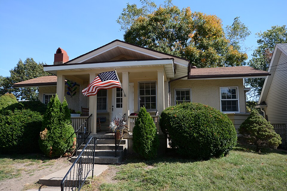
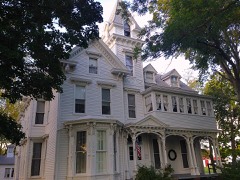
Listed on the National Register of Historic Places in 1980.
From the record
“The Carlinville Chapter House is a historic building located at 111 S. The building was constructed between 1909 and 1910 as a meetinghouse for Carlinville's chapter of the American Woman's League.”
Wikipedia article Carlinville Chapter House, CC BY-SA 4.0.
One of 8 National Register listings published here for Macoupin County · listed in 1980 · category: Building.
Also known as. American Woman's League Chapter Houses TR
Township. Carlinville township
Architectural style. Prairie School architecture
Architect. Helfensteller, Hirsch & Watson
National Register reference number.80001385- the number the National Park Service assigned this property when it was listed, and the key its nomination file is catalogued under at the National Archives.
Carlinville is now (1911), a beautiful little city 6f 3,616 population, with most of its business houses on four streets which face the square. The place is devoid of manufactories, although at one time it had nourishing machine shops, a brewery, established in 1859 by Steel & Lebherz, which continued in operation many years. This and the machine shops have long been abandoned. There were mills in Carlinville, the output of which was many hundred barrels of flour per day. These have gone out of existence, most of them having been destroyed by fire, until today not one remains.
Carlinville is a splendid trading town and has one of the. most fertile and prosperous regions in central Illinois from which to secure customers. With good roads and railroad facilities unsurpassed in the Chicago & Alton and the Illinois Traction System, the people easily reach her marts, not only from all points of the county but from adjoining territory. Her merchants are consequently busy and prosperous, as is evidenced by the modern store buildings and many handsome homes, cRurches and other structures.
Regional context, not property-specific
evidence. The federal mineral resources record lists
2 workings within 5 miles of Carlinville Chapter House: 1 past producer, 1 occurrence.
None of them still produces. What was taken out: Stone, Stone, Crushed/Broken. Distance is straight-line from the
map coordinates, so a quarry counted here may appear on a neighbouring
settlement's page as well.
Regional context, not property-specific
evidence. The National Weather Service names
Carlinville, the town this property stands in, in 50 storm reports between 1995 and 2025: 27 hail, 21 thunderstorm wind, 2 tornado.
No death or injury is recorded in these reports. Each account below is quoted exactly as the forecast office
filed it, from the NOAA Storm Events Database, and each date
opens the federal record of that event.
Numerous tree limbs were blown down around town. Also, a 55 foot tree was blown over crashing through a fence and into a back yard. The tree was alive but hollow. Several power lines were blown down as well.
Ham radio spotters reported threee-quarters inch diameter hail in the Brighton area. Several minutes later, the Illinois State Police and the county sheriff reported golf ball-size hail in and around Carlinville, lasting for about ten minutes.
No historic map-sheet match is published
for this property yet. That does not mean no map exists. This record needs
a coordinate-quality review before it can be joined to a sheet boundary.
Browse the county's mapped places while that work is
pending.
Listed places nearby
2 within 8 miles
Other National Register properties close
enough to walk or drive between, ordered by distance from this one. Both
positions come from the same geocoding pass that matched these properties
to their map sheets.
Listing record. National Park Service National Register of Historic Places, listed-properties dataset, current to 2026-05-22.
Map join. Address geocoded through the United States Census geocoder, then tested against the published boundary of every sheet in the USGS Historical Topographic Map Collection.
How this page is made. Listing fields come from federal records; map-sheet coverage is a labelled coordinate-to-boundary calculation, not a source-field claim.
Mines and quarries. USGS Mineral Resources Data System (MRDS) https://mrdata.usgs.gov/mrds/ A work of the United States government, no copyright under 17 U.S.C. 105.
Storms. NOAA National Centers for Environmental Information, Storm Events Database https://www.ncei.noaa.gov/stormevents/ A work of the United States government, no copyright under 17 U.S.C. 105. Narratives are quoted verbatim from the National Weather Service report and are not edited or summarised.
 Block