Listed on the National Register of Historic Places in 1984.
From the record
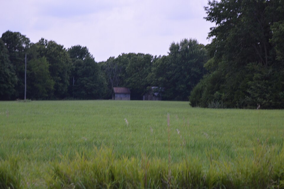
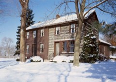
“Cambre House and Farm is a historic farmstead located southwest of Niota, Hancock County, Illinois, United States. The farmhouse was built in 1867 by Adolphe Cambre, a French immigrant and member of Nauvoo's short-lived Icarian community.”
Wikipedia article Cambre House and Farm, CC BY-SA 4.0.
One of 9 National Register listings published here for Hancock County · listed in 1984 · category: Building.
National Register reference number.84000308- the number the National Park Service assigned this property when it was listed, and the key its nomination file is catalogued under at the National Archives.
Regional context, not property-specific
evidence. The
federal wildfire occurrence database
lists 4 fires within 5 miles of Cambre House and Farm
between 2009 and 2020, burning about 5 acres in total. None started naturally. None was recorded as arson.
Distance is straight-line from the map coordinates, so a fire counted
here may appear on a neighbouring settlement's page as well.
Reported cause
Fires
Debris and open burning
2
Missing data/not specified/undetermined
1
Smoking
1
The most recent of
them, most recent first, with the day each was reported and the service
that recorded it.
Regional context, not property-specific
evidence. The federal mineral resources record lists
3 workings within 5 miles of Cambre House and Farm: 2 producers, 1 past producer.
2 still produce. What was taken out: Molybdenum, Stone, Crushed/Broken, Sand and Gravel, Construction. Distance is straight-line from the
map coordinates, so a quarry counted here may appear on a neighbouring
settlement's page as well.
Regional context, not property-specific
evidence. The National Weather Service names
Niota, the town this property stands in, in 12 storm reports between 1995 and 2024: 6 thunderstorm wind, 2 hail, 2 flood, 1 tornado.
The reports record 7 injuries. Each account below is quoted exactly as the forecast office
filed it, from the NOAA Storm Events Database, and each date
opens the federal record of that event.
The supercell storm that produced this tornado developed over Clark County, Missouri and produced a funnel cloud over Fort Madison, Iowa before it moved into west-central Illinois and preceded to produce a large tornado. The tornado started out as an F0 when it first touched down south of Niota and, based on damage surveyed the following day, grew to F3 strength by the time it reached Dallas City. Eye witnesses saw three separate funnels at on point. The Dallas City school received major damage and one older house was blown off its foundation. Several mobile homes were destroyed and a car was rolled six feet up a hill. The tornado preceded to the northeast and gained in strength. About one mile northwest of Disco the tornado reached F4 strength. At this time the tornado was just about right on the county line between Hancock and Henderson Counties and struck the Maxine Clover farm site. The Clover brick home was totally destroyed with only a few parts of walls still standing. The tornado appeared to be about one-half mile wide. The tornado continued to the northeast where it struck the Dick Edmunds farm site. The Edmunds seventeen year old brick home was destroyed along with most of the other farm buildings. Sixty animals had to be destroyed. As the tornado crossed highway 94 just south of Terre Haute it only produced F0 to F1 damage, but still appeared to be about one-half mile wide by the scoured dirt path it ground into the area farm fields. At this time the tornado was approaching the small community of Raritan. The Wendell Shaner farm site, located one and one-half miles southwest of Raritan, was hit at this time. Mr. Shaner was thrown about 70 yards out of his home into a field east of the house. Mr. Shaner received broken rips and other internal injuries. The Shaner farm site was totally destroyed. Where the home had been located there was nothing left, but the basement stuffed full of debris. Hundreds of dead hogs were scattered along and up a hill to the northeast of the home site. The tornado then clipped the southeast corner of the community of Raritan where damage was limited to areas along and south of main street. The Carl Huss home was totally destroyed while he was in the basement. Mr. Huss received a large bruise on his back when cement blocks were pulled in from the west side of the basement as the home was shredded off its foundation. The 137-year-old farmstead of John and Bev Livermore was also hit at about this time. Mr. Livermore was in the basement with his two grand-children when the tornado struck. The home heating fuel tank, located in the basement, was sucked up and thrown 50 yards away from the house. Mr. Livermore literally had to lay on his grandson to keep him from being pulled out of the basement. The home was totally destroyed. The Richard Likes home, also on the east side of Raritan, was totally blown off the foundation and pushed 50 yards into the field to the east. The Likes were not home at the time. This is also about the time the tornado appeared to reach its maximum width of 0.6 miles. One to two miles northeast of Rariton the large tornado either weakened or dissipated. Regardless, F0 to F1 damage and debris continued across Warren County from either the weakened tornado or multiple spinoff tornados. The tornado finally exited Warren county about six miles southwest of Abingdon. This large tornado produced no fatalities and only one injury was of a serious nature.
Heavy rains resulted in flash flooding between Dallas City, IL and Niota, IL during the late evening of August 27. At 1016 pm, the flood waters were covering Highway 9 between Niota and Dallas City. Prior to that time, flood waters in the area were deep enough to float a car.
No historic map-sheet match is published
for this property yet. That does not mean no map exists. This record needs
a coordinate-quality review before it can be joined to a sheet boundary.
Browse the county's mapped places while that work is
pending.
Listed places nearby
2 within 8 miles
Other National Register properties close
enough to walk or drive between, ordered by distance from this one. Both
positions come from the same geocoding pass that matched these properties
to their map sheets.
Listing record. National Park Service National Register of Historic Places, listed-properties dataset, current to 2026-05-22.
Map join. Address geocoded through the United States Census geocoder, then tested against the published boundary of every sheet in the USGS Historical Topographic Map Collection.
How this page is made. Listing fields come from federal records; map-sheet coverage is a labelled coordinate-to-boundary calculation, not a source-field claim.
Wildfire. Short, Karen C. 2022. Spatial wildfire occurrence data for the United States, 1992-2020 [FPA_FOD_20221014]. 6th Edition. Fort Collins, CO: Forest Service Research Data Archive. https://doi.org/10.2737/RDS-2013-0009.6 Collected with United States Government funding and usable without additional permissions or fees.
Mines and quarries. USGS Mineral Resources Data System (MRDS) https://mrdata.usgs.gov/mrds/ A work of the United States government, no copyright under 17 U.S.C. 105.
Storms. NOAA National Centers for Environmental Information, Storm Events Database https://www.ncei.noaa.gov/stormevents/ A work of the United States government, no copyright under 17 U.S.C. 105. Narratives are quoted verbatim from the National Weather Service report and are not edited or summarised.
 Block