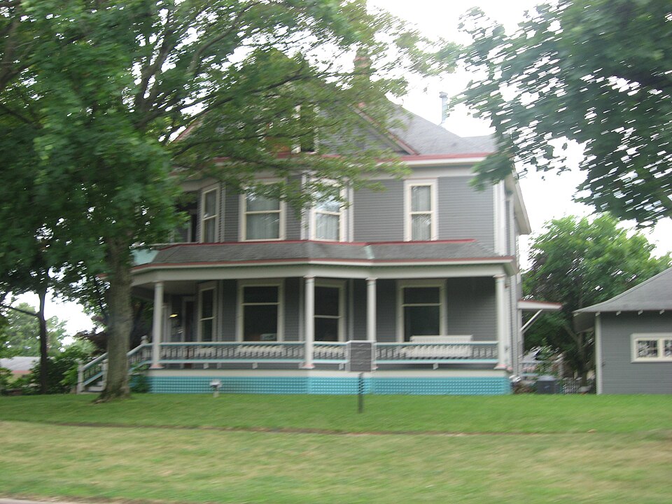
Architectural style. Queen Anne style architecture in the United States
National Register reference number.88000470- the number the National Park Service assigned this property when it was listed, and the key its nomination file is catalogued under at the National Archives.
What happened here
An account from the chapter on Shelbyville township. The inset identifies its exact
source book and publication year.
Death came to Wilher Broughton, a valiant and patriotic son of Shelby county, on the battlefield in France, where he was serving as a messenger and scout in the United States army. On the night of July 19, 1918, he was wounded, and removed to a hospital at Oise, France. Six days later, or on July 25, he died from the effects of the machine gun bullet.
The chapter on Shelbyville Township in Shelby County in the World War, published 1919 names Shelbyville. This is what it says, exactly as the scans read.
One avenue through which the work of this committee was done was the Child Welfare Department. Under the general direction of Mrs. S. S. Crook, many children in Shelbyville and throughout the county were weighed and measured, the work being done at different times over a long period. With the weighing and measuring, the parents were given instruction as to the proper care of the children, that the child life of the county might be conserved in harmony with the state- and nation-wide plan. A great deal of literature was distributed, and even the school boys became intensely interested in the subject. Mrs. Joseph T. Bowen, State Chairman, told of one lad who wrote a composition in which he said: "Xow that we are at war, it is everybody's business to have a baby and to save it!"
The making and shipping of clothing to Belgian refugees was undertaken, the work being done principally from three centers - Shelbyville, Findlay and Clarksburg. Mrs. Arthur Birkett of Findlay and the Misses Mel Compton and Verna Ragan of Clarksburg co-operated splendidly with Mrs. Hoover and the women of Shelbyville, and many hundreds of aprons, dresses and boys' waists were shipped to destitute Belgian children.
Regional context, not property-specific
evidence. The
federal wildfire occurrence database
lists 4 fires within 5 miles of Horace M. Tallman House
in 2013, burning about 116 acres in total. None started naturally. None was recorded as arson.
Distance is straight-line from the map coordinates, so a fire counted
here may appear on a neighbouring settlement's page as well.
Reported cause
Fires
Debris and open burning
3
Missing data/not specified/undetermined
1
The most recent of
them, most recent first, with the day each was reported and the service
that recorded it.
Regional context, not property-specific
evidence. The federal mineral resources record lists
2 workings within 5 miles of Horace M. Tallman House: 1 producer, 1 past producer.
1 still produces. What was taken out: Sand and Gravel, Construction, Stone, Crushed/Broken. Distance is straight-line from the
map coordinates, so a quarry counted here may appear on a neighbouring
settlement's page as well.
Regional context, not property-specific
evidence. The National Weather Service names
Shelbyville, the town this property stands in, in 47 storm reports between 1994 and 2026: 32 thunderstorm wind, 9 hail, 3 flash flood, 2 lightning.
The reports record 1 death and 2 injuries. Each account below is quoted exactly as the forecast office
filed it, from the NOAA Storm Events Database, and each date
opens the federal record of that event.
A 29 year-old fisherman was struck by lightning on the Kaskaskia River near the Lake Shelbyville Dam at around 3:50 PM CDT on Sunday, May 26th. The man later died at Shelby Memorial Hospital in Shelbyville.
The roof was torn off a building in downtown Shelbyville. Numerous trees and tree branches were blown down, and two homes were damaged by falling branches.
Numerous trees and power poles were blown down along a path from 4 miles southwest of Shelbyville to the far western edge of Shelbyville. Damage path was 1/2 mile wide and 3 miles long. Damage was caused by downburst winds as determined by an NWS Survey.
A tornado touched down 1 mile southwest of Shelbyville, then tracked eastward to 1/2 mile southeast of Shelbyville. Numerous shallow-rooted trees were torn or uprooted. The tornado tracked through a campground, where several unoccupied trailers were damaged by falling trees and limbs. A carport was destroyed and porches were torn away from a few trailers. In addition, 2 unanchored metal sheds were destroyed.
Illinois Route 128 north of Shelbyville was flooded briefly. Also, Illinois Route 16 was flooded in spots near its intersection with Illinois Route 32.
A twenty-two foot sail boat, that was being stored with its keel up, was blown over. Two house boats and a ten foot section of docks sustained minor damage at a marina on Lake Shelbyville.
In Shelbyville, numerous power poles were blown down. In Stewardson, one roof of a home was completely ripped off as well as several porch roofs. No injuries were reported.
Numerous large trees, tree limbs, and power lines were blown down. One large tree fell onto a house and a truck. The house had minor damage and the truck was smashed. One camper was damaged by a fallen tree at a Lake Shelbyville Recreation site two miles northeast of Shelbyville. No injuries were reported. An electrical wind generator tower was damaged just north of Shelbyville near Route 128, where a farmer was struck by lightning while working on a metal shed. He was uninjured by the strike.
Several large tree limbs were blown down on the north side of Shelbyville. A few of the limbs fell onto several cars. No damage estimate was available.
No historic map-sheet match is published
for this property yet. That does not mean no map exists. This record needs
a coordinate-quality review before it can be joined to a sheet boundary.
Browse the county's mapped places while that work is
pending.
Listed places nearby
4 within 8 miles
Other National Register properties close
enough to walk or drive between, ordered by distance from this one. Both
positions come from the same geocoding pass that matched these properties
to their map sheets.
Listing record. National Park Service National Register of Historic Places, listed-properties dataset, current to 2026-05-22.
Map join. Address geocoded through the United States Census geocoder, then tested against the published boundary of every sheet in the USGS Historical Topographic Map Collection.
How this page is made. Listing fields come from federal records; map-sheet coverage is a labelled coordinate-to-boundary calculation, not a source-field claim.
Wildfire. Short, Karen C. 2022. Spatial wildfire occurrence data for the United States, 1992-2020 [FPA_FOD_20221014]. 6th Edition. Fort Collins, CO: Forest Service Research Data Archive. https://doi.org/10.2737/RDS-2013-0009.6 Collected with United States Government funding and usable without additional permissions or fees.
Mines and quarries. USGS Mineral Resources Data System (MRDS) https://mrdata.usgs.gov/mrds/ A work of the United States government, no copyright under 17 U.S.C. 105.
Storms. NOAA National Centers for Environmental Information, Storm Events Database https://www.ncei.noaa.gov/stormevents/ A work of the United States government, no copyright under 17 U.S.C. 105. Narratives are quoted verbatim from the National Weather Service report and are not edited or summarised.
 Block