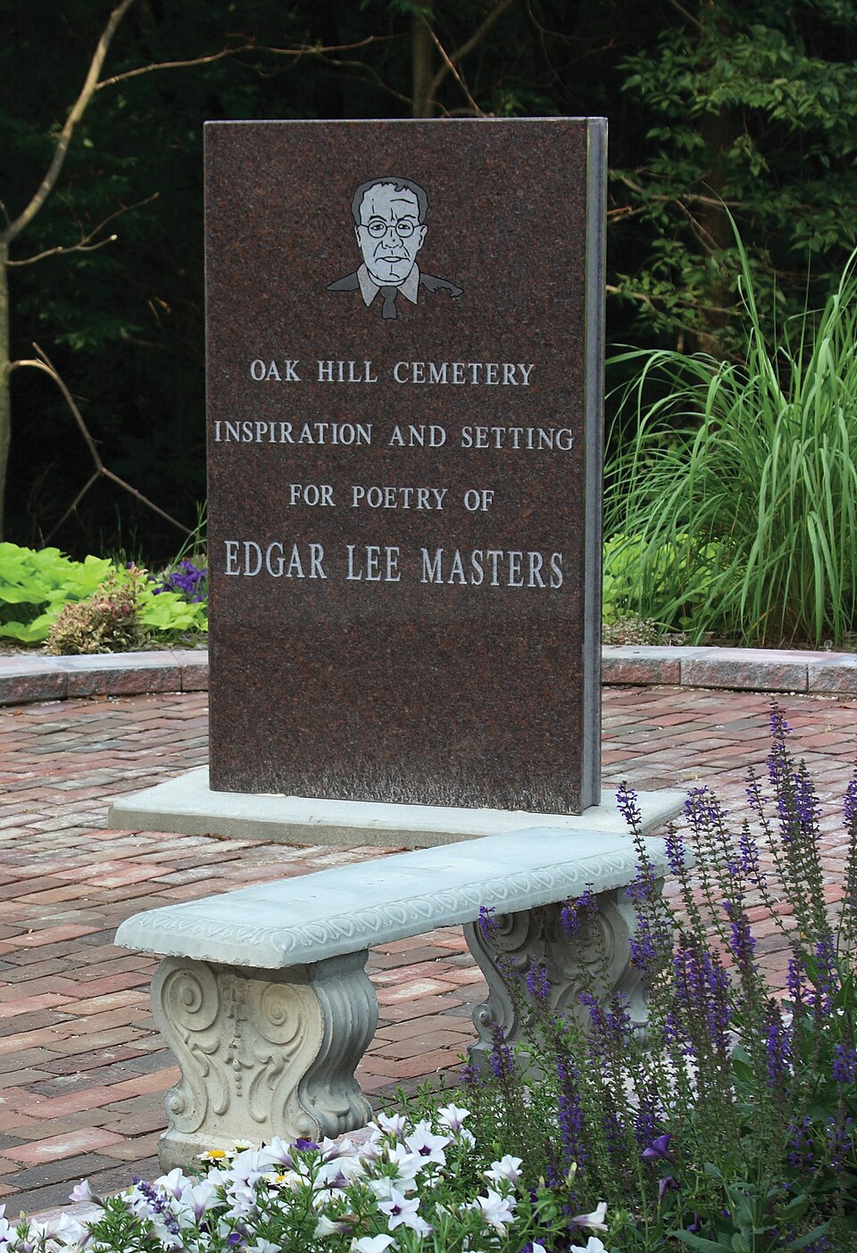
National Register reference number.95001240- the number the National Park Service assigned this property when it was listed, and the key its nomination file is catalogued under at the National Archives.
The ground it stands on
20,657 words
The chapter on Lewistown Township in History of Fulton County, Illinois;, published 1879 names Lewistown. This is what it says, exactly as the scans read.
This township is bounded upon the north by Putman township, upon the east by Liverpool, the south by Waterford, and upon the west by Bcrnadotte. Formerly most of its surface was covered with timber, but muc^h of tliis has been cleared away and the land is in a high state of cultivation. There are in the townshij) 13,471 acres of improved land, with an average value of $24 per acre. Of unimproved land there are 8,796 acres, with an average value of $9.40 per acre. There arc' in the township 851 horses, with an average value of S7'2 per head. Of cattle tiicre are 1,857, having a total value of $22,138. Indeed, as an agricultural township, Lewistown ranks among the first in this fine agricultural county.
It will naturally be expected that in our historical sketch of Lewistown we will give more than a passing notice of those early and prominent citizens whose fortunes were cast with the early history of the place. For a period of eight years, from 1S21 to 1820, Ossian M. Ross took a conspicnous ])art in jiromoting the enter-, prises of the infant village, so far separated iVoiu civilization. He was a man of great force of character, aud the utuiost coutidence was reposed in him by the few inhabitants of the place, lie moved to Havana, Mason county, in 1829, became its tirst merchant, and there passed the remainder of his days. Stej)hen Dewey, the surveyor and first settler of the town; is described as a social and intelligent gentleman, and occupied various offices of trust and responsibilitv. He erected several of the first buildings of the town. David W. Barnes located here when he first came to the county, which was in 1822, but he .soon removed to his farui near (^anton.
Regional context, not property-specific
evidence. The
federal wildfire occurrence database
lists 2 fires within 5 miles of Oak Hill Cemetery
between 2004 and 2019, burning about 38 acres in total. None started naturally. None was recorded as arson.
Distance is straight-line from the map coordinates, so a fire counted
here may appear on a neighbouring settlement's page as well.
Reported cause
Fires
Missing data/not specified/undetermined
1
Debris and open burning
1
The most recent of
them, most recent first, with the day each was reported and the service
that recorded it.
Regional context, not property-specific
evidence. The National Weather Service names
Lewistown, the town this property stands in, in 60 storm reports between 1995 and 2025: 31 thunderstorm wind, 27 hail, 1 flash flood, 1 flood.
No death or injury is recorded in these reports. Each account below is quoted exactly as the forecast office
filed it, from the NOAA Storm Events Database, and each date
opens the federal record of that event.
Wind damage reported along Highway 24 from 3 miles east of Lewistown to Little America. Numerous tree branches were blown down and several picnic tables were overturned along this path.
A portion of a barn roof was blown off, as were shingles from a home. A portion of a large tree was also blown down. The report was relayed by the county Emergency Manager.
Heavy rainfall in a short amount of time caused areas of minor flooding in and near Lewistown. Water flowed across the road at Rt 100 and Taylor Road and numerous streets were flooded in Lewistown.
Widespread large hail, with maximum sizes ranging from 1 to 3 inches, was reported along a line from Lewistown, to St. David, to Canton. The largest hail was reported in the vicinity of St David.
Thunderstorm winds blew down numerous trees, tree limbs, and power lines in Lewistown and in Sepo. No injuries were reported and no damage estimate was available.
As the storms moved through Fulton County, numerous large tree limbs and power lines were blown down 1 mile north of Lewistown, in Canton, and in Banner.
No historic map-sheet match is published
for this property yet. That does not mean no map exists. This record needs
a coordinate-quality review before it can be joined to a sheet boundary.
Browse the county's mapped places while that work is
pending.
Listed places nearby
5 within 8 miles
Other National Register properties close
enough to walk or drive between, ordered by distance from this one. Both
positions come from the same geocoding pass that matched these properties
to their map sheets.
Listing record. National Park Service National Register of Historic Places, listed-properties dataset, current to 2026-05-22.
Map join. Address geocoded through the United States Census geocoder, then tested against the published boundary of every sheet in the USGS Historical Topographic Map Collection.
How this page is made. Listing fields come from federal records; map-sheet coverage is a labelled coordinate-to-boundary calculation, not a source-field claim.
Wildfire. Short, Karen C. 2022. Spatial wildfire occurrence data for the United States, 1992-2020 [FPA_FOD_20221014]. 6th Edition. Fort Collins, CO: Forest Service Research Data Archive. https://doi.org/10.2737/RDS-2013-0009.6 Collected with United States Government funding and usable without additional permissions or fees.
Storms. NOAA National Centers for Environmental Information, Storm Events Database https://www.ncei.noaa.gov/stormevents/ A work of the United States government, no copyright under 17 U.S.C. 105. Narratives are quoted verbatim from the National Weather Service report and are not edited or summarised.
 Block