BlockBefore
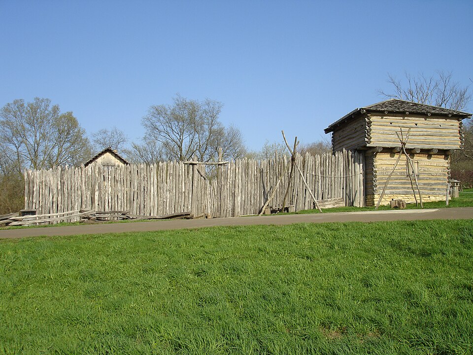
Photograph of Apple River Fort
Photograph by IvoShandor, CC BY-SA 3.0. Via Wikimedia Commons.

Apple River Fort Site

Listed on the National Register of Historic Places in 1997.

From the record

“Apple River Fort, today known as the Apple River Fort State Historic Site, was one of many frontier forts hastily completed by settlers in northern Illinois and southern Wisconsin following the onset of the 1832 Black Hawk War. Located in present-day Elizabeth, Illinois, United States, the fort at the Apple River settlement was built in less than a week.”

Wikipedia article Apple River Fort, CC BY-SA 4.0.

One of 17 National Register listings published here for Jo Daviess County · listed in 1997 · category: Site.

Sources: the Wikipedia article · the case file at the National Archives · the National Register database, National Park Service

The listing

  • What is counted as historic. The nomination lists 1 site as contributing to the listing.
  • Address. 0.25 mi. ESE of jct. of Mrytle and Illinois Sts., Elizabeth, 61028
  • When was it listed? November 1997
  • Category. site
  • Township. Woodbine township
  • National Register reference number. 97001332 - the number the National Park Service assigned this property when it was listed, and the key its nomination file is catalogued under at the National Archives.

The ground it stands on

5,944 words

The chapter on Woodbine Township in The History of Jo Daviess County, Illinois, Containing a History of the County, Its Cities, Towns, Etc., a Biographical Directory of Its Citizens, War Record of Its Volunteers in the Late Rebellion ... History of the Northwest, History of Illinois ... Constitution of the United States, published 1878 names Elizabeth. This is what it says, exactly as the scans read.

ARmTAGE JOSEPH, Carpenter and Farmer; Sec. 19; P. O. Elizabeth; born in Yorkshire, Eng., Sept. 4, 1838; came to America in 1843; came to Jo Daviess Co. in 1843; has lived at Galena most of the time; has made five trips to the gold regions of the mountains ; married Miss Catherine Ann Bray May 7, 1862; she was born in Cornwall, Eng., in 1840; they have five children: Frank S., Mary Grace, Sarah B., Nettie, and an infant not named ; Mrs. A. is a sister of T. B. Bray, a prominent citizen of Elizabeth ; he was born in June, 1835, at Cornwall, Eng.; he came to tlrs Co. in 1843; married Miss Lucretia Robinson, a daughter of Davis Robinson, Esq., in 1857 ; they have three children : Harry Clyde, John Albert and Charles H.

Passage source: The History of Jo Daviess County, Illinois, Containing a History of the County, Its Cities, Towns, Etc., a Biographical Directory of Its Citizens, War Record of Its Volunteers in the Late Rebellion ... History of the Northwest, History of Illinois ... Constitution of the United States, published 1878.

ARTMAN JOSEPH J. Farmer; Sec. 34; P.O. Elizabeth; born in Prussia Nov. 15, 1847; came to this country with his parents in 1851 via New Orleans; on the route up the river his mother was taken with the cholera and died, and was buried at Memphis ; he and his father came to this-Co. and settled on his present farm, formerly owned by his uncle ; his father, who now resides with him, was born in Prussia April 16, 1814; he married Miss Josephine Ben worth in Nov., 1869; she was born in Switzerland ; have four children : Charles A., Annie R., Henry J. and Andrew; owns 336 acres land.

Passage source: The History of Jo Daviess County, Illinois, Containing a History of the County, Its Cities, Towns, Etc., a Biographical Directory of Its Citizens, War Record of Its Volunteers in the Late Rebellion ... History of the Northwest, History of Illinois ... Constitution of the United States, published 1878.

Machine-read from a century-old scan, so expect the errors a machine makes: misspelled names, dropped words, stray characters.

Read the whole chapter on Woodbine Township - 5,944 words on its settlement, mills, schools and churches.

Fires near this property

10 since 2008

Regional context, not property-specific evidence. The federal wildfire occurrence database lists 10 fires within 5 miles of Apple River Fort Site between 2008 and 2010, burning about 32 acres in total. None started naturally. 1 was recorded as arson. Distance is straight-line from the map coordinates, so a fire counted here may appear on a neighbouring settlement's page as well.

Reported cause Fires
Missing data/not specified/undetermined6
Debris and open burning2
Equipment and vehicle use1
Arson/incendiarism1

The most recent of them, most recent first, with the day each was reported and the service that recorded it.

DateCause SizeReported by Name on the report
27 September 2010Arson/incendiarismunder an acreIllinois Division of Forestry ResourcesWURSTER
12 September 2008Missing data/not specified/undeterminedunder an acreIllinois Division of Forestry ResourcesELECTRIC
16 July 2010Debris and open burningunder an acreIllinois Division of Forestry ResourcesTREE
5 April 2010Missing data/not specified/undetermined12 acresIllinois Division of Forestry ResourcesHASS
23 April 2010Missing data/not specified/undeterminedunder an acreIllinois Division of Forestry ResourcesHANOVER2
2 April 2008Missing data/not specified/undetermined1.0 acresIllinois Division of Forestry ResourcesWHEELERIGHT
25 March 2008Missing data/not specified/undetermined3.0 acresIllinois Division of Forestry ResourcesBALDERINI
18 March 2010Debris and open burning15 acresIllinois Division of Forestry ResourcesWOODBINE

Every fire recorded in Jo Daviess County

Mines and quarries near this property

10 within 5 miles

Regional context, not property-specific evidence. The federal mineral resources record lists 10 workings within 5 miles of Apple River Fort Site: 6 past producers, 3 unknowns, 1 producer. 1 still produces. What was taken out: Lead, Zinc, Stone, Crushed/Broken, Zinc, Lead. Distance is straight-line from the map coordinates, so a quarry counted here may appear on a neighbouring settlement's page as well.

Where SiteCommodity StatusRecorded
Haggerty MineZinc, LeadUnknownGalena, Sphalerite
Kansas MineLead, ZincUnknownGalena, Sphalerite
Blakely QuarryStone, Crushed/BrokenPast Producer
Brown QuarryStone, Crushed/BrokenProducer
Brudi QuarryStone, Crushed/BrokenPast Producer
Illinois MineLead, ZincUnknownGalena, Sphalerite
Skene MineLead, ZincPast Producer1901, 1907
Wishon MineLead, ZincPast Producer1865, 1910
Haggerty MineLeadPast Producer
Illinois MineLeadPast Producer

Every working recorded in Jo Daviess County

Storms near this property

21 since 1994

Regional context, not property-specific evidence. The National Weather Service names Elizabeth, the town this property stands in, in 21 storm reports between 1994 and 2026: 13 thunderstorm wind, 6 hail, 2 heavy rain. The reports record 2 injuries. Each account below is quoted exactly as the forecast office filed it, from the NOAA Storm Events Database, and each date opens the federal record of that event.

WhenEvent Place namedHarm What the report says
February 1999Thunderstorm WindElizabeth2 hurtno account filed
April 1994HailElizabeth$5,000Thunderstorm winds damaged a porch in East Dubuque and knocked down trees at Menominee. Large hail damaged cars and siding at Elizabeth.
July 2018Thunderstorm WindElizabeth$3,000Local law enforcement reported windows were blown out and a deck was severely damaged on a house.
July 2006Thunderstorm WindElizabeth$3,000trees and corn down
May 2024Thunderstorm WindElizabeth-Spotter estimated wind gust.
July 2024Thunderstorm WindElizabeth-A public report of large tree branches down and garden corn flattened.
July 2024Thunderstorm WindElizabeth-A public report estimating 60 MPH winds at the leading edge of the line of storms with low visibility.
July 2023Thunderstorm WindElizabeth-Tree limbs down near Highway 20 and Elizabeth Scales Mound Road, relayed by law enforcement.
June 2019Thunderstorm WindElizabeth-A trained spotter reported an 8 inch diameter tree limb down.
September 2019Thunderstorm WindElizabeth-A large tree was blown down along Highway 20.
August 2018Thunderstorm WindElizabeth-A State Official reported trees were blown down on the southeast side of Elizabeth.
March 2017Thunderstorm WindElizabeth-Some dead trees were observed blown down.
June 2017Thunderstorm WindElizabeth-Tree branches were blown down.
July 2011Heavy RainElizabeth-As of 517 am CDT July 28, the 12 hour rainfall total near Elizabeth, IL was 9.35 inches. The rainfall total since July 21 was 15.97 inches.
July 2011Heavy RainElizabeth-As of 630 am CDT July 28, the 24 hour rainfall total in Elizabeth, IL was 9.52 inches.
September 2010HailElizabeth-Quarter-sized hail fell in Elizabeth, IL between 310 pm CDT and 315 pm CDT September 21.
March 2007Thunderstorm WindElizabeth-Sheriffs department reported many trees down, some blocking roads in the Elizabeth area.
April 2026HailElizabeth-no account filed
July 2009HailElizabeth-no account filed
June 1998HailElizabeth-no account filed

Every storm recorded in Jo Daviess County

Map coverage status

No historic map-sheet match is published for this property yet. That does not mean no map exists. This record needs a coordinate-quality review before it can be joined to a sheet boundary. Browse the county's mapped places while that work is pending.

Listed places nearby

2 within 8 miles

Other National Register properties close enough to walk or drive between, ordered by distance from this one. Both positions come from the same geocoding pass that matched these properties to their map sheets.

Photograph PropertyDistance Listed
Bishop's Busy Big Store-Lyric Opera House0.4 miles2022
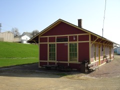
Chicago Great Western Railroad Depot0.4 miles1996

Sources for this property

National Archives recordThe nomination case file for reference 97001332 in Record Group 79.
Wikipedia articleCommunity-written account of this property, licensed CC BY-SA.
Jo Daviess CountyAll 17 listed properties in this county.

Provenance

  • Listing record. National Park Service National Register of Historic Places, listed-properties dataset, current to 2026-05-22.
  • Map join. Address geocoded through the United States Census geocoder, then tested against the published boundary of every sheet in the USGS Historical Topographic Map Collection.
  • How this page is made. Listing fields come from federal records; map-sheet coverage is a labelled coordinate-to-boundary calculation, not a source-field claim.
  • Wildfire. Short, Karen C. 2022. Spatial wildfire occurrence data for the United States, 1992-2020 [FPA_FOD_20221014]. 6th Edition. Fort Collins, CO: Forest Service Research Data Archive. https://doi.org/10.2737/RDS-2013-0009.6 Collected with United States Government funding and usable without additional permissions or fees.
  • Mines and quarries. USGS Mineral Resources Data System (MRDS) https://mrdata.usgs.gov/mrds/ A work of the United States government, no copyright under 17 U.S.C. 105.
  • Storms. NOAA National Centers for Environmental Information, Storm Events Database https://www.ncei.noaa.gov/stormevents/ A work of the United States government, no copyright under 17 U.S.C. 105. Narratives are quoted verbatim from the National Weather Service report and are not edited or summarised.